
Small western pond
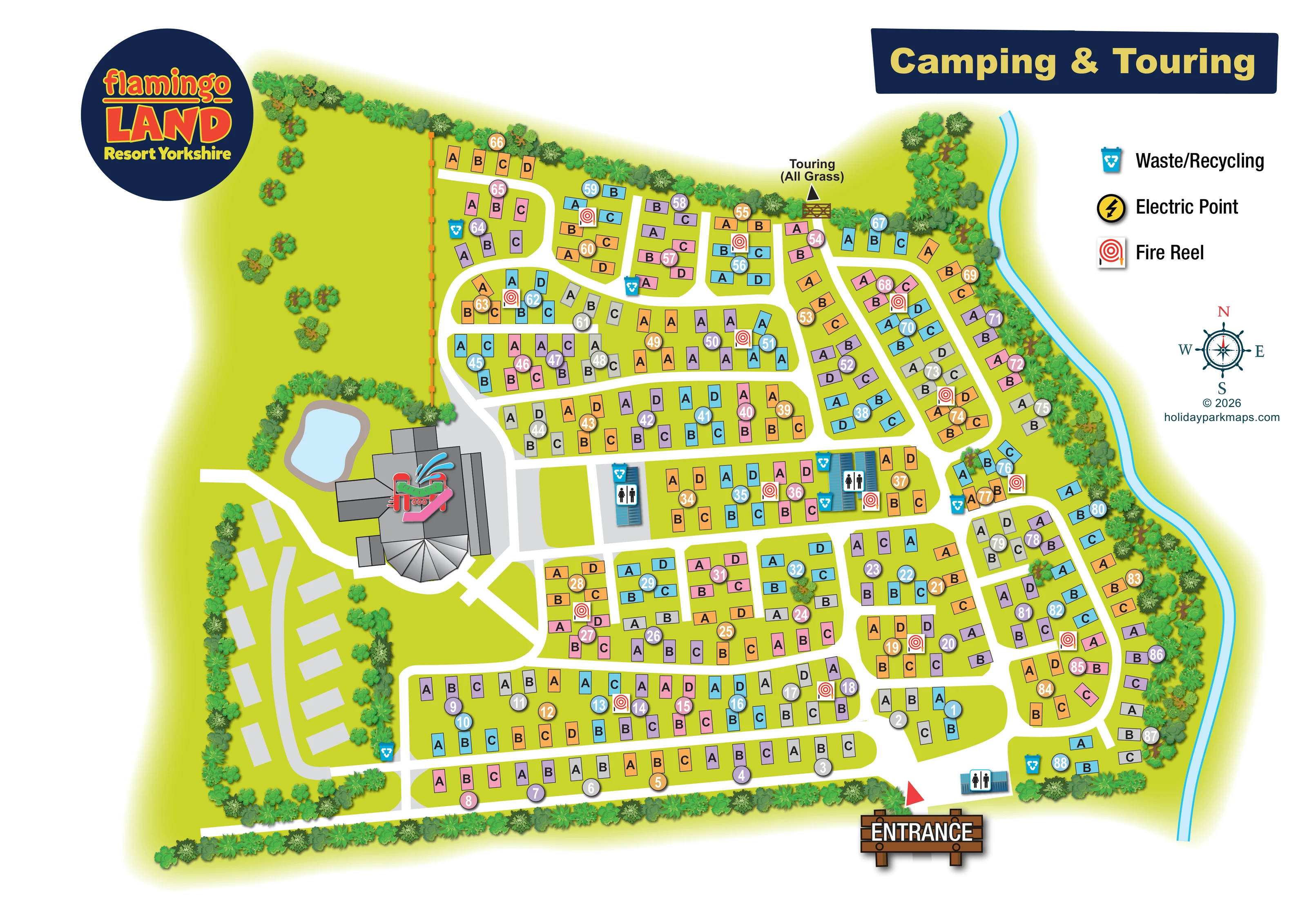
An irregular pale-blue pond with a taupe bank sits immediately north-west of the large grey building.
ILLUSTRATED PARK MAP · P122
Kirby Misperton, Malton, North Yorkshire · United Kingdom
 Enlarge the map ↗
A SENSE OF THE PLACE
Flamingo Land's Holiday Village combines accommodation with the wider theme park and zoo resort at Kirby Misperton. Visitors can choose self-catering lodges or bring tents, caravans and motorhomes.
Seasonal touring is also advertised. The map helps guests understand the camping and accommodation layout within a resort where rides, animal attractions and entertainment form a substantial part of the holiday experience.
LOOK CLOSER
An irregular pale-blue pond with a taupe bank sits immediately north-west of the large grey building.
A narrow, curving pale-blue watercourse with bright cyan edges follows the eastern side of the site.
Dense illustrated trees and shrubs frame much of the site, with scattered planting within the pitch layout and open grass to the north-west.
An orange post-and-rail-style line separates the upper pitch area from the broad grassy space to its west.
A large timber-style ENTRANCE sign and red triangular marker identify arrival near the lower-right edge of the plan.
Broad white routes form interconnected rows, branches and loops between pitch blocks, with grey access surfaces around the western building and adjacent service area.
A timber gate on the northern boundary is marked by an outward arrow and the label Touring (All Grass).
Male and female toilet pictograms mark blue-roofed service buildings in the central area and beside the southern entrance.
A large timber-style ENTRANCE sign and red triangular marker identify arrival near the lower-right edge of the plan.
Broad white routes form interconnected rows, branches and loops between pitch blocks, with grey access surfaces around the western building and adjacent service area.
A timber gate on the northern boundary is marked by an outward arrow and the label Touring (All Grass).
Male and female toilet pictograms mark blue-roofed service buildings in the central area and beside the southern entrance.
Blue recycling-bin symbols appear at several route-side locations, including beside service buildings and around the outer pitch rows; the legend names them Waste/Recycling.
Red hose-reel pictograms are distributed throughout the pitch layout and identified by the legend.
The legend includes a yellow circle with a black lightning bolt labelled Electric Point. Clear corresponding locations are not established on the plan.
A substantial grey-roofed building is overlaid with a colourful slide-and-splash illustration. It acts as a prominent leisure landmark, although the building's name and precise function are not labelled.
An irregular pale-blue pond with a taupe bank sits immediately north-west of the large grey building.
A narrow, curving pale-blue watercourse with bright cyan edges follows the eastern side of the site.
Dense illustrated trees and shrubs frame much of the site, with scattered planting within the pitch layout and open grass to the north-west.
An orange post-and-rail-style line separates the upper pitch area from the broad grassy space to its west.
READING THE MAP
This Camping & Touring map for Flamingo Land Resort Yorkshire focuses on a densely arranged holiday pitch area within the wider resort at Kirby Misperton, near Malton in North Yorkshire. Rather than illustrating the theme park and zoo, it gives visitors a dedicated plan for finding their pitch, recognising nearby service buildings and understanding the main routes through this part of the site.
The artwork combines an overhead layout with colourful landscape illustration. Lettered pitch spaces sit around numbered circles, creating a two-part addressing system across long rows and smaller curved blocks. White routes stand out against lime-green grass, while trees, a small pond and an eastern watercourse give the plan recognisable edges and landmarks.
Arrival is clearly marked by a large timber-style entrance sign at the bottom of the page. At the opposite end, a gate and arrow point towards all-grass touring beyond the mapped area. Toilet buildings, waste and recycling points, and fire reels are shown within the layout. The Flamingo Land logo and navy-and-yellow heading give this practical section map a strong connection to the resort's identity.
The plan is organised around a southern entrance, positioned towards the right-hand side of the page. From here, a network of broad white routes links the long lower pitch rows, central blocks and shorter groups that follow the eastern boundary. The eastern rows bend alongside a narrow blue watercourse, while the northern route ends at a timber gate labelled Touring (All Grass), indicating accommodation beyond the illustrated section.
Pitch spaces are drawn as simple outlined rectangles rather than pictures of tents or caravans. Each carries a letter, with nearby numbered circles identifying its group. Alternating cyan, orange, pink, lavender and grey fills help separate adjacent groups visually; the map does not assign these colours to named accommodation types. This makes the addressing system the principal organising feature of the artwork.
Blue-roofed toilet buildings appear around the central service area and close to the entrance. Waste and recycling bins and red fire-reel symbols are repeated across the site. The right-hand legend explains these two symbols and also includes an electric-point symbol, without establishing clear electric-point positions on the plan.
On the western side, a substantial shaded grey building carries a colourful slide-and-splash pictogram. A small pond sits beside it, and a grey access loop passes unlabelled rectangular spaces to the south-west. An orange fence separates the upper pitches from open grass. Dense illustrated planting encloses much of the site, with smaller tree clusters among the pitches.
The artwork is a single landscape-format section map, not a whole-resort plan. Its large logo, bold title, compact legend and compass occupy the surrounding white space without competing with the pitch labels.
KEEP EXPLORING
Chosen for shared landscapes, accommodation or facilities.
 Explore the map ↗
United Kingdom
Woodland camping, lodges, lakes and colour-coded bike trails at Avon Tyrrell Outdoor Centre.
 Explore the map ↗
United Kingdom
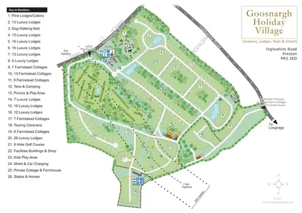
Numbered lodge and cottage areas, golf, ponds and shared facilities on a landscaped Goosnargh site plan.
 Explore the map ↗
United Kingdom
A lakeside holiday-park and fishery map with numbered accommodation, fishing positions and clearly grouped visitor services.
Features may come from the sample artwork, its key or published park information. Approximate numbers describe the drawing and may cover only part of a park. They are intended to help you compare map examples. Current facilities and booking information should be checked with the park.
LET’S MAP YOUR PARK
For a map quotation, find your park and draw a rough boundary around it. The area you select helps us work out the design time and price.
Draw your park for a quote ↗Or talk to our map designers
01751 473136