
Hedges, trees and grass
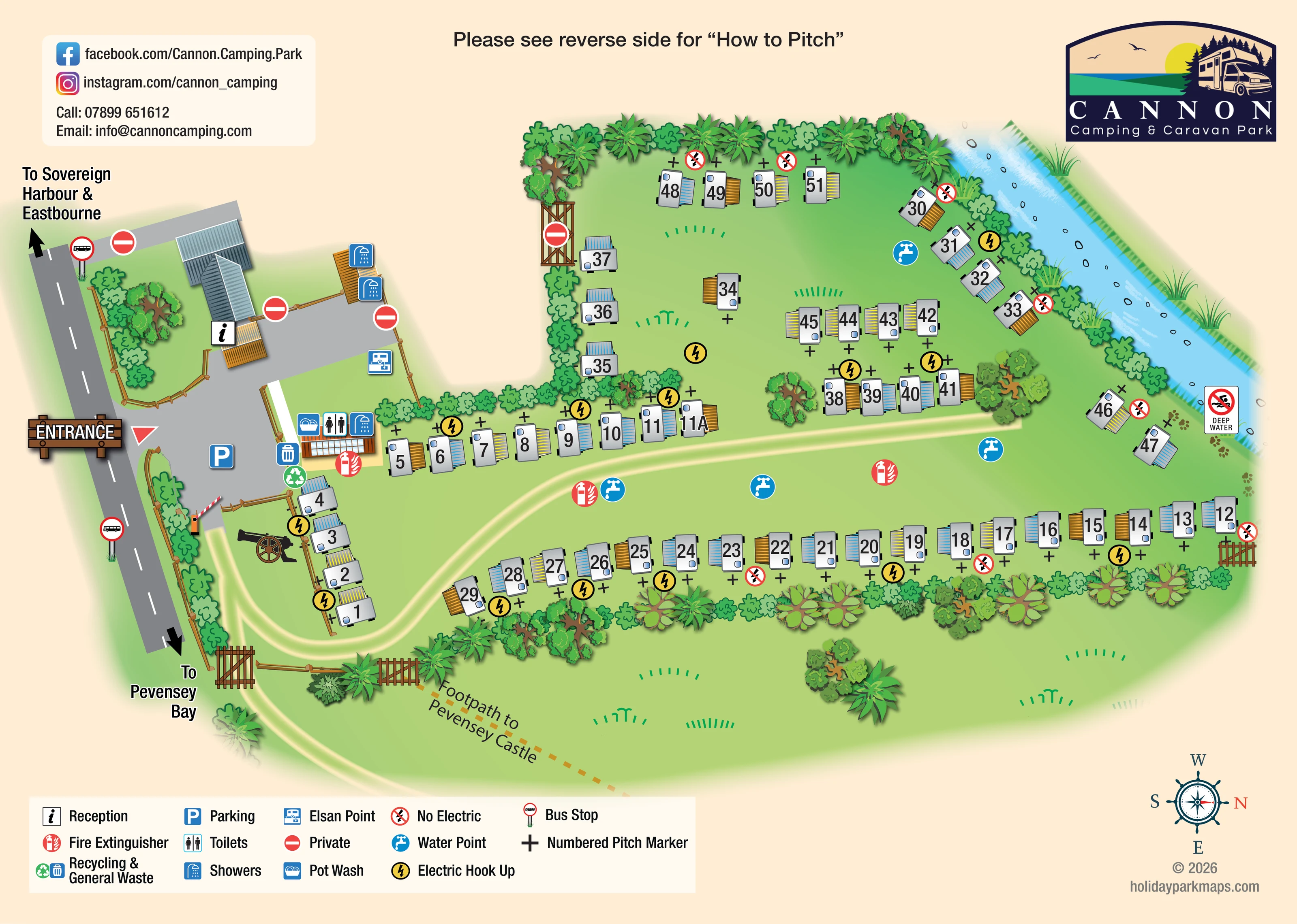
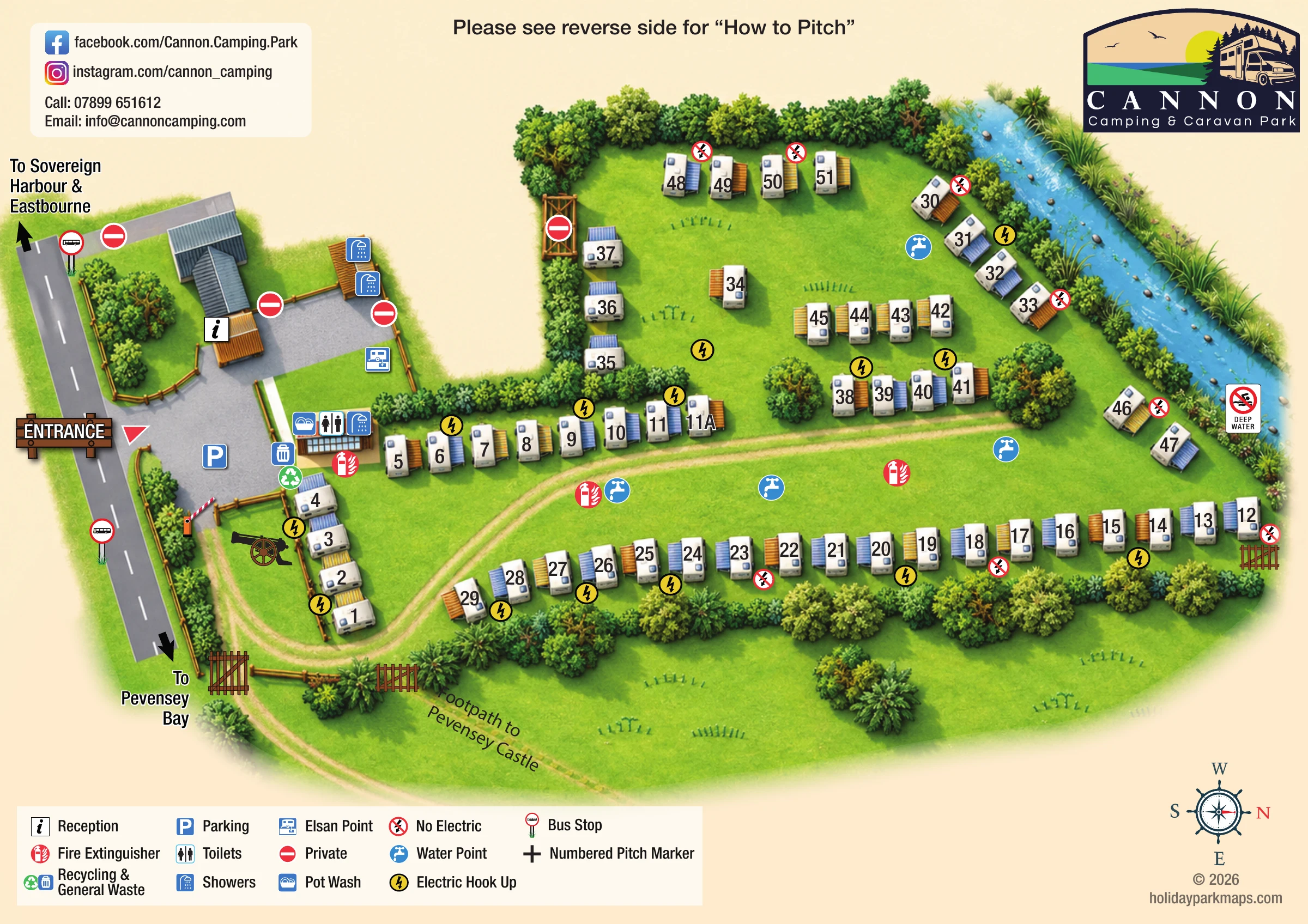
Dense illustrated hedges and mixed tree shapes enclose the pitch groups, with open grass between rows and beyond the lower boundary.
ILLUSTRATED PARK MAP · P065
Eastbourne Road, Pevensey Bay, Eastbourne, East Sussex · United Kingdom
 Enlarge the map ↗
A SENSE OF THE PLACE
Cannon Camping & Caravan Park is based at Eastbourne Road, Pevensey Bay, Eastbourne, East Sussex. The operator describes the beach as within walking distance. Camping and caravan pitches are offered, with electric hook-ups available.
The operator describes the site as pet friendly. The family-run site is on the East Sussex coast, between Eastbourne and Hastings.
LOOK CLOSER
Dense illustrated hedges and mixed tree shapes enclose the pitch groups, with open grass between rows and beyond the lower boundary.
A blue watercourse with reeds follows the upper-right boundary. A deep-water warning sign and paw-print motif appear nearby.
The walking map depicts the Pevensey Bay coastline, beach strip, sea, Sovereign Harbour basins and harbour entrance.
The walking map labels Pevensey, Pevensey Bay, Crumbles, Pevensey Recreation Ground, Holy Rood Roman Catholic Church and Bay View; accompanying route text identifies Bay View Golf course. These are surrounding-area references, not park facilities.
A black cannon illustration beside the entrance-side pitches creates a distinctive visual reference to the park name; its status as a physical site feature is not established.
An information symbol identifies reception at the illustrated building beside the entrance forecourt.
Parking is marked in the grey entrance forecourt. A separate parking symbol appears near Coast Road on the walking map.
Toilets and showers are marked on the amenity building beside the pitch-field entrance; further shower symbols appear beside the reception-side courtyard.
An information symbol identifies reception at the illustrated building beside the entrance forecourt.
Parking is marked in the grey entrance forecourt. A separate parking symbol appears near Coast Road on the walking map.
Toilets and showers are marked on the amenity building beside the pitch-field entrance; further shower symbols appear beside the reception-side courtyard.
A pot-wash symbol is grouped with the toilet and shower symbols on the main amenity building.
Chemical-waste disposal is marked at the edge of the entrance-side courtyard.
Recycling and general-waste symbols are grouped beside the amenity building and forecourt.
Blue tap symbols are distributed through the main pitch field and upper enclosure.
Yellow lightning symbols mark electric provision among the pitch rows; red crossed-lightning symbols identify no-electric locations.
Red extinguisher symbols appear beside the amenity building and at several points within the pitching area.
A timber entrance sign marks access from the roadside into the forecourt. A red-and-white barrier separates this arrival area from the grass pitching area.
Bus-stop symbols appear on both sides of the main road beside the park entrance.
Red no-entry-style symbols, defined as Private in the legend, mark several entrance-side boundaries and an upper-field gate.
Black crosses represent physical numbered pitch markers alongside the large numbers printed over the caravan illustrations.
A pale curving track enters through the barrier, bends around the first pitch group and continues between the longer rows.
Dense illustrated hedges and mixed tree shapes enclose the pitch groups, with open grass between rows and beyond the lower boundary.
A blue watercourse with reeds follows the upper-right boundary. A deep-water warning sign and paw-print motif appear nearby.
A dashed ochre route leaves through a boundary gate on the park plan. The walking map also depicts a blue-and-white inland route towards Pevensey and its castle silhouette.
The walking map identifies a green-and-white Beach Walk via Timberlaine Road to the coast.
Purple, orange and red routes connect the park area with Sovereign Harbour. Matching text headings carry printed walking-time estimates and describe waterfront paths and lock bridges.
The walking map depicts the Pevensey Bay coastline, beach strip, sea, Sovereign Harbour basins and harbour entrance.
Walking-map text references off-site harbour restaurants, bars and shops, together with onward walking towards Eastbourne promenade, beach and pier.
The walking map labels Pevensey, Pevensey Bay, Crumbles, Pevensey Recreation Ground, Holy Rood Roman Catholic Church and Bay View; accompanying route text identifies Bay View Golf course. These are surrounding-area references, not park facilities.
A black cannon illustration beside the entrance-side pitches creates a distinctive visual reference to the park name; its status as a physical site feature is not established.
READING THE MAP
This two-part map design for Cannon Camping & Caravan Park combines a practical pitch plan with a walking guide to the East Sussex coast. Based at Pevensey Bay, the park is shown as a compact grass site with roughly 50 numbered pitches, leafy boundaries and a watercourse along one edge. Illustrated touring caravans, striped awnings and large pitch numbers give the main plan an immediately recognisable camping-and-caravanning character.
The arrival area is particularly clear: a timber-style entrance sign leads visitors towards reception, parking and the main amenities before a barrier opens onto the pitching field. Water points, electric hook-ups, waste facilities and sanitation symbols are integrated into the plan rather than left as a detached list.
The companion walking map expands the visitor’s view beyond the park. Colour-coded routes connect the site area with Pevensey Bay beach and Sovereign Harbour, while an inland route reaches towards Pevensey Castle. Together, the sheets show how a small coastal park can use coordinated mapping to explain both everyday site navigation and the surrounding places guests may want to explore.
The landscape park plan organises the site around a roadside arrival forecourt on the left. Reception occupies an illustrated blue-grey-roofed building, with parking, additional shower symbols and an Elsan point nearby. The main amenity building sits beside the pitching-field entrance and carries toilet, shower and pot-wash symbols, with recycling and general waste alongside it. A red-and-white barrier marks the transition from the forecourt to the grass field.
A pale track curves around the entrance-side pitches and continues between the longer accommodation rows. Approximately 50 pitches are represented by grey touring caravans with coloured striped awnings. Large numbers identify the pitches, while black crosses show the numbered-marker convention. Yellow hook-up symbols and crossed no-electric symbols distinguish electrical provision. Water taps and fire extinguishers are distributed through the field.
Hedges divide the main rows from a more enclosed upper area containing perimeter pitches and short interior groups. Layered trees, timber fences and gates reinforce the boundaries. A reed-lined blue watercourse follows the upper-right edge, accompanied by a deep-water warning. An ochre dashed footpath leaves towards Pevensey Castle, and roadside arrows indicate Pevensey Bay, Sovereign Harbour and Eastbourne.
The separate portrait walking map uses a simpler cartographic treatment. Grey land, white roads, cyan waterways, green open spaces and a yellow beach strip form the base beneath segmented coloured routes. A boxed locator picks out the park. Green identifies the beach walk, while purple, orange and red distinguish approaches to Sovereign Harbour. Route-description blocks explain the harbour bridges, dining and shopping destinations, and onward connection towards Eastbourne promenade. A blue-and-white inland line reaches the castle symbol at Pevensey. Shared logos and nautical compasses link the two otherwise different page formats.
 Enlarge this map ↗
KEEP EXPLORING
Chosen for shared landscapes, accommodation or facilities.
 Explore the map ↗
United Kingdom
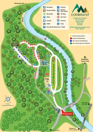
Colour-coded camping pitches, woodland routes and River Forth frontage at Cobleland Campsite.
 Explore the map ↗
United Kingdom
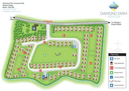
Numbered accommodation, a central green and tree-lined rhyne on the Diamond Farm park map.
 Explore the map ↗
United Kingdom
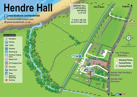
Coastal camping, touring and glamping map with a railway-side layout, beach path and illustrated rural surroundings.
Features may come from the sample artwork, its key or published park information. Approximate numbers describe the drawing and may cover only part of a park. They are intended to help you compare map examples. Current facilities and booking information should be checked with the park.
LET’S MAP YOUR PARK
For a map quotation, find your park and draw a rough boundary around it. The area you select helps us work out the design time and price.
Draw your park for a quote ↗Or talk to our map designers
01751 473136