
West Rhyne and boundary watercourse
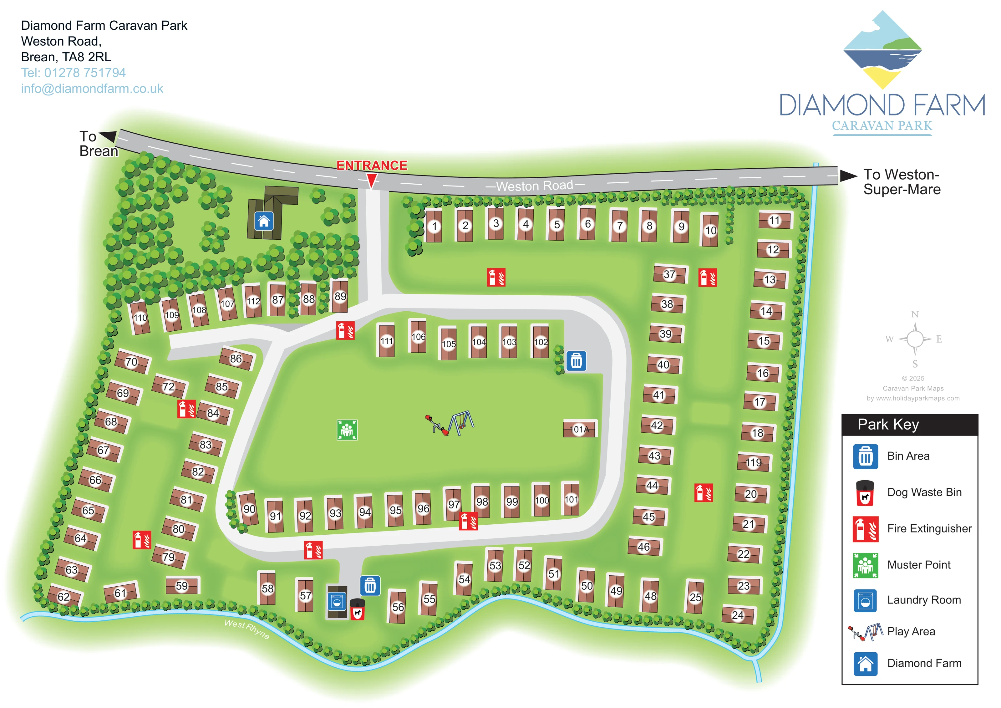
A narrow blue watercourse labelled West Rhyne traces the irregular southern boundary and continues up the eastern edge.
ILLUSTRATED PARK MAP · P101
Diamond Farm Caravan Park, Weston Road, Brean · United Kingdom
 Enlarge the map ↗
A SENSE OF THE PLACE
Diamond Farm is a family-run caravan and camping business at Brean in Somerset. Its origins date to the 1950s, when camping developed alongside the family's farming activities.
The park combines a countryside setting with access to the beaches and seaside attractions around Brean and Burnham-on-Sea. The map helps visitors understand the camping layout and routes around a site established for touring holidays.
LOOK CLOSER
A narrow blue watercourse labelled West Rhyne traces the irregular southern boundary and continues up the eastern edge.
Repeated rounded tree symbols enclose much of the site, with denser planting around Diamond Farm in the north-west and shorter groups beside accommodation rows.
A substantial open lawn lies inside the road loop, containing the play area and muster point.
A prominent red entrance label and downward arrow identify the access near the upper centre-left of the plan.
The road follows the upper boundary, with directional arrows towards Brean on the left and Weston-super-Mare on the right.
A broad grey access route divides after the entrance, forming a rounded loop around the central green and a branch serving the western accommodation rows.
An olive-brown building cluster among trees near the entrance is marked with the blue house symbol identified as Diamond Farm in the key.
Small illustrations of swings and a seesaw locate the play area on the central green.
A prominent red entrance label and downward arrow identify the access near the upper centre-left of the plan.
The road follows the upper boundary, with directional arrows towards Brean on the left and Weston-super-Mare on the right.
A broad grey access route divides after the entrance, forming a rounded loop around the central green and a branch serving the western accommodation rows.
An olive-brown building cluster among trees near the entrance is marked with the blue house symbol identified as Diamond Farm in the key.
Small illustrations of swings and a seesaw locate the play area on the central green.
A blue washing-machine symbol marks a small building near the lower centre of the plan.
Blue bin symbols appear beside the eastern side of the central loop and near the southern laundry building.
A red-and-black dog waste bin symbol is positioned beside the southern laundry and bin area.
Repeated red extinguisher symbols mark points throughout the accommodation rows and beside internal routes.
A green assembly symbol is placed on the central lawn, west of the illustrated play equipment.
A narrow blue watercourse labelled West Rhyne traces the irregular southern boundary and continues up the eastern edge.
Repeated rounded tree symbols enclose much of the site, with denser planting around Diamond Farm in the north-west and shorter groups beside accommodation rows.
A substantial open lawn lies inside the road loop, containing the play area and muster point.
The supplied park background places Diamond Farm in a countryside setting with access to beaches and seaside attractions around Brean and Burnham-on-Sea.
READING THE MAP
This map of Diamond Farm Caravan Park in Brean, Somerset, combines a clear numbered accommodation plan with a distinctive green landscape setting. Weston Road runs across the top of the artwork, with arrows towards Brean and Weston-super-Mare and a prominent red marker showing the entrance. Inside the park, a rounded road loop frames a large central lawn, while further accommodation rows follow the outer boundaries and a western access branch.
Trees give the plan much of its character: closely spaced planting encloses the site, and a denser group surrounds the Diamond Farm buildings near the entrance. Along the lower and right-hand edges, the blue line of West Rhyne provides another useful visual boundary. Small illustrations locate the play area, while colour-coded symbols identify the laundry, bin areas, fire extinguisher points and muster point.
The page balances this practical information with the park's diamond-shaped coastal logo, a compact contact block and a clearly separated Park Key. It is a useful example of a numbered caravan-park map where accommodation, shared green space and everyday visitor facilities need to remain easy to distinguish.
The plan is presented from above, with Weston Road defining the northern edge and the entrance placed just left of centre. A short access road leads into a junction: one route branches towards the western accommodation rows, while the other forms a broad loop around the central green. Numbered brown rectangles follow the northern boundary, continue in two rows down the eastern side and curve around the southern edge. Additional rows face the green from inside the loop, creating a clear distinction between the park's outer accommodation and its central open space.
The landscape is integral to the drawing. Rounded tree symbols line most boundaries and gather densely around the olive-brown Diamond Farm building cluster in the north-west. West Rhyne is shown as a narrow blue channel along the undulating southern edge and up the eastern side. Soft green shading gives the grounds visual continuity without obscuring the roads or accommodation labels.
Swings and a seesaw mark the play area on the central lawn, with a green muster-point symbol nearby. The laundry sits near the lower centre, beside a bin area and dog waste bin. Another bin area appears beside the eastern section of the loop, and red fire extinguisher markers are distributed around the plan.
The right-hand Park Key explains all seven symbol types. Above it sit a pale compass and designer credit; the larger park logo occupies the upper-right corner. Contact details balance the composition at upper left. The accompanying detail view enlarges the key and adjacent eastern boundary, making the symbols easier to inspect without introducing another map or accommodation area.
KEEP EXPLORING
Chosen for shared landscapes, accommodation or facilities.
 Explore the map ↗
United Kingdom
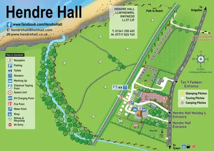
Coastal camping, touring and glamping map with a railway-side layout, beach path and illustrated rural surroundings.
 Explore the map ↗
United Kingdom
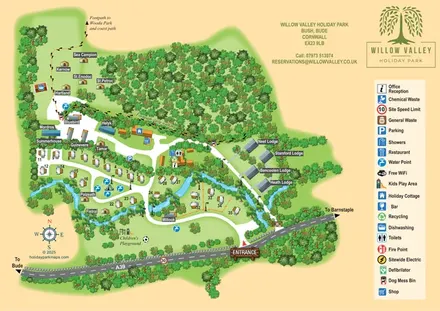
A woodland-valley park map combining named glamping stays, numbered pitches, riverside lodges and footprint-marked walking routes.
 Explore the map ↗
United Kingdom
Woodland park map with mixed pitches, bell tents, lodges and a fishing lake.
Features may come from the sample artwork, its key or published park information. Approximate numbers describe the drawing and may cover only part of a park. They are intended to help you compare map examples. Current facilities and booking information should be checked with the park.
TAKE A CLOSER LOOK
View the illustrated map in detail or choose a file to download. These are sample maps; contact the park for current visitor information.


LET’S MAP YOUR PARK
For a map quotation, find your park and draw a rough boundary around it. The area you select helps us work out the design time and price.
Draw your park for a quote ↗Or talk to our map designers
01751 473136
 diamondstatic.png
 diamondstatic_large.png