
Open central lawn
A broad green clearing separates the perimeter accommodation, with scattered individual trees and small tree groups.
ILLUSTRATED PARK MAP · P069
235a Leicester Road · United Kingdom
 Enlarge the map ↗
A SENSE OF THE PLACE
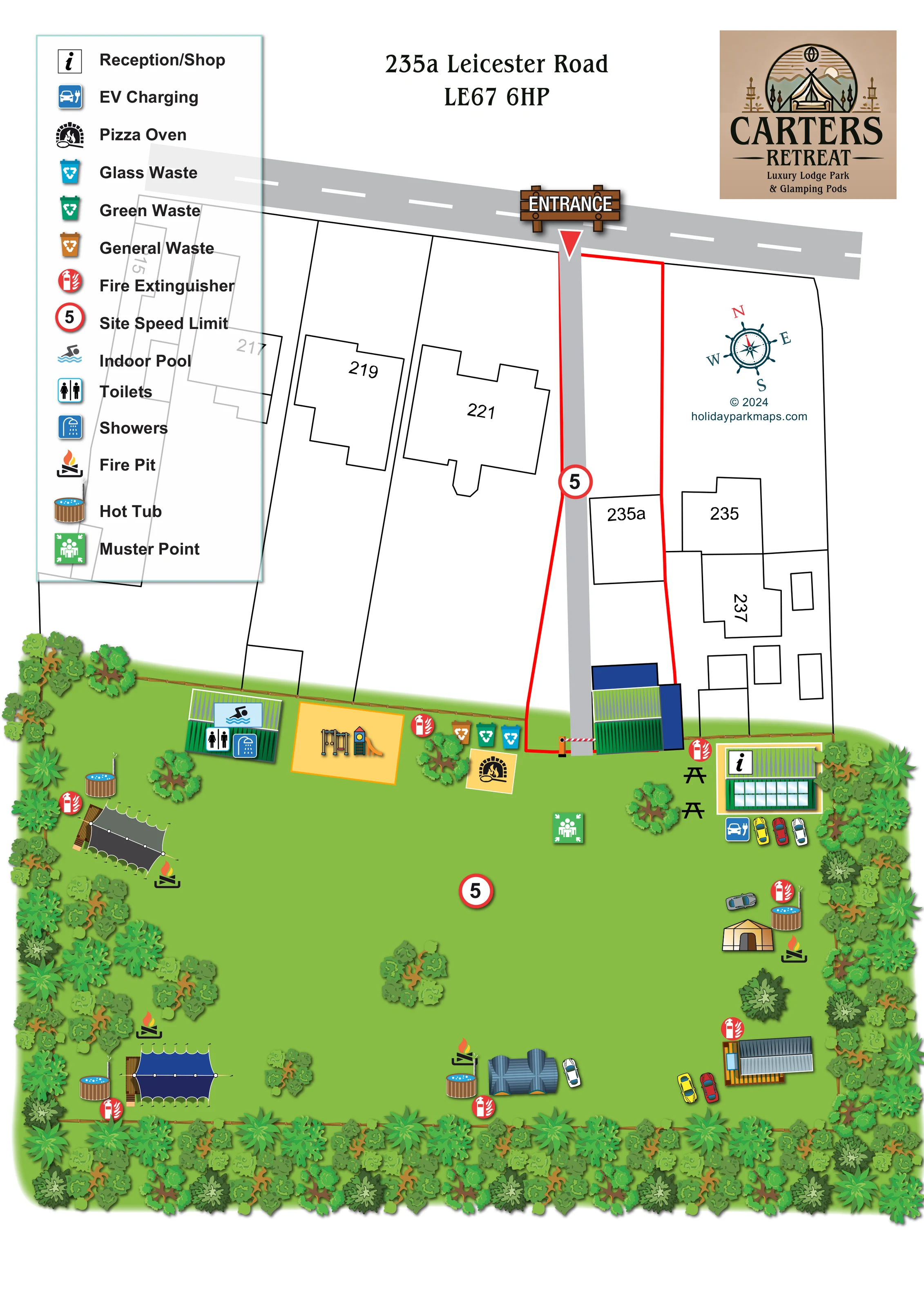
The Carters Retreat artwork presents a lodge-park layout at Leicester Road near Coalville. Accommodation plots and internal routes are combined with a range of visitor spaces.
The map labels reception and a shop, an indoor pool, a pizza oven, hot-tub and fire-pit areas, and electric vehicle charging. These are described as features of the artwork, without assuming that every mapped element has been built or is currently available.
LOOK CLOSER
A broad green clearing separates the perimeter accommodation, with scattered individual trees and small tree groups.
Dense overlapping tree illustrations frame three sides of the retreat; timber-style fencing follows the landscaped boundary.
The information symbol identifies a glazed-front building on the right of the arrival area as reception/shop.
An EV charging symbol is positioned beside illustrated cars immediately below reception.
A swimmer symbol marks the green-roofed amenity building at the upper-left edge of the lawn.
Toilet and shower symbols are grouped with the indoor-pool building.
A yellow rectangular play surface beside the pool building contains illustrated climbing equipment, hanging rings and a slide.
A pizza-oven symbol sits on a pale yellow square to the left of the entrance barrier, beside the waste station.
The information symbol identifies a glazed-front building on the right of the arrival area as reception/shop.
An EV charging symbol is positioned beside illustrated cars immediately below reception.
A swimmer symbol marks the green-roofed amenity building at the upper-left edge of the lawn.
Toilet and shower symbols are grouped with the indoor-pool building.
A yellow rectangular play surface beside the pool building contains illustrated climbing equipment, hanging rings and a slide.
A pizza-oven symbol sits on a pale yellow square to the left of the entrance barrier, beside the waste station.
Several round timber-sided hot tubs are illustrated beside accommodation around the lawn perimeter.
Repeated flame-and-log symbols identify fire-pit locations beside several glamping structures.
Two black picnic-table symbols sit between reception and the arrival area.
Colour-coded bins for glass waste, green waste and general waste are grouped near the entrance and pizza oven.
Red extinguisher symbols recur beside accommodation and around the main amenity area.
A green muster-point symbol is placed on the lawn below the entrance area.
A straight grey drive leads from the roadside entrance to a striped barrier at the edge of the landscaped retreat.
Circular red-bordered signs marked 5 appear on the access drive and central lawn; the legend identifies them as site speed-limit signs.
Cars are shown beside reception and some accommodation, without a separately labelled parking layout.
A broad green clearing separates the perimeter accommodation, with scattered individual trees and small tree groups.
Dense overlapping tree illustrations frame three sides of the retreat; timber-style fencing follows the landscaped boundary.
A broad grey road crosses the upper page, with neighbouring buildings and property divisions drawn as plain black outlines.
READING THE MAP
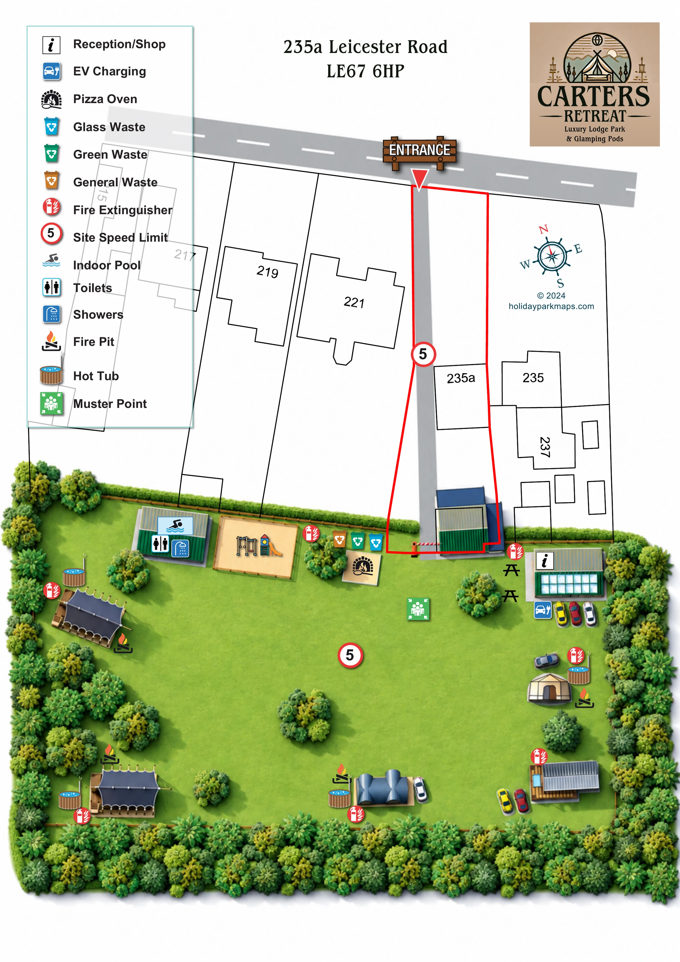
This illustrated map of Carters Retreat near Coalville brings together a roadside approach, a small lodge and glamping layout, and the visitor spaces around a tree-framed lawn. The entrance from Leicester Road is given particular prominence: a timber-style sign and red pointer lead into a straight drive, making the relationship between the public road and the retreat easy to understand.
The lower half of the page changes from simple property outlines to colourful accommodation and landscape illustration. Canvas-style structures, pod-like forms and a decked lodge sit around the edge of an open green clearing. Hot tubs and fire-pit symbols give several of these settings their own visual identity, while a dense border of trees defines the retreat's shape.
The map also shows reception and a shop, EV charging, an indoor pool with toilets and showers, a children's play area and a pizza oven. A large symbol key ties these visitor destinations together with waste facilities and safety points. It is a useful example of mapping a compact retreat where the arrival sequence and character of individual accommodation spaces matter more than a numbered pitch grid.
The single portrait map uses two distinct drawing treatments. Across the upper portion, a grey road with dashed white markings passes plain black outlines of neighbouring properties. A conspicuous entrance sign marks the turn into a long, narrow access drive. Red linework highlights the approach corridor, which finishes at a striped barrier beside an unlabelled blue-and-green building. A compass rose sits in the open space to the right, below the park logo and address.
Beyond the barrier, the illustrated retreat spreads across a bright green lawn. Reception and the shop occupy a glazed-front building on the right, with an EV charging symbol and cars immediately below it. Nearby picnic-table symbols indicate outdoor seating. To the left, a green-roofed building carries the indoor-pool, toilet and shower symbols. Beside it, a yellow play surface contains climbing equipment and a slide. The pizza oven and three colour-coded waste bins form another small amenity group close to the entrance.
Accommodation is positioned around the clearing rather than along a drawn road circuit. Two large canvas-style structures sit on the left, a smaller tan tent or pod-like form stands on the right, and a blue curved-roof grouping appears along the bottom edge. A rectangular lodge with timber decking occupies the lower-right corner. Several locations have adjacent illustrated hot tubs and fire-pit symbols; cars and extinguisher markers add further landmarks.
Dense overlapping trees enclose the sides and bottom of the park, with scattered trees breaking up the central lawn. A large upper-left legend explains the facility and safety pictograms, including the muster point and speed-limit markers. The overall composition prioritises approach, recognisable destinations and the different accommodation settings, without introducing plot numbering or a detailed internal path network.
 Enlarge this map ↗
KEEP EXPLORING
Chosen for shared landscapes, accommodation or facilities.
 Explore the map ↗
United Kingdom
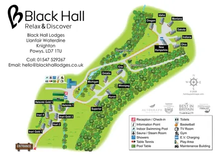
Named lodges, shepherds' huts and a shared leisure hub in a wooded countryside plan.
 Explore the map ↗
United Kingdom
A colour-zoned coastal park map with touring areas, woodland trails, ponds and a leisure club.
 Explore the map ↗
United Kingdom
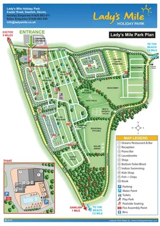
Portrait park plan with named fields, numbered accommodation, beach directions and an enlarged leisure-complex inset.
Features may come from the sample artwork, its key or published park information. Approximate numbers describe the drawing and may cover only part of a park. They are intended to help you compare map examples. Current facilities and booking information should be checked with the park.
LET’S MAP YOUR PARK
For a map quotation, find your park and draw a rough boundary around it. The area you select helps us work out the design time and price.
Draw your park for a quote ↗Or talk to our map designers
01751 473136