
Pond with island
A large pale-blue pond with a small green island occupies the landscaped area beyond the upper touring section.
ILLUSTRATED PARK MAP · P438
Cartref, Ford Heath, Shrewsbury, Shropshire · United Kingdom
 Enlarge the map ↗
A SENSE OF THE PLACE
Cartref Caravan and Camping is a long-established site at Ford Heath near Shrewsbury. It has welcomed campers since the 1970s, with successive improvements shaping the present park.
The owners describe an emphasis on personal service and continuing investment in the visitor experience. The site map helps guests understand the camping layout and shared spaces before arriving in this part of rural Shropshire.
LOOK CLOSER
A large pale-blue pond with a small green island occupies the landscaped area beyond the upper touring section.
A fountain-like illustration in a small blue pool forms the centrepiece of the adult-only touring loop.
A green enclosure beyond the right-hand boundary is illustrated with a dog silhouette and a dashed brown outline. Its precise use is not labelled.
Dense rows of stylised trees define the park perimeter, pond enclosure and several internal divisions.
Marked on the building group immediately inside the entrance.
An information symbol identifies the entrance-side building group.
A shopping-trolley symbol marks the shop beside the arrival buildings.
A glass symbol marks a building on the left side of the lower park, beside illustrated outdoor seating.
Marked on the building group immediately inside the entrance.
An information symbol identifies the entrance-side building group.
A shopping-trolley symbol marks the shop beside the arrival buildings.
A glass symbol marks a building on the left side of the lower park, beside illustrated outdoor seating.
A warden symbol appears beside a small building near the play equipment and lower accommodation area.
A combined callout identifies these facilities in a long building along the left boundary, approximately midway through the accommodation layout.
Marked close to the washroom and laundry building.
Blue tap symbols mark shared water points in the lower and middle accommodation areas.
Red fire-point symbols are distributed between the lower camping area and the upper touring section.
A green assembly symbol appears on the left side of the lower park.
A blue parking symbol appears beside the upper loop within the adult-only section.
Small slide and swing illustrations sit beside the warden building on the left of the lower park.
A picnic-table illustration appears beside the bar building.
The upper touring loop is explicitly labelled Adult Only Area; this is a section label, not a statement that the whole park is adult-only.
A large pale-blue pond with a small green island occupies the landscaped area beyond the upper touring section.
A life-ring symbol is positioned at the lower edge of the large pond.
A fountain-like illustration in a small blue pool forms the centrepiece of the adult-only touring loop.
A green enclosure beyond the right-hand boundary is illustrated with a dog silhouette and a dashed brown outline. Its precise use is not labelled.
Dense rows of stylised trees define the park perimeter, pond enclosure and several internal divisions.
A large red arrow and ENTRANCE label identify access from the road along the bottom edge.
Broad white lanes lead from reception through the lower camping and touring area to an upper loop.
Opposing arrows on the external road point towards Shrewsbury and towards Pontesbury and Cardeston.
READING THE MAP
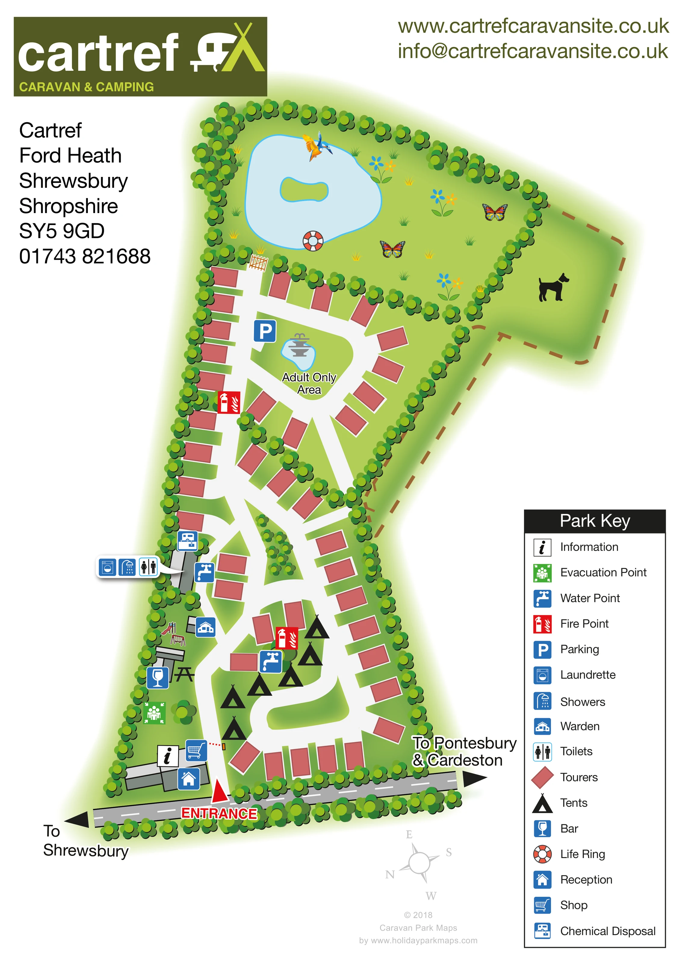
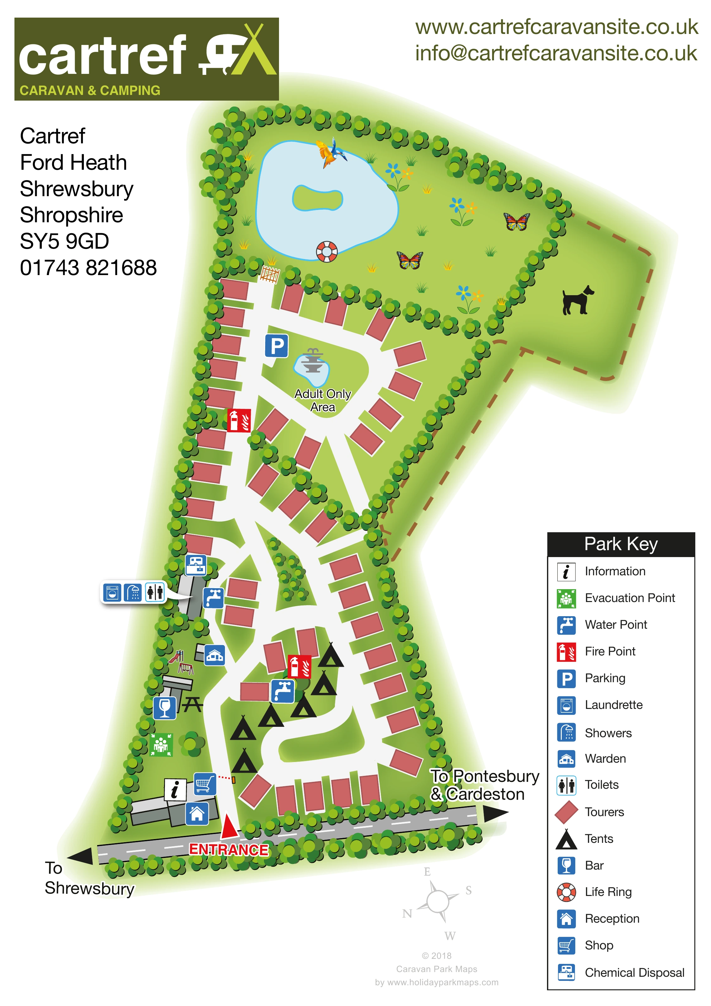
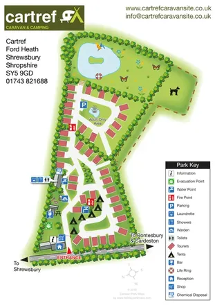
This illustrated map of Cartref Caravan & Camping presents a tree-lined touring and camping site at Ford Heath, near Shrewsbury in Shropshire. Its elongated layout leads visitors from the entrance and reception buildings through a mixed accommodation area to a clearly labelled adult-only touring section. Beyond the pitches, a large pond with a small island gives the upper part of the plan a distinctive landscape landmark.
The artwork uses salmon-red touring blocks, black tent symbols and broad white lanes to keep the accommodation pattern easy to follow. Shared facilities are picked out with blue pictograms, while red fire-point markers and a green evacuation symbol stand apart from the everyday visitor services. Reception, the shop, bar, washrooms and laundry are all shown in relation to the internal routes.
Rather than relying on pitch numbers, this design explains the park through its overall shape, planted boundaries and recognisable destinations. A prominent entrance arrow, local road directions and a substantial Park Key make it a useful example of a compact visitor map combining practical wayfinding with a friendly, illustrated rural character.
The portrait artwork places Cartref’s olive-and-lime branding at the top left, with contact details arranged across the header and left margin. The illustrated plan runs down the centre of the page, while a tall Park Key occupies the lower-right corner. A compass and discreet designer credit complete the lower margin.
At the bottom of the plan, a grey road carries arrows towards Shrewsbury in one direction and Pontesbury and Cardeston in the other. A bold red entrance marker points into the park beside the reception, information and shop building group. From here, broad white lanes divide around green islands and serve touring positions along both sides of the site. Black tent symbols identify camping space within the lower loop.
The left-hand side gathers several shared destinations: the bar and illustrated outdoor seating, a small area of play equipment, the warden building and a longer service building. A compact callout identifies toilets, showers and the laundrette, with chemical disposal nearby. Water points and fire points are marked within the accommodation areas, and an evacuation point appears near the lower-left boundary.
Further up, the lanes form a distinct adult-only touring loop around a small pool and fountain illustration. Parking is marked beside this loop. Beyond it, dense trees frame a larger pond with an island and a life-ring symbol. Flowers, butterflies and a colourful bird add visual interest to the surrounding green space. An outlined enclosure with a dog silhouette extends to the right.
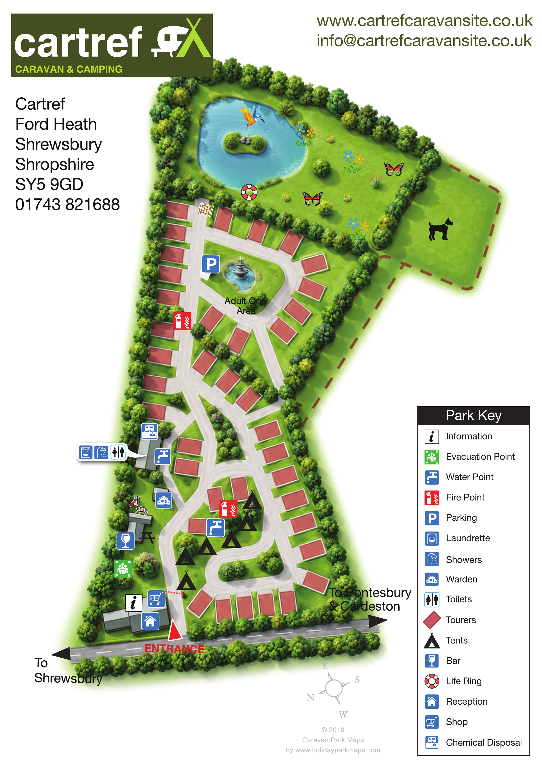
The accompanying enlarged view repeats the lower-right portion of this same artwork, making the legend easier to read; it is not a separate park section or alternative layout.
 Enlarge this map ↗
KEEP EXPLORING
Chosen for shared landscapes, accommodation or facilities.
 Explore the map ↗
United Kingdom
Woodland-framed Barnsoul map with mixed accommodation, shared facilities and paw-marked walking routes.
 Explore the map ↗
United Kingdom
A colour-zoned coastal park map with touring areas, woodland trails, ponds and a leisure club.
 Explore the map ↗
United Kingdom
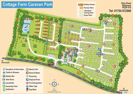
Illustrated touring and camping park map with numbered pitches, a fishing pond and a central farm courtyard.
Features may come from the sample artwork, its key or published park information. Approximate numbers describe the drawing and may cover only part of a park. They are intended to help you compare map examples. Current facilities and booking information should be checked with the park.
TAKE A CLOSER LOOK
View the illustrated map in detail or choose a file to download. These are sample maps; contact the park for current visitor information.


LET’S MAP YOUR PARK
For a map quotation, find your park and draw a rough boundary around it. The area you select helps us work out the design time and price.
Draw your park for a quote ↗Or talk to our map designers
01751 473136
 cartref_large.png