
Trees, hedges and stone boundaries
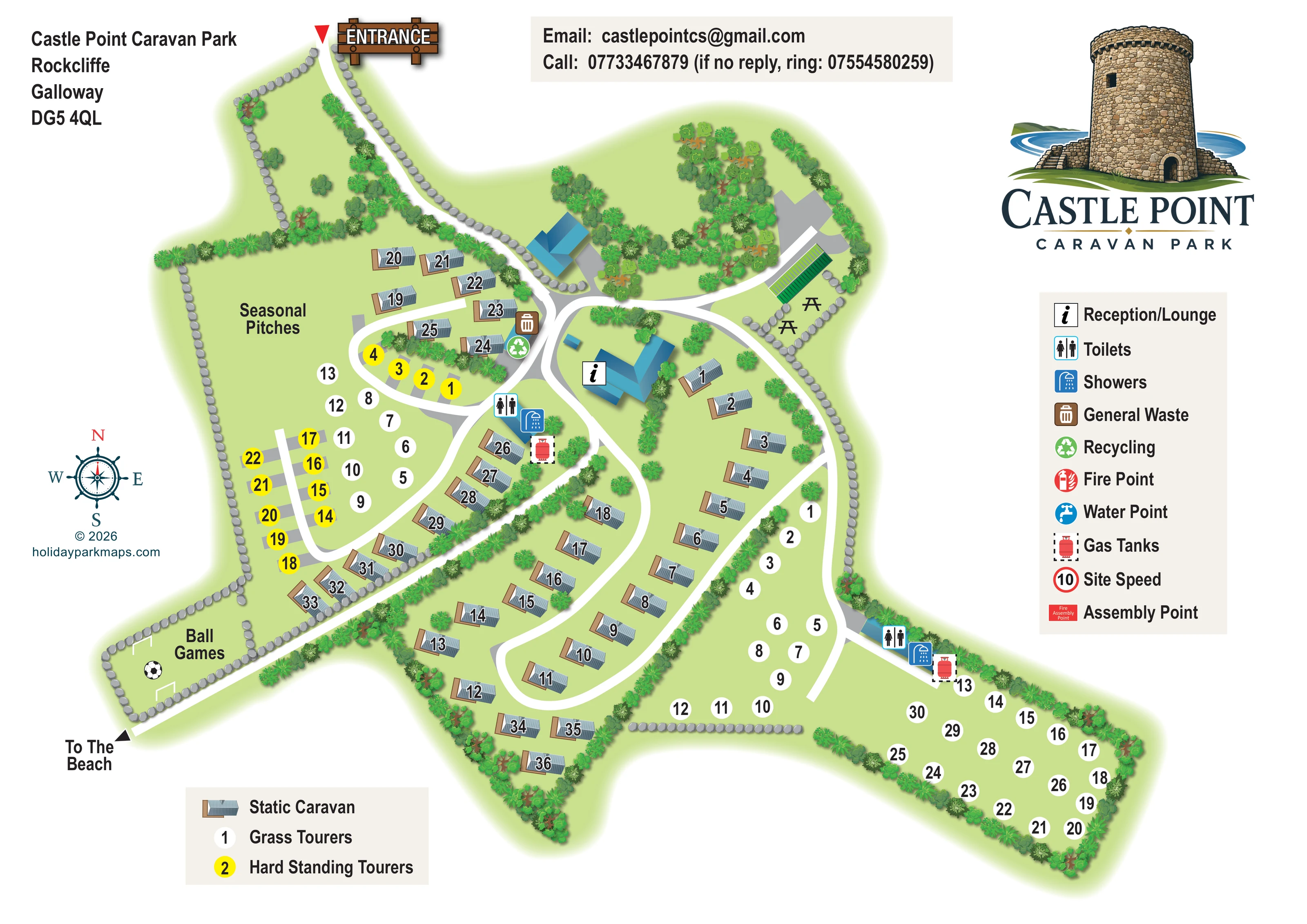
Dense illustrated planting defines accommodation compartments, with repeated grey stones marking several edges and the entrance approach.
ILLUSTRATED PARK MAP · P070
Castle Point Caravan Park, Rockcliffe, Galloway · United Kingdom
 Enlarge the map ↗
A SENSE OF THE PLACE
Castle Point Caravan Park is based at Rockcliffe, Galloway. The park is about 300 yards from the sea, with three sandy beaches within walking distance. The park accommodates touring caravans, motorhomes, tents and static holiday caravans, with statics available for hire and sale.
Facilities include two toilet blocks, accessible toilet and shower rooms, laundry and washing-up areas, and electric vehicle charging. Up to two pets per booking are normally permitted; some hire caravans exclude pets and larger numbers require arrangement. There is a children’s play area, football space, table tennis, cycle storage, a bike wash and a drying cabinet for wet clothing.
LOOK CLOSER
Dense illustrated planting defines accommodation compartments, with repeated grey stones marking several edges and the entrance approach.
An information symbol identifies the blue-roofed reception/lounge building at the main internal junction.
Two paired toilet-and-shower locations are shown: one near the western touring area and another beside the eastern grass touring area.
Adjacent waste and recycling symbols sit near the junction between the entrance approach and western accommodation.
Red tank symbols in dashed boxes appear beside both mapped toilet-and-shower locations.
A separate south-western enclosure is labelled Ball Games and illustrated with a football and two goals.
Two picnic-table silhouettes appear in a small stone-edged area on the north-eastern branch.
A prominent wooden-style ENTRANCE sign marks the northern end of the long approach lane.
An information symbol identifies the blue-roofed reception/lounge building at the main internal junction.
Two paired toilet-and-shower locations are shown: one near the western touring area and another beside the eastern grass touring area.
Adjacent waste and recycling symbols sit near the junction between the entrance approach and western accommodation.
Red tank symbols in dashed boxes appear beside both mapped toilet-and-shower locations.
A separate south-western enclosure is labelled Ball Games and illustrated with a football and two goals.
Two picnic-table silhouettes appear in a small stone-edged area on the north-eastern branch.
A prominent wooden-style ENTRANCE sign marks the northern end of the long approach lane.
A south-westward route passes the ball games enclosure and ends at an arrow labelled To The Beach. The beach itself is outside the plan.
Broad white routes connect the reception junction, western touring loops, central caravan loop and eastern grass pitches.
Dense illustrated planting defines accommodation compartments, with repeated grey stones marking several edges and the entrance approach.
Included in the facilities legend; no unambiguous matching position is visible on the plan.
A blue tap symbol appears in the legend, without a clearly identifiable plotted location.
The legend includes a red-ringed 10 symbol labelled Site Speed; it is not clearly positioned on the plan.
A red Fire Assembly Point panel appears in the legend, but a corresponding labelled location is not clearly shown.
Park information describes laundry and washing-up areas, accessible toilet and shower rooms, and electric vehicle charging. These are not individually identified in the map.
Park information also describes a children's play area, table tennis, cycle storage, a bike wash and a drying cabinet. These should not be treated as individually mapped amenities.
READING THE MAP
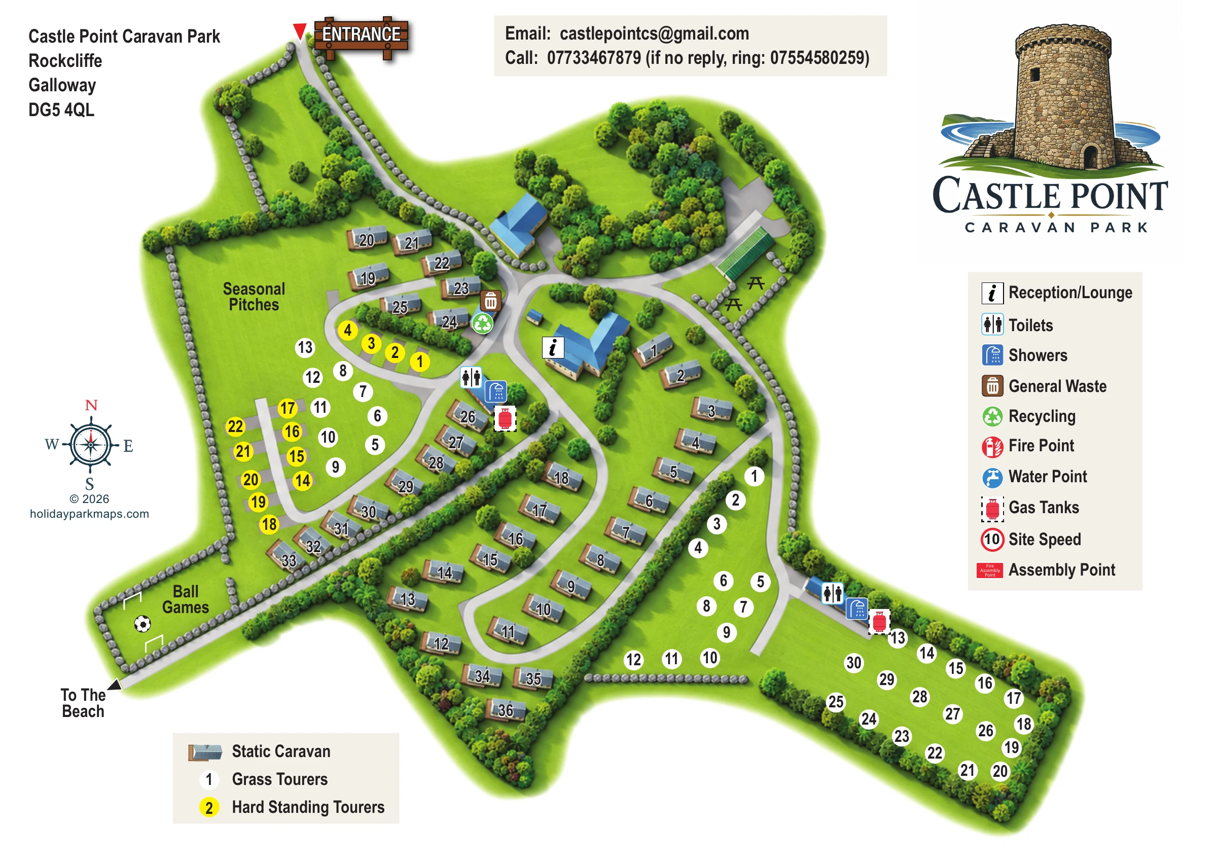
This illustrated map of Castle Point Caravan Park in Rockcliffe, Galloway, brings together static caravans, touring pitches and a route towards the beach on one landscape page. Its irregular footprint is made easy to follow through a long entrance approach, a central reception junction and a series of curving routes that divide the park into recognisable accommodation areas.
The design gives each accommodation type a distinct visual language. Static caravans appear as small, shaded buildings with numbered roofs, while grass touring pitches use white circles and hardstanding pitches use bright yellow markers. Trees, shrubs and stone boundaries help explain how the different areas relate to one another without overwhelming the route network.
Practical visitor information is equally prominent. The map shows two toilet-and-shower locations, waste and recycling facilities, gas tanks, a ball games area and picnic tables. A beach-direction arrow adds useful coastal context without attempting to map the shoreline. The large castle-tower logo, nautical compass and wooden-style entrance sign give the page a distinctive identity alongside its practical wayfinding role.
The single-page plan starts with a clearly marked entrance at the top of the artwork. A narrow white approach lane curves between stone boundaries and planting before reaching the main internal junction. Reception and lounge are identified by an information symbol on a blue-roofed building close to this arrival point.
To the west, the area labelled Seasonal Pitches combines grass touring markers with yellow hardstanding markers placed over grey pads. Small groups of static caravans occupy neighbouring strips, and a compact loop connects these pitches to the central facilities. Waste and recycling symbols sit near the upper junction, while a toilet-and-shower building and gas tank symbol appear further south.
The principal static-caravan area follows an elongated loop through the centre of the park. Individually numbered caravan illustrations are staggered along its sides, with further units near the southern tip. A planted strip separates this area from the grass touring pitches to the east. Those pitches extend into a broader south-eastern field, where another toilet-and-shower location and gas tank are marked along the upper edge.
A separate route heads south-west beside a stone-edged ball games enclosure, illustrated with goals and a football, before reaching the To The Beach arrow. At the opposite end of the plan, a short north-eastern branch reaches a small area with picnic-table symbols and an unlabelled green structure.
The artwork uses two legends: one for accommodation and one for facilities. Broad white routes, bold numbers and coloured pictograms supply the functional information, while textured foliage, shaded buildings and the softly faded green footprint give the plan its illustrated character. The large castle logo sits outside the site plan as branding, not as a mapped landmark.
 Enlarge this map ↗
KEEP EXPLORING
Chosen for shared landscapes, accommodation or facilities.
 Explore the map ↗
United Kingdom
Coastal park map with static-caravan rows, touring pitches, a camping field and two leisure clusters.
 Explore the map ↗
United Kingdom
Illustrated touring-park plan with facilities, public footpaths and adjoining field-access details.
 Explore the map ↗
United Kingdom
Tree-framed mixed-accommodation park map with two entrances, touring loops and a clearly illustrated social hub.
Features may come from the sample artwork, its key or published park information. Approximate numbers describe the drawing and may cover only part of a park. They are intended to help you compare map examples. Current facilities and booking information should be checked with the park.
LET’S MAP YOUR PARK
For a map quotation, find your park and draw a rough boundary around it. The area you select helps us work out the design time and price.
Draw your park for a quote ↗Or talk to our map designers
01751 473136