
Fishing pond
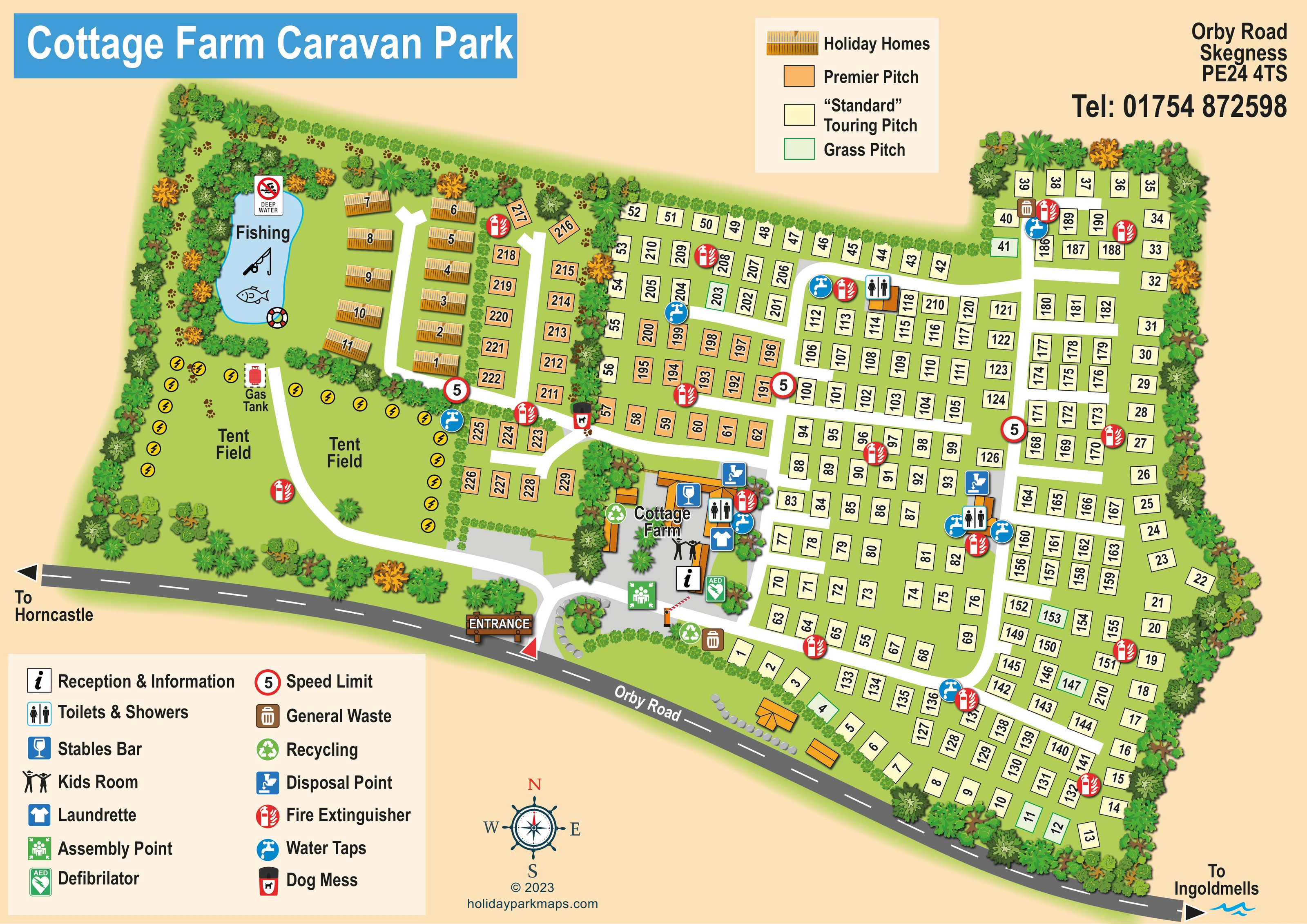
A blue pond labelled Fishing sits within the wooded western corner, accompanied by rod and fish illustrations, a lifebuoy and a deep-water/no-swimming sign.
ILLUSTRATED PARK MAP · P087
Orby Road, Skegness · United Kingdom
 Enlarge the map ↗
A SENSE OF THE PLACE
Cottage Farm Caravan Park, also listed as Cottage Farm Camp, is a family-run site at Addlethorpe near Skegness. The Orby Road location provides a base in the Lincolnshire coastal area.
The park's visitor listing describes seasonal and shorter touring stays for caravans, motorhomes and tents, alongside privately owned holiday homes. The map shows the organisation of the accommodation areas and access routes.
LOOK CLOSER
A blue pond labelled Fishing sits within the wooded western corner, accompanied by rod and fish illustrations, a lifebuoy and a deep-water/no-swimming sign.
Dense illustrated trees enclose much of the park. Smaller hedges separate the pond, holiday homes, camping areas and roadside pitches.
An information symbol locates reception within the Cottage Farm building group immediately inside the entrance.
Symbols identify facilities at the central farm complex and at additional blocks within the touring area.
The legend's glass symbol is placed over a building in the Cottage Farm courtyard.
A paired-children symbol identifies the Kids Room within the central building group.
A blue shirt symbol marks the laundrette beside the other courtyard facilities.
Blue tap symbols are distributed through the touring area and beside the tent fields and central facilities.
An information symbol locates reception within the Cottage Farm building group immediately inside the entrance.
Symbols identify facilities at the central farm complex and at additional blocks within the touring area.
The legend's glass symbol is placed over a building in the Cottage Farm courtyard.
A paired-children symbol identifies the Kids Room within the central building group.
A blue shirt symbol marks the laundrette beside the other courtyard facilities.
Blue tap symbols are distributed through the touring area and beside the tent fields and central facilities.
Blue disposal symbols appear at the farm facilities and at another service block in the touring area.
Brown general-waste and green recycling symbols mark collection points around the entrance courtyard, with another general-waste point in the northern touring section.
A dog-waste bin symbol appears at the junction between the western accommodation areas and the main touring layout.
Repeated red extinguisher symbols identify points throughout the pitch blocks, tent fields and central facilities.
A green AED symbol is positioned beside reception near the entrance.
A green assembly-point symbol is shown in the entrance courtyard.
A labelled red tank symbol stands beside the western tent-field access lane.
Yellow circles containing lightning bolts line parts of the tent fields. They conventionally suggest electrical connection points, although they are not explained in the visible legend.
A blue pond labelled Fishing sits within the wooded western corner, accompanied by rod and fish illustrations, a lifebuoy and a deep-water/no-swimming sign.
Dense illustrated trees enclose much of the park. Smaller hedges separate the pond, holiday homes, camping areas and roadside pitches.
A prominent timber-style ENTRANCE sign marks the single depicted arrival point from Orby Road, leading to a landscaped junction and reception courtyard.
A red-and-white barrier is illustrated beside reception on the internal access route.
Broad white lanes link the courtyard, touring rows, holiday-home enclave and tent fields, with curved connecting routes and short branches.
Red-ringed signs displaying 5 are positioned on several internal lanes and explained as Speed Limit in the legend.
Arrows at opposite ends of Orby Road indicate Horncastle to the left and Ingoldmells to the lower right.
A decorative compass below the plan provides north, east, south and west orientation.
READING THE MAP
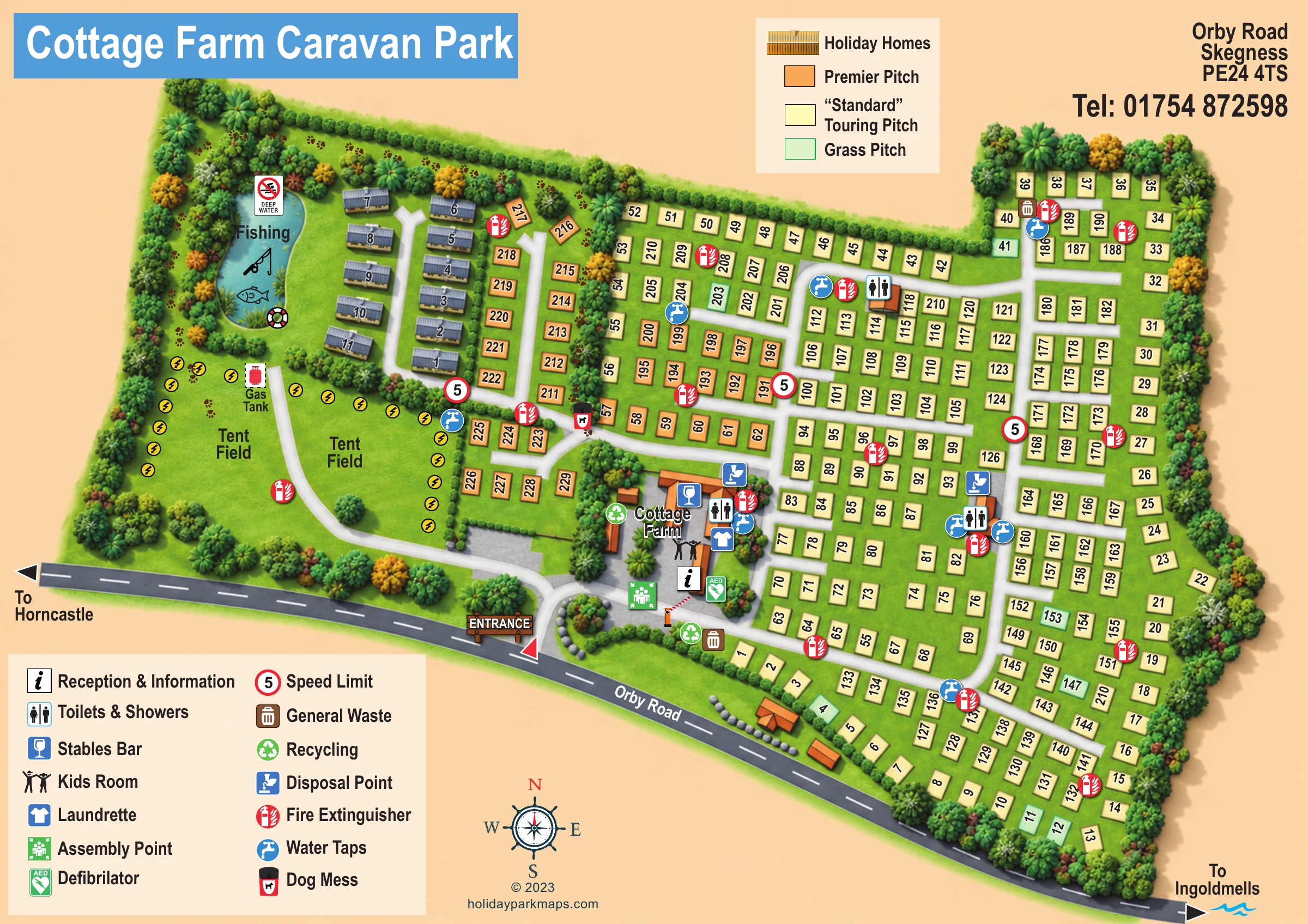
This illustrated map of Cottage Farm Caravan Park brings together a busy touring layout, open tent fields and a small holiday-home area beside a fishing pond. Located at Addlethorpe near Skegness, the park is shown behind a sweeping stretch of Orby Road, with a clearly marked entrance leading to the Cottage Farm courtyard and reception.
The artwork makes the different accommodation areas easy to distinguish. Cream rectangles identify Standard Touring Pitches, orange marks Premier Pitches, and green outlines pick out Grass Pitches. Holiday homes receive a more pictorial treatment, with golden roofs arranged along their own short lane. To the west, two labelled tent fields provide a visual contrast to the tightly organised pitch rows.
A separate facility legend explains the symbols for toilets and showers, the Stables Bar, Kids Room, laundrette and practical service points. Trees, hedges and the blue fishing pond give the plan recognisable landmarks without obscuring the numbered pitches. This sample is particularly relevant to touring and camping parks that need to present several accommodation categories alongside a central group of visitor facilities.
The plan is organised around an entrance from Orby Road on the lower edge of the page. A timber-style entrance sign, landscaped island and curved white access lane lead visitors towards the Cottage Farm building group. Reception and information, the Stables Bar, Kids Room and laundrette are identified here, together with toilets and showers, a disposal point and water taps. An assembly-point symbol and green AED marker sit close to reception, beside an illustrated barrier.
Most of the centre and right-hand side is occupied by numbered touring pitches. Long parallel rows are linked by white lanes, with further pitches following the irregular outer boundary. The accommodation key differentiates cream Standard Touring Pitches, orange Premier Pitches and pale green Grass Pitches. Premier Pitches are grouped mainly towards the western side of this area, while the Grass Pitches appear at scattered positions. Additional toilet and shower blocks, disposal facilities and water taps are marked within the touring layout. Red fire-extinguisher symbols recur across the site, and waste, recycling and dog-waste points use their own pictograms.
The western side has a different character. Two open areas labelled Tent Field flank a curving lane, with yellow lightning-bolt symbols around parts of their edges and a labelled gas tank nearby. Above them, a small group of illustrated holiday homes faces a short access lane beside the fishing pond. The water is labelled and decorated with a fishing rod, fish and lifebuoy, with a deep-water warning sign alongside.
Dense tree borders and smaller hedge divisions help define these zones. The complete artwork includes an upper accommodation key, lower-left facility legend, compass rose and road arrows towards Horncastle and Ingoldmells. The enlarged views show portions of this same single-page design rather than separate park sections.
 Enlarge this map ↗
KEEP EXPLORING
Chosen for shared landscapes, accommodation or facilities.
 Explore the map ↗
United Kingdom
Woodland holiday-park map with named accommodation areas, touring loops and illustrated recreation facilities.
 Explore the map ↗
United Kingdom
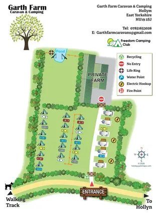
Illustrated farm campsite map with tent camping, electric touring bays, a pond and clearly marked private farm access.
 Explore the map ↗
United Kingdom
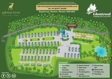
Woodland-framed Glentrool site map with numbered caravans, yellow touring pitches and a turquoise pond.
Features may come from the sample artwork, its key or published park information. Approximate numbers describe the drawing and may cover only part of a park. They are intended to help you compare map examples. Current facilities and booking information should be checked with the park.
LET’S MAP YOUR PARK
For a map quotation, find your park and draw a rough boundary around it. The area you select helps us work out the design time and price.
Draw your park for a quote ↗Or talk to our map designers
01751 473136