
Castle Sween
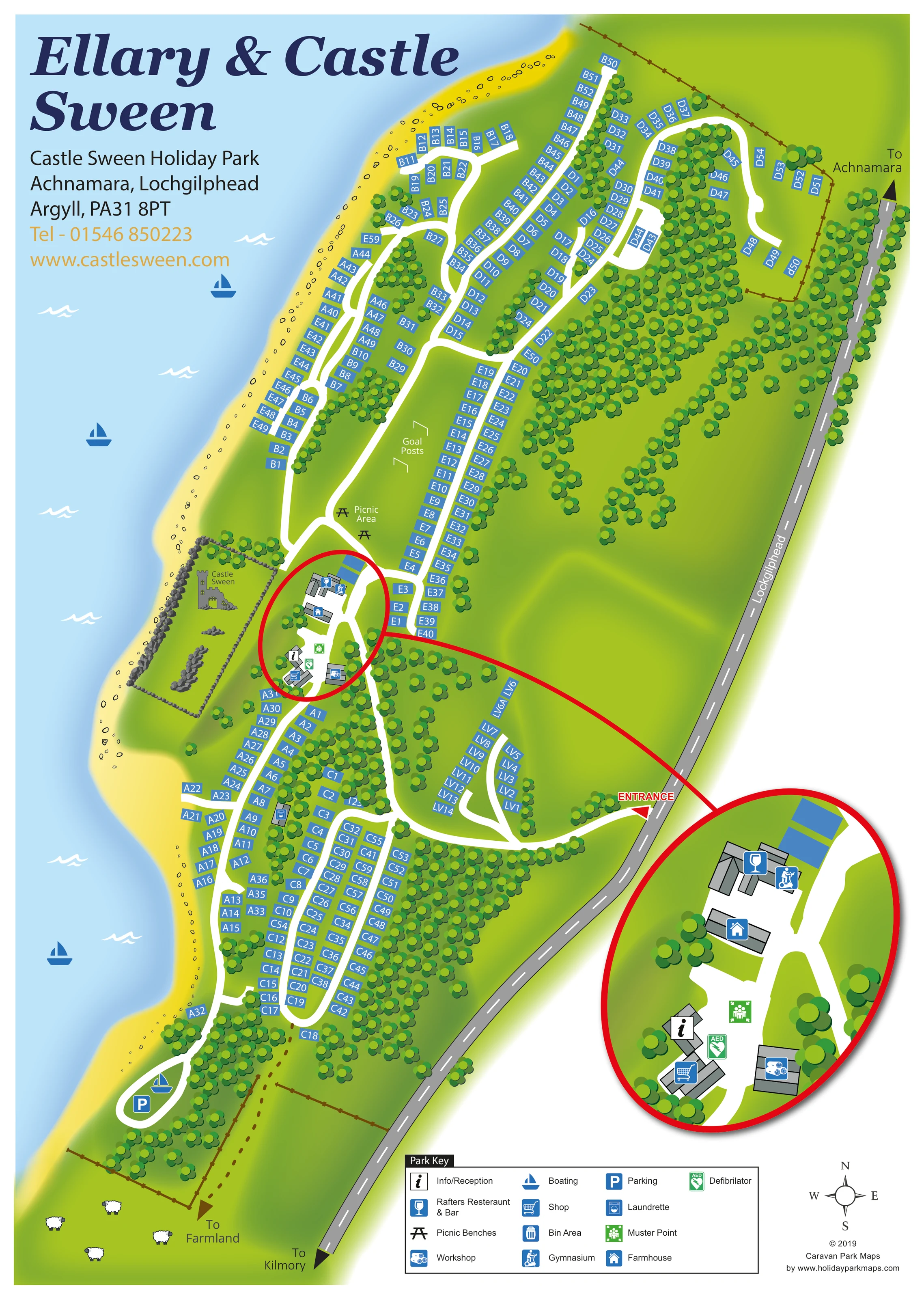
Named castle ruins are drawn within a stone-walled enclosure on the shoreline beside the central facilities.
ILLUSTRATED PARK MAP · P439
Castle Sween Holiday Park, Achnamara, Lochgilphead, Argyll · United Kingdom
 Enlarge the map ↗
A SENSE OF THE PLACE
Castle Sween Holiday Park is based at Achnamara, Lochgilphead, Argyll. The park is beside Loch Sween within the coastal and hill landscape of the Ellary Estate. Holiday homes and lodges are offered for ownership; two- and three-bedroom holiday homes are also rented in the Loch View area.
A slipway is provided for launching trailer-borne boats, with designated boat storage areas. Park facilities include a convenience shop, Rafters bar and restaurant, and a gym. A centrally located laundrette is advertised as open around the clock.
LOOK CLOSER
Named castle ruins are drawn within a stone-walled enclosure on the shoreline beside the central facilities.
A long curved yellow shoreline borders pale blue water along the western side of the park, with small stones and wave motifs.
Dense groups of stylised trees divide accommodation areas, edge roads and fill the eastern interior.
A dotted route points towards farmland at the southern end, illustrated with fences and sheep.
An information symbol marks a building in the central facilities cluster, repeated in the enlarged inset.
The restaurant and bar symbol appears on the northern building in the facilities cluster.
A shopping-trolley symbol identifies the shop beside reception in the central cluster.
A gym symbol shares the northern facilities building area with the restaurant and bar.
An information symbol marks a building in the central facilities cluster, repeated in the enlarged inset.
The restaurant and bar symbol appears on the northern building in the facilities cluster.
A shopping-trolley symbol identifies the shop beside reception in the central cluster.
A gym symbol shares the northern facilities building area with the restaurant and bar.
A washing-machine symbol marks the laundrette within the southern accommodation area.
The workshop is marked on a separate building at the eastern side of the central facilities cluster.
A house symbol identifies the building between the restaurant area and reception.
A green AED symbol appears beside reception and is particularly clear in the magnified inset.
A green assembly symbol marks the open space within the central facilities cluster.
Two bench symbols and a picnic-area label occupy the open grass immediately north of the castle and facilities.
A pair of illustrated goals is labelled on the central open grass between accommodation rows.
A boating symbol marks the southern waterfront access loop. Additional sailboat graphics decorate the loch.
A parking symbol is placed beside the boating point on the small southern shoreline loop.
A bin-area symbol appears within the southern accommodation section; the key explains the symbol.
Named castle ruins are drawn within a stone-walled enclosure on the shoreline beside the central facilities.
A long curved yellow shoreline borders pale blue water along the western side of the park, with small stones and wave motifs.
Dense groups of stylised trees divide accommodation areas, edge roads and fill the eastern interior.
A dotted route points towards farmland at the southern end, illustrated with fences and sheep.
A red-labelled entrance connects the park's white internal road network to the grey public road on the eastern boundary.
The public road has directional arrows towards Achnamara at the top and Kilmory at the bottom, with Lochgilphead indicated along the road.
Park information describes a slipway for trailer-borne boats and designated boat storage areas. The map marks boating access but does not separately label these facilities.
READING THE MAP
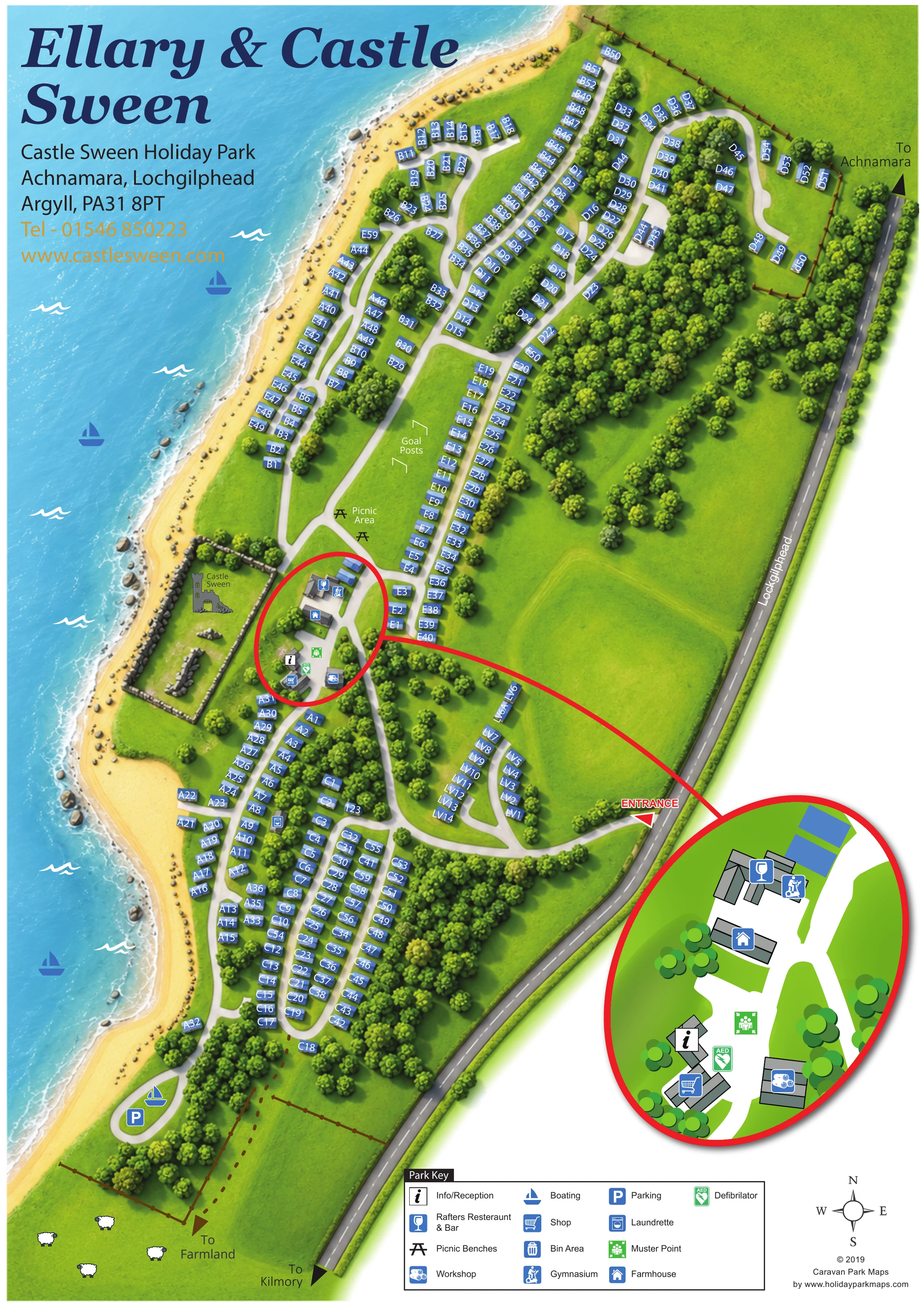
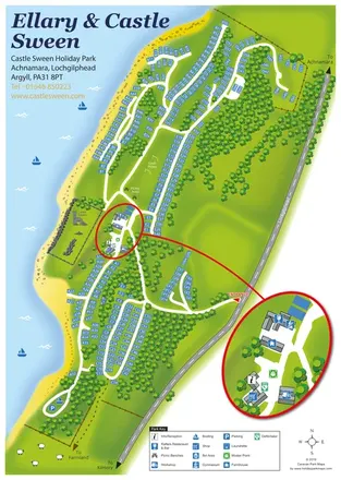
This illustrated map of Castle Sween Holiday Park presents a long, wooded holiday-home site beside Loch Sween in Argyll. Its shoreline setting is central to the composition: pale blue water fills the left side, a yellow coastal edge follows the accommodation rows, and the ruins of Castle Sween form a distinctive landmark beside the park's main facilities.
The plan shows roughly 275 holiday-home plots arranged along winding white roads, with lettered references helping visitors identify different parts of the park. An entrance from the eastern boundary road leads into branching routes serving the waterfront rows, wooded interior and smaller LV group. Reception, the shop, Rafters restaurant and bar, the gymnasium and other central buildings are brought together in a large circular enlargement, making this busy area easier to read without crowding the main plan.
Picnic benches, goal posts, waterfront parking and a boating point add practical detail. The combination of numbered accommodation, illustrated landscape and a focused facilities inset makes this a useful example for sizeable parks with an irregular coastal layout.
The artwork uses a portrait page to follow the park's elongated shape between the loch and the public road. Blue accommodation rectangles run in long rows beside white internal roads, turning with the shoreline and branching into smaller wooded clusters. The northern half contains several parallel routes and curved end sections; the southern half uses tighter loops, with the smaller LV group reached from a branch near the entrance.
Arrival is marked by a red entrance arrow on the eastern boundary. The grey public road continues towards Achnamara and Kilmory, while a separate dotted route points towards farmland at the southern end. A compass provides orientation without introducing a scale or detailed topographic information.
Castle Sween is drawn as a group of ruins inside a stone-walled enclosure on the waterfront. Immediately alongside it, the main facilities cluster includes information and reception, a shop, Rafters restaurant and bar, a gymnasium, a farmhouse and a workshop. Green symbols identify a defibrillator and muster point. A red outline surrounds this area on the main plan and connects it to a much larger circular inset, where building shapes and overlapping facility symbols can be read more clearly.
Elsewhere, the map identifies a laundrette and bin area among the southern plots, a picnic area and goal posts on the central grass, and parking beside a boating point at the southern shore. Trees are used extensively to separate accommodation groups and soften the roads. Boats, waves, shoreline stones and sheep add setting-specific illustration. The boxed Park Key, heading and contact block complete the single-page design; the inset is an enlargement of the same site rather than an additional section.
 Enlarge this map ↗
KEEP EXPLORING
Chosen for shared landscapes, accommodation or facilities.
 Explore the map ↗
United Kingdom
Illustrated lakeside park plan with numbered holiday units, leisure buildings and a looping Woodland Walk.
 Explore the map ↗
United Kingdom
Colour-coded accommodation, lakeside facilities and woodland routes at Burton Constable Holiday Park & Arboretum.
 Explore the map ↗
United Kingdom
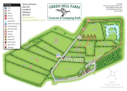
Green Hill Farm's field-based caravan and camping map combines numbered pitches, named camping areas, Horseshoe Lake and a clearly differentiated Forest Walk.
Features may come from the sample artwork, its key or published park information. Approximate numbers describe the drawing and may cover only part of a park. They are intended to help you compare map examples. Current facilities and booking information should be checked with the park.
TAKE A CLOSER LOOK
View the illustrated map in detail or choose a file to download. These are sample maps; contact the park for current visitor information.


LET’S MAP YOUR PARK
For a map quotation, find your park and draw a rough boundary around it. The area you select helps us work out the design time and price.
Draw your park for a quote ↗Or talk to our map designers
01751 473136