
Open camping fields and grass strips
Green field shapes provide the setting for touring strips and the larger camping area. They are not measured land parcels or evidence of available pitch capacity.
ILLUSTRATED PARK MAP · P071
Castlerigg Farm, Keswick, Cumbria · United Kingdom
 Enlarge the map ↗
A SENSE OF THE PLACE
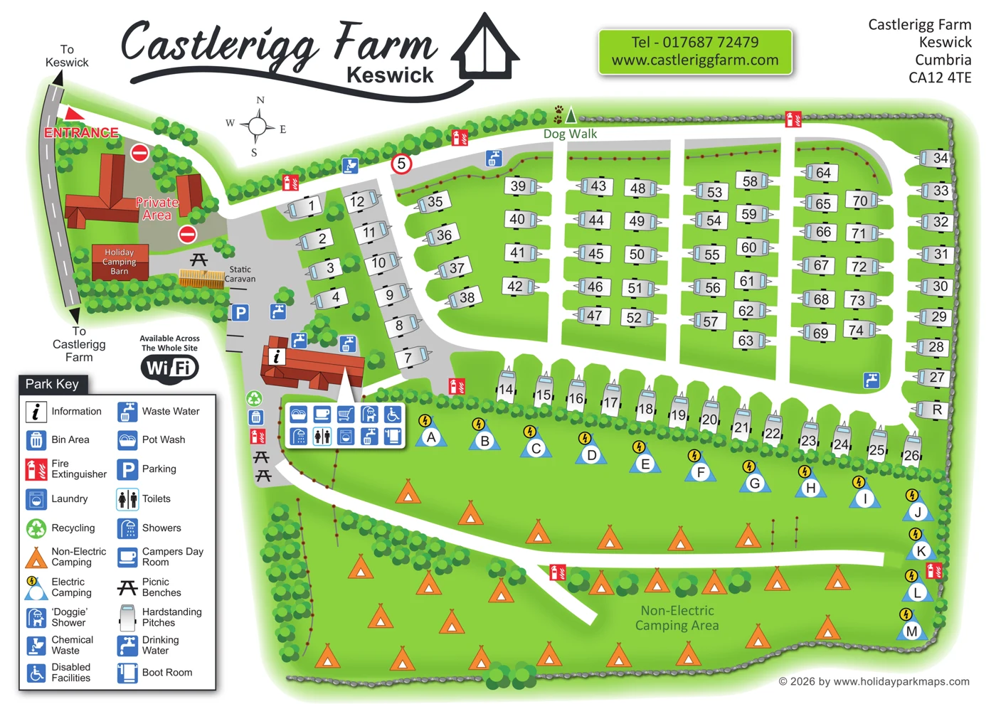
Castlerigg Farm is based at Keswick, Cumbria. Castlerigg Farm is an elevated campsite near Keswick in the Lake District, with views towards Derwent Water and surrounding fells. The park offers camping and touring pitches and advertises a four-berth static caravan.
Published facilities include showers/toilets, laundry, a campers' day room, shop, dog walking area and dog shower.
LOOK CLOSER
Green field shapes provide the setting for touring strips and the larger camping area. They are not measured land parcels or evidence of available pitch capacity.
Repeated clusters of green circles depict trees or hedge planting along boundaries and between accommodation areas. They are stylised landscape notation, not a tree survey or proof of woodland cover.
An illustrated line of shaded grey stones resembles a dry-stone boundary wall. Its exact construction and dimensions are not specified.
Thin grey lines with repeated brown circular posts appear to depict fencing or internal barriers. They are not explained by the legend.
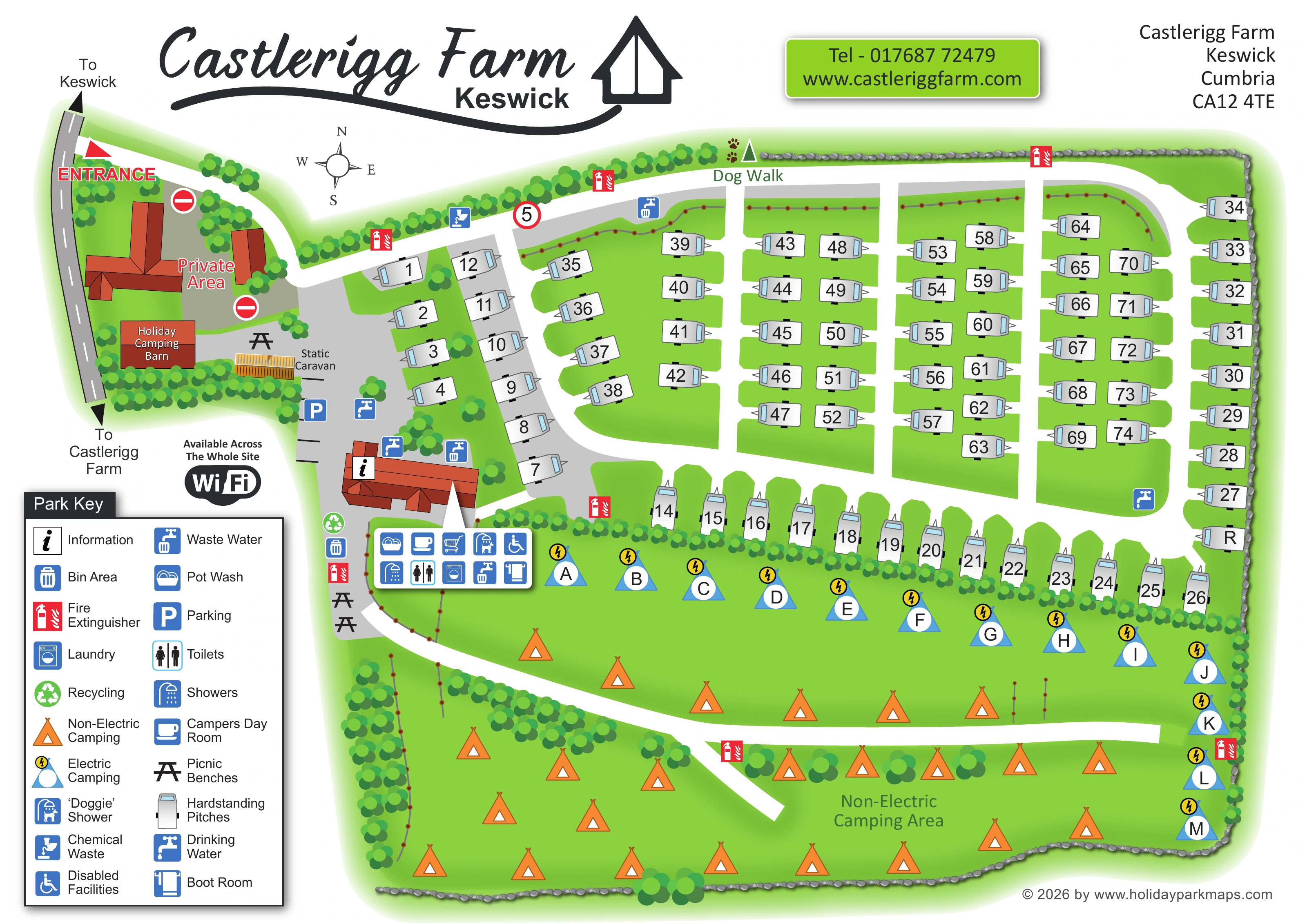
An information symbol is placed on the principal amenities building. It may serve an arrival function, but the artwork does not explicitly label it Reception.
Toilets are included in the facilities callout attached to the main amenities building. Individual room positions are not shown.
Showers are identified within the main amenities cluster.
A wheelchair symbol identifies facilities described in the key as Disabled Facilities. The map does not specify their equipment, dimensions or accessibility certification.
An information symbol is placed on the principal amenities building. It may serve an arrival function, but the artwork does not explicitly label it Reception.
Toilets are included in the facilities callout attached to the main amenities building. Individual room positions are not shown.
Showers are identified within the main amenities cluster.
A wheelchair symbol identifies facilities described in the key as Disabled Facilities. The map does not specify their equipment, dimensions or accessibility certification.
Laundry facilities are shown in the amenities panel.
A washing-up facility is identified by the Pot Wash symbol.
A campers' day room is represented by a cup symbol. This symbol is not evidence of a café, restaurant or bar.
A shopping-trolley icon in the amenities callout appears to indicate a shop. The trolley is not explained in the printed key, but a shop is independently mentioned in the supplied catalogue research.
A dedicated dog shower is identified in the main amenities cluster.
A boot room is identified by the amenities callout. No drying equipment or storage capacity is specified.
Drinking-water taps are marked around the western forecourt and towards the eastern end of the touring area.
Waste-water disposal is indicated along the northern touring route and at the amenities building. The building callout and nearby symbol should not automatically be interpreted as separate installations.
A chemical-waste disposal point is shown beside the northern approach to the hardstanding rows.
A bin area is marked beside the main amenities building.
A recycling point is shown next to the bin area.
Parking is marked in the grey forecourt between the static caravan and information building. Short black bay divisions are drawn, but no parking capacity is stated.
Picnic-bench symbols appear near the static caravan and beside the southern side of the amenities area.
A dog-walk direction is marked at the northern boundary. The artwork does not show the full extent, length or rules of the walk.
Electric camping is shown with blue tent symbols and yellow lightning badges. These establish an electric camping category, not individual pedestal positions or electrical specifications.
A separate badge states that Wi-Fi is available across the whole site. This is an artwork claim, not a tested coverage assessment.
Red fire-extinguisher pictograms are distributed around the touring routes, amenities area and camping field. Their appearance is not confirmation of present equipment positions or servicing.
Green field shapes provide the setting for touring strips and the larger camping area. They are not measured land parcels or evidence of available pitch capacity.
Repeated clusters of green circles depict trees or hedge planting along boundaries and between accommodation areas. They are stylised landscape notation, not a tree survey or proof of woodland cover.
An illustrated line of shaded grey stones resembles a dry-stone boundary wall. Its exact construction and dimensions are not specified.
Thin grey lines with repeated brown circular posts appear to depict fencing or internal barriers. They are not explained by the legend.
Supplied catalogue research describes an elevated Lake District campsite near Keswick, with views towards Derwent Water and surrounding fells. The plan itself does not depict the lake, fell skyline or contours.
READING THE MAP
Castlerigg Farm is a clear example of an illustrated camping and touring map for a Lake District park. The Keswick plan divides the site into numbered hardstanding pitches and separate camping areas, with lettered electric camping markers and a more open non-electric field. A static caravan and camping barn add variety to the accommodation shown.
The main visitor facilities are grouped near the entrance and western forecourt. The artwork identifies washrooms, laundry, a campers’ day room, shop, pot washing, a boot room and accessible facilities, alongside water and waste services. A dog walk follows the upper boundary, and a dog shower is included among the amenities.
This sample is useful for parks combining touring caravans, motorhomes and tents. Pitch numbers, camping symbols and facility icons provide several levels of information without losing the overall layout. The contrast between organised hardstanding rows and an open camping field also makes it a good reference for presenting different parts of a mixed campsite.
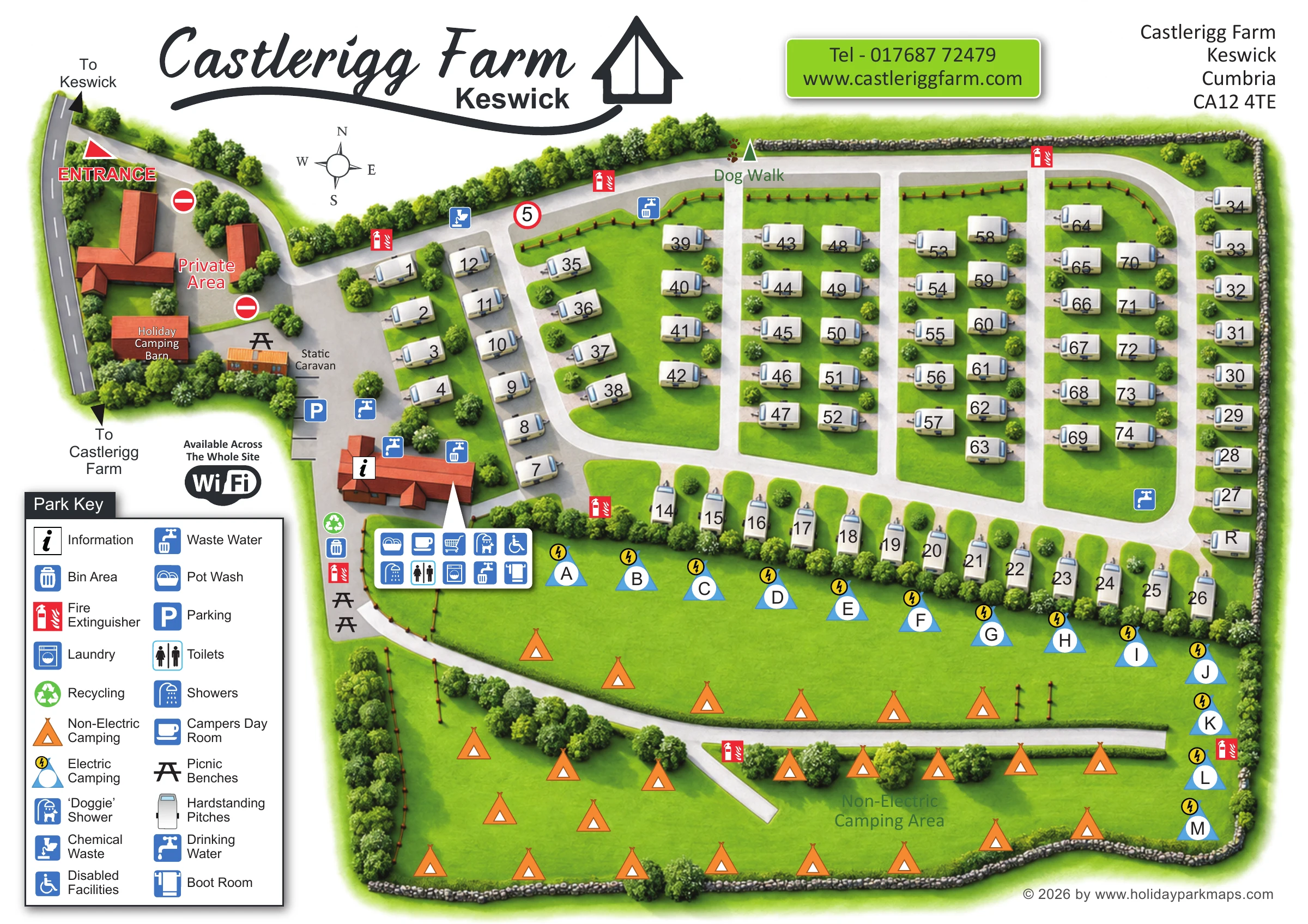
This single-page landscape map presents Castlerigg Farm as a bright, predominantly overhead campsite plan with small dimensional touches in its buildings and boundary illustrations. A large black script name, sweeping underline, tent-shaped logo and bold Keswick subtitle dominate the upper margin. A lime-green contact panel and a separate address block complete the header, while a compass rose provides orientation without a scale bar.
The entrance is marked at the upper left, branching from an external road with directions towards Keswick and Castlerigg Farm. Red-roofed buildings occupy the western side, including a clearly marked private courtyard, a Holiday Camping Barn and the main information and amenities building. A separately labelled static caravan is drawn in yellow beside the forecourt. Parking and water symbols help establish this western area as the service hub.
Across the upper and central site, grey caravan-shaped hardstanding markers sit in parallel rows and around the southern and eastern perimeter. Large black numbers are placed directly on the symbols. Broad white lanes separate the green pitch strips, with grey surfacing around parts of the approach and forecourt. Below a tree-lined division, blue tent symbols use white letter discs and yellow lightning badges to identify electric camping. Orange tents illustrate the non-electric camping area around a curving white route and its branch.
The lower-left Park Key uses two columns of mostly blue-and-white pictograms. A rounded, shadowed callout links the main building to its grouped amenities, including washing facilities, the campers' day room, dog shower and boot room. A shopping-trolley pictogram is present but not explained in the key. Red fire-extinguisher markers punctuate the site, and a paw-print Dog Walk marker points beyond the northern boundary.
Clustered circular trees, fence-like post lines and shaded stone-wall borders give the plan a rural character. These treatments support visual organisation rather than measurable terrain description. The strong symbol hierarchy is readable at detail resolution, although the amenities callout benefits from a larger reproduction.
 Enlarge this map ↗
KEEP EXPLORING
Chosen for shared landscapes, accommodation or facilities.
 Explore the map ↗
United Kingdom
Ashby Park map with seven fishing lakes, colour-coded accommodation and illustrated wooded shorelines.
 Explore the map ↗
United Kingdom
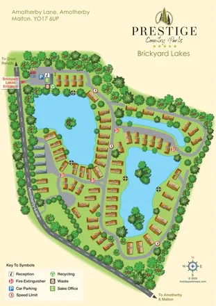
Brickyard Lakes map with lakeside holiday homes, wooded islands and clearly marked arrival facilities.
 Explore the map ↗
United Kingdom
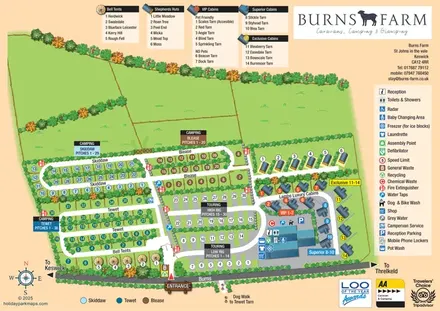
Colour-coded camping and touring sections, illustrated glamping units and a detailed amenities hub at Burns Farm.
Features may come from the sample artwork, its key or published park information. Approximate numbers describe the drawing and may cover only part of a park. They are intended to help you compare map examples. Current facilities and booking information should be checked with the park.
TAKE A CLOSER LOOK
View the illustrated map in detail or choose a file to download. These are sample maps; contact the park for current visitor information.


LET’S MAP YOUR PARK
For a map quotation, find your park and draw a rough boundary around it. The area you select helps us work out the design time and price.
Draw your park for a quote ↗Or talk to our map designers
01751 473136