
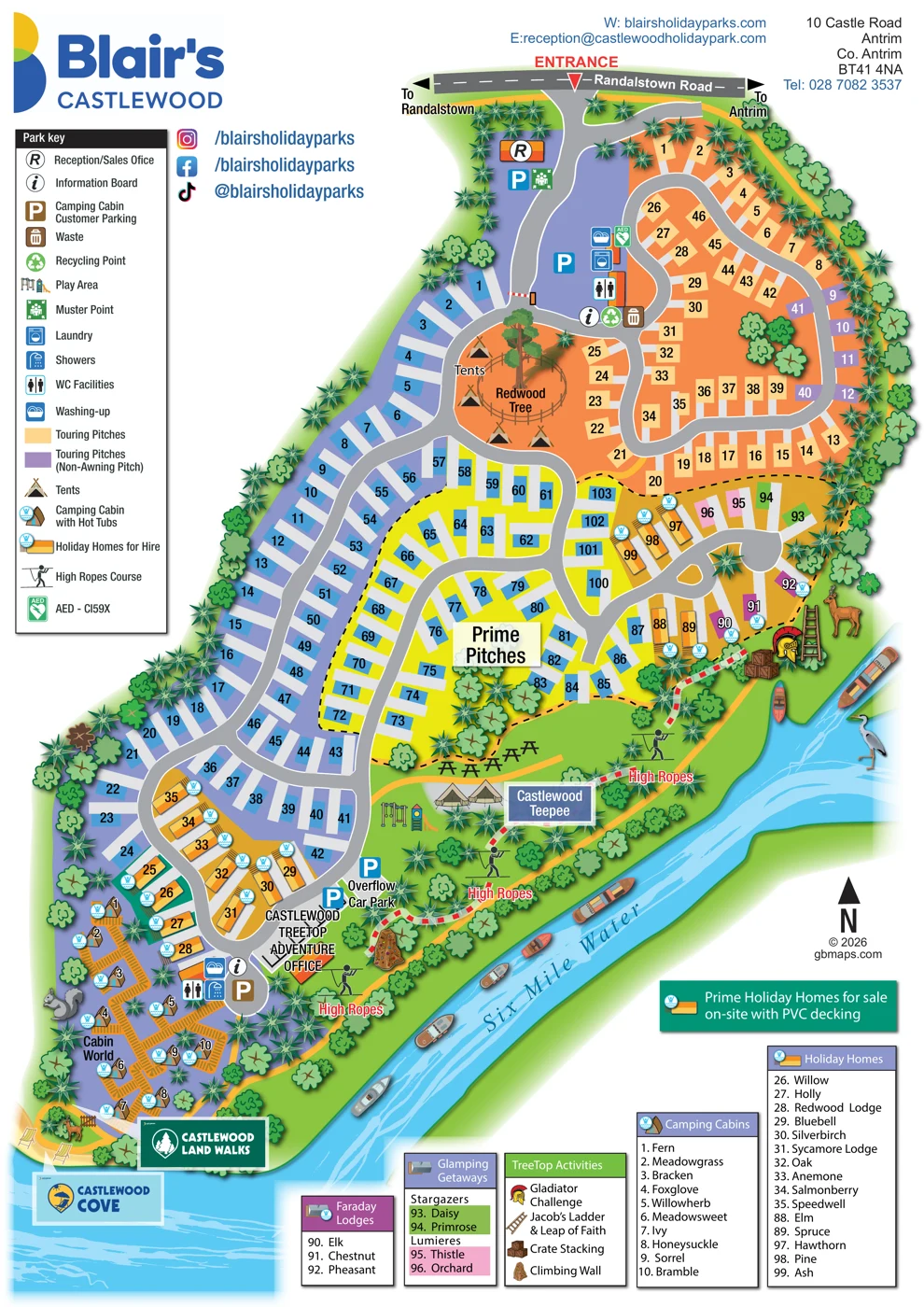
Redwood Tree and tent area
A large named tree anchors a small tent area within the upper accommodation loop.
ILLUSTRATED PARK MAP · P072
10 Castle Road, Antrim, Co. Antrim · United Kingdom
 Enlarge the map ↗
A SENSE OF THE PLACE
Castlewood Holiday Park is a woodland retreat near Antrim, with Shane's Castle and the Six Mile Water contributing to its setting. Mature trees and local wildlife are part of the park's character.
Touring and seasonal pitches complement its holiday park accommodation. Published park information also describes a play area and high-ropes activities, providing options for families spending time on site.
LOOK CLOSER
A large named tree anchors a small tent area within the upper accommodation loop.
The river defines the right and lower edges of the park, illustrated with blue water, ripples, boats and a heron.
Dense broadleaf and spiky evergreen tree symbols line the perimeter and divide accommodation from the riverside activities.
Castlewood Cove is labelled at the bottom of the map beside the river and an illustrated seating area.
Reception and sales office immediately inside the Randalstown Road entrance.
Parking symbols appear near reception, within the upper park and near the adventure office; an overflow car park is labelled in the lower section.
Washing-up and WC symbols appear in upper and lower service clusters, with laundry in the upper cluster and showers in the lower cluster.
Information-board symbols appear at the upper service junction and near the lower cabin facilities.
Reception and sales office immediately inside the Randalstown Road entrance.
Parking symbols appear near reception, within the upper park and near the adventure office; an overflow car park is labelled in the lower section.
Washing-up and WC symbols appear in upper and lower service clusters, with laundry in the upper cluster and showers in the lower cluster.
Information-board symbols appear at the upper service junction and near the lower cabin facilities.
Waste and recycling symbols are grouped at the upper service junction.
A green muster-point symbol is positioned beside reception.
An AED symbol is mapped beside the upper service buildings.
Swings and a slide illustrate a play area beside the Castlewood Teepee.
Several high-ropes illustrations and labels follow the wooded riverside strip.
A dedicated adventure office is labelled beside the lower parking and road loop.
Illustrated equipment and the TreeTop Activities panel identify Gladiator Challenge, Jacob’s Ladder and Leap of Faith, crate stacking and a climbing wall.
A large tent-like structure is labelled Castlewood Teepee in the central riverside leisure area.
Picnic-table illustrations occupy the open green strip between accommodation and the riverside activity route.
Hot-tub symbols accompany camping cabins, holiday homes and the Faraday Lodge group.
A large named tree anchors a small tent area within the upper accommodation loop.
The river defines the right and lower edges of the park, illustrated with blue water, ripples, boats and a heron.
Dense broadleaf and spiky evergreen tree symbols line the perimeter and divide accommodation from the riverside activities.
A branded Castlewood Land Walks sign appears near the lower riverside corner.
Castlewood Cove is labelled at the bottom of the map beside the river and an illustrated seating area.
The entrance meets Randalstown Road, with directional arrows towards Randalstown and Antrim.
A yellow route follows the riverside leisure strip, while short red-and-white barrier markings appear at selected access points.
Published park information places Castlewood near Shane’s Castle.
READING THE MAP
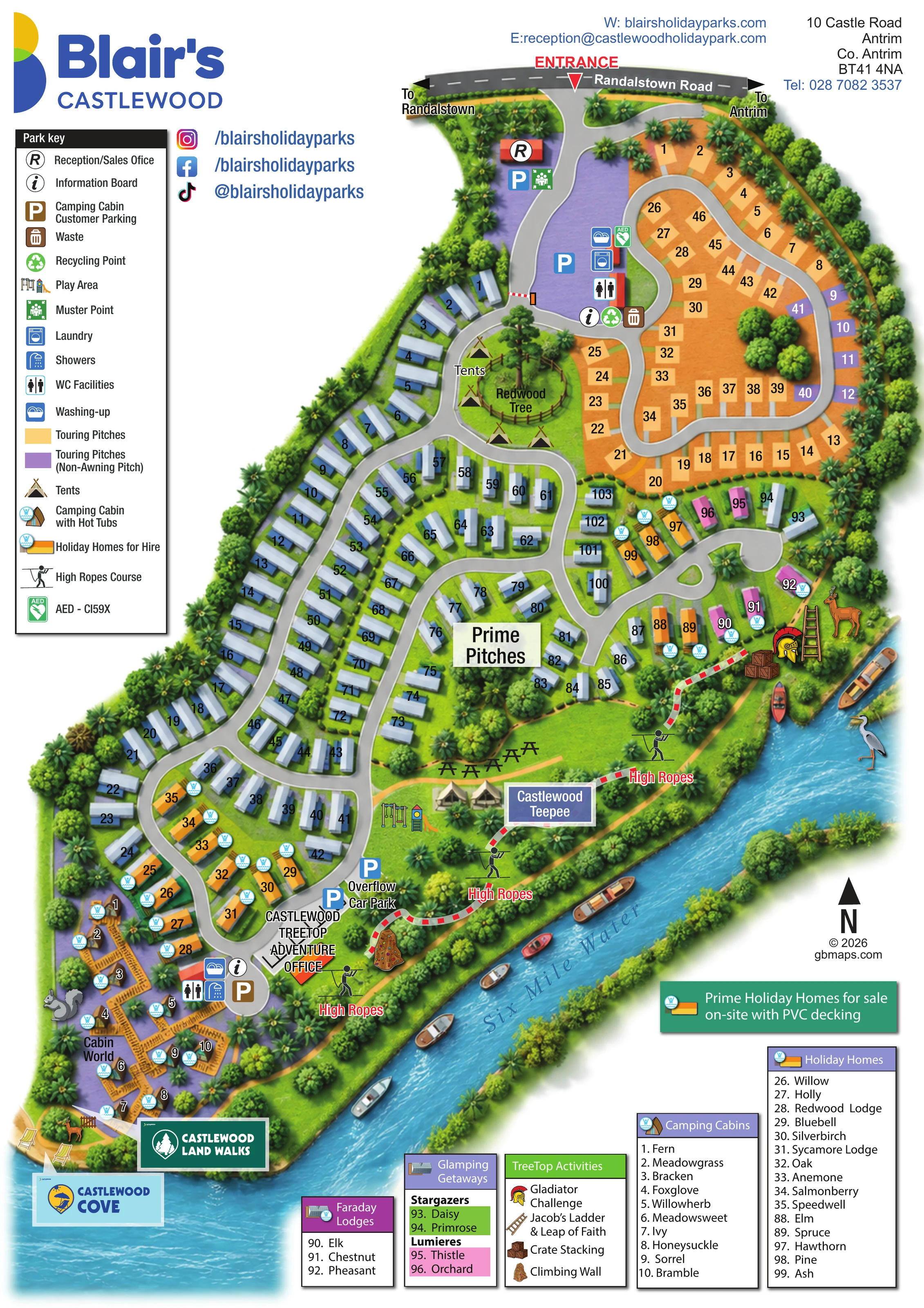
Castlewood Holiday Park’s illustrated map brings together a woodland holiday setting, a varied accommodation offer and a riverside adventure area on one portrait sheet. The Six Mile Water forms a vivid blue edge to the park, while dense tree symbols give the accommodation loops and outdoor activity spaces a recognisable landscape framework.
Visitors enter from Randalstown Road at the top of the plan, with reception and parking immediately visible. From there, winding roads lead through touring pitches, numbered accommodation areas, holiday homes and smaller lodge and glamping groups. At the opposite end, Cabin World is shown as a distinctive collection of camping cabins connected by orange deck-like walkways.
The map also gives the park’s leisure offer a clear place in the overall layout. High ropes, a play area, the Castlewood Teepee and named treetop challenges occupy the green strip beside the river. A substantial symbol key and separate accommodation panels help readers move between the illustrated overview and practical destinations. For a park with several different holiday products, this design shows how colour, numbering and landscape illustration can work together without making every area look the same.
The plan follows an elongated site from the Randalstown Road entrance at the top to Cabin World and Castlewood Cove at the lower end. Reception sits just inside the entrance, beside parking and a muster-point symbol. A winding grey road continues through interconnected loops, with numbered accommodation plots arranged along both sides. The upper loop is predominantly an orange touring area, including purple non-awning pitches and a group of holiday homes. A second facility cluster shows washing-up, laundry, WC facilities, an AED, information, recycling and waste symbols.
Further down, blue numbered plots occupy broad lilac and bright yellow areas, the latter labelled Prime Pitches. A separate riverside cluster distinguishes holiday homes, Faraday Lodges and Glamping Getaways, with green Stargazers and pink Lumieres plots. Orange holiday-home illustrations use decking details and circular hot-tub symbols where shown. At the lower end, ten named camping cabins form Cabin World, linked by conspicuous orange deck-like walkways and served by another sanitary and washing-up cluster.
The Six Mile Water runs along the right-hand boundary and across the bottom of the sheet. Between the accommodation and river, a green activity strip contains high-ropes symbols, picnic tables, the Castlewood Teepee and a play area. The Castlewood Treetop Adventure office and overflow car park sit near the lower road loop. Illustrated challenge equipment corresponds to the activity panel listing Gladiator Challenge, Jacob’s Ladder and Leap of Faith, crate stacking and a climbing wall.
A tall park key occupies the left margin, while named accommodation and activity panels line the lower edge. Blair’s Castlewood branding, social-media details, contact information, a north arrow and illustrated riverside scenery complete the portrait composition.
 Enlarge this map ↗
KEEP EXPLORING
Chosen for shared landscapes, accommodation or facilities.
 Explore the map ↗
United Kingdom
A woodland estate park map combining caravan loops, touring pitches, riverside paths and Bruce’s Cave landmarks.
 Explore the map ↗
Denmark
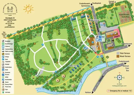
Illustrated canal-side campsite and hostel map with cabins, tipis, walking routes and town connections.
 Explore the map ↗
United Kingdom
Woodland park map with mixed pitches, bell tents, lodges and a fishing lake.
Features may come from the sample artwork, its key or published park information. Approximate numbers describe the drawing and may cover only part of a park. They are intended to help you compare map examples. Current facilities and booking information should be checked with the park.
LET’S MAP YOUR PARK
For a map quotation, find your park and draw a rough boundary around it. The area you select helps us work out the design time and price.
Draw your park for a quote ↗Or talk to our map designers
01751 473136