
Five named fishing lakes
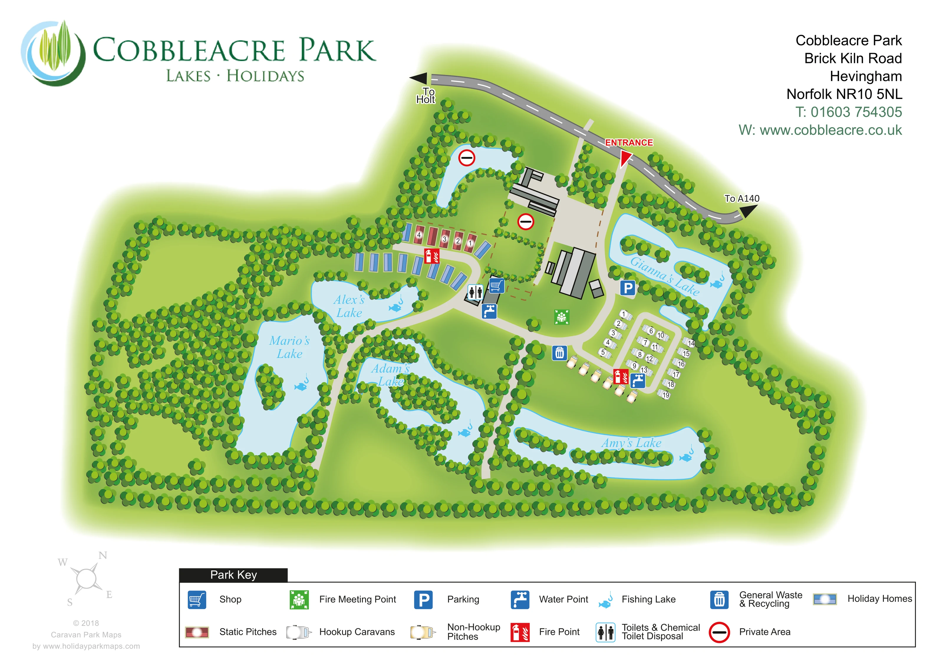
Mario’s Lake, Alex’s Lake, Adam’s Lake, Amy’s Lake and Gianna’s Lake are labelled and marked with fish-and-hook symbols. Their irregular outlines, planted islands and tree-lined banks dominate the plan.
ILLUSTRATED PARK MAP · P446
Cobbleacre Park, Brick Kiln Road, Hevingham, Norfolk · United Kingdom
 Enlarge the map ↗
A SENSE OF THE PLACE
Cobbleacre Park at Hevingham combines fishing lakes with holiday accommodation and touring pitches in the Norfolk countryside. The lakes cater for different angling interests, with day visits and fishing breaks available.
Touring spaces include fully serviced grass and hardstanding options overlooking the water. A bait and tackle shop supports fishing visits, while holiday homes provide an alternative to bringing a caravan or camping equipment.
LOOK CLOSER
Mario’s Lake, Alex’s Lake, Adam’s Lake, Amy’s Lake and Gianna’s Lake are labelled and marked with fish-and-hook symbols. Their irregular outlines, planted islands and tree-lined banks dominate the plan.
Dense tree symbols enclose the park, separate lakes and frame open grassy areas, with particularly extensive planting across the western half.
Red-ringed private-area symbols identify an unnamed northern pond and an adjoining building compound. Dashed brown boundaries distinguish private ground near the arrival area.
A blue shopping-trolley symbol marks the shop at the central junction near the holiday homes and toilet facilities.
A combined toilet and chemical-disposal symbol is positioned beside the central shop area.
Blue tap symbols identify water points near the central facilities and the touring pitches.
A blue bin symbol marks waste and recycling provision beside the approach to the touring area.
A blue P symbol marks parking beside Gianna’s Lake, close to the eastern accommodation area.
Mario’s Lake, Alex’s Lake, Adam’s Lake, Amy’s Lake and Gianna’s Lake are labelled and marked with fish-and-hook symbols. Their irregular outlines, planted islands and tree-lined banks dominate the plan.
Dense tree symbols enclose the park, separate lakes and frame open grassy areas, with particularly extensive planting across the western half.
Red-ringed private-area symbols identify an unnamed northern pond and an adjoining building compound. Dashed brown boundaries distinguish private ground near the arrival area.
A blue shopping-trolley symbol marks the shop at the central junction near the holiday homes and toilet facilities.
A combined toilet and chemical-disposal symbol is positioned beside the central shop area.
Blue tap symbols identify water points near the central facilities and the touring pitches.
A blue bin symbol marks waste and recycling provision beside the approach to the touring area.
A blue P symbol marks parking beside Gianna’s Lake, close to the eastern accommodation area.
Red fire-point symbols appear near the static and holiday-home groups and beside the touring pitches.
A green assembly symbol marks a fire meeting point on grass beside the main internal access route.
The entrance is prominently labelled on the northern road, with directional arrows towards Holt and the A140.
Pale routes connect the entrance, central facilities and accommodation groups, then branch between and alongside the lakes.
READING THE MAP
This illustrated map of Cobbleacre Park in Hevingham, Norfolk, puts the fishing landscape at the centre of the visitor experience. Five named lakes spread across a tree-lined site, while holiday homes, static pitches and touring caravans occupy compact groups near the entrance and central facilities. The result is a map that explains both where visitors stay and how those accommodation areas relate to the water.
Pale-blue lakes, green tree belts and softly shaded grass give the artwork its countryside character. Practical information remains distinct: numbered accommodation symbols, blue service icons, red fire points and a clearly marked entrance sit above the landscape without overwhelming it. Directions towards Holt and the A140 help connect the internal plan to the surrounding road network.
The large Cobbleacre Park branding, contact block and full-width Park Key make this a self-contained visitor map. It is a useful sample for fishing parks and mixed-accommodation sites that need to show a relatively small pitch provision within a broader setting of lakes, planting and open space.
The plan is organised around an entrance on the curving road at the top of the page. Black arrows identify the directions towards Holt and the A140, while a red label and triangular marker pinpoint the turn into the park. A pale internal lane descends past grey-roofed buildings and marked private ground before reaching the central accommodation and facilities area.
To the left of this junction, a short row of red static-pitch symbols sits above blue holiday homes arranged along a curved lane beside Alex’s Lake. To the right, white hookup caravans form a compact numbered group around a small loop. Pale-yellow non-hookup caravan symbols line the approach below it. The shop, toilets and chemical toilet disposal are marked near the central junction, with water points, waste and recycling, fire points and a fire meeting point distributed nearby. Parking is identified beside Gianna’s Lake.
The landscape occupies most of the artwork. Mario’s Lake lies within the densely planted western section; Alex’s Lake sits above it; Adam’s Lake fills the lower centre; Amy’s Lake stretches across the south-east; and Gianna’s Lake follows the eastern arrival area. Fish-and-hook symbols identify their fishing role. Planted islands, peninsulas and enclosing tree belts make the water bodies visually distinct. An additional northern pond is marked as private rather than as a named fishing lake.
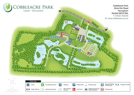
The single-page composition combines an overhead landscape illustration with a large logo at upper left, contact details at upper right and a two-row key along the bottom. A small compass completes the orientation information. The enlarged detail views show portions of that same key, not separate park sections.
KEEP EXPLORING
Chosen for shared landscapes, accommodation or facilities.
 Explore the map ↗
United Kingdom
Ashby Park map with seven fishing lakes, colour-coded accommodation and illustrated wooded shorelines.
 Explore the map ↗
United Kingdom
Illustrated caravan park plan with woodland and riverside walks, fishing pools and wildlife panels.
 Explore the map ↗
United Kingdom
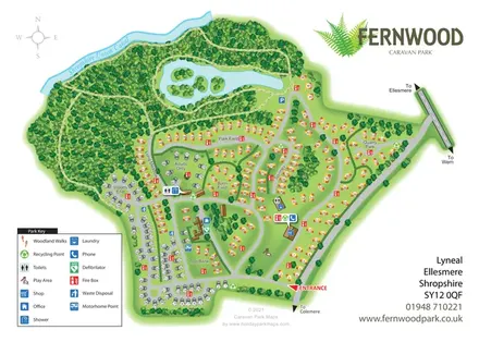
Fernwood's illustrated park plan combines numbered accommodation, woodland walks, a canal-side setting and an island-dotted lake.
Features may come from the sample artwork, its key or published park information. Approximate numbers describe the drawing and may cover only part of a park. They are intended to help you compare map examples. Current facilities and booking information should be checked with the park.
TAKE A CLOSER LOOK
View the illustrated map in detail or choose a file to download. These are sample maps; contact the park for current visitor information.


LET’S MAP YOUR PARK
For a map quotation, find your park and draw a rough boundary around it. The area you select helps us work out the design time and price.
Draw your park for a quote ↗Or talk to our map designers
01751 473136