
Extensive woodland
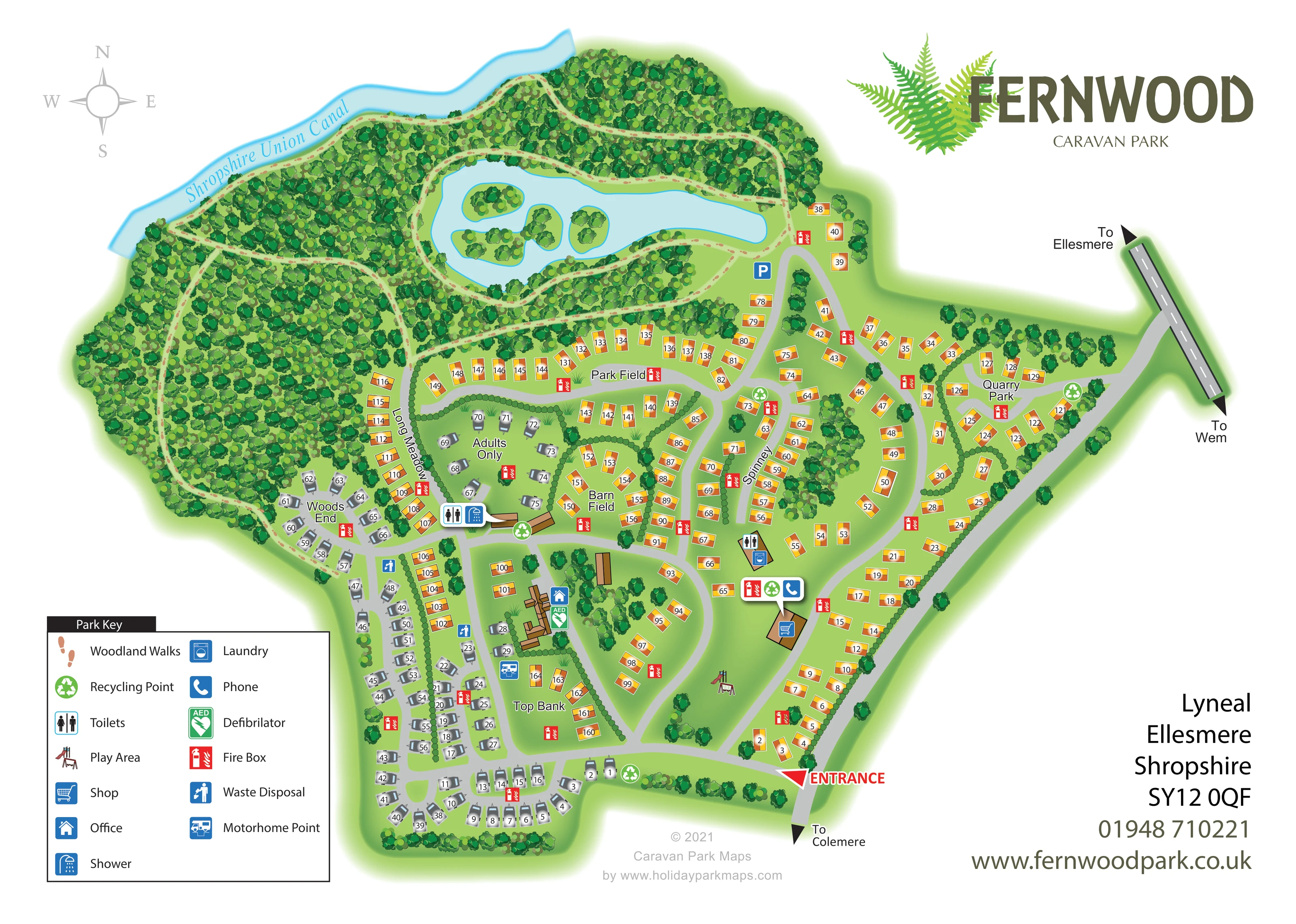
Dense illustrated woodland fills much of the northern and western plan and forms planted boundaries around accommodation.
ILLUSTRATED PARK MAP · P458
Lyneal, Ellesmere, Shropshire · United Kingdom
 Enlarge the map ↗
A SENSE OF THE PLACE
Fernwood Holiday Park is based at Lyneal, Ellesmere, Shropshire. The park includes 40 acres of private woodland beside the Shropshire Union Canal. The park offers touring stays, holiday-home stays and holiday-home ownership.
Fishing lake, children's play area, heated showers and laundrette are listed.
LOOK CLOSER
Dense illustrated woodland fills much of the northern and western plan and forms planted boundaries around accommodation.
A labelled pale-blue canal follows the north-western edge of the woodland.
An elongated lake with several small planted islands occupies the northern centre, surrounded by walking routes.
Peach footprint trails weave through the woods, follow the canal edge and loop around the lake; the key identifies them as Woodland Walks.
A large red arrow marks the entrance at the southern end of the eastern access road.
Directional arrows connect the park approach with Ellesmere and Wem, while the lower access road points towards Colemere.
The office icon sits beside an illustrated building complex near the touring area and Top Bank.
A shopping-trolley icon identifies a brown-roofed building beside the eastern internal road.
Dense illustrated woodland fills much of the northern and western plan and forms planted boundaries around accommodation.
Peach footprint trails weave through the woods, follow the canal edge and loop around the lake; the key identifies them as Woodland Walks.
A labelled pale-blue canal follows the north-western edge of the woodland.
An elongated lake with several small planted islands occupies the northern centre, surrounded by walking routes.
Park information identifies a fishing lake; the artwork depicts the lake but does not explicitly label its fishing use.
A large red arrow marks the entrance at the southern end of the eastern access road.
Directional arrows connect the park approach with Ellesmere and Wem, while the lower access road points towards Colemere.
The office icon sits beside an illustrated building complex near the touring area and Top Bank.
A shopping-trolley icon identifies a brown-roofed building beside the eastern internal road.
Toilet and shower icons mark the service building near Woods End and the Adults Only section; another toilet point is shown beside the eastern laundry building.
A washing-machine icon marks the small service building on the eastern side of the accommodation area.
A small illustrated slide-and-swing structure occupies open grass near the lower eastern accommodation rows.
Green circular recycling symbols are distributed around the entrance, service buildings and accommodation roads.
Blue waste-disposal symbols appear within the western touring area.
A blue motorhome service symbol is positioned near Top Bank and the central touring pitches.
A telephone icon appears in the facility callout beside the shop.
A green AED symbol is shown beside the office building.
Repeated red fire-box symbols are placed throughout the accommodation neighbourhoods.
A blue P symbol marks parking beside the lake's eastern approach, although parking is not included in the main key.
A discrete hedge-enclosed touring area is labelled Adults Only; this label applies to the mapped section rather than the whole park.
READING THE MAP
This illustrated map of Fernwood Caravan Park places its woodland and waterside setting at the centre of the visitor experience. Located at Lyneal near Ellesmere in Shropshire, the park is shown beside the Shropshire Union Canal, with a large lake, wooded islands and walking routes occupying much of the upper half of the artwork. Below and to the east, numbered accommodation is arranged along gently curving roads and within clearly named areas.
The design combines practical arrival information with a strong sense of place. Orange holiday-home symbols contrast with grey touring caravans, while service icons identify the office, shop, washing facilities and other useful points. A separately labelled Adults Only touring enclosure sits among the hedged neighbourhoods. The entrance arrow, local destination signs and two-column key help visitors move from the wider road network to their pitch or accommodation. Fernwood's prominent fern-leaf logo and the generous white margin give the detailed plan a clear branded setting.
The plan is organised around two contrasting zones: dense woodland and water to the north and west, and accommodation roads across the lower and eastern portions. The Shropshire Union Canal follows the upper-left boundary. Inside the woodland, peach footprint trails branch between the trees and form loops around an elongated lake containing several small wooded islands. A parking symbol sits near the lake's eastern approach.
The red entrance marker appears at the south-eastern edge, beside the road pointing towards Colemere. Internal grey roads divide into curves, loops and short branches serving the accommodation. An eastern approach connects with a road signed towards Ellesmere and Wem. Named areas—Top Bank, Barn Field, Park Field, Long Meadow, Woods End, Spinney and Quarry Park—help break the plan into recognisable neighbourhoods. Orange rectangular accommodation symbols predominate in the centre and east, while grey touring caravans cluster in the south and west. A hedge-bordered touring enclosure is explicitly labelled Adults Only.
Facilities are integrated into this road network. The office and AED are beside a central building complex; the shop occupies a separate building along the eastern road. Toilets, showers and laundry are marked at service buildings, with waste disposal and a motorhome point supporting the touring areas. Recycling and fire-box symbols are repeated across the site, and a small illustrated play area sits on open grass near the entrance-side accommodation.
The lower-left key explains the colour-coded icons and walking marks. The upper-right fern logo and lower-right contact panel balance the detailed plan. The accompanying enlarged views show the same artwork's key and entrance details, rather than additional park sections.
KEEP EXPLORING
Chosen for shared landscapes, accommodation or facilities.
 Explore the map ↗
United Kingdom
Illustrated caravan park plan with woodland and riverside walks, fishing pools and wildlife panels.
 Explore the map ↗
United Kingdom
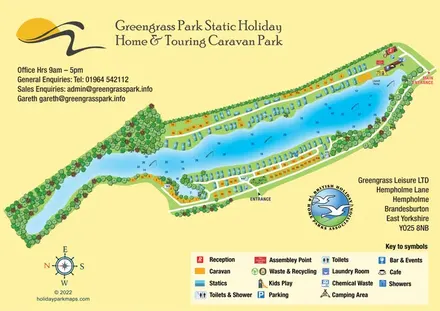
Colour-coded lakeside accommodation and illustrated facilities at Greengrass Park, East Yorkshire.
 Explore the map ↗
United Kingdom
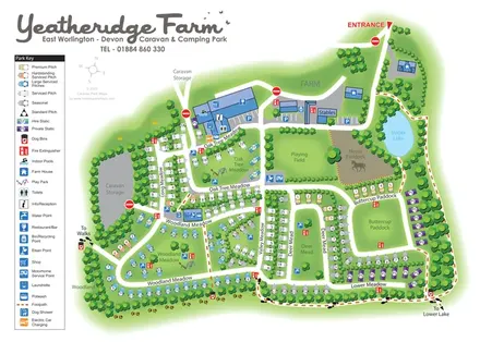
Colour-coded pitches, farm facilities and lakeside walking connections at Yeatheridge Farm, Devon.
Features may come from the sample artwork, its key or published park information. Approximate numbers describe the drawing and may cover only part of a park. They are intended to help you compare map examples. Current facilities and booking information should be checked with the park.
TAKE A CLOSER LOOK
View the illustrated map in detail or choose a file to download. These are sample maps; contact the park for current visitor information.


LET’S MAP YOUR PARK
For a map quotation, find your park and draw a rough boundary around it. The area you select helps us work out the design time and price.
Draw your park for a quote ↗Or talk to our map designers
01751 473136