
Wooded grounds
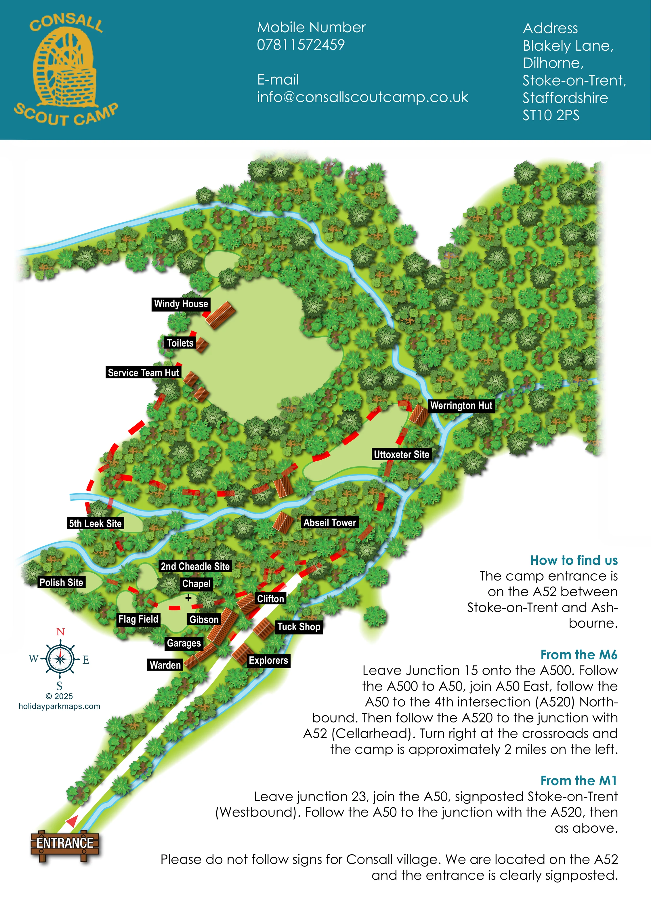
Dense illustrated tree cover surrounds the clearings, buildings and linear network, with a particularly extensive wooded area in the upper-right part of the plan.
ILLUSTRATED PARK MAP · P083
Blakely Lane, Dilhorne, Stoke-on-Trent, Staffordshire · United Kingdom
 Enlarge the map ↗
A SENSE OF THE PLACE
Consall Scout Camp provides woodland camping and indoor accommodation in the Staffordshire Moorlands. It serves Scouts and other organised groups, including schools, colleges and youth organisations.
Facilities include toilets, showers, an abseiling tower and areas for backwoods activities. The Gibson Building provides indoor sleeping, cooking and dining space. The map helps group leaders understand the campsite and activity layout within the wooded grounds.
LOOK CLOSER
Dense illustrated tree cover surrounds the clearings, buildings and linear network, with a particularly extensive wooded area in the upper-right part of the plan.
Uttoxeter Site, 5th Leek Site, Polish Site and 2nd Cheadle Site are labelled among separate pale-green clearings.
A broad, unlabelled grassy clearing forms the largest open space, beside Windy House, Toilets and the Service Team Hut.
A timber-style ENTRANCE sign and red arrow mark the lower-left end of the long approach.
A white approach corridor runs diagonally from the entrance to the main building cluster.
A substantial directions panel identifies the A52 entrance and gives approaches from the M6 and M1, with a note distinguishing the camp from Consall village.
A toilet building is labelled on the western edge of the large upper clearing.
The tower is named in the wooded central area, between Uttoxeter Site and the lower camping clearings.
Dense illustrated tree cover surrounds the clearings, buildings and linear network, with a particularly extensive wooded area in the upper-right part of the plan.
Uttoxeter Site, 5th Leek Site, Polish Site and 2nd Cheadle Site are labelled among separate pale-green clearings.
A broad, unlabelled grassy clearing forms the largest open space, beside Windy House, Toilets and the Service Team Hut.
A timber-style ENTRANCE sign and red arrow mark the lower-left end of the long approach.
A white approach corridor runs diagonally from the entrance to the main building cluster.
A substantial directions panel identifies the A52 entrance and gives approaches from the M6 and M1, with a note distinguishing the camp from Consall village.
A toilet building is labelled on the western edge of the large upper clearing.
The tower is named in the wooded central area, between Uttoxeter Site and the lower camping clearings.
A Chapel label and black cross mark a location beside the lower clearings, near Flag Field and Gibson.
A named grassy space sits near the chapel and main building cluster.
A small roofed building labelled Tuck Shop stands on the eastern side of the white approach.
A prominent elongated building is labelled Gibson in the main arrival-side cluster.
Windy House and Service Team Hut sit beside the upper clearing; Werrington Hut is near Uttoxeter Site. Clifton and Explorers are in the lower building cluster. Their individual accommodation functions are not stated on the artwork.
Warden and Garages are labelled beside Gibson, close to the approach.
Published park information includes showers, although no separate shower label is visible on this plan.
Published park information describes areas for backwoods activities; the artwork does not explicitly label their positions.
READING THE MAP
This illustrated map of Consall Scout Camp presents a woodland group campsite in the Staffordshire Moorlands, near Dilhorne and Stoke-on-Trent. Rather than arranging accommodation into numbered rows, it introduces the camp through named clearings, huts and shared landmarks. Uttoxeter Site, Polish Site, 2nd Cheadle Site and 5th Leek Site sit within a dense green landscape, while the main buildings gather around the long entrance approach.
The artwork combines a pictorial site plan with practical arrival information on a single portrait page. A teal header carries the camp’s golden-yellow emblem, contact details and address; below it, orange-roofed buildings and bold black name panels stand out against the woodland. The entrance receives its own timber-style sign, and a compass rose helps visitors orientate the plan.
Distinctive Scout-camp features include the Abseil Tower, Chapel and Flag Field, alongside Toilets, the Tuck Shop and Gibson. This sample is particularly relevant to camps and outdoor education venues that need to explain dispersed activity spaces and communal buildings, rather than individual holiday accommodation plots.
The plan follows an irregular wooded footprint, beginning with a narrow approach at the lower left and broadening into clearings and woodland above. A white entrance corridor leads towards the main building cluster, where Warden, Garages, Gibson, Clifton, Explorers and the Tuck Shop are individually named. Nearby, the Chapel is marked with a black cross, and Flag Field occupies a small green opening.
Further into the grounds, Polish Site, 2nd Cheadle Site and 5th Leek Site appear as separate clearings among the trees. Uttoxeter Site forms a longer open area near Werrington Hut. The Abseil Tower is labelled between these central spaces and the lower part of the camp. A much larger clearing occupies the upper-left portion of the developed site, with Windy House, Toilets and Service Team Hut positioned along its western edge. Extensive tree cover fills the upper-right area.
The illustration uses overlapping tree crowns in several shapes and green tones, giving the clearings a strong visual contrast. Buildings have orange-brown striped roofs and shadows, while bold white lettering on black panels keeps names legible over the detailed landscape. A light-blue branching network and red dashed markings add further linear structure, although the page provides no key defining them.
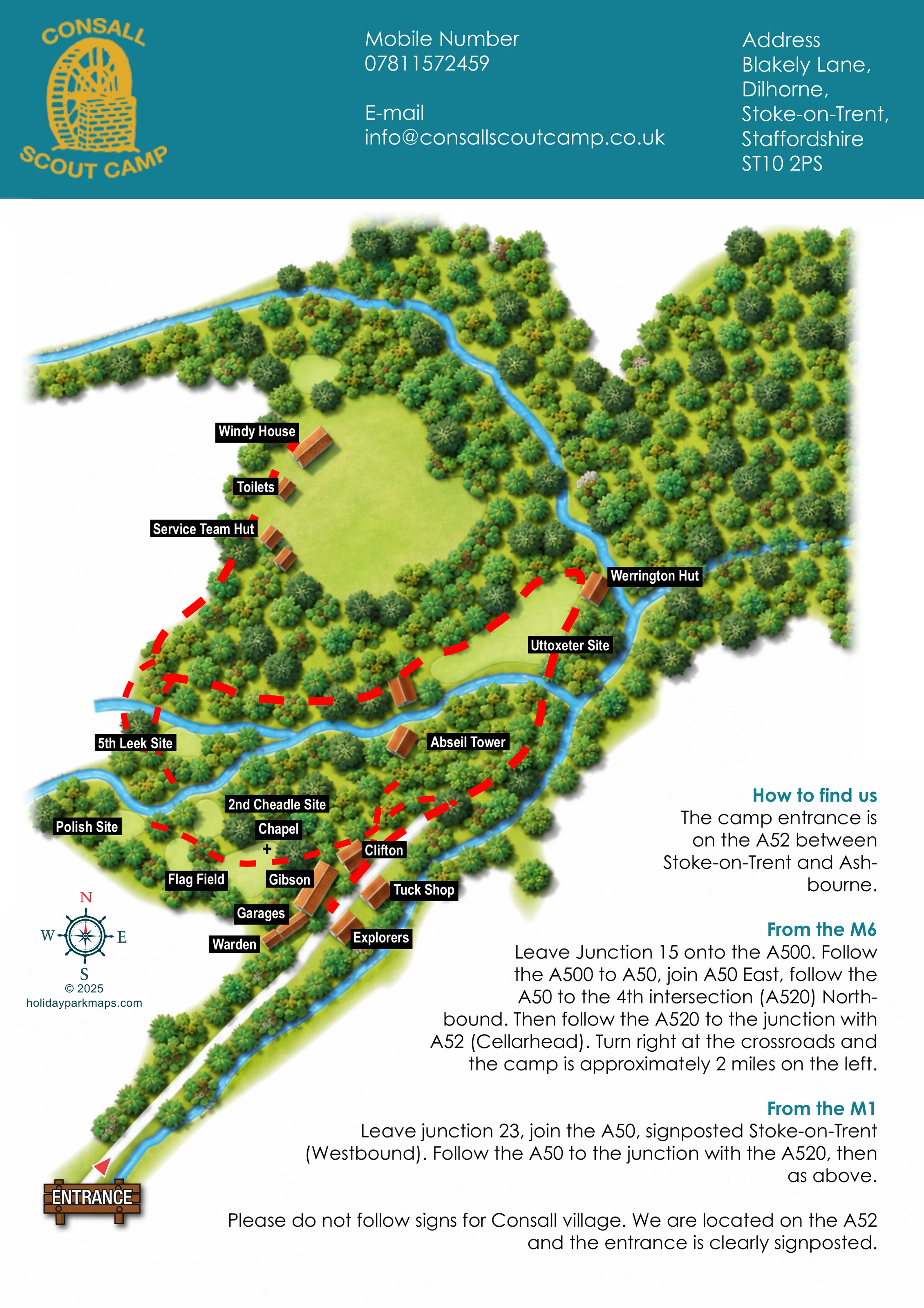
The single-page composition also includes a decorative compass, designer credit and a substantial ‘How to find us’ panel. Teal subheadings separate the motorway approaches, and the contact header anchors the page with the camp’s branding. The enlarged views show details of this same artwork, rather than additional campsite sections or separate map variants.
 Enlarge this map ↗
KEEP EXPLORING
Chosen for shared landscapes, accommodation or facilities.
 Explore the map ↗
United Kingdom
Illustrated coastal campsite plan with named fields, electric pitch colours, beach routes and the Afon Hen.
 Explore the map ↗
United Kingdom
A wooded Allerton park plan with colour-coded neighbourhoods, touring pitches and a central facilities hub.
 Explore the map ↗
United Kingdom
Colour-coded pitches, named log cabins and a woodland trail at Alpine Grove, Somerset.
Features may come from the sample artwork, its key or published park information. Approximate numbers describe the drawing and may cover only part of a park. They are intended to help you compare map examples. Current facilities and booking information should be checked with the park.
LET’S MAP YOUR PARK
For a map quotation, find your park and draw a rough boundary around it. The area you select helps us work out the design time and price.
Draw your park for a quote ↗Or talk to our map designers
01751 473136