
Tree planting and boundary hedge
A continuous illustrated hedge lines the left boundary, with larger tree clusters along the lower edge and smaller groups between parking and tent areas.
ILLUSTRATED PARK MAP · P448
Stentaway Lane, Croyde, Devon · United Kingdom
 Enlarge the map ↗
A SENSE OF THE PLACE
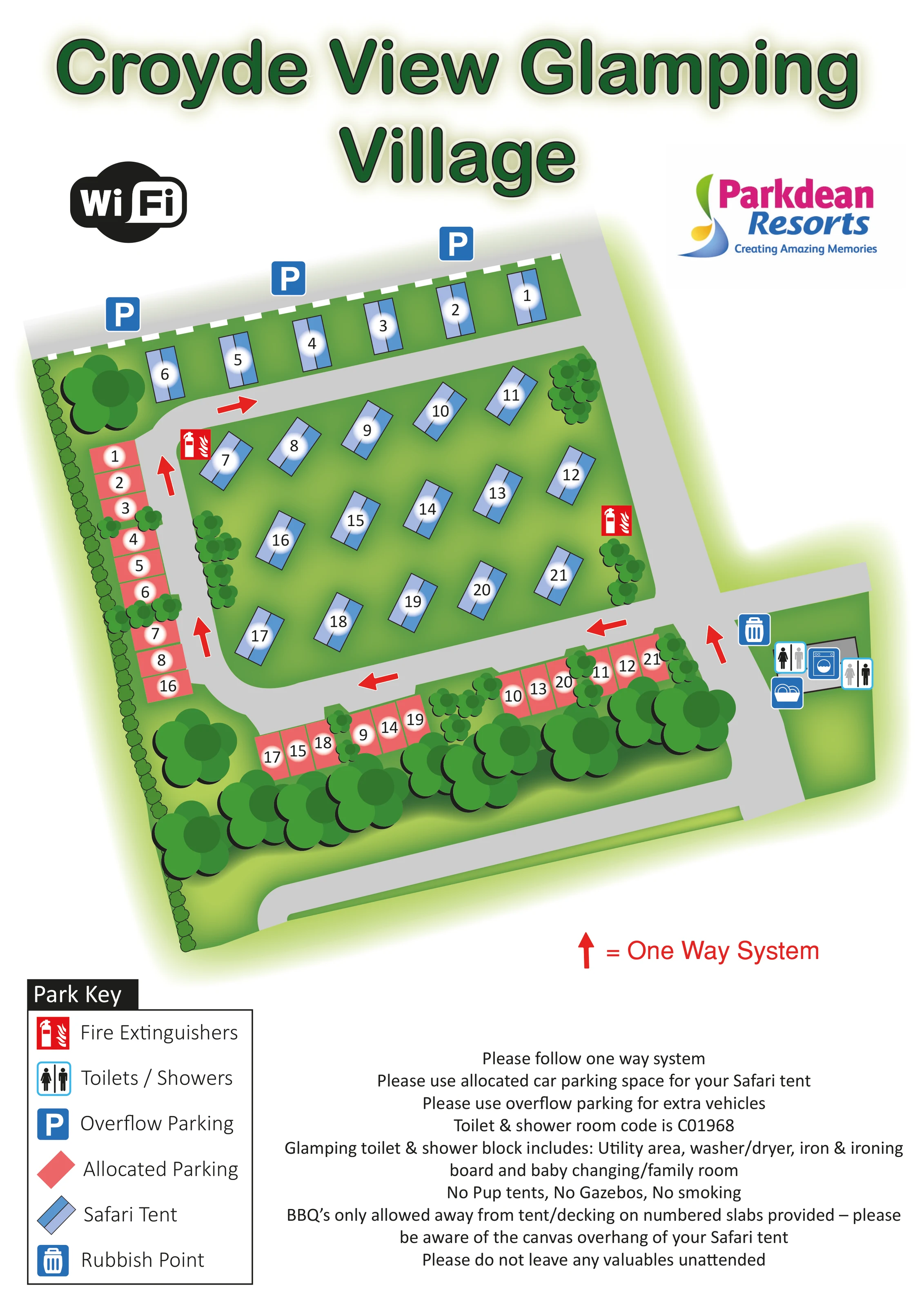
This map was created for Croyde View Glamping Village in North Devon. Safari tents, allocated parking and a one-way vehicle route are the main elements shown in the artwork.
A shared toilet and shower building is labelled with laundry and family facilities, with overflow parking separate from the tent areas. The design demonstrates how a glamping layout can make arrival, parking and shared amenities easier to understand.
LOOK CLOSER
A continuous illustrated hedge lines the left boundary, with larger tree clusters along the lower edge and smaller groups between parking and tent areas.
Green ground areas support an upper strip of tents and a larger central group, divided by the internal road.
Coral-red numbered bays run down the left edge and along the lower side of the tent area, linking parking to individual safari tents.
Blue P symbols mark a separate parking strip along the upper edge, with white bay divisions.
Large red arrows mark travel along the lower internal road, up the left side and across the upper internal road.
The internal circulation joins a broad road on the right. Another grey road follows the lower boundary; no named entrance or exit is labelled.
A small grey building on the right is marked with toilet and shower-related symbols and is identified by the accompanying text as the glamping toilet and shower block.
The text lists a utility area, washer/dryer, iron and ironing board within the shared facilities block.
Coral-red numbered bays run down the left edge and along the lower side of the tent area, linking parking to individual safari tents.
Blue P symbols mark a separate parking strip along the upper edge, with white bay divisions.
Large red arrows mark travel along the lower internal road, up the left side and across the upper internal road.
The internal circulation joins a broad road on the right. Another grey road follows the lower boundary; no named entrance or exit is labelled.
A small grey building on the right is marked with toilet and shower-related symbols and is identified by the accompanying text as the glamping toilet and shower block.
The text lists a utility area, washer/dryer, iron and ironing board within the shared facilities block.
Baby changing and a family room are named among the facilities within the toilet and shower block.
A blue bin symbol sits beside the right-hand junction near the shared facilities.
Red extinguisher symbols mark points beside the left internal road and towards the right side of the central tent area.
A prominent Wi-Fi badge appears above the plan. It does not identify a hotspot location or coverage area.
The visitor notes refer to numbered slabs for barbecues, but their individual positions are not separately identifiable on the plan.
A continuous illustrated hedge lines the left boundary, with larger tree clusters along the lower edge and smaller groups between parking and tent areas.
Green ground areas support an upper strip of tents and a larger central group, divided by the internal road.
READING THE MAP
This map of Croyde View Glamping Village in Croyde, North Devon, focuses on the practical relationship between safari tents, parking and shared facilities. Roughly 20 tents are shown across a narrow upper strip and a larger central lawn, with trees and a boundary hedge giving the compact layout a green setting. Each tent has a clear number, repeated on its allocated parking bay, so the connection between accommodation and parking is immediately visible.
Vehicle movement is a prominent part of the artwork. Broad grey roads and bold red arrows explain the one-way circulation, while blue parking symbols distinguish the overflow area along the top of the plan. A shared toilet and shower building sits near the right-hand junction, accompanied by laundry, family-facility and rubbish-point information.
The portrait composition combines a large park title, operator branding, a simple illustrated plan and a boxed key. It is a useful example of a small glamping map designed around arrival and everyday orientation rather than a large resort's leisure attractions.
The single-page artwork presents the village as an angled overhead plan on a white portrait sheet. A straight row of blue safari-tent symbols occupies the upper green strip, while further tents sit in staggered rows across the larger central lawn. Their two-tone rectangular symbols are deliberately simple, with black outlines and numbers placed over soft white highlights.
Parking is organised around the accommodation rather than distributed beside every tent. Coral-red allocated bays follow the left boundary and the lower internal road, carrying corresponding tent numbers. A separate overflow strip runs along the upper edge, marked by blue P symbols and white bay divisions. The grey road network separates the two tent groups and connects with the broad right-hand access road. Oversized red arrows show the one-way direction through the internal roads, supported by a separate arrow explanation beneath the plan.
The shared facilities building appears on the right, close to the road junction and rubbish point. Toilet symbols and blue amenity pictograms identify this cluster; the accompanying notes name showers, a utility area, washer/dryer, ironing equipment and baby changing/family facilities. Red fire-extinguisher symbols stand out at points around the tent area. The text also refers to numbered barbecue slabs, although these are not individually located on the drawing.
Illustrated trees form a substantial lower boundary and smaller internal clusters, while a repeated hedge motif defines the left edge. Above the plan are the large green title, Wi-Fi badge and Parkdean Resorts logo. Below it, the six-item Park Key sits beside a visitor-information panel. The detail enlargements show these same lower-page elements, not separate map variants.
KEEP EXPLORING
Chosen for shared landscapes, accommodation or facilities.
 Explore the map ↗
United Kingdom
Colour-coded campsite map with riverside pitches, bell tents, a swimming pool and fishing lake.
 Explore the map ↗
United Kingdom
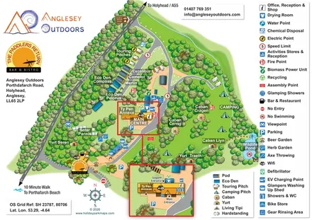
Illustrated camping and glamping map with an activity-centre inset and wildlife pond.
 Explore the map ↗
United Kingdom
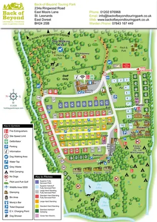
Colour-coded touring pitches, named glamping units and woodland routes at Back of Beyond Touring Park.
Features may come from the sample artwork, its key or published park information. Approximate numbers describe the drawing and may cover only part of a park. They are intended to help you compare map examples. Current facilities and booking information should be checked with the park.
TAKE A CLOSER LOOK
View the illustrated map in detail or choose a file to download. These are sample maps; contact the park for current visitor information.


LET’S MAP YOUR PARK
For a map quotation, find your park and draw a rough boundary around it. The area you select helps us work out the design time and price.
Draw your park for a quote ↗Or talk to our map designers
01751 473136