
Woodland belts and clearings
Dense illustrated trees surround the centre and form a substantial central belt separating the western and eastern fields.
ILLUSTRATED PARK MAP · P095
144 Cudham Lane North, Cudham, Kent · United Kingdom
 Enlarge the map ↗
A SENSE OF THE PLACE
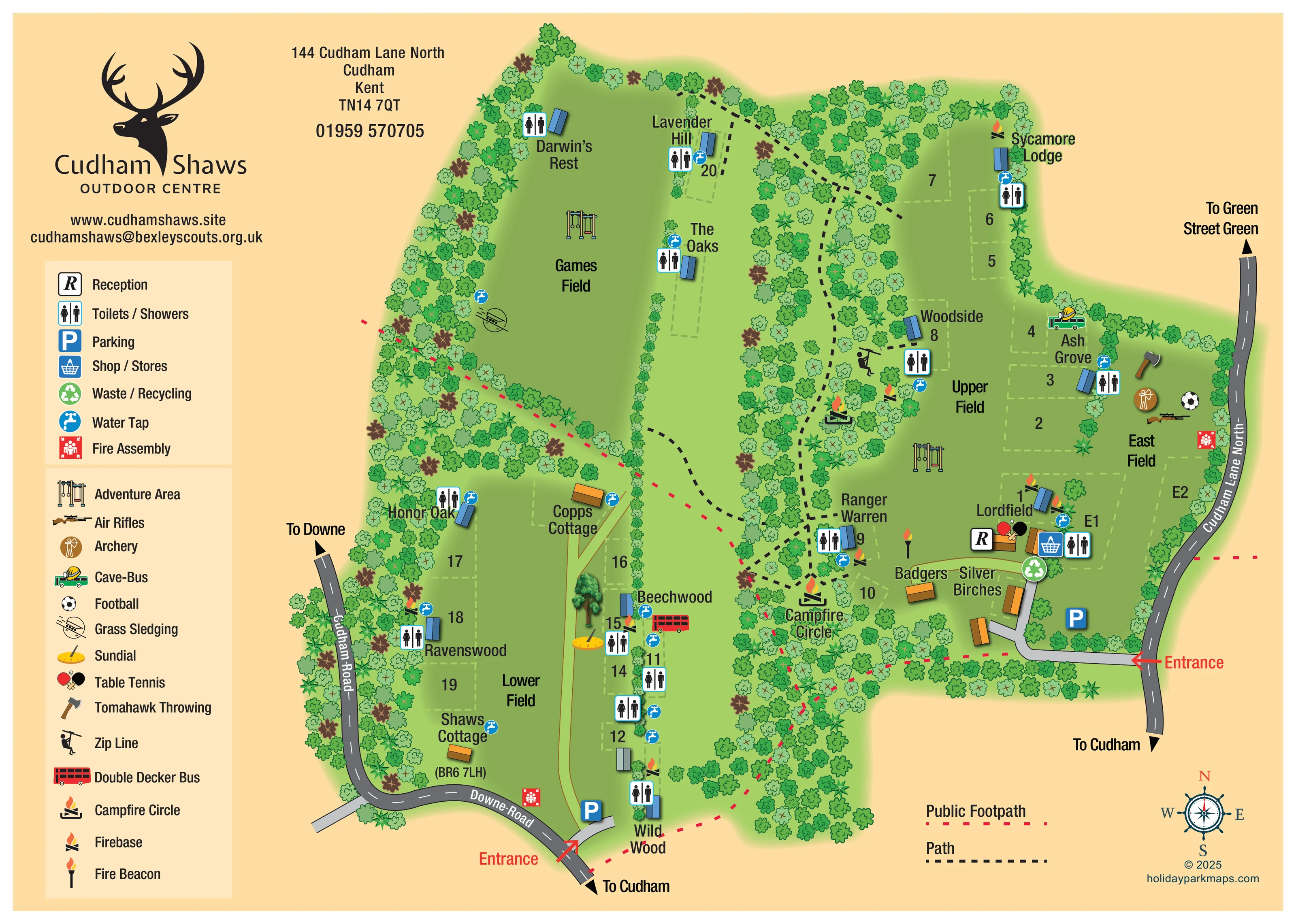
Cudham Shaws Outdoor Centre is based at 144 Cudham Lane North, Cudham, Kent. Upper and lower areas have separate entrances; lower access is from Downe Road, BR6 7LH. Camping pitches and cabins cater for uniformed youth groups.
The centre serves Duke of Edinburgh groups and advertises showers and access to footpaths.
LOOK CLOSER
Dense illustrated trees surround the centre and form a substantial central belt separating the western and eastern fields.
Four large field labels establish the principal open spaces and their relationship to camping sites and activities.
Names include Darwin’s Rest, Lavender Hill, The Oaks, Sycamore Lodge, Woodside, Ash Grove, Lordfield, Ranger Warren, Honor Oak, Ravenswood, Beechwood and Wild Wood. Copps Cottage, Shaws Cottage, Badgers and Silver Birches identify additional buildings or areas.
An R symbol identifies reception in the building cluster near the Cudham Lane North entrance.
A basket symbol marks the shop or stores beside the eastern reception cluster.
Blue P symbols identify parking near the eastern entrance and the lower entrance from Downe Road.
Repeated combined toilet and shower symbols serve named sites around the upper, eastern and lower fields.
Blue tap symbols are distributed across the camping areas, games field edge and building groups.
An R symbol identifies reception in the building cluster near the Cudham Lane North entrance.
A basket symbol marks the shop or stores beside the eastern reception cluster.
Blue P symbols identify parking near the eastern entrance and the lower entrance from Downe Road.
Repeated combined toilet and shower symbols serve named sites around the upper, eastern and lower fields.
Blue tap symbols are distributed across the camping areas, games field edge and building groups.
A green recycling symbol appears beside the main eastern building and access cluster.
Red assembly symbols are shown near East Field and beside Downe Road at the lower end of the centre.
Illustrated play-equipment symbols appear in Games Field and Upper Field.
An air-rifle illustration marks an activity location in East Field.
An ochre circular archer symbol identifies an activity location in East Field.
An illustrated axe marks the throwing activity near the eastern woodland boundary.
A football symbol appears among the East Field activities.
Crossed bats and a ball identify table tennis beside reception.
A sledging symbol marks an activity on the western side of Games Field.
A green bus with a helmet graphic marks the Cave-Bus near Ash Grove.
A red double decker bus is illustrated beside Beechwood on the lower field's eastern edge.
A rider symbol locates the zip line in the woodland beside Woodside.
A yellow sundial is drawn near Beechwood, beside the lower field's internal route.
Campfire-circle symbols appear in the central woodland, including a prominently labelled Campfire Circle near Ranger Warren.
Small flame-over-logs symbols identify firebases beside several named sites.
A flame on a tall post is shown near Ranger Warren and the eastern building group.
Dense illustrated trees surround the centre and form a substantial central belt separating the western and eastern fields.
Four large field labels establish the principal open spaces and their relationship to camping sites and activities.
Names include Darwin’s Rest, Lavender Hill, The Oaks, Sycamore Lodge, Woodside, Ash Grove, Lordfield, Ranger Warren, Honor Oak, Ravenswood, Beechwood and Wild Wood. Copps Cottage, Shaws Cottage, Badgers and Silver Birches identify additional buildings or areas.
Red entrance arrows identify access from Cudham Lane North on the east and Downe Road at the southern end of Lower Field.
Red dashed routes cross the centre and connect with its outer edges, distinguished from internal paths.
Black dashed paths branch through the central woodland and link field edges, named sites and campfire locations.
Cudham Lane North, Cudham Road and Downe Road are labelled, with outward directions to Green Street Green, Downe and Cudham.
READING THE MAP
This illustrated map of Cudham Shaws Outdoor Centre in Cudham, Kent, brings together group camping, woodland paths and outdoor activities on a single landscape page. Rather than presenting rows of holiday accommodation, the artwork organises the centre around its Games, Upper, East and Lower fields, with named sites tucked against tree-lined boundaries.
The woodland is a defining part of the design. Dense bands of illustrated trees separate the clearings and frame a network of internal paths, while red dashed public footpaths remain visually distinct. Two entrances are shown: one from Cudham Lane North beside the reception and main building cluster, and another from Downe Road serving the lower area.
A substantial illustrated key covers practical facilities and the centre’s varied activities. Alongside toilets, showers, water taps and parking, the map locates archery, air rifles, tomahawk throwing, grass sledging and a zip line. The Cave-Bus, red double decker bus, sundial and campfire features give this sample a particularly recognisable outdoor-centre character.
The plan uses an overhead layout with gently dimensional buildings and pictorial activity symbols. Games Field sits in the upper-left clearing, with Lower Field extending below it. Upper Field and East Field occupy the right-hand side, separated from the western spaces by a substantial wooded corridor. Pale dashed boundaries and named sites help divide the open grass without filling it with individual tent illustrations.
Arrival information is prominent. A red arrow marks the Cudham Lane North entrance, where a grey drive leads past parking to reception, shop or stores and nearby buildings. A second arrow marks the lower entrance from Downe Road, with its own parking symbol. Surrounding roads carry curved labels and destination arrows towards Cudham, Downe and Green Street Green.
Black dashed paths branch through the woodland, passing Woodside, Ranger Warren and the labelled Campfire Circle. Red dashed public footpaths cross the wider plan and continue to its edges. Repeated toilet/shower and water-tap symbols place practical information beside the named camping areas; recycling and fire assembly symbols are also shown.
The activity illustrations convey different uses of the clearings. East Field contains football, archery, air rifles and tomahawk throwing symbols, while the Cave-Bus sits near Ash Grove. Adventure-area symbols appear in Games Field and Upper Field, with grass sledging on the western side and a zip line near Woodside. Beechwood is accompanied by a sundial and red double decker bus; table tennis appears beside reception. Separate flame symbols distinguish campfire circles, firebases and a fire beacon.
The left-hand branding and two-part legend sit outside the main site drawing. A route key and compass rose complete the lower-right corner, keeping supporting information away from the field labels.
KEEP EXPLORING
Chosen for shared landscapes, accommodation or facilities.
 Explore the map ↗
United Kingdom
Ashby Park map with seven fishing lakes, colour-coded accommodation and illustrated wooded shorelines.
 Explore the map ↗
United Kingdom
Woodland-framed Barnsoul map with mixed accommodation, shared facilities and paw-marked walking routes.
 Explore the map ↗
United Kingdom
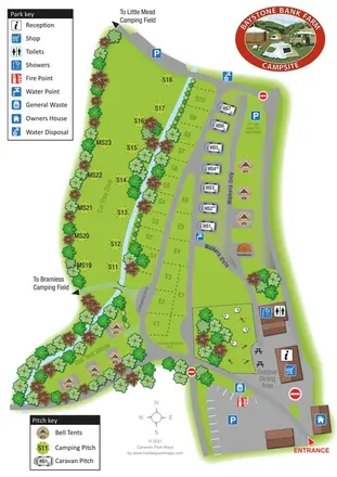
A stream-side farm campsite plan with car-free camping, caravan pitches and separate bell-tent areas.
Features may come from the sample artwork, its key or published park information. Approximate numbers describe the drawing and may cover only part of a park. They are intended to help you compare map examples. Current facilities and booking information should be checked with the park.
LET’S MAP YOUR PARK
For a map quotation, find your park and draw a rough boundary around it. The area you select helps us work out the design time and price.
Draw your park for a quote ↗Or talk to our map designers
01751 473136