
Tree belts, hedges and planted divisions
Dense illustrated trees enclose the site and separate accommodation areas, with smaller shrubs around buildings and along pitch boundaries.
ILLUSTRATED PARK MAP · P098
Daisy Bank Caravan Park and Campsite, Montgomery, Powys, Wales · United Kingdom
 Enlarge the map ↗
A SENSE OF THE PLACE
Daisy Bank is an adults-only touring park near Snead in Mid Wales. Its landscaped areas provide a choice of pitch settings, including gravel hardstandings and space for larger motorhomes.
Heated washrooms, private wet rooms, dog walking areas and pitch-and-putt support a countryside stay. Pods, a bell tent and lodge ownership provide alternatives to touring, while the surrounding valley forms the backdrop to the site.
LOOK CLOSER
Dense illustrated trees enclose the site and separate accommodation areas, with smaller shrubs around buildings and along pitch boundaries.
A building marked R stands beside the entrance-side parking area and main internal junction.
An information symbol marks a small structure near the arrival road and putting green.
A blue parking symbol appears next to the reception building.
Two amenity buildings carry grouped toilet, shower, washing-up and wheelchair symbols, one near Roundton and Camlad and another beside the storage yard. The wheelchair symbols indicate mapped provision, not a comprehensive accessibility guarantee.
Elsan symbols appear in the central touring-service areas, including near Camlad and beside the storage-yard amenity building.
Repeated tap symbols identify water points around the lower pitch and pod areas.
Waste and recycling symbols are grouped around the amenity buildings and central service areas.
A building marked R stands beside the entrance-side parking area and main internal junction.
An information symbol marks a small structure near the arrival road and putting green.
A blue parking symbol appears next to the reception building.
Two amenity buildings carry grouped toilet, shower, washing-up and wheelchair symbols, one near Roundton and Camlad and another beside the storage yard. The wheelchair symbols indicate mapped provision, not a comprehensive accessibility guarantee.
Elsan symbols appear in the central touring-service areas, including near Camlad and beside the storage-yard amenity building.
Repeated tap symbols identify water points around the lower pitch and pod areas.
Waste and recycling symbols are grouped around the amenity buildings and central service areas.
Red fire-point symbols are distributed across the lodge and touring sections.
A labelled red assembly-point sign is shown on the open ground near the putting green.
A small illustrated green and flag occupy an open lawn between the lodge area and entrance road.
A labelled grey service yard lies below reception, next to the lower amenity building.
A Free WiFi badge is placed beside the storage-yard and amenity area; no coverage boundary is drawn.
Black picnic-bench symbols accompany several pods and the bell tent.
Dog silhouettes and pawprints indicate a walking route outside the southern hedge, with gates at the lower corners.
Dog-waste bin symbols appear beside the gates along the southern perimeter.
Dense illustrated trees enclose the site and separate accommodation areas, with smaller shrubs around buildings and along pitch boundaries.
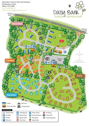
The main entrance joins the A489 at the upper right. Road-end arrows point towards Church Stoke and Bishop’s Castle.
A central route connects the arrival area with branching and looping roads through Roundton, Camlad, Meadow and Kerry.
A red-ringed 5 sign marks the arrival road, and a no-entry symbol appears beside the storage-yard approach.
A short black dotted pedestrian connection runs through planting between the upper amenity area and the Camlad road.
READING THE MAP
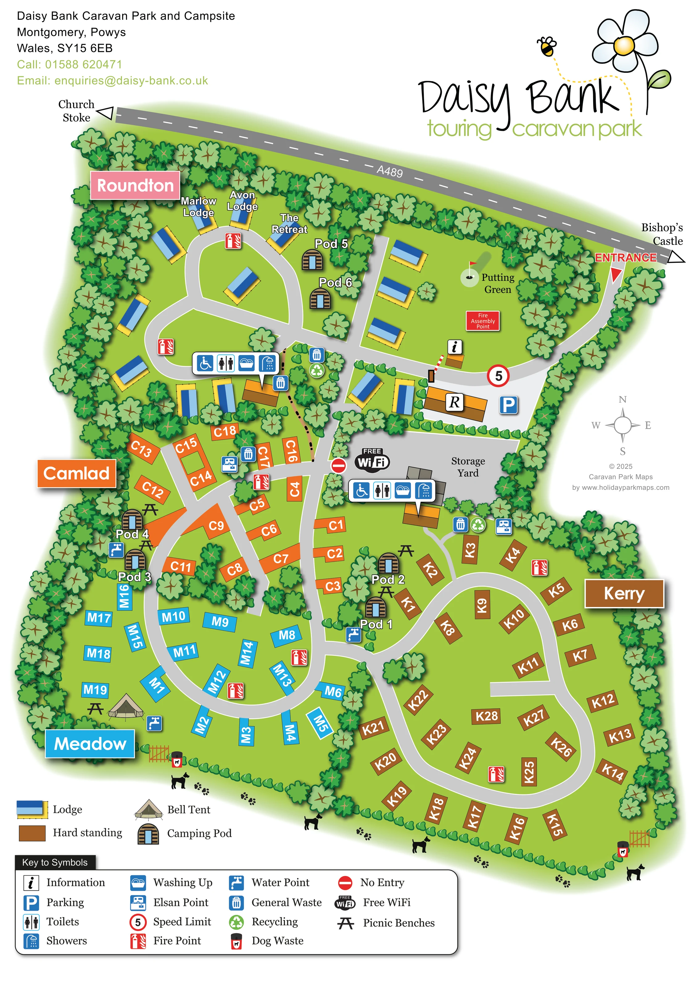
This illustrated map of Daisy Bank Caravan Park and Campsite in Montgomery, Powys brings together touring pitches, lodges and glamping accommodation in a single landscaped plan. Four clearly named areas — Roundton, Camlad, Meadow and Kerry — give the site an easy-to-follow structure, with coloured pitch markers helping visitors recognise their section at a glance.
The A489 runs across the top of the artwork, with the entrance leading towards reception, parking and information before the internal roads branch through the park. Blue-roofed lodges sit among trees in Roundton, while camping pods and a bell tent add distinctive accommodation landmarks elsewhere. A putting green, two amenity buildings and a southern perimeter dog-walking route provide useful points of reference beyond the pitches themselves.
The design balances practical visitor information with Daisy Bank’s informal daisy-and-bee branding. Bold facility symbols, large area signs and a comprehensive key keep the plan readable, while illustrated trees, hedges and lawns convey the planted countryside setting without obscuring the routes.
The single-page plan places the A489 along its sloping upper edge, with directional arrows towards Church Stoke and Bishop’s Castle. At the upper-right entrance, a curved road leads past the information point and putting green to a reception building marked R and an adjacent parking area. From this arrival hub, a central route connects the park’s four accommodation sections.
Roundton occupies the upper-left portion. Its looping road serves blue-roofed lodges, including Marlow Lodge, Avon Lodge and The Retreat, with two camping pods beside the planted central boundary. Below, orange pitch markers identify Camlad, cyan markers distinguish Meadow and brown markers define Kerry. The lower sections use broad curved roads, with pitches arranged both inside and outside the loops. Other pods sit beside the trees between these areas, and a bell tent is illustrated near the bottom of Meadow.
Two amenity buildings carry grouped symbols for toilets, showers, washing up and wheelchair provision. Water points, Elsan disposal, general waste, recycling and fire points are marked around the site. A grey storage yard sits below reception, alongside the lower amenity building and a Free WiFi badge. Picnic benches accompany several glamping units, while dog silhouettes, pawprints, gates and dog-waste bins identify the southern perimeter walking route.
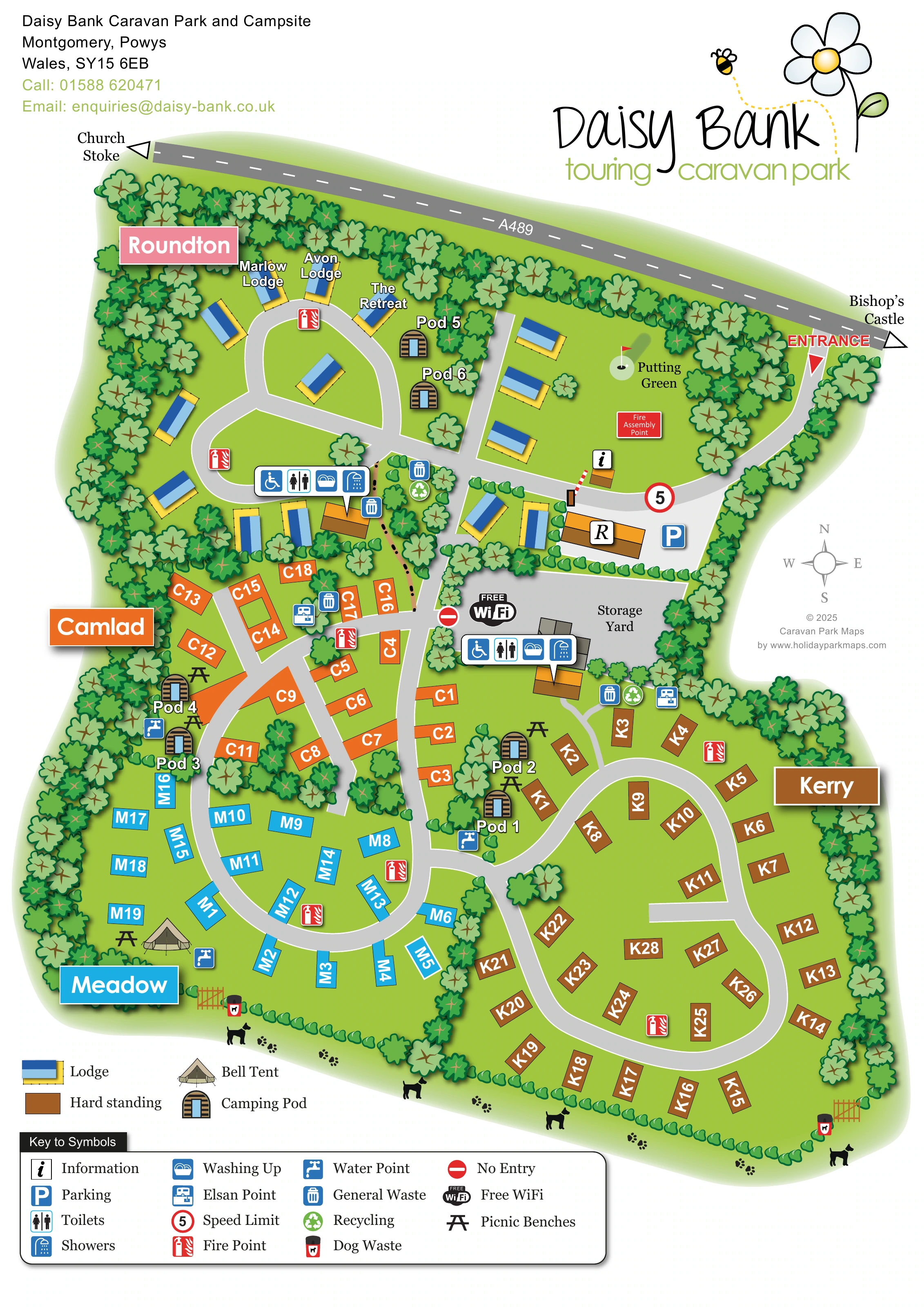
The page finishes with separate accommodation illustrations and a rounded facility-symbol legend. A compass sits in the right margin, and the large Daisy Bank logo balances contact details above the plan. The accompanying detail views enlarge this same legend rather than showing additional park sections.
KEEP EXPLORING
Chosen for shared landscapes, accommodation or facilities.
 Explore the map ↗
United Kingdom
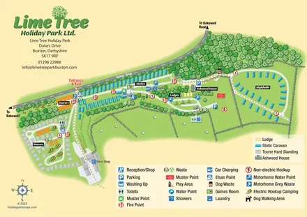
Mixed-accommodation park map with woodland, public footpaths and clearly differentiated service symbols.
 Explore the map ↗
United Kingdom
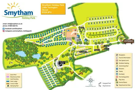
Colour-coded accommodation, woodland ponds and a Tarka Trail footpath on Smytham’s illustrated park map.
 Explore the map ↗
United Kingdom
Woodland-framed Barnsoul map with mixed accommodation, shared facilities and paw-marked walking routes.
Features may come from the sample artwork, its key or published park information. Approximate numbers describe the drawing and may cover only part of a park. They are intended to help you compare map examples. Current facilities and booking information should be checked with the park.
TAKE A CLOSER LOOK
View the illustrated map in detail or choose a file to download. These are sample maps; contact the park for current visitor information.


LET’S MAP YOUR PARK
For a map quotation, find your park and draw a rough boundary around it. The area you select helps us work out the design time and price.
Draw your park for a quote ↗Or talk to our map designers
01751 473136