
Vineyard
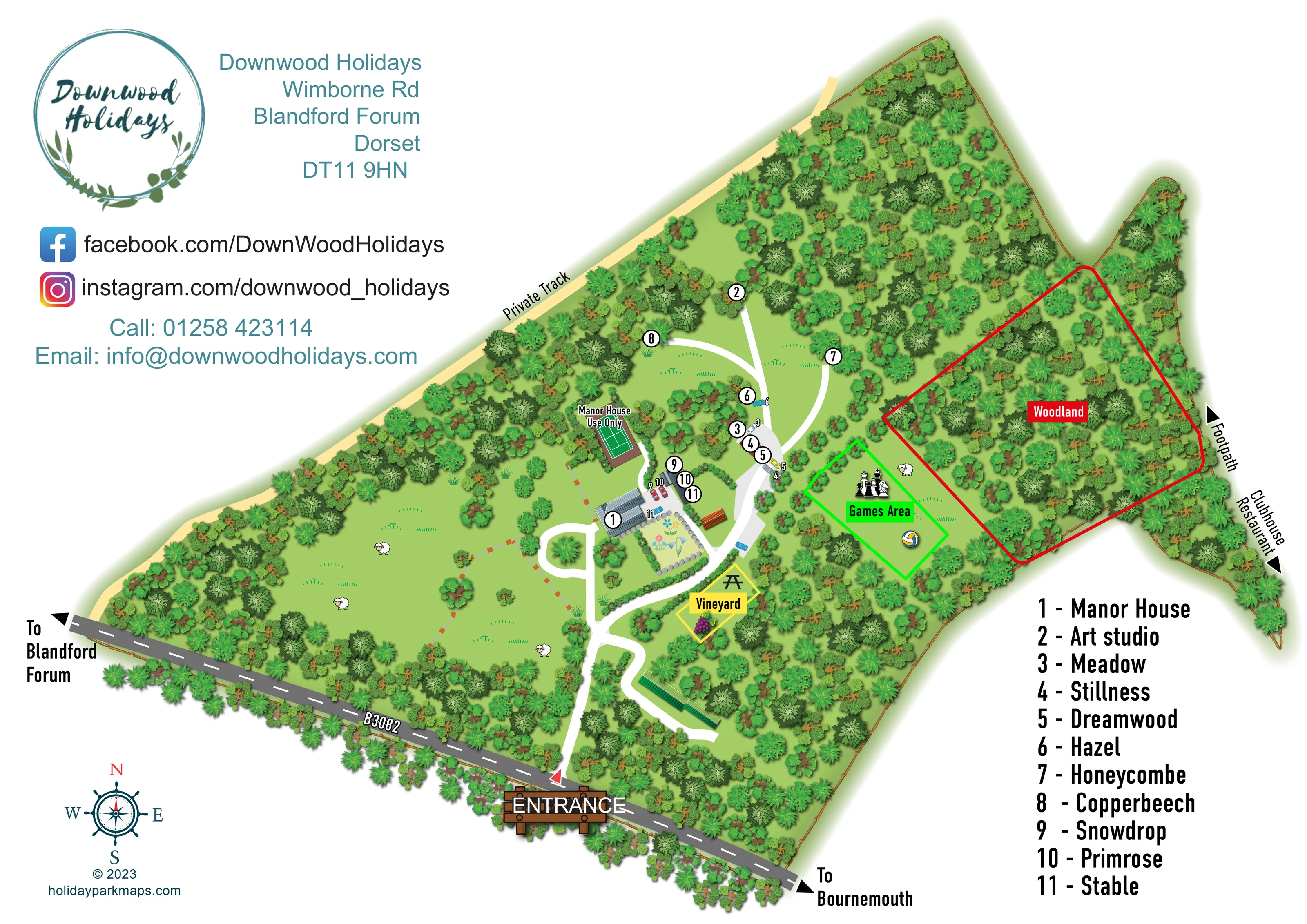
Yellow outlined and labelled area beside the approach drive, with grape and picnic-table pictograms.
ILLUSTRATED PARK MAP · P102
Downwood Holidays, Wimborne Rd, Blandford Forum, Dorset · United Kingdom
 Enlarge the map ↗
A SENSE OF THE PLACE
Downwood Holidays is based at Wimborne Rd, Blandford Forum, Dorset. The operator describes a 40-acre countryside estate near Blandford Forum. Self-catering properties include a large manor house, cottages, a treehouse and converted stable accommodation.
The operator says most properties accept dogs; this is not a guarantee for every accommodation unit. Cottages are advertised with kitchens, complimentary Wi-Fi and private outdoor spaces; selected properties have private hot tubs. The manor house can be booked for group gatherings, celebrations and weddings, alone or with other accommodation.
LOOK CLOSER
Yellow outlined and labelled area beside the approach drive, with grape and picnic-table pictograms.
Extensive tree cover surrounds the estate; a distinct eastern woodland area is outlined and labelled in red.
Broad grassy areas west of the manor contain sheep illustrations and dividing fences; these are not depicted as camping fields.
A rectangular flower-filled garden with a stone-like border sits beside the manor, with surrounding hedges and a bench illustration.
Named central estate building, illustrated with grey roof planes beside the garden and smaller property cluster.
Numbered destination at the end of a northern branch of the internal route, among trees.
Green lined court north-west of the manor, explicitly annotated 'Manor House Use Only'.
Bright green outlined recreation area east of the accommodation, illustrated with chess pieces and a volleyball symbol.
Named central estate building, illustrated with grey roof planes beside the garden and smaller property cluster.
Numbered destination at the end of a northern branch of the internal route, among trees.
Green lined court north-west of the manor, explicitly annotated 'Manor House Use Only'.
Bright green outlined recreation area east of the accommodation, illustrated with chess pieces and a volleyball symbol.
Yellow outlined and labelled area beside the approach drive, with grape and picnic-table pictograms.
A picnic-table pictogram appears within the mapped vineyard area.
Extensive tree cover surrounds the estate; a distinct eastern woodland area is outlined and labelled in red.
Broad grassy areas west of the manor contain sheep illustrations and dividing fences; these are not depicted as camping fields.
A rectangular flower-filled garden with a stone-like border sits beside the manor, with surrounding hedges and a bench illustration.
Small car illustrations beside several destinations indicate local parking relationships; some carry corresponding property numbers.
Prominent timber-style entrance sign and red pointer mark the turn from the public road into the estate.
Broad white routes connect the entrance, manor, central property cluster and more secluded woodland destinations.
Pale yellow track runs along the north-western edge of the estate.
An arrow and rotated label identify a footpath direction on the eastern edge.
An outward-pointing arrow on the eastern margin names a clubhouse and restaurant; neither is depicted as an on-site building.
The B3082 is labelled across the southern frontage, with outward arrows towards Blandford Forum and Bournemouth.
READING THE MAP
This illustrated map of Downwood Holidays presents a small holiday estate near Blandford Forum in Dorset, where named properties sit among woodland, gardens and open pasture. Rather than arranging accommodation in rows, the artwork follows the character of the grounds: a manor-house focus, a compact central cluster and more secluded destinations reached by branching routes through the trees. A numbered key connects each location to its name, keeping the plan readable despite the dense landscape illustration.
The entrance from the B3082 is a prominent starting point, with directions towards Blandford Forum and Bournemouth helping visitors place the estate in its surroundings. Within the grounds, a vineyard, games area and woodland are picked out with contrasting coloured outlines. A tennis court carries a specific Manor House use annotation, while sheep and fenced grassland give the western side a distinctly rural feel.
The page combines practical arrival information with a visual introduction to the estate. Its botanical branding, teal contact block and richly varied green palette make it a useful example of mapping for a countryside collection of individually named holiday properties.
The single landscape-format map places the estate diagonally across a white page, leaving room for branding and contact information at upper left and a substantial destination key at lower right. The B3082 follows the lower boundary. A timber-style entrance sign and red pointer mark the access point, from which a broad white route leads into the grounds.
Near the centre, the Manor House is shown with grey roof planes beside a flower-filled rectangular garden. Snowdrop, Primrose and Stable form a nearby cluster, while Meadow, Stillness, Dreamwood and Hazel lie along the route farther north. Curved branches reach Honeycombe and Copperbeech, and another branch leads to the art studio. Black-edged white number circles connect these locations to the key without requiring long property names across the illustrated landscape. Small cars beside several destinations reinforce the relationship between the routes and accommodation.
The western grounds are relatively open, with pasture, sheep illustrations and fences. By contrast, the northern and eastern areas use dense, overlapping tree canopies. Three highlighted areas stand out: a yellow vineyard beside the approach route, a green games area illustrated with chess pieces and a volleyball, and a red outlined woodland section to the east. The vineyard also includes a picnic-table pictogram. A tennis court near the manor is labelled 'Manor House Use Only'.
A pale yellow private track follows the north-western edge. Eastern arrows point towards a footpath and a clubhouse and restaurant beyond the depicted buildings. Road-end arrows, a decorative compass and clearly separated labels complete the orientation system. The result is an estate overview that gives both named destinations and landscape character a clear place on the page.
KEEP EXPLORING
Chosen for shared landscapes, accommodation or facilities.
 Explore the map ↗
United Kingdom
Ashby Park map with seven fishing lakes, colour-coded accommodation and illustrated wooded shorelines.
 Explore the map ↗
United Kingdom
Woodland-framed Barnsoul map with mixed accommodation, shared facilities and paw-marked walking routes.
 Explore the map ↗
United Kingdom
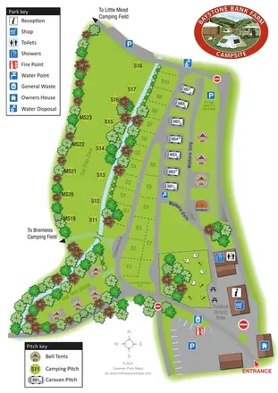
A stream-side farm campsite plan with car-free camping, caravan pitches and separate bell-tent areas.
Features may come from the sample artwork, its key or published park information. Approximate numbers describe the drawing and may cover only part of a park. They are intended to help you compare map examples. Current facilities and booking information should be checked with the park.
LET’S MAP YOUR PARK
For a map quotation, find your park and draw a rough boundary around it. The area you select helps us work out the design time and price.
Draw your park for a quote ↗Or talk to our map designers
01751 473136