
Duncannon Beach
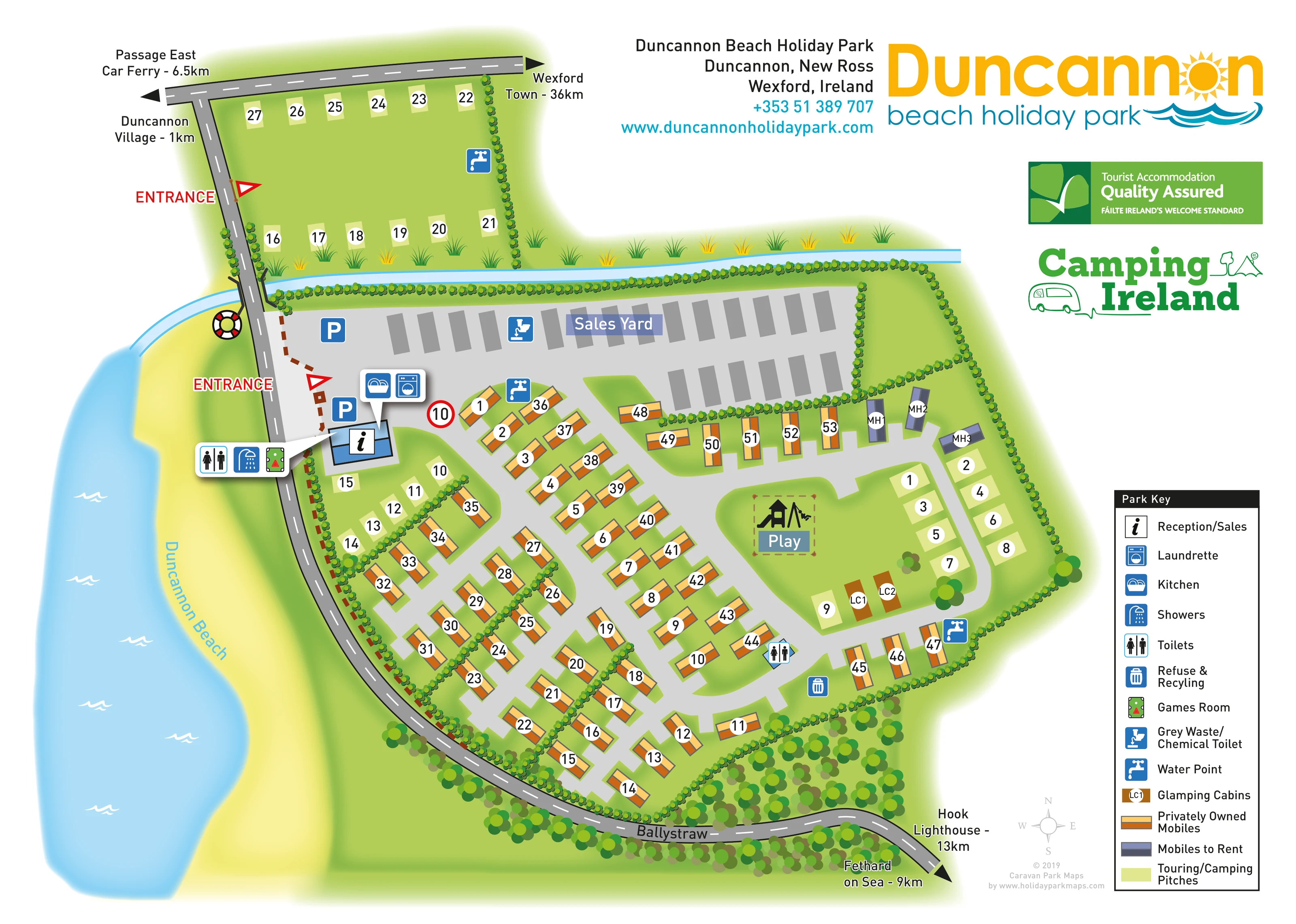
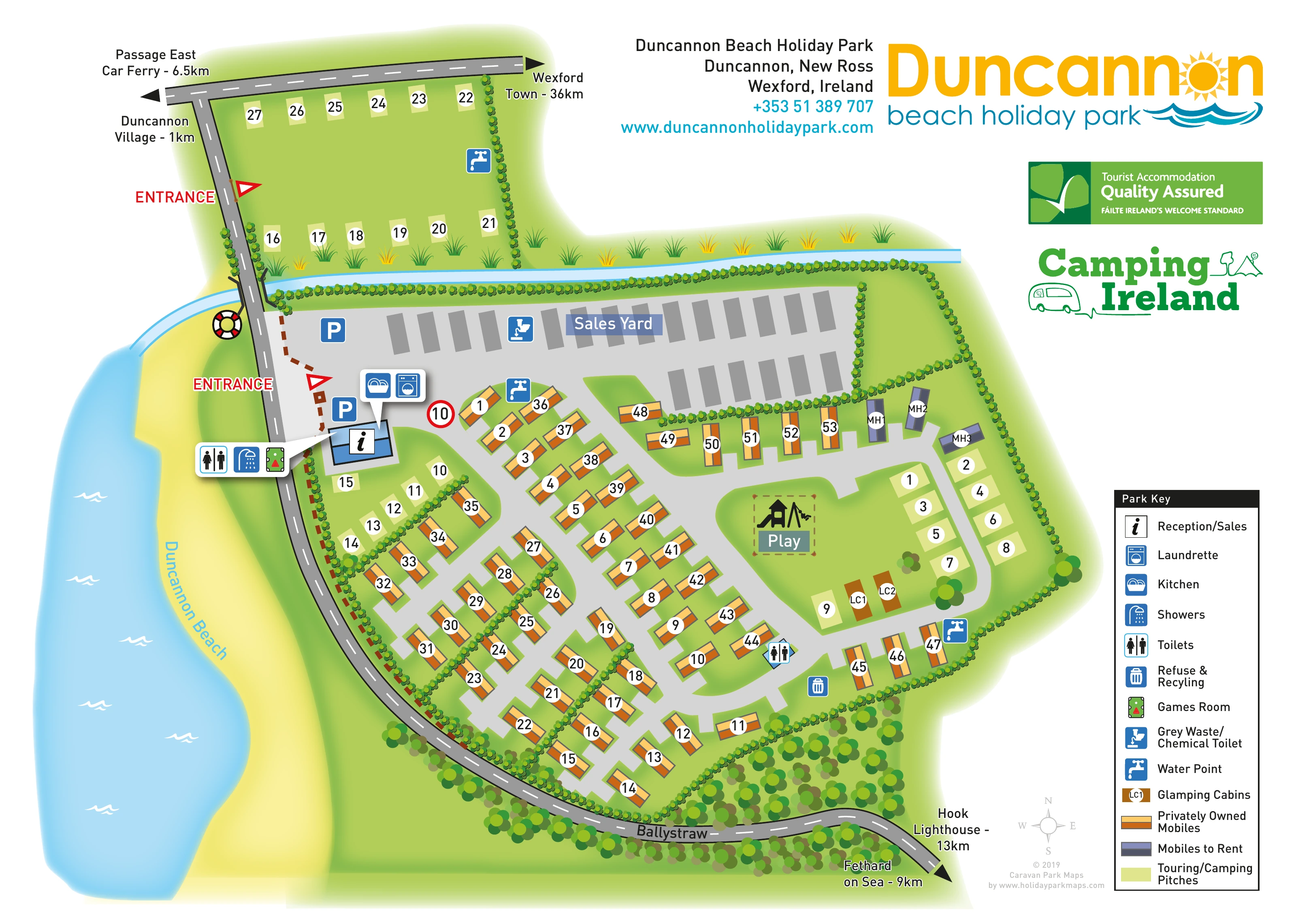
Named sandy shoreline and blue sea occupy the western side of the illustration, outside the roadside park boundary.
ILLUSTRATED PARK MAP · P452
Ballystraw, Duncannon, Wexford · Ireland
 Enlarge the map ↗
A SENSE OF THE PLACE
Duncannon Beach Holiday Park is based at Ballystraw, Duncannon, Wexford. The beachside setting includes nature walks and access to Duncannon village. The park offers safari tents, mobile-home rentals, a cottage, touring caravans and motorhome pitches.
The park provides a playground, astroturf football pitch and outdoor cinema.
LOOK CLOSER
Named sandy shoreline and blue sea occupy the western side of the illustration, outside the roadside park boundary.
A pale-blue channel runs across the northern edge of the main park and meets the beach near the roadside crossing.
Repeated hedge symbols divide accommodation groups and frame boundaries; denser tree planting follows the southern road.
Information symbol on a blue building immediately inside the main entrance, alongside service callouts.
Large grey yard north of the main accommodation area, containing rows of grey rectangular stock symbols.
Two blue parking symbols near reception and the western side of the sales yard.
Paired service icons in a callout pointing to the reception-side building.
Toilets and showers are grouped in an entrance-side callout; another toilet symbol appears within the main accommodation area.
Information symbol on a blue building immediately inside the main entrance, alongside service callouts.
Large grey yard north of the main accommodation area, containing rows of grey rectangular stock symbols.
Two blue parking symbols near reception and the western side of the sales yard.
Paired service icons in a callout pointing to the reception-side building.
Toilets and showers are grouped in an entrance-side callout; another toilet symbol appears within the main accommodation area.
Billiards-table pictogram grouped with the entrance-side toilet and shower callout.
Prominent black slide-and-swing pictogram within a dashed brown enclosure on the central-eastern green.
Blue tap symbols distributed across the northern pitch field and the main park.
Refuse/recycling symbol beside the southern internal lane and grey-waste/chemical-toilet symbol within the sales-yard area.
Named sandy shoreline and blue sea occupy the western side of the illustration, outside the roadside park boundary.
A pale-blue channel runs across the northern edge of the main park and meets the beach near the roadside crossing.
Repeated hedge symbols divide accommodation groups and frame boundaries; denser tree planting follows the southern road.
Red entrance labels and triangular markers identify access from the western road to the main park and to the separate northern pitch field.
Light-grey internal routes serve angled mobile-home rows, with a rounded loop around the eastern touring/camping and glamping area.
Arrow-ended roads point towards Duncannon village, Passage East Car Ferry, Wexford Town, Fethard on Sea and Hook Lighthouse. Ballystraw is labelled on the southern bend.
A lifebuoy symbol is drawn beside the western road near the watercourse; it has no corresponding key entry.
These amenities are mentioned in the park information but are not separately labelled or recognisable in the artwork.
Nature walks are part of the wider park setting; no walking circuit is plotted on this map.
READING THE MAP
This illustrated map presents Duncannon Beach Holiday Park in its coastal setting at Ballystraw, Duncannon, County Wexford. A sweeping strip of yellow sand and blue sea anchors the left side of the page, while the park’s mobile homes, touring/camping pitches and glamping cabins are arranged within a bright green landscape. The beach is an important part of the composition, helping visitors relate the accommodation areas to the shoreline and neighbouring road.
The plan distinguishes a separate northern pitch field from the main park, with two clearly marked entrances and reception positioned beside the principal arrival point. Colour-coded accommodation, numbered plots and blue facility symbols explain the site without relying on detailed building drawings. A sales yard, central play space and rounded eastern access loop give the map a recognisable structure.
Large coastal branding and a dedicated Park Key complete the page. This sample is particularly relevant to mixed-accommodation parks that need to explain ownership and rental categories, touring areas and shared services while retaining a strong sense of place.
The main plan follows an irregular site beside Duncannon Beach. A dark-grey public road descends along the western boundary before bending across the bottom of the illustration, where it is labelled Ballystraw. Arrowheads and destination labels place the park in relation to Duncannon village, Passage East Car Ferry, Wexford Town, Fethard on Sea and Hook Lighthouse. A narrow blue watercourse crosses the upper part of the composition and reaches the beach near the road.
Two red entrance markers separate access to the northern touring/camping field from arrival at the main park. Reception sits just inside the main entrance, with nearby parking symbols and grouped callouts for the kitchen, laundrette, toilets, showers and games room. Immediately north is a broad sales yard, illustrated with rows of grey stock rectangles and a touring-waste disposal symbol.
Within the main park, light-grey lanes branch between angled rows of privately owned mobile homes. Orange and cream unit colours contrast with three purple rental mobiles near the eastern boundary. Pale touring/camping pitches occupy the northern field, a smaller reception-side group and the eastern loop. Two brown glamping cabins sit beside this loop, close to the play area. Water-point symbols are spread across the site, with further toilets and a refuse/recycling point marked among the main accommodation rows.
Hedges divide the groups, and denser trees follow the southern boundary. The right-hand margin contains the accommodation and facility key, compass and branding. The accompanying enlargement shows this same eastern accommodation area and key in greater detail; it is not a separate park section or additional accommodation inventory.
KEEP EXPLORING
Chosen for shared landscapes, accommodation or facilities.
 Explore the map ↗
United Kingdom
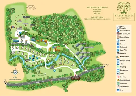
A woodland-valley park map combining named glamping stays, numbered pitches, riverside lodges and footprint-marked walking routes.
 Explore the map ↗
United Kingdom
Woodland park map with mixed pitches, bell tents, lodges and a fishing lake.
 Explore the map ↗
United Kingdom
A colour-zoned coastal park map with touring areas, woodland trails, ponds and a leisure club.
Features may come from the sample artwork, its key or published park information. Approximate numbers describe the drawing and may cover only part of a park. They are intended to help you compare map examples. Current facilities and booking information should be checked with the park.
TAKE A CLOSER LOOK
View the illustrated map in detail or choose a file to download. These are sample maps; contact the park for current visitor information.


LET’S MAP YOUR PARK
For a map quotation, find your park and draw a rough boundary around it. The area you select helps us work out the design time and price.
Draw your park for a quote ↗Or talk to our map designers
01751 473136
 duncannonbeacha_large.png