
Tree belts and planted buffers
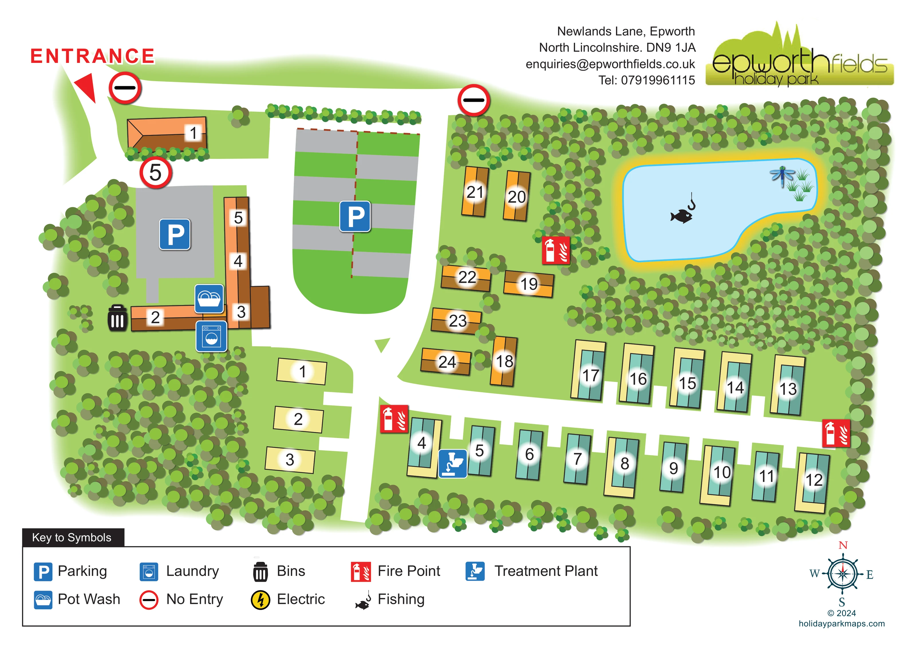
Dense stylised trees enclose much of the park, surround the pond and form a substantial planted block in the south-west.
ILLUSTRATED PARK MAP · P112
Newlands Lane, Epworth, North Lincolnshire · United Kingdom
 Enlarge the map ↗
A SENSE OF THE PLACE
Epworth Fields is a family-run holiday park outside the historic town of Epworth in North Lincolnshire. It offers camping, self-catering cottages and lodge ownership.
The town's shops, bars and places to eat complement the park's rural setting. Its map shows how the different accommodation areas fit together, supporting visitors who are planning a camping break or a longer-term holiday base.
LOOK CLOSER
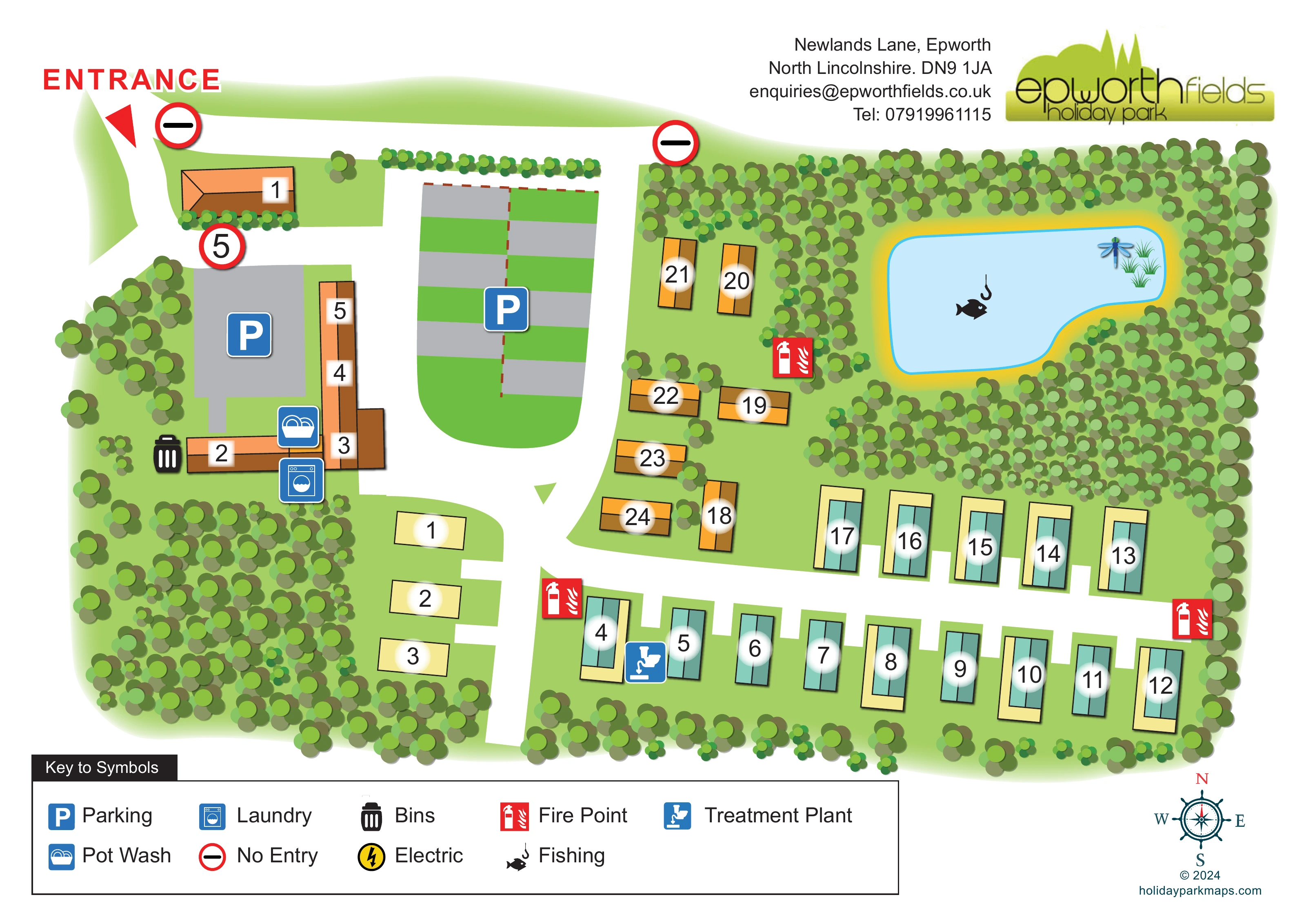
Dense stylised trees enclose much of the park, surround the pond and form a substantial planted block in the south-west.
Light-green ground separates accommodation units, roads and planted areas.
Large red ENTRANCE lettering and a triangular pointer mark arrival at the upper-left corner of the plan.
Broad white roads connect the western buildings and parking with the southern and eastern accommodation rows; short white spurs serve individual locations.
Two no-entry symbols mark the upper road, and a red-ringed 5 sign appears near the western parking area.
Blue P symbols identify a grey western parking area and a larger central area illustrated with alternating grey and green strips.
A blue pot-wash symbol is positioned beside the western connected building range.
A blue washing-machine symbol locates the laundry beside the western buildings.
Large red ENTRANCE lettering and a triangular pointer mark arrival at the upper-left corner of the plan.
Broad white roads connect the western buildings and parking with the southern and eastern accommodation rows; short white spurs serve individual locations.
Two no-entry symbols mark the upper road, and a red-ringed 5 sign appears near the western parking area.
Blue P symbols identify a grey western parking area and a larger central area illustrated with alternating grey and green strips.
A blue pot-wash symbol is positioned beside the western connected building range.
A blue washing-machine symbol locates the laundry beside the western buildings.
A black bin symbol appears immediately west of the lower arm of the western building range.
Red fire-point symbols are distributed beside the central accommodation cluster and along the southern access road.
The blue symbol identified in the key as Treatment Plant is placed beside the western end of the southern accommodation row.
A large irregular blue pond in the north-east contains the fish-and-hook symbol used for Fishing in the key.
Dense stylised trees enclose much of the park, surround the pond and form a substantial planted block in the south-west.
Light-green ground separates accommodation units, roads and planted areas.
A yellow lightning-bolt symbol labelled Electric appears in the key; no corresponding location is clearly identifiable on the main plan.
A decorative compass at the lower right indicates north towards the top of the page.
READING THE MAP
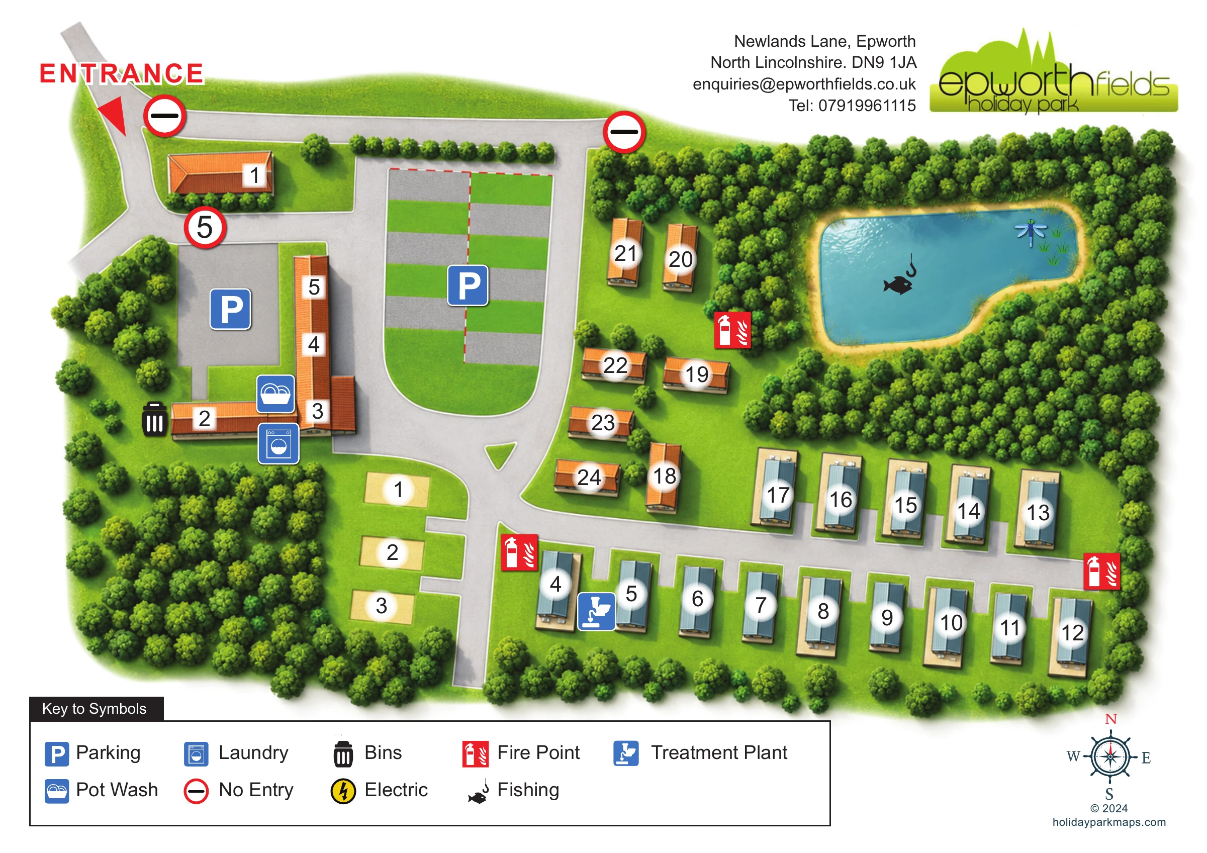
This illustrated map of Epworth Fields brings together a compact holiday park layout and its tree-lined rural character. Set at Newlands Lane outside Epworth in North Lincolnshire, the park is presented as a clear overhead plan, with numbered accommodation, broad white access roads and a fishing pond surrounded by dense planting.
The entrance is immediately recognisable at the upper left, while parking and the western building group establish the arrival side of the site. Further into the plan, teal and orange roof illustrations distinguish different groups of accommodation without crowding the page with descriptive labels. Blue service icons locate parking, laundry and pot washing, and red fire-point markers stand out against the green landscape.
A generous symbol key sits beneath the plan, with the park’s logo and contact details above it and a decorative compass at the lower right. The result is a useful sample for smaller parks needing to show accommodation, practical facilities and an attractive landscape feature within one straightforward visitor map.
The plan is organised around a north-west entrance, marked by bold red lettering and a triangular pointer. From this arrival corner, broad white roads connect a detached western building, a connected building range and two marked parking areas. The larger central parking area is drawn with alternating grey and green strips, making it visually different from both the roads and the surrounding grass.
The main accommodation area extends south and east of this arrival zone. Teal-roofed rectangular units line the southern road in opposing rows, with short white access spurs and cream margins around some buildings. Orange-roofed units form a smaller cluster closer to the centre. A few plain cream rectangles occupy the south-western branch. Large black numbers on white halos make the locations easy to pick out, while the western buildings use a separate numbered grouping.
The north-east corner is dominated by an irregular pale-blue fishing pond. Its fish-and-hook symbol gives the feature a practical meaning, while reeds and a dragonfly add an illustrative accent. Dense groups of circular tree canopies surround the water, continue around the park boundary and fill a substantial south-western planted area.
Pot wash, laundry and bins are marked beside the western buildings. Fire points appear around the accommodation roads, and the treatment plant is identified near the western end of the southern row. No-entry signs and a red-ringed 5 sign supplement the route information. The boxed legend, upper-right branding and lower-right compass complete the single-page composition; the enlarged detail views reproduce its lower margin rather than introduce another map.
 Enlarge this map ↗
KEEP EXPLORING
Chosen for shared landscapes, accommodation or facilities.
 Explore the map ↗
United Kingdom
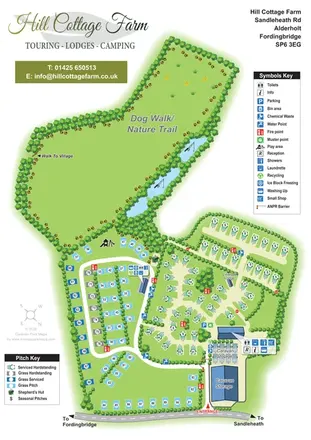
Portrait park map with mixed touring pitches, seasonal rows, ponds and an extensive dog walk.
 Explore the map ↗
United Kingdom
A woodland estate park map combining caravan loops, touring pitches, riverside paths and Bruce’s Cave landmarks.
 Explore the map ↗
United Kingdom
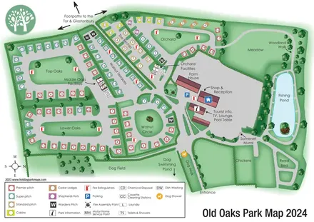
Colour-coded touring and glamping map with hedge-lined pitch groups, a fishing pond and detailed dog facilities.
Features may come from the sample artwork, its key or published park information. Approximate numbers describe the drawing and may cover only part of a park. They are intended to help you compare map examples. Current facilities and booking information should be checked with the park.
TAKE A CLOSER LOOK
View the illustrated map in detail or choose a file to download. These are sample maps; contact the park for current visitor information.


LET’S MAP YOUR PARK
For a map quotation, find your park and draw a rough boundary around it. The area you select helps us work out the design time and price.
Draw your park for a quote ↗Or talk to our map designers
01751 473136
 newlandsmap_large.png