
Tree belts and planted divisions
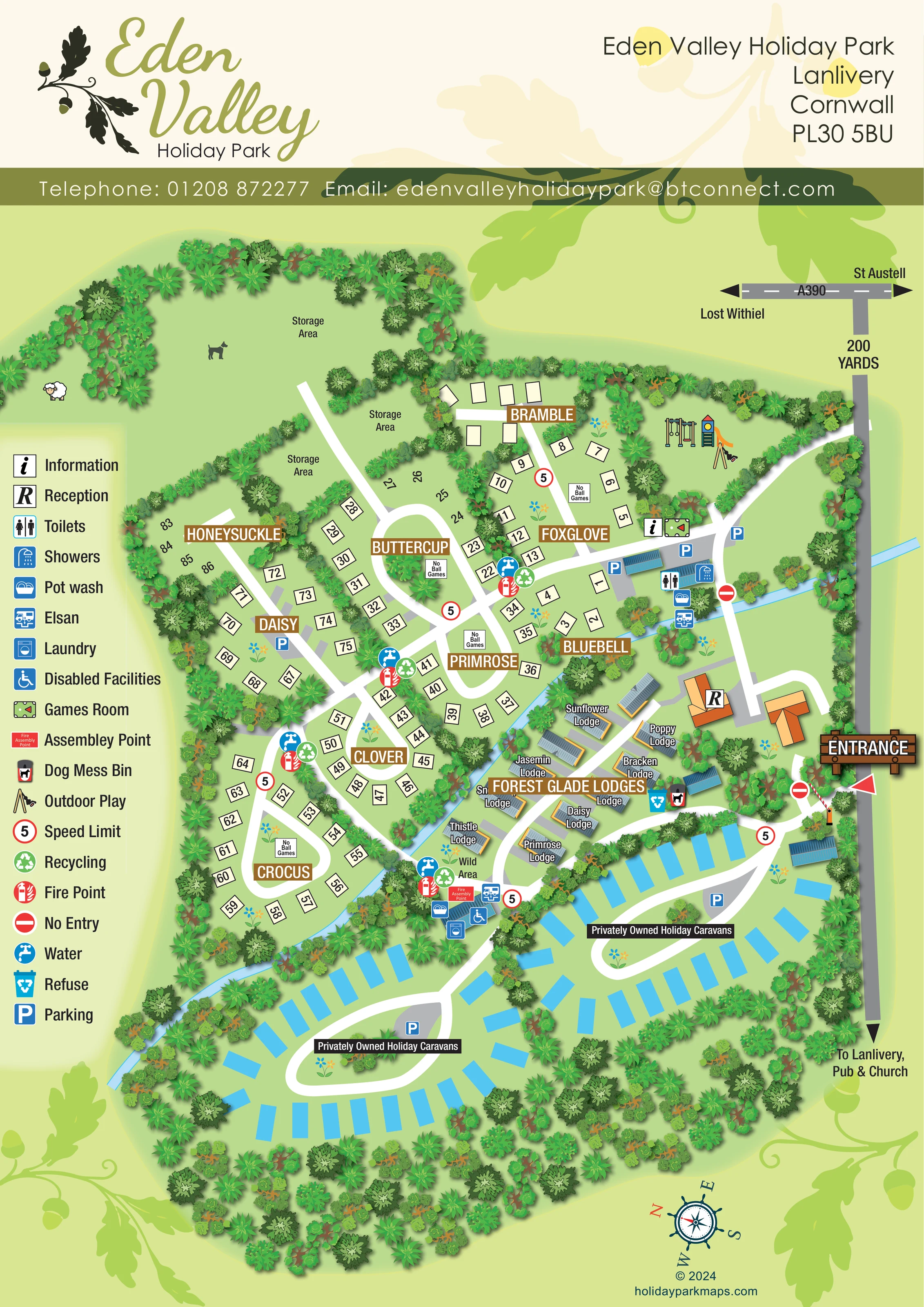
Dense illustrated trees enclose the park and separate accommodation sections, storage areas and routes.
ILLUSTRATED PARK MAP · P109
Eden Valley Holiday Park, Lanlivery, Cornwall · United Kingdom
 Enlarge the map ↗
A SENSE OF THE PLACE
Eden Valley Holiday Park lies in a sheltered valley near Lanlivery and Lostwithiel in Cornwall. It offers touring and camping pitches, lodge holidays and holiday home ownership.
Showers, toilets, a games room and laundry facilities support a quieter style of stay. The countryside location provides a base for exploring Cornwall's towns, beaches and inland landscapes, with a choice of pitch services and self-catering accommodation.
LOOK CLOSER
Dense illustrated trees enclose the park and separate accommodation sections, storage areas and routes.
A narrow pale-blue watercourse runs diagonally through the plan, between the pitch areas and the lodges, continuing towards the lower-left boundary.
A small green space is labelled 'Wild Area' beside Thistle Lodge and the lower service cluster.
An R symbol marks an orange-roofed building just inside the entrance, beside the lodge area.
An information symbol is placed beside the games-room marker near the upper amenity and parking cluster.
Toilet and shower symbols identify the amenity buildings near Foxglove and Bluebell.
Pot-wash symbols appear at the upper amenity cluster and the lower service building beside the lodges.
Elsan symbols mark disposal facilities at both principal service clusters.
An R symbol marks an orange-roofed building just inside the entrance, beside the lodge area.
An information symbol is placed beside the games-room marker near the upper amenity and parking cluster.
Toilet and shower symbols identify the amenity buildings near Foxglove and Bluebell.
Pot-wash symbols appear at the upper amenity cluster and the lower service building beside the lodges.
Elsan symbols mark disposal facilities at both principal service clusters.
A laundry symbol is positioned at the lower service building, close to Forest Glade Lodges and the caravan areas.
The legend's wheelchair symbol is placed at the lower service building; it identifies a facility rather than guaranteeing accessibility throughout the park.
A green billiards-table symbol marks the games room beside the information point.
Illustrated swings, climbing equipment and a slide occupy a tree-enclosed green area at the upper right of the park.
Repeated blue tap symbols are distributed through the pitch sections and beside the lower amenity building.
Green recycling symbols recur around the pitch areas; refuse-bin markers appear beside the lodge route.
A dog mess bin is marked beside the refuse point on the route between the entrance and lodges.
Red fire-point symbols recur alongside water and recycling markers. A fire assembly point is labelled beside the lower service building.
Blue P symbols mark grey parking surfaces near the upper amenities, Daisy pitches and both privately owned caravan loops.
A prominent timber-style entrance sign, red pointer and illustrated barrier identify access from the road along the right-hand edge.
The roadside diagram names the A390, St Austell and Lost Withiel, with a further arrow towards Lanlivery, the pub and church.
Broad white routes connect the entrance, amenities, pitches and lodges, then branch into two separate caravan loops.
The artwork includes repeated red-bordered 5 speed-limit symbols, no-entry signs and several 'No Ball Games' notices.
Dense illustrated trees enclose the park and separate accommodation sections, storage areas and routes.
A narrow pale-blue watercourse runs diagonally through the plan, between the pitch areas and the lodges, continuing towards the lower-left boundary.
A small green space is labelled 'Wild Area' beside Thistle Lodge and the lower service cluster.
Several tree-divided areas at the upper left are explicitly labelled for storage rather than guest accommodation.
READING THE MAP
This illustrated map of Eden Valley Holiday Park in Lanlivery, Cornwall, brings a varied countryside site into one portrait-format plan. Tree-lined pitch sections occupy the upper and left-hand areas, Forest Glade Lodges sit near the centre, and two loops of privately owned holiday caravans fill the lower part of the artwork. A narrow blue watercourse threads between these accommodation groups, reinforcing the green valley setting.
The design gives each accommodation type a different visual treatment: numbered cream pitches, roofed lodge illustrations and bright blue caravan footprints. Flower-named section banners help visitors recognise their part of the park, while a tall symbol key explains amenities, parking and service points. Reception, the entrance barrier and the nearby road connections are easy to locate within the wider composition.
Oak leaves link the park's logo with the page background, creating a consistent identity without replacing practical information. This sample is particularly relevant to mixed holiday parks that need to explain several accommodation areas, shared facilities and a branching internal road network on a single guest-facing map.
The plan is organised around an entrance on the right-hand edge, where a timber-style sign, red pointer and illustrated barrier lead towards reception. A grey external road connects the page to directions for Lanlivery, its pub and church, and an A390 diagram naming St Austell and Lost Withiel. Inside the park, broad white roads branch through green spaces rather than following a rigid grid.
The pitch areas are divided into botanical sections including Bramble, Foxglove, Buttercup, Honeysuckle, Daisy, Bluebell, Primrose, Clover and Crocus. Numbered cream pitch markers follow short spurs and rounded loops, with trees and hedges separating neighbouring groups. Several storage areas sit beyond these pitches at the upper left. The upper-right corner contains illustrated play equipment, while information, a games room, parking and an amenity cluster lie nearby.
Forest Glade Lodges form a central strip of individually named units with shaded, ribbed roofs and warm-coloured edges. A labelled wild area sits near Thistle Lodge. Below and to either side, cyan caravan footprints surround two distinct loops labelled for privately owned holiday caravans. Grey parking areas sit within the loops.
The legend explains toilets, showers, pot washing, Elsan disposal, laundry, disabled facilities and other service symbols. Water, recycling and fire-point markers recur through the pitch sections, while the lower service cluster includes the assembly point. Refuse and a dog mess bin are marked beside the lodge route. A diagonal blue watercourse and dense tree belts give the accommodation zones a strong landscape framework. The complete design is one portrait plan; its enlarged details show the same artwork, not additional park sections.
KEEP EXPLORING
Chosen for shared landscapes, accommodation or facilities.
 Explore the map ↗
United Kingdom
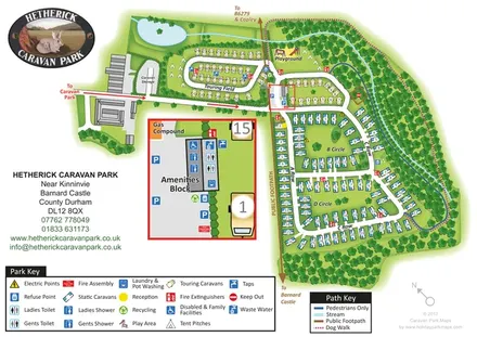
Woodland caravan park map with named pitch areas, walking routes and an enlarged amenities block.
 Explore the map ↗
United Kingdom
A woodland estate park map combining caravan loops, touring pitches, riverside paths and Bruce’s Cave landmarks.
 Explore the map ↗
United Kingdom
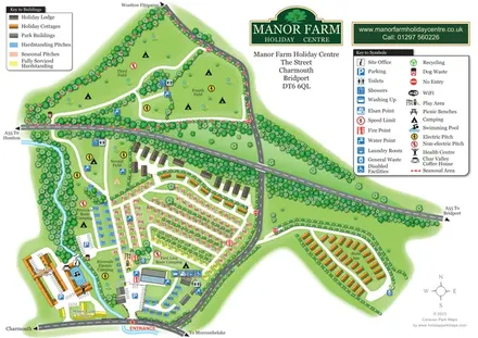
Colour-coded pitches, riverside camping and separate accommodation areas at Manor Farm Holiday Centre, Dorset.
Features may come from the sample artwork, its key or published park information. Approximate numbers describe the drawing and may cover only part of a park. They are intended to help you compare map examples. Current facilities and booking information should be checked with the park.
LET’S MAP YOUR PARK
For a map quotation, find your park and draw a rough boundary around it. The area you select helps us work out the design time and price.
Draw your park for a quote ↗Or talk to our map designers
01751 473136