
Pasture and paddocks
Broad pasture fields and smaller fenced paddocks surround the equestrian and accommodation areas.
ILLUSTRATED PARK MAP · P459
Field Farm, Langham Road, Ember Lane, Mumby, Lincolnshire · United Kingdom
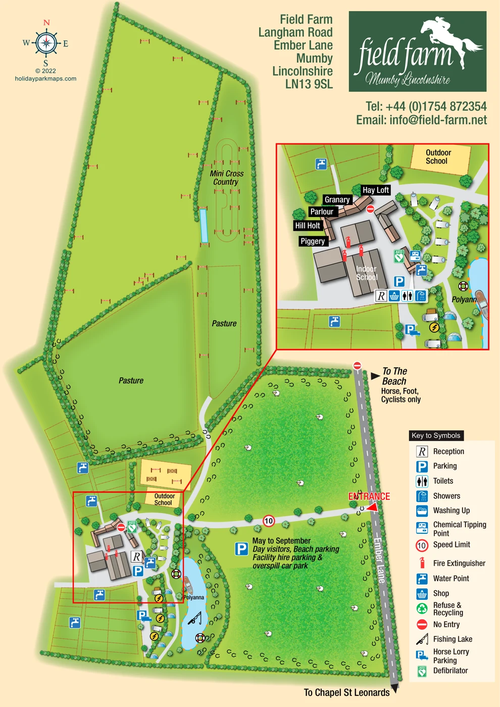 Enlarge the map ↗
A SENSE OF THE PLACE
Field Farm at Mumby specialises in holidays where guests can bring their horses. Its Lincolnshire coastal location supports beach riding alongside facilities for equestrian activities.
Accommodation includes cottages, caravans and camping, with paddocks and other horse facilities forming part of the site. The map helps show the relationship between visitor accommodation and the spaces used by horses and riders.
LOOK CLOSER
Broad pasture fields and smaller fenced paddocks surround the equestrian and accommodation areas.
Hedgerows and repeated tree illustrations define the farm boundary, internal field divisions and the accommodation hub.
A blue lake beside the southern accommodation area is marked with the fishing symbol and illustrated with a boat and lifebuoys.
Five named accommodation buildings around the main courtyard: Hay Loft, Granary, Parlour, Hill Holt and Piggery. The park information identifies cottages as part of the accommodation offer.
Small caravan illustrations follow the curved drive beside the main buildings and continue towards the lakeside.
Tent illustrations appear beside the lake; camping is also identified in the park information. These illustrations do not establish a fixed camping capacity.
A large building within the main complex is labelled Indoor School.
A sand-coloured rectangular riding area lies immediately north of the main building group.
Five named accommodation buildings around the main courtyard: Hay Loft, Granary, Parlour, Hill Holt and Piggery. The park information identifies cottages as part of the accommodation offer.
Small caravan illustrations follow the curved drive beside the main buildings and continue towards the lakeside.
Tent illustrations appear beside the lake; camping is also identified in the park information. These illustrations do not establish a fixed camping capacity.
A large building within the main complex is labelled Indoor School.
A sand-coloured rectangular riding area lies immediately north of the main building group.
An additional sand-coloured enclosure beside the outdoor school contains illustrated jumping obstacles.
The northern grounds include a labelled Mini Cross Country area, numerous jump illustrations and a narrow blue water feature.
Broad pasture fields and smaller fenced paddocks surround the equestrian and accommodation areas.
Hedgerows and repeated tree illustrations define the farm boundary, internal field divisions and the accommodation hub.
A blue lake beside the southern accommodation area is marked with the fishing symbol and illustrated with a boat and lifebuoys.
Reception is marked at the southern edge of the courtyard complex, particularly clearly in the enlargement.
A shop symbol appears alongside the reception and amenity symbols in the enlarged hub.
Toilet and shower symbols are positioned together near the main visitor facilities.
Water points are distributed around the paddocks and visitor hub; a chemical tipping point is marked beside the buildings.
The legend includes a washing-up symbol, but its location is not clearly established on the plan.
Refuse and recycling are included in the symbol key without a clearly identifiable mapped position.
Fire extinguisher symbols appear around the courtyard buildings, and a defibrillator symbol is positioned near the visitor hub.
Yellow electrical connection symbols are shown beside several lakeside caravan illustrations.
Parking symbols identify spaces near the buildings and horse-lorry parking beside the southern accommodation area.
The eastern field is labelled for May-to-September day visitors, beach parking, facility-hire parking and overspill parking.
The marked entrance opens from Ember Lane onto a drive leading west to the main buildings; a 10 speed-limit symbol appears on this drive.
A northward connection is labelled To The Beach and Horse, Foot, Cyclists only; the southern road direction points towards Chapel St Leonards.
Repeated horseshoe marks trace routes along field edges and around parts of the eastern grassland.
Field Farm specialises in holidays where guests bring their horses, with its Lincolnshire coastal setting supporting beach riding.
READING THE MAP
Field Farm’s map brings together holiday accommodation and a much larger equestrian landscape at Mumby, Lincolnshire. Rather than presenting rows of numbered pitches, the artwork explains how the visitor hub relates to riding schools, paddocks, pasture and cross-country areas. Ember Lane provides a clear eastern reference, with the entrance, directions towards Chapel St Leonards and a beachward route all marked on the plan.
The main drawing gives the fields room to breathe, using hedgerows, fences, jumps and horseshoe symbols to describe the farm’s character. Around the southern building group, the information becomes more concentrated: named accommodation, reception, visitor facilities and caravan illustrations sit close to the indoor school and fishing lake. A red-linked enlargement makes this busy area easier to read without sacrificing the wider landscape.
The result is a sample suited to clients whose sites mix holiday stays with specialist outdoor activities. Its warm cream background, fresh greens, illustrated buildings and bold service icons create a recognisable visitor map, while the prominent horse-and-rider branding makes Field Farm’s equestrian focus immediately apparent.
The plan follows an elongated, irregular farm footprint, with Ember Lane running down the right-hand side. An entrance near the middle of that edge leads west along a pale-grey drive to the compact building group. Large green fields occupy most of the page: hedged pasture fills the centre and left, while sheep illustrations and horseshoe marks distinguish the eastern grassland. The southern part of this eastern area is labelled for May-to-September day visitors, beach parking, facility-hire parking and overspill parking.
The northern grounds contain scattered illustrated jumps and a labelled Mini Cross Country area, including a narrow blue water feature. Towards the accommodation hub, fenced paddocks form smaller geometric compartments around the outdoor school. A nearby sand-coloured enclosure also contains illustrated jumping obstacles. Horseshoe symbols trace routes around several field edges and towards the beachward connection.
At the lower left, the main building complex is linked to a large red-bordered inset. This enlargement identifies Hay Loft, Granary, Parlour, Hill Holt and Piggery around the courtyard, together with the Indoor School and the nearby Outdoor School. It also clarifies the positions of reception, shop, toilets, showers, chemical tipping point, water points, parking, fire extinguishers and a defibrillator. Small caravan illustrations occupy the curved access area east of the buildings and continue south beside the lake, where tent illustrations and electrical connection symbols also appear.
The bright-blue fishing lake has an illustrated boat, angling symbol and lifebuoys, with the label Polyanna beside it. A lower-right legend explains the service symbols, including washing up and refuse and recycling. At the top, a horse-and-rider logo, address and contact block balance the landscape drawing, while a compass and designer credit occupy the opposite corner.
KEEP EXPLORING
Chosen for shared landscapes, accommodation or facilities.
 Explore the map ↗
United Kingdom
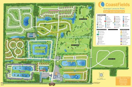
Colour-coded accommodation villages, fishing lakes, golf grounds and an Aqua Park at Grange Leisure Park.
 Explore the map ↗
United Kingdom
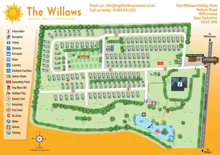
An overhead caravan and touring park map with sun branding, a pictogram key and an illustrated fishing lake.
 Explore the map ↗
United Kingdom
Ashby Park map with seven fishing lakes, colour-coded accommodation and illustrated wooded shorelines.
Features may come from the sample artwork, its key or published park information. Approximate numbers describe the drawing and may cover only part of a park. They are intended to help you compare map examples. Current facilities and booking information should be checked with the park.
LET’S MAP YOUR PARK
For a map quotation, find your park and draw a rough boundary around it. The area you select helps us work out the design time and price.
Draw your park for a quote ↗Or talk to our map designers
01751 473136