
Fishing lake
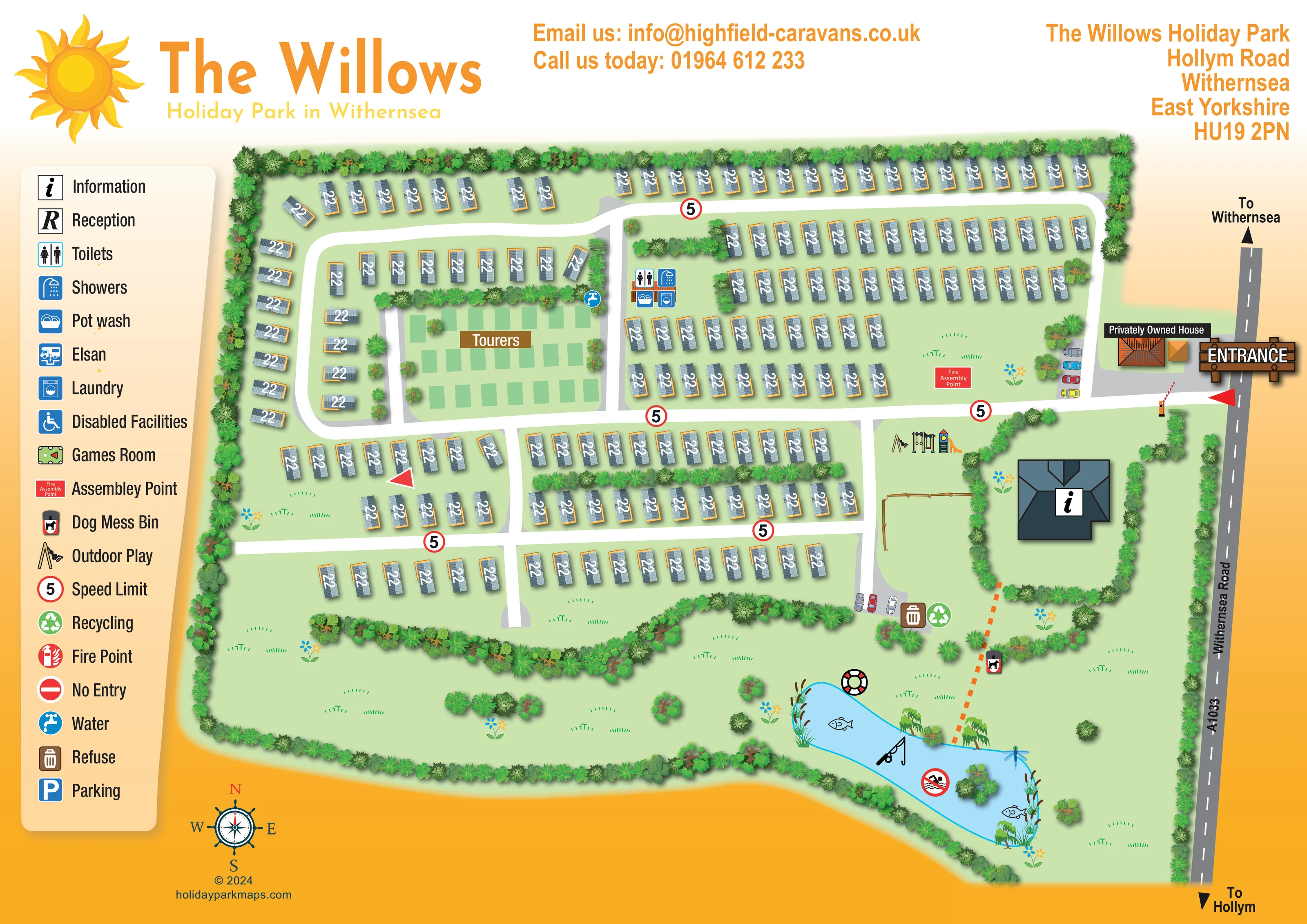
An elongated blue lake occupies the south-eastern landscaped area, with a fishing-rod symbol, fish, reeds, willows and a small planted island.
ILLUSTRATED PARK MAP · P338
The Willows Holiday Park, Hollym Road, Withernsea, East Yorkshire · United Kingdom
 Enlarge the map ↗
A SENSE OF THE PLACE
The Willows Holiday Park is set in the countryside near Withernsea on the East Yorkshire coast. Holiday home ownership and touring pitches provide different ways to enjoy its location close to the beach and town.
A bar and restaurant, games room, fishing lake, children's play area and mini golf offer recreation within the park. Laundry and washroom facilities support touring stays, with the map bringing the shared amenities and accommodation areas together.
LOOK CLOSER
An elongated blue lake occupies the south-eastern landscaped area, with a fishing-rod symbol, fish, reeds, willows and a small planted island.
Dense illustrated planting encloses the site and separates accommodation rows, building grounds and southern open lawns.
Broad grassed areas with scattered shrubs, flowers and small tree groups lie below the main accommodation blocks.
A large dark-roofed building marked with an information symbol stands in a hedge-enclosed plot south of the entrance road.
Four service symbols are grouped on a small building beside the touring area and the central north–south road.
A blue tap symbol appears at the north-eastern edge of the touring area.
Illustrated swings, climbing equipment and a slide sit just south of the main entrance road, beside the information-building grounds.
A lifebuoy illustration and a crossed-out swimming symbol accompany the lake.
A large dark-roofed building marked with an information symbol stands in a hedge-enclosed plot south of the entrance road.
Four service symbols are grouped on a small building beside the touring area and the central north–south road.
A blue tap symbol appears at the north-eastern edge of the touring area.
Illustrated swings, climbing equipment and a slide sit just south of the main entrance road, beside the information-building grounds.
An elongated blue lake occupies the south-eastern landscaped area, with a fishing-rod symbol, fish, reeds, willows and a small planted island.
A lifebuoy illustration and a crossed-out swimming symbol accompany the lake.
Paired refuse and recycling symbols are placed beside the southern parking apron.
A dog waste bin symbol stands beside the orange dashed route towards the lake.
Small groups of illustrated cars occupy grey roadside bays near the entrance and south of the information-building grounds.
A red labelled assembly-point panel is placed on the lawn immediately north of the entrance road.
An orange-roofed house beside the entrance is explicitly labelled as privately owned, distinguishing it from visitor facilities.
A timber-style entrance sign and illustrated barrier identify access from the road along the eastern boundary.
The eastern road is labelled Withernsea Road and A1033, with directional references to Withernsea above and Hollym below.
Broad white roads form a western loop, an upper perimeter route and connecting cross-roads through the caravan rows.
An orange dashed line links the information-building grounds with the lake bank.
Red-ringed signs displaying 5 are repeated along the internal roads.
Dense illustrated planting encloses the site and separates accommodation rows, building grounds and southern open lawns.
Broad grassed areas with scattered shrubs, flowers and small tree groups lie below the main accommodation blocks.
Reception has an R symbol in the key, but no corresponding location is clearly identifiable on the plan.
An Elsan symbol is included in the key without a clearly identifiable plotted location.
The key includes a wheelchair symbol labelled Disabled Facilities; the plan does not clearly locate it.
A games-room symbol appears in the key, although its position is not clearly marked in the main plan.
A fire-point symbol is defined in the key without a clearly identifiable placement.
The key defines a conventional no-entry sign; the red triangular arrows on the plan are a different graphic.
Published park information describes a bar and restaurant, but these are not separately identified on the artwork.
Mini golf is described in the park information but is not clearly identified on this map.
READING THE MAP
This illustrated map of The Willows Holiday Park brings together a predominantly static-caravan layout, a separate touring area and a landscaped fishing lake near Withernsea on the East Yorkshire coast. Its bright sun branding and orange-and-yellow page treatment frame a practical overhead plan, with white roads standing out clearly against pale green lawns.
The map shows how visitors enter from Withernsea Road and move through the park's looping and connecting roads. Caravan rows occupy most of the upper and central plan, while the touring pitches sit in a clearly labelled pocket on the western side. Shared washroom services, outdoor play equipment, parking and an information building provide recognisable landmarks rather than relying on accommodation labels alone.
The southern landscape gives this sample its particular character. Dense planting softens the accommodation boundaries, and a blue lake illustrated with reeds, fish and willows creates a strong visual destination. A tall pictogram key keeps practical information together at the left, leaving the main plan open enough to explain the relationship between accommodation, arrival facilities and recreation.
The single landscape-format artwork places the park plan beneath a broad branded header, with a cream facility key down the left-hand side. The eastern boundary follows the illustrated A1033, labelled Withernsea Road, with arrows towards Withernsea and Hollym. A timber-style entrance sign, barrier and labelled privately owned house establish the arrival point. Just inside, illustrated cars and a red fire assembly-point panel provide further landmarks.
White internal roads divide the accommodation into a western loop, a long northern route and several connected rows through the centre. Static caravans are represented by shaded grey-blue roof symbols with orange edges and white numeric overlays. Within the western loop, the area labelled Tourers uses simple green pitch rectangles. A water-point symbol appears along its upper edge, and a nearby small service building carries toilet, shower, pot-wash and laundry icons.
South of the entrance road, swings, climbing equipment and a slide mark the outdoor play area. The adjacent information building has a distinctive dark roof and a large information symbol, enclosed by a curved planted boundary. A southern parking apron sits beside refuse and recycling symbols. An orange dashed route continues from the building grounds past a dog waste bin towards the lake.
The lower part of the map opens into grassed landscape with tree groups, shrubs and decorative flowers. The fishing lake is drawn in light blue with reeds, willows, fish, a dragonfly and a small planted island; a fishing rod, lifebuoy and crossed-out swimming symbol reinforce its function and character. The key also defines several services whose positions are not clearly plotted. A compass rose below the plan completes the orientation information.
KEEP EXPLORING
Chosen for shared landscapes, accommodation or facilities.
 Explore the map ↗
United Kingdom
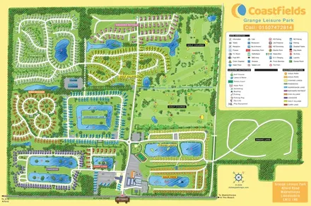
Colour-coded accommodation villages, fishing lakes, golf grounds and an Aqua Park at Grange Leisure Park.
 Explore the map ↗
United Kingdom
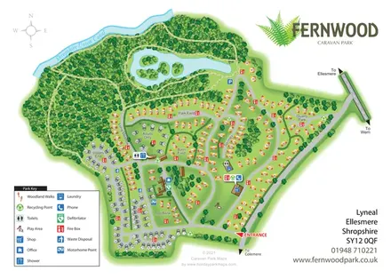
Illustrated caravan park plan with woodland and riverside walks, fishing pools and wildlife panels.
 Explore the map ↗
United Kingdom
Fernwood's illustrated park plan combines numbered accommodation, woodland walks, a canal-side setting and an island-dotted lake.
Features may come from the sample artwork, its key or published park information. Approximate numbers describe the drawing and may cover only part of a park. They are intended to help you compare map examples. Current facilities and booking information should be checked with the park.
LET’S MAP YOUR PARK
For a map quotation, find your park and draw a rough boundary around it. The area you select helps us work out the design time and price.
Draw your park for a quote ↗Or talk to our map designers
01751 473136