
Recreational field
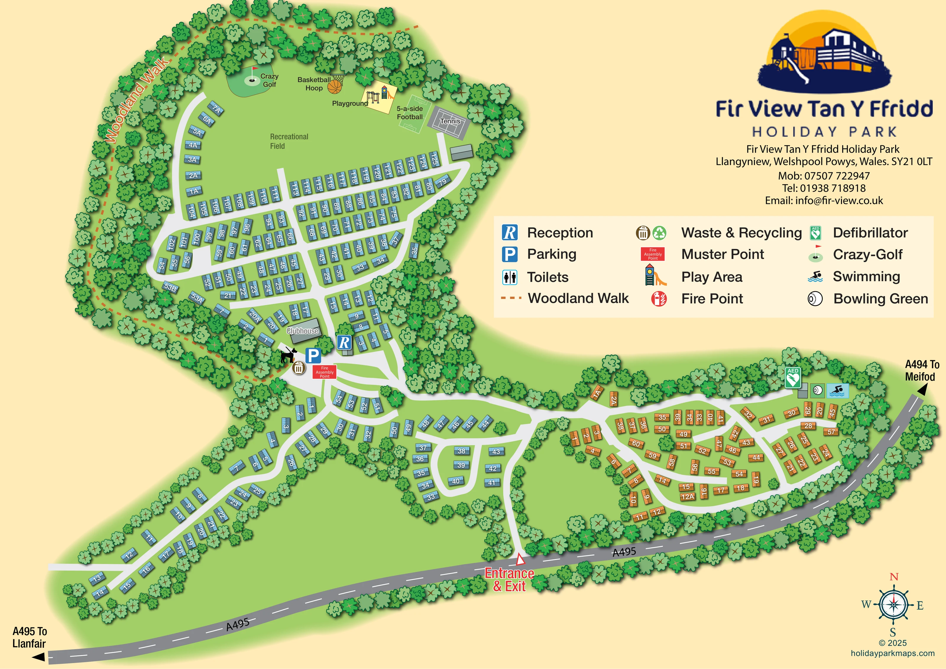
A large labelled grass area occupies the top of the main blue accommodation section, with several activities arranged around its wooded edge.
ILLUSTRATED PARK MAP · P121
Fir View Tan Y Ffridd Holiday Park, Llangyniew, Welshpool Powys, Wales · United Kingdom
 Enlarge the map ↗
A SENSE OF THE PLACE
Fir View Tan Y Ffridd is a static holiday caravan park at Llangyniew near Welshpool. Pitches follow the changing elevation of the site, giving holiday homes views over the Mid Wales countryside.
The park focuses on caravan ownership and a quieter setting for leisure time. Its map helps explain the hillside layout and internal roads, with the wider region providing opportunities for countryside outings.
LOOK CLOSER
A large labelled grass area occupies the top of the main blue accommodation section, with several activities arranged around its wooded edge.
Dense illustrated trees surround the upper section, line much of the park boundary and separate accommodation groups and open grass.
A blue R marker identifies reception at the junction below the main upper accommodation section.
A labelled grey building stands beside reception and the central arrival facilities.
A blue P marker identifies parking beside the clubhouse and reception.
A waste marker appears beside the central facilities; the legend identifies the combined waste and recycling service.
A red Fire Assembly Point sign is placed at the central junction near parking; the legend calls this a muster point.
A green AED marker appears beside a small building at the upper edge of the orange accommodation section.
A blue R marker identifies reception at the junction below the main upper accommodation section.
A labelled grey building stands beside reception and the central arrival facilities.
A blue P marker identifies parking beside the clubhouse and reception.
A waste marker appears beside the central facilities; the legend identifies the combined waste and recycling service.
A red Fire Assembly Point sign is placed at the central junction near parking; the legend calls this a muster point.
A green AED marker appears beside a small building at the upper edge of the orange accommodation section.
A blue swimming symbol marks a facility beside the bowling-green symbol in the right-hand section. The artwork does not specify whether it is indoors or outdoors.
A bowling symbol within a green square identifies the bowling green near swimming and the AED marker.
A large labelled grass area occupies the top of the main blue accommodation section, with several activities arranged around its wooded edge.
A green illustrated putting area with a flag marks crazy golf at the north-western edge of the recreational field.
A labelled basketball and hoop illustration sits between crazy golf and the playground.
A yellow play-area patch contains illustrated swings and a slide along the northern edge of the recreational field.
A small outlined football pitch is labelled beside the playground.
A grey court with white line markings is labelled Tennis at the north-eastern edge of the recreational field.
Dense illustrated trees surround the upper section, line much of the park boundary and separate accommodation groups and open grass.
An orange dashed route follows the western and northern woodland around the upper section and returns towards the clubhouse area.
A prominent red label and outlined triangular marker identify access from the A495 along the bottom of the plan.
Pale roads branch from the entrance towards the central facilities, lower-left accommodation and the right-hand section, with loops and short spurs serving the units.
The boundary road is labelled A495, with an A495 direction to Llanfair at the left and an A494 direction to Meifod at the right.
Toilets are included in the key, but no corresponding location is clearly identifiable in the plan.
A fire-point symbol is included in the key, without a clearly identifiable mapped position.
READING THE MAP
This illustrated map presents Fir View Tan Y Ffridd Holiday Park at Llangyniew near Welshpool, in the Mid Wales countryside. Its winding roads, wooded boundaries and several connected accommodation areas give the plan a distinctive shape: a broad upper section, a long lower-left arm and a smaller orange-coloured group beside the public road.
The map brings approximately 250 caravan-style positions into one readable overview, using numbered blue and orange units against light green grass. Reception, the clubhouse and parking form a clear central landmark, while the entrance from the A495 is highlighted along the lower edge. At the top, a recreational field gathers crazy golf, a basketball hoop, a playground, five-a-side football and tennis around its wooded perimeter. A dashed woodland walk provides a second way to understand this part of the site.
Generous space on the right accommodates the park's branding and a large symbol key. This sample is particularly relevant to ownership parks with a branching road network, extensive tree cover and facilities spread between distinct areas.
The single landscape plan combines a mostly overhead site drawing with pictorial landscape and activity details. Access is marked on the A495 at the bottom of the page, where a red-and-white entrance label leads into a pale internal road. From here, the network divides towards the orange accommodation section on the right and the blue sections to the left and above.
Reception, parking and the labelled clubhouse sit at the junction below the largest accommodation area. Waste and recycling and a fire assembly point are also marked here. Above this hub, closely spaced roads serve rows of numbered blue caravans, then open out towards a large recreational field. Crazy golf, a basketball hoop, playground equipment, a five-a-side pitch and a tennis court are individually illustrated or labelled along the field's northern edge. An orange dashed woodland walk follows the surrounding trees along the western and northern boundary.
Below the central facilities, a winding road serves a more dispersed blue accommodation arm stretching towards the lower-left corner. A small loop branches off beside the open grass in the lower centre. On the right, orange caravan symbols follow several curved roads; swimming, a bowling green and a defibrillator marker are grouped near the section's upper boundary.
Repeated tree canopies, dark outlines and soft shadows give the plan texture without obscuring its roads. White plot labels rotate with the caravan symbols. The upper-right logo and contact block sit above a spacious three-column legend, while a compass rose completes the lower-right corner. The artwork is one continuous plan rather than a collection of separate section maps.
KEEP EXPLORING
Chosen for shared landscapes, accommodation or facilities.
 Explore the map ↗
United Kingdom
Woodland-framed Barnsoul map with mixed accommodation, shared facilities and paw-marked walking routes.
 Explore the map ↗
United Kingdom
A wooded, streamside park map with a linked farm, café, touring and cottage area.
 Explore the map ↗
United Kingdom
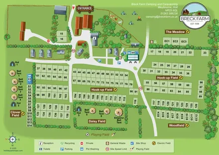
A field-based farm campsite map with numbered pitches, bell tents, huts and a wooded boundary.
Features may come from the sample artwork, its key or published park information. Approximate numbers describe the drawing and may cover only part of a park. They are intended to help you compare map examples. Current facilities and booking information should be checked with the park.
LET’S MAP YOUR PARK
For a map quotation, find your park and draw a rough boundary around it. The area you select helps us work out the design time and price.
Draw your park for a quote ↗Or talk to our map designers
01751 473136