
The Wildflower Meadow
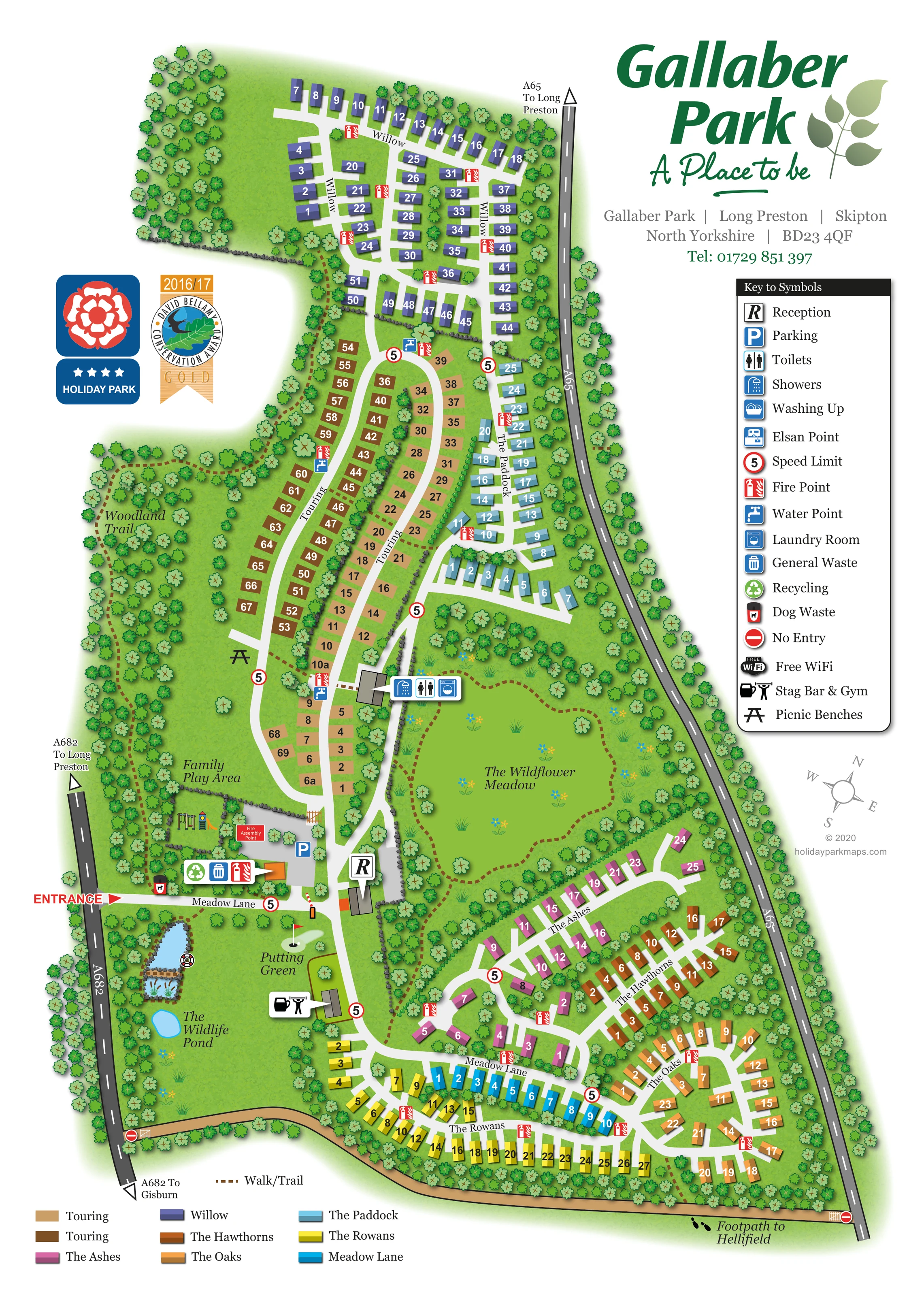
A large central meadow is illustrated with flowers, grass tufts, scattered trees and a looping dashed walk.
ILLUSTRATED PARK MAP · P466
Gallaber Park, Long Preston, Skipton, North Yorkshire · United Kingdom
 Enlarge the map ↗
A SENSE OF THE PLACE
Gallaber Park is based at Long Preston, Skipton, North Yorkshire. The site is located beside the Yorkshire Dales National Park near Settle and Skipton. The park offers holiday-home ownership at Gallaber.
The park advertises a gym, on-site bar, putting green, picnic area, play area and free site Wi-Fi. The park highlights Malham Cove, Gordale Scar and Ribblehead Viaduct as nearby excursions.
LOOK CLOSER
A large central meadow is illustrated with flowers, grass tufts, scattered trees and a looping dashed walk.
A small labelled blue pond lies in the southwestern open space, close to the putting green and another narrow illustrated water feature.
Dense tree belts frame the park, divide accommodation groups and form a broad wooded strip along the western side.
A prominent R callout identifies the reception building beside the principal internal junction near the entrance.
A blue parking symbol marks the entrance-side area near reception and the family play area.
A combined bar and exercise symbol points to a building south of reception, beside the putting green.
A labelled, illustrated play area sits just north of the entrance road, with small play-equipment drawings.
A labelled green with a hole and flag occupies the open landscaped area below the entrance.
A prominent R callout identifies the reception building beside the principal internal junction near the entrance.
A blue parking symbol marks the entrance-side area near reception and the family play area.
A combined bar and exercise symbol points to a building south of reception, beside the putting green.
A labelled, illustrated play area sits just north of the entrance road, with small play-equipment drawings.
A labelled green with a hole and flag occupies the open landscaped area below the entrance.
A picnic-bench symbol is placed on grass beside the western touring lane.
Grouped toilet, shower and laundry symbols point to a building between the touring pitches and wildflower meadow.
Repeated water-point and Elsan symbols identify servicing locations around the touring area.
Waste and recycling symbols are grouped near the entrance, with a separate dog-waste marker beside the entrance road.
Red fire-point symbols recur throughout the accommodation areas; a labelled fire assembly point appears near the entrance and play area.
Washing up is included in the symbol key, but a corresponding location is not clearly identifiable on the plan.
Free WiFi appears in the key without a clearly positioned coverage area or map marker.
A large central meadow is illustrated with flowers, grass tufts, scattered trees and a looping dashed walk.
A small labelled blue pond lies in the southwestern open space, close to the putting green and another narrow illustrated water feature.
Dense tree belts frame the park, divide accommodation groups and form a broad wooded strip along the western side.
A brown dashed trail winds through the western woodland beside the touring area.
The walk/trail line forms a conspicuous loop within the central wildflower meadow and links towards the amenity building.
A tan path follows the southern boundary, with a labelled onward footpath to Hellifield at the southeastern end.
A red entrance label and arrow mark access from the A682 on the western side into Meadow Lane.
Dark grey perimeter roads are labelled A65 and A682, with directional references to Long Preston and Gisburn.
White roads connect the entrance hub with looping touring lanes and short residential branches. Named lanes correspond to the accommodation colour key.
Red-bordered 5 speed-limit symbols appear along internal roads, while no-entry symbols mark the ends of the southern boundary route.
READING THE MAP
This illustrated map of Gallaber Park at Long Preston, near Skipton in North Yorkshire, brings together holiday-home neighbourhoods, touring pitches and generous landscaped spaces in one portrait-format plan. The park is drawn between the A682 and A65, with a clearly marked western entrance leading towards reception and the main internal roads. Colour-coded accommodation groups make the different parts of the site easy to distinguish without allowing the numbered plots to dominate the page.
Landscape is an important part of this particular design. A large wildflower meadow occupies the centre, a woodland trail follows the western side, and the southern open space contains a wildlife pond and putting green. These features give visitors useful landmarks as well as showing the character of the grounds.
The map also locates the family play area, Stag Bar & Gym, touring service points and an amenity building. A substantial symbol key, named lanes and an accommodation colour key support everyday navigation, while the Gallaber Park branding remains prominent above the plan.
The plan follows Gallaber Park's elongated shape, with dark grey public roads defining its eastern and western edges. Entry is marked in red from the A682, opening onto Meadow Lane beside parking, reception and the family play area. The reception building forms a useful orientation point where routes divide towards the northern touring areas and the southern holiday-home lanes.
At the northern end, purple Willow units are arranged around a branching road network. Below them, two brown touring areas run in long rows beside curving white lanes, with water points, Elsan points and fire symbols distributed through this part of the park. Light-blue units in The Paddock sit along its eastern side. A building beside the touring pitches is identified by a grouped shower, toilet and laundry callout.
The southern accommodation is more closely branched. The Ashes, The Hawthorns, The Oaks, The Rowans and Meadow Lane each have their own colour, supported by names along the roads and a separate key at the foot of the page. Bold plot numbers remain legible against the coloured blocks.
Between these neighbourhoods, the wildflower meadow is drawn as a broad green space with a looping brown dashed walk. A second dashed route winds through western woodland. Near the entrance, illustrated play equipment, the putting green, wildlife pond and Stag Bar & Gym provide recognisable destinations. A tan path follows the southern boundary towards the labelled footpath to Hellifield.
The right-hand legend explains service and safety symbols, while enlarged pointer labels identify key buildings. The accompanying detail view enlarges this same legend and adjacent plan area; it is not a separate park section or additional map variant.
KEEP EXPLORING
Chosen for shared landscapes, accommodation or facilities.
 Explore the map ↗
United Kingdom
Woodland-framed Barnsoul map with mixed accommodation, shared facilities and paw-marked walking routes.
 Explore the map ↗
United Kingdom
A colour-zoned coastal park map with touring areas, woodland trails, ponds and a leisure club.
 Explore the map ↗
United Kingdom
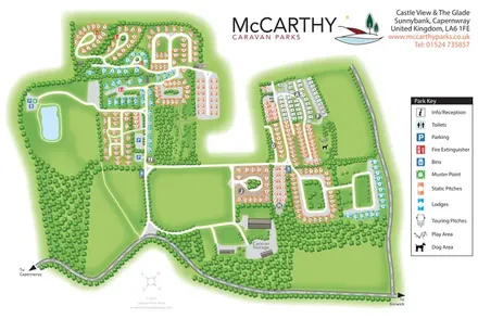
Tree-framed static, lodge and touring areas at Castle View & The Glade, with a pond, practical facilities and a clear colour-coded key.
Features may come from the sample artwork, its key or published park information. Approximate numbers describe the drawing and may cover only part of a park. They are intended to help you compare map examples. Current facilities and booking information should be checked with the park.
TAKE A CLOSER LOOK
View the illustrated map in detail or choose a file to download. These are sample maps; contact the park for current visitor information.


LET’S MAP YOUR PARK
For a map quotation, find your park and draw a rough boundary around it. The area you select helps us work out the design time and price.
Draw your park for a quote ↗Or talk to our map designers
01751 473136