
Park Field
An open area explicitly identified for dog walking and recreation, with football and paw-print symbols.
ILLUSTRATED PARK MAP · P129
Rhes y Cae Road, Hendre, near Mold, Flintshire, North Wales · United Kingdom
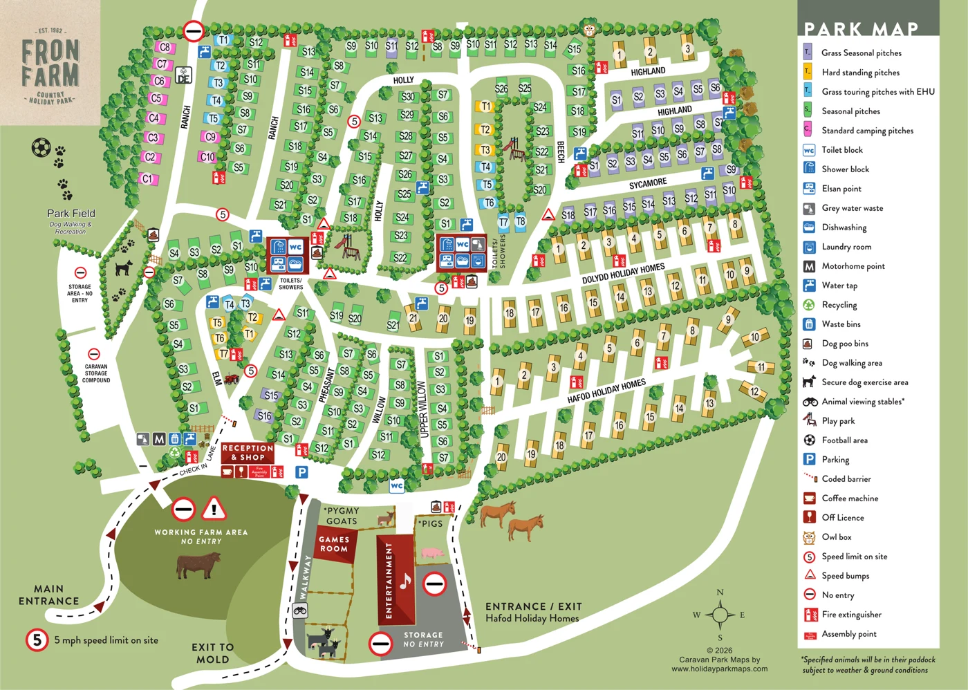 Enlarge the map ↗
A SENSE OF THE PLACE
Fron Farm Country Holiday Park is based at Rhes y Cae Road, Hendre, near Mold, Flintshire, North Wales. The site is located on a working farm with marked walking routes. Touring choices include fully serviced hardstandings, electric grass pitches and standard grass camping.
The park lists two shower/toilet blocks, accessible facilities, laundry, shop and two play parks.
LOOK CLOSER
An open area explicitly identified for dog walking and recreation, with football and paw-print symbols.
An olive-green area is separated from visitor circulation and marked as a restricted working farm. A cattle illustration reinforces its character without establishing stock numbers.
Brown dashed fences divide animal spaces beside the games room and entertainment building. Named pygmy-goat and pig areas are subject to the map's weather/ground-condition qualification.
Repeated clusters of green circles and larger stylised trees divide pitches, edge roads and enclose the park. They communicate planting and boundaries, not measured woodland coverage or individual tree counts.
A prominently labelled reception building stands beside the check-in lane.
The shop shares the reception building.
WC symbols appear in both principal toilet/shower buildings and as a separate marker south of Willow. The separate marker does not have an accompanying building footprint.
Shower symbols are grouped with the toilets in the two main service buildings.
A prominently labelled reception building stands beside the check-in lane.
The shop shares the reception building.
WC symbols appear in both principal toilet/shower buildings and as a separate marker south of Willow. The separate marker does not have an accompanying building footprint.
Shower symbols are grouped with the toilets in the two main service buildings.
Accessible facilities are listed in the supplied research, but no accessible-facility symbol or location is identified on this page.
A laundry-room icon is included in the eastern principal service building.
Dishwashing symbols are included in both main service buildings.
Chemical toilet disposal points are represented within both main service-building groups.
Grey-water disposal symbols occur at the entrance-side service cluster and at the eastern principal service building.
A dedicated motorhome service-point symbol is shown; it is not an accommodation pitch.
Blue water-tap symbols are distributed through the pitch areas and beside service buildings.
Electric hook-up provision is communicated through the cyan pitch category rather than individual electrical-pedestal icons.
A recycling point is shown within the entrance-side service cluster.
A general waste-bin marker is shown near reception.
Dog-waste bin symbols occur beside the dog-exercise area, principal service buildings and southern animal area.
Park Field is expressly labelled for dog walking and recreation. Paw-print graphics also extend through the adjoining dog-exercise strip.
An enclosed-looking strip marked by a dog silhouette, planting and gates is keyed as a secure dog-exercise area. The artwork does not establish present access rules.
Play equipment is depicted in a small central-west enclosure and within the Beech pitch loop.
A football symbol designates recreation within Park Field, without drawing a measured pitch.
A separate building is labelled as a games room.
A long red-roofed building is labelled for entertainment and carries a musical-note symbol. No programme or opening schedule is given.
Animal viewing is marked along a dedicated walkway beside fenced animal areas. Pygmy goats and pigs are named. A footnote makes paddock presence conditional on weather and ground conditions.
A coffee-machine service is indicated at reception; this does not establish a café or restaurant.
An off-licence service is indicated at reception and shop.
An owl-box location is represented by a distinctive illustrated owl icon.
A parking marker is provided near reception; no bay count is drawn.
Barrier symbols identify controlled vehicle access. No access credentials are reproduced.
Red extinguisher symbols are distributed around the accommodation and facility areas. These are artwork locations, not current emergency instructions.
An assembly-point marker is placed at reception. Its present operational status requires confirmation.
The artwork shows a site speed limit, speed-bump symbols and no-entry restrictions. These support wayfinding and separation of visitor and operational areas.
A caravan storage compound is labelled separately from visitor pitches, with other storage areas also restricted. No stored caravans are individually depicted or counted.
A DofE-style emblem appears beside Ranch, but it is not explained in the legend. It does not establish a separate campsite, accreditation or current activity programme.
An open area explicitly identified for dog walking and recreation, with football and paw-print symbols.
An olive-green area is separated from visitor circulation and marked as a restricted working farm. A cattle illustration reinforces its character without establishing stock numbers.
Brown dashed fences divide animal spaces beside the games room and entertainment building. Named pygmy-goat and pig areas are subject to the map's weather/ground-condition qualification.
Repeated clusters of green circles and larger stylised trees divide pitches, edge roads and enclose the park. They communicate planting and boundaries, not measured woodland coverage or individual tree counts.
A small beehive-and-bees illustration sits near reception, while donkey illustrations occupy open ground beside Hafod's access route. Neither is explained as a visitor facility.
READING THE MAP
Fron Farm Country Holiday Park is a detailed example of mapping a large, varied park in a working-farm setting near Mold in North Wales. Named areas such as Ranch, Holly, Beech, Highland and Willow help divide the plan into manageable sections, alongside the Dolydd and Hafod holiday-home areas.
The design distinguishes seasonal pitches, hardstandings, electric grass touring and standard camping, giving a broad view of the accommodation mix. Reception and shop are linked to a dedicated check-in lane, while sanitary facilities, laundry, dishwashing and touring-service points are distributed around the park. Recreation space, dog-walking and exercise areas, games and entertainment buildings, and animal-viewing features add another layer of visitor information.
This sample is particularly useful for parks with multiple named sections and a wide range of pitch types. It shows how colour, labels and area names can organise a busy plan, while farm illustrations and landscape details give the map a character that belongs to this particular site.
This single landscape page presents Fron Farm as a dense illustrated overhead plan, framed by a rustic logo panel at the upper left and a tall white legend on the right. A pale sage-green ground unifies the artwork. Broad white roads divide accommodation into named lanes and loops, while repeated green tree and hedge symbols define boundaries and separate rows. There is a north-pointing compass near the lower right, but no scale or distance information.
Pitch categories are distinguished by colour: green seasonal pitches, purple grass seasonal pitches, cyan electric grass touring pitches, yellow hardstandings and pink standard camping pitches. Large black labels sit on pale circular backplates. Numbering restarts between areas, making the accompanying names—Ranch, Holly, Beech, Highland, Sycamore, Elm, Pheasant, Willow and Upper Willow—important to interpretation. Gold roof-shaped units form the Dolydd and Hafod Holiday Homes areas on the eastern side, with another small group at Highland. These have individual white access spurs, although their precise accommodation type is not defined in the key.
Reception and shop anchor the lower-left arrival area. Dashed routing and dark red arrowheads distinguish the main entrance, check-in approach and exit towards Mold; Hafod has a separately labelled entrance/exit. Red-roofed facility buildings, blue service icons and conspicuous red safety symbols identify toilets, showers, laundry, disposal points, taps and fire provision. Recreation is integrated into the plan through play-equipment illustrations, a football-marked Park Field, dog-walking graphics and a secure dog-exercise enclosure.
The southern portion gives the map much of its character: a restricted working farm, games room, entertainment building, animal-viewing walkway and labelled paddocks sit alongside illustrated farm animals. An owl-box symbol and small bee graphics add further detail. The result combines practical wayfinding with a recognisably rural identity. Labels are generally clear at detail resolution, though planting and icons crowd some pitches. The purple legend prefix needs checking, and the visible 2026 copyright should not be treated as a survey date.
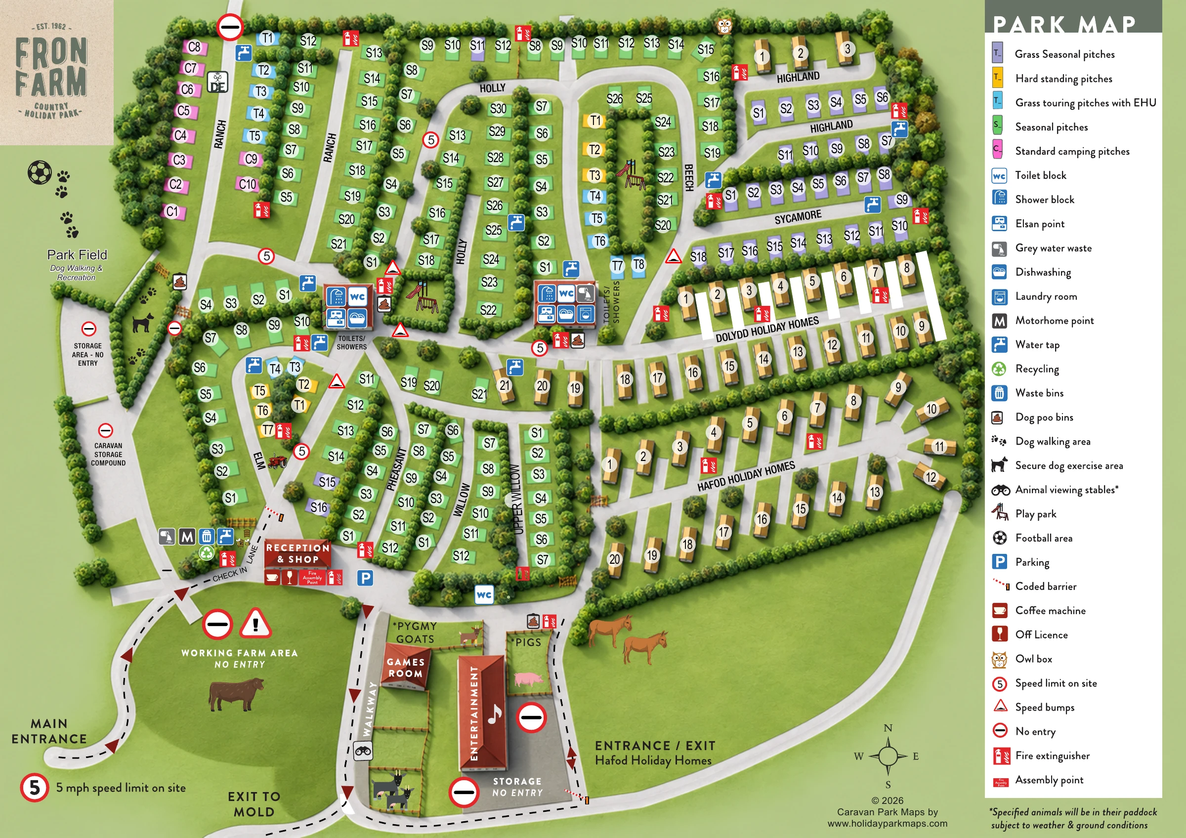 Enlarge this map ↗
KEEP EXPLORING
Chosen for shared landscapes, accommodation or facilities.
 Explore the map ↗
United Kingdom
Ashby Park map with seven fishing lakes, colour-coded accommodation and illustrated wooded shorelines.
 Explore the map ↗
United Kingdom
Woodland-framed Barnsoul map with mixed accommodation, shared facilities and paw-marked walking routes.
 Explore the map ↗
United Kingdom
Riverside park map with named pitch fields, illustrated huts and a paw-print dog walk.
Features may come from the sample artwork, its key or published park information. Approximate numbers describe the drawing and may cover only part of a park. They are intended to help you compare map examples. Current facilities and booking information should be checked with the park.
TAKE A CLOSER LOOK
View the illustrated map in detail or choose a file to download. These are sample maps; contact the park for current visitor information.


LET’S MAP YOUR PARK
For a map quotation, find your park and draw a rough boundary around it. The area you select helps us work out the design time and price.
Draw your park for a quote ↗Or talk to our map designers
01751 473136