
Tree and hedge boundaries
Continuous stylised planting encloses most of the park, screens the maintenance strip and separates the southern sections from the main accommodation rows.
ILLUSTRATED PARK MAP · P469
Newhouse Road, North Berwick · United Kingdom
 Enlarge the map ↗
A SENSE OF THE PLACE
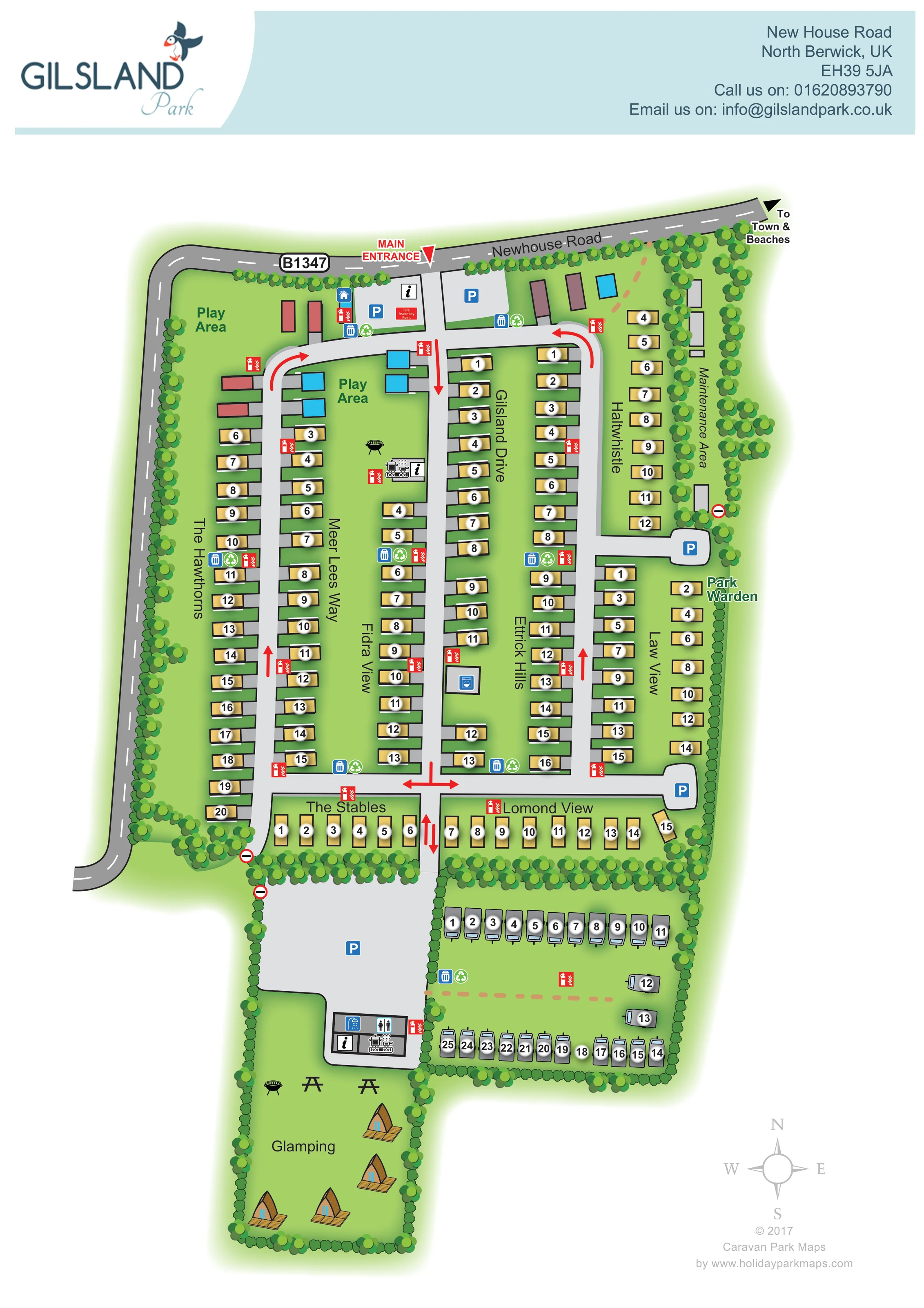
Gilsland Park offers holiday accommodation near North Berwick in East Lothian. Options include holiday caravans, camping cabins and lodges with hot tubs.
The town and beach are close to the park, making it a base for coastal breaks. Its visitor listing states that touring caravans are not accepted. The map shows the layout of the fixed accommodation and shared access routes.
LOOK CLOSER
Continuous stylised planting encloses most of the park, screens the maintenance strip and separates the southern sections from the main accommodation rows.
Light-green lawns form the background to the accommodation, play spaces, grey-caravan enclosure and glamping garden.
A red pointer marks the entrance from Newhouse Road on the northern boundary.
The grey public road runs across the top of the plan and bends along its western side, with dashed white centre markings.
A black arrow at the north-eastern road end points towards the town and beaches; neither destination is depicted.
Red directional arrows distinguish circulation along the principal lanes, with opposing arrows on the southern connecting routes. No-entry symbols appear at several boundary or service connections.
Ochre dashed routes connect the north-eastern accommodation area towards the road and cross the southern grey-caravan enclosure.
Blue P symbols mark parking near the entrance, at eastern lane ends and in a broad southern parking court.
A red pointer marks the entrance from Newhouse Road on the northern boundary.
The grey public road runs across the top of the plan and bends along its western side, with dashed white centre markings.
A black arrow at the north-eastern road end points towards the town and beaches; neither destination is depicted.
Red directional arrows distinguish circulation along the principal lanes, with opposing arrows on the southern connecting routes. No-entry symbols appear at several boundary or service connections.
Ochre dashed routes connect the north-eastern accommodation area towards the road and cross the southern grey-caravan enclosure.
Blue P symbols mark parking near the entrance, at eastern lane ends and in a broad southern parking court.
Two green spaces near the northern end are labelled Play Area, one beside the western boundary and one inside the accommodation layout.
The Park Warden label sits beside a unit in the eastern Law View area.
A narrow, tree-screened strip with grey structures occupies the north-eastern edge and is labelled Maintenance Area.
Black information symbols appear near the entrance, beside the central play space and within the southern amenities building.
Shower and male/female toilet pictograms identify facilities in the building beside the southern parking court.
Hob-and-pot pictograms appear beside the central play area and in the southern amenities building.
A blue washing-machine symbol marks a small building beside the central accommodation lanes.
Barbecue illustrations appear near the central play space and beside the glamping area; picnic-table silhouettes occupy the southern shared lawn.
Repeated blue bin and green recycling symbols are distributed around the entrance, accommodation lanes and southern enclosure.
Red extinguisher-and-flame pictograms mark repeated fire points throughout the accommodation and shared areas.
A labelled red Fire Assembly Point marker appears in the entrance-side parking area.
Continuous stylised planting encloses most of the park, screens the maintenance strip and separates the southern sections from the main accommodation rows.
Light-green lawns form the background to the accommodation, play spaces, grey-caravan enclosure and glamping garden.
READING THE MAP
This illustrated map of Gilsland Park in North Berwick combines a compact accommodation plan with clear arrival and facility information. Newhouse Road forms the upper boundary, where a prominent red entrance marker introduces the internal road network. An arrow towards the town and beaches places the park in its coastal holiday setting without extending the drawing into a wider location map.
Most of the site is arranged in named rows of caravan-style accommodation, shown as gold rectangles with easily recognised white number badges. Green tree belts frame the plan and separate the main rows from the southern sections. Here, the artwork introduces a distinct enclosure of grey caravan symbols and a small glamping garden illustrated with timber pods and decks.
The map also shows two play areas, parking, laundry, shared amenities, picnic tables and barbecue points. Red traffic arrows and fire symbols contrast with the quieter green and grey layout. A pale-aqua header and puffin logo give the portrait page a recognisable park identity, making this a useful sample of a branded visitor map for a densely organised holiday site.
The plan begins at Newhouse Road, identified as the B1347, which crosses the northern edge and curves down the western side. The main entrance is marked with a red pointer between parking areas. Nearby information and fire assembly point markers provide landmarks at arrival, while the road continues towards an arrow labelled for the town and beaches.
Inside the park, broad grey lanes form a connected arrangement of long parallel routes and cross-links. Red arrows explain the illustrated traffic directions, including the connection into the southern parking court. Accommodation is organised into named rows: The Hawthorns and Meer Lees Way on the west, Fidra View and Gilsland Drive through the middle, and Ettrick Hills, Haltwhistle and Law View towards the east. The Stables and Lomond View run across the lower edge of the main block. Gold units, short grey access strips and circular number badges create a consistent visual rhythm.
Two labelled play areas interrupt the northern rows. A small laundry building sits within the central layout, and repeated bin, recycling and fire-point symbols are placed alongside the lanes. The eastern maintenance strip is distinguished by its label, grey structures and dense planting; the park warden is marked farther south.
Beyond the main block, a hedge-lined enclosure contains grey caravan illustrations around an open lawn and dashed connecting path. Beside it, a large parking court leads to a building carrying shower, toilet, information and cooking pictograms. The glamping garden extends below, with four timber-pod illustrations, picnic tables and a barbecue. A compass rose completes the single-page composition in the lower-right margin.
KEEP EXPLORING
Chosen for shared landscapes, accommodation or facilities.
 Explore the map ↗
United Kingdom
A colour-zoned coastal park map with touring areas, woodland trails, ponds and a leisure club.
 Explore the map ↗
United Kingdom
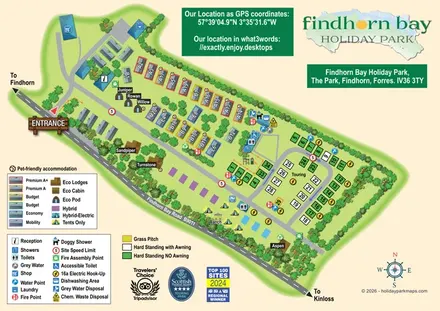
Illustrated mixed-accommodation park plan with colour-coded caravans, named eco units and a touring loop.
 Explore the map ↗
United Kingdom
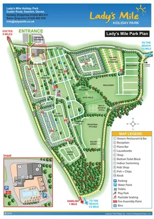
Portrait park plan with named fields, numbered accommodation, beach directions and an enlarged leisure-complex inset.
Features may come from the sample artwork, its key or published park information. Approximate numbers describe the drawing and may cover only part of a park. They are intended to help you compare map examples. Current facilities and booking information should be checked with the park.
TAKE A CLOSER LOOK
View the illustrated map in detail or choose a file to download. These are sample maps; contact the park for current visitor information.


LET’S MAP YOUR PARK
For a map quotation, find your park and draw a rough boundary around it. The area you select helps us work out the design time and price.
Draw your park for a quote ↗Or talk to our map designers
01751 473136