
Bala Lake / Llyn Tegid
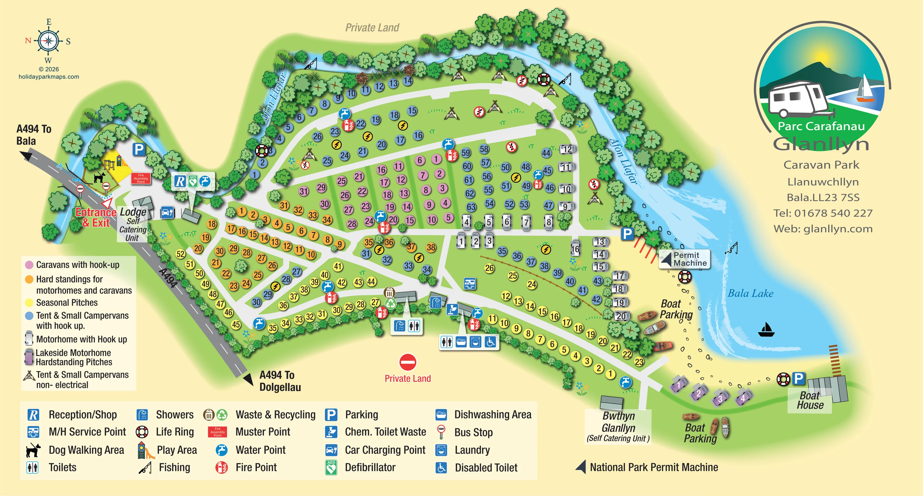
The lake is labelled 'Bala Lake' and illustrated as a broad blue inlet with a curved pale shore and a small sailing-boat silhouette.
ILLUSTRATED PARK MAP · P134
Llanuwchllyn, Bala, Gwynedd · United Kingdom
 Enlarge the map ↗
A SENSE OF THE PLACE
Glanllyn Caravan and Camping Park lies on the shore of Llyn Tegid near Bala in Eryri. Grass and hardstanding pitches accommodate tents, caravans, campervans and motorhomes within mature parkland.
Private launching access supports kayaking, paddleboarding and sailing. Washrooms, a shop, a children's play area and basic Wi-Fi provide on-site facilities. A walking route towards Bala and a bus stop by the entrance add options for exploring beyond the park.
LOOK CLOSER
The lake is labelled 'Bala Lake' and illustrated as a broad blue inlet with a curved pale shore and a small sailing-boat silhouette.
The labelled river curves around the upper and right-hand edges of the accommodation areas before meeting the lake.
Dense illustrated trees follow the river, while smaller repeated shrubs define the roadside and lower park boundary.
The combined reception/shop symbol is positioned beside the entrance buildings.
Grouped toilet and shower symbols identify service buildings along the lower central edge of the pitch areas.
A wheelchair toilet symbol appears in the lower service-building cluster; the legend calls it 'Disabled Toilet'.
A washing-machine symbol locates laundry facilities in the lower washroom cluster.
The dishwashing symbol is grouped with toilets and laundry beside the lower internal road.
The combined reception/shop symbol is positioned beside the entrance buildings.
Grouped toilet and shower symbols identify service buildings along the lower central edge of the pitch areas.
A wheelchair toilet symbol appears in the lower service-building cluster; the legend calls it 'Disabled Toilet'.
A washing-machine symbol locates laundry facilities in the lower washroom cluster.
The dishwashing symbol is grouped with toilets and laundry beside the lower internal road.
A chemical toilet waste symbol is positioned beside the service buildings.
A dedicated service-point symbol sits beside an internal road near the motorhome pitch areas.
Repeated blue tap symbols are distributed through the accommodation areas and near reception.
Waste and recycling symbols are grouped beside a lower central service building.
A car-and-plug symbol identifies a charging point near the entrance lodge.
A yellow play enclosure with illustrated equipment sits beside the entrance-side parking area.
A dog symbol marks an entrance-side area next to the play enclosure.
Blue parking symbols mark an entrance-side parking area and parking near the shore and boat house.
Two lakeside areas are labelled 'Boat Parking' and illustrated with small boats.
A labelled boat house occupies the far lakeside end of the plan, with a short brown landing extending towards the water.
A labelled arrow points to the permit machine near the lakeside parking area; the lower key expands the description to 'National Park Permit Machine'.
Fishing-rod symbols appear along the river and beside the lake.
Repeated red fire-point symbols are placed throughout the pitch groups and beside service buildings.
A red 'Fire Assembly Point' panel sits near reception and the play area; the legend calls this the muster point.
A green AED symbol is grouped with reception and a water point.
Life-ring symbols mark several river and lakeside positions.
The lake is labelled 'Bala Lake' and illustrated as a broad blue inlet with a curved pale shore and a small sailing-boat silhouette.
The labelled river curves around the upper and right-hand edges of the accommodation areas before meeting the lake.
Dense illustrated trees follow the river, while smaller repeated shrubs define the roadside and lower park boundary.
A prominent entrance-and-exit label marks access from the A494, with road arrows towards Bala and Dolgellau.
Bus-stop symbols appear on either side of the A494 near the entrance.
Private land is labelled beyond the upper river boundary and below the service buildings, where a no-entry symbol reinforces the distinction.
READING THE MAP
This illustrated map of Glanllyn Caravan Park brings together a varied touring and camping layout on the shore of Bala Lake, also known as Llyn Tegid. Set at Llanuwchllyn in Gwynedd, the park is drawn between the A494, the tree-lined Afon Llafar and a curved lakeside frontage. The water is a defining part of the composition, not simply a backdrop: fishing symbols, boat parking, a boat house and a permit-machine label all help explain the waterfront.
The accommodation key distinguishes caravan hook-ups, shared hardstandings, seasonal pitches, tent and small-campervan pitches, dedicated motorhome spaces and non-electric camping. Coloured numbered markers keep these groups readable across a branching network of internal roads. Two named self-catering buildings provide additional landmarks at opposite ends of the site.
Reception, entrance-side recreation facilities and the lower washroom buildings are located with recognisable pictograms. A large bilingual Glanllyn logo, a nautical-style compass and two separate keys complete a landscape-format design suited to a park where visitors need to understand both their pitch type and its relationship to shared facilities and the shore.
The plan begins at the A494 entrance on the left, where a prominent red-and-white label sits beside reception, the self-catering lodge and a car charging symbol. Nearby are parking, a yellow illustrated play enclosure, a dog walking symbol, bus stops and the fire assembly point. Road arrows identify the directions towards Bala and Dolgellau.
Inside the park, pale-grey roads divide the green ground into a mixture of narrow strips and broader pitch groups. Orange markers identify hardstandings for caravans and motorhomes towards the entrance, while a compact pink block marks caravan pitches with hook-up. Blue tent and small-campervan markers extend along the river and through the interior. Yellow seasonal markers largely follow the lower perimeter. Towards the lake, overhead motorhome drawings replace circular markers, and a small purple row distinguishes the lakeside hardstandings. Tent illustrations indicate non-electric camping areas beside the river without defining individual plots.
Service buildings sit along the lower central edge. Grouped symbols identify toilets, showers, an accessible toilet, laundry, dishwashing and chemical toilet waste disposal. Water and fire points recur across the plan, with waste and recycling, a motorhome service point and an entrance-side defibrillator also marked.
Afon Llafar curves around the upper boundary beneath dense illustrated trees before entering Bala Lake. Fishing and life-ring symbols connect this landscape to visitor use. The lakeside end includes labelled boat parking, a permit-machine callout, Bwthyn Glanllyn and the boat house with a short waterside landing.
The single landscape artboard is balanced by large bilingual branding on the right and separate accommodation and facility keys below. Its enlarged views show details of the same continuous plan rather than additional sections of the park.
KEEP EXPLORING
Chosen for shared landscapes, accommodation or facilities.
 Explore the map ↗
United Kingdom
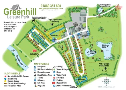
Woodland park map with mixed pitches, bell tents, lodges and a fishing lake.
 Explore the map ↗
United Kingdom
Illustrated camping and touring map with fishing lakes, dog areas and colour-coded pitches.
 Explore the map ↗
United Kingdom
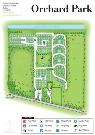
Orchard Holiday Park map with curved accommodation clusters, dog-walking lawns and a named waterside boundary.
Features may come from the sample artwork, its key or published park information. Approximate numbers describe the drawing and may cover only part of a park. They are intended to help you compare map examples. Current facilities and booking information should be checked with the park.
LET’S MAP YOUR PARK
For a map quotation, find your park and draw a rough boundary around it. The area you select helps us work out the design time and price.
Draw your park for a quote ↗Or talk to our map designers
01751 473136