
Woodland and tree-lined divisions
Trees enclose the site, divide the camping areas and form a broad wooded belt between the internal drive and the roadside boundary.
ILLUSTRATED PARK MAP · P146
Guideacres, Riplingham Road, Cottingham, East Yorkshire · United Kingdom
 Enlarge the map ↗
A SENSE OF THE PLACE
Guideacres is based at Riplingham Road, Cottingham, East Yorkshire. Guideacres is Girlguiding East Yorkshire's county campsite on the edge of the Yorkshire Wolds. Four campsites, Ferens, Busby, Revell and Nightingale, back onto woodland and are separated by tree lines. Campers share fridges and freezers, and a chemical-toilet emptying point is provided.
The site hosts camping, sleepovers, day and evening activities; indoor space can also be used for meetings and training. Girlguiding members are its main users, although other recognised groups can book available dates. Two washroom areas, Shelduck and Mallard, each provide three flush toilets, three hot-and-cold washbasins and a shower.
LOOK CLOSER
Trees enclose the site, divide the camping areas and form a broad wooded belt between the internal drive and the roadside boundary.
Fine grey lines with small brown posts appear intermittently beneath trees around the outer boundary.
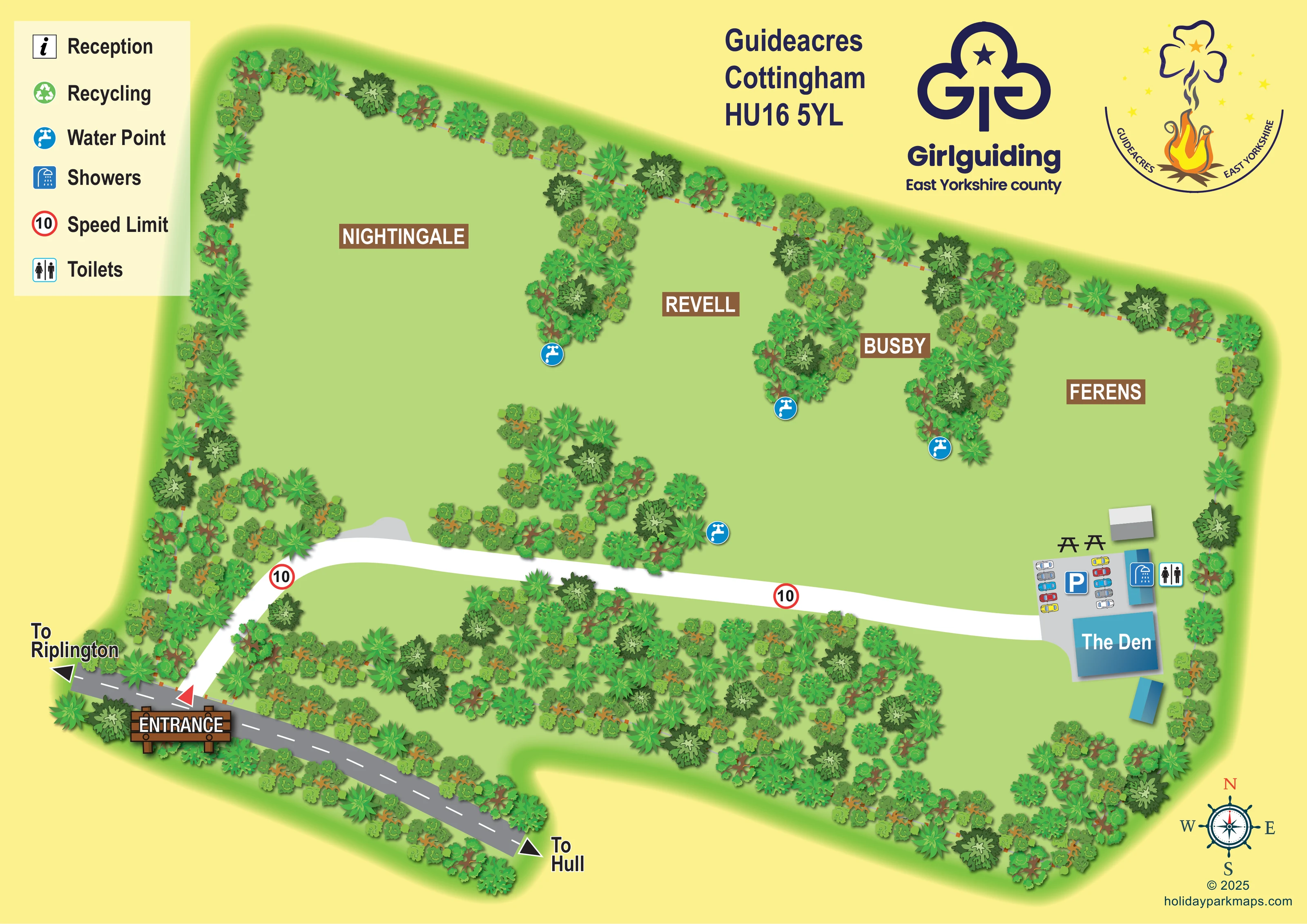
Nightingale, Revell, Busby and Ferens are labelled across the main open grassland.
A prominent blue-roofed building labelled The Den anchors the eastern facilities cluster beside the car park.
A grey parking area with a blue P symbol and illustrated cars sits at the end of the access road beside The Den.
Toilet and shower symbols mark a building beside the car park. The artwork does not separately label the two washroom areas described in the wider site information.
Blue tap symbols are distributed near the ends of tree-lined camping divisions and beside the main drive.
Two black picnic-table illustrations appear on the grass immediately above the parking area.
Nightingale, Revell, Busby and Ferens are labelled across the main open grassland.
A prominent blue-roofed building labelled The Den anchors the eastern facilities cluster beside the car park.
A grey parking area with a blue P symbol and illustrated cars sits at the end of the access road beside The Den.
Toilet and shower symbols mark a building beside the car park. The artwork does not separately label the two washroom areas described in the wider site information.
Blue tap symbols are distributed near the ends of tree-lined camping divisions and beside the main drive.
Two black picnic-table illustrations appear on the grass immediately above the parking area.
Trees enclose the site, divide the camping areas and form a broad wooded belt between the internal drive and the roadside boundary.
Fine grey lines with small brown posts appear intermittently beneath trees around the outer boundary.
A wooden-style ENTRANCE sign and red triangular marker identify the access junction on the lower-left edge of the plan.
A broad white drive curves in from the entrance, then crosses the site towards the car park and The Den.
Red-ringed signs bearing 10 are shown at the entrance bend and along the internal drive.
The grey external road has direction arrows labelled To Riplington and To Hull.
Reception is listed in the key, but no corresponding location is clearly marked on the plan.
Recycling is listed in the key, but no corresponding location is clearly marked on the plan.
READING THE MAP
This illustrated map of Guideacres in Cottingham presents a group campsite through its clearings, tree lines and shared facilities rather than a conventional grid of holiday pitches. Guideacres is Girlguiding East Yorkshire’s county campsite on the edge of the Yorkshire Wolds, and the artwork gives that identity a prominent place with both county branding and a campfire emblem.
Four named camping areas — Nightingale, Revell, Busby and Ferens — stretch across the green interior. Belts of illustrated trees distinguish the areas and frame the site, making the landscape itself an important part of the wayfinding. A white access drive leads from the clearly marked roadside entrance to parking and The Den at the opposite end of the plan.
Water-point symbols, toilet and shower markers, picnic tables and a compact key add practical detail without filling the open camping spaces with unnecessary graphics. The pale yellow background, blue buildings and brown campsite labels give the page a distinctive visual structure suited to a youth-group campsite.
The single landscape-format plan shows an irregular campsite enclosed by trees, with the four camping areas arranged from Nightingale on the left through Revell and Busby to Ferens on the right. Their names appear in bold white capitals on brown panels. The spaces remain open and uncluttered: there are no individual tent positions or numbered pitches. Tree belts project into the grass to define the different areas, while blue tap symbols identify water points near these divisions and the main drive.
At the lower left, a timber-style ENTRANCE sign and red triangular marker pick out the junction with the external road. That road is drawn in grey with a dashed centre line and arrows towards Hull and Riplington. Inside the site, a broad white drive curves past the wooded edge before crossing towards the facilities at the right. Red-ringed 10 signs are placed along this route.
The eastern cluster contains a grey car park, illustrated cars and a blue parking symbol beside The Den. The building’s large blue roof and white name make it a strong destination landmark. A neighbouring roof block carries shower and toilet symbols, and two picnic-table illustrations sit just above the parking area. Other small roof shapes are shown without functional labels.
A cream legend occupies the upper-left corner, while the site title, postcode and two Girlguiding-related emblems fill the upper margin. Reception and recycling are included in the key but are not clearly located within the plan. A compass completes the lower-right corner. Varied tree crowns, roof shading and a soft green boundary glow give the overhead drawing depth without obscuring the route or campsite names.
KEEP EXPLORING
Chosen for shared landscapes, accommodation or facilities.
 Explore the map ↗
United Kingdom
Illustrated coastal campsite plan with named fields, electric pitch colours, beach routes and the Afon Hen.
 Explore the map ↗
United Kingdom
A wooded Allerton park plan with colour-coded neighbourhoods, touring pitches and a central facilities hub.
 Explore the map ↗
United Kingdom
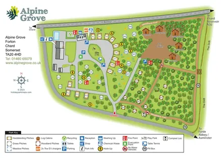
Colour-coded pitches, named log cabins and a woodland trail at Alpine Grove, Somerset.
Features may come from the sample artwork, its key or published park information. Approximate numbers describe the drawing and may cover only part of a park. They are intended to help you compare map examples. Current facilities and booking information should be checked with the park.
LET’S MAP YOUR PARK
For a map quotation, find your park and draw a rough boundary around it. The area you select helps us work out the design time and price.
Draw your park for a quote ↗Or talk to our map designers
01751 473136