
Woodland enclosure and tree belts
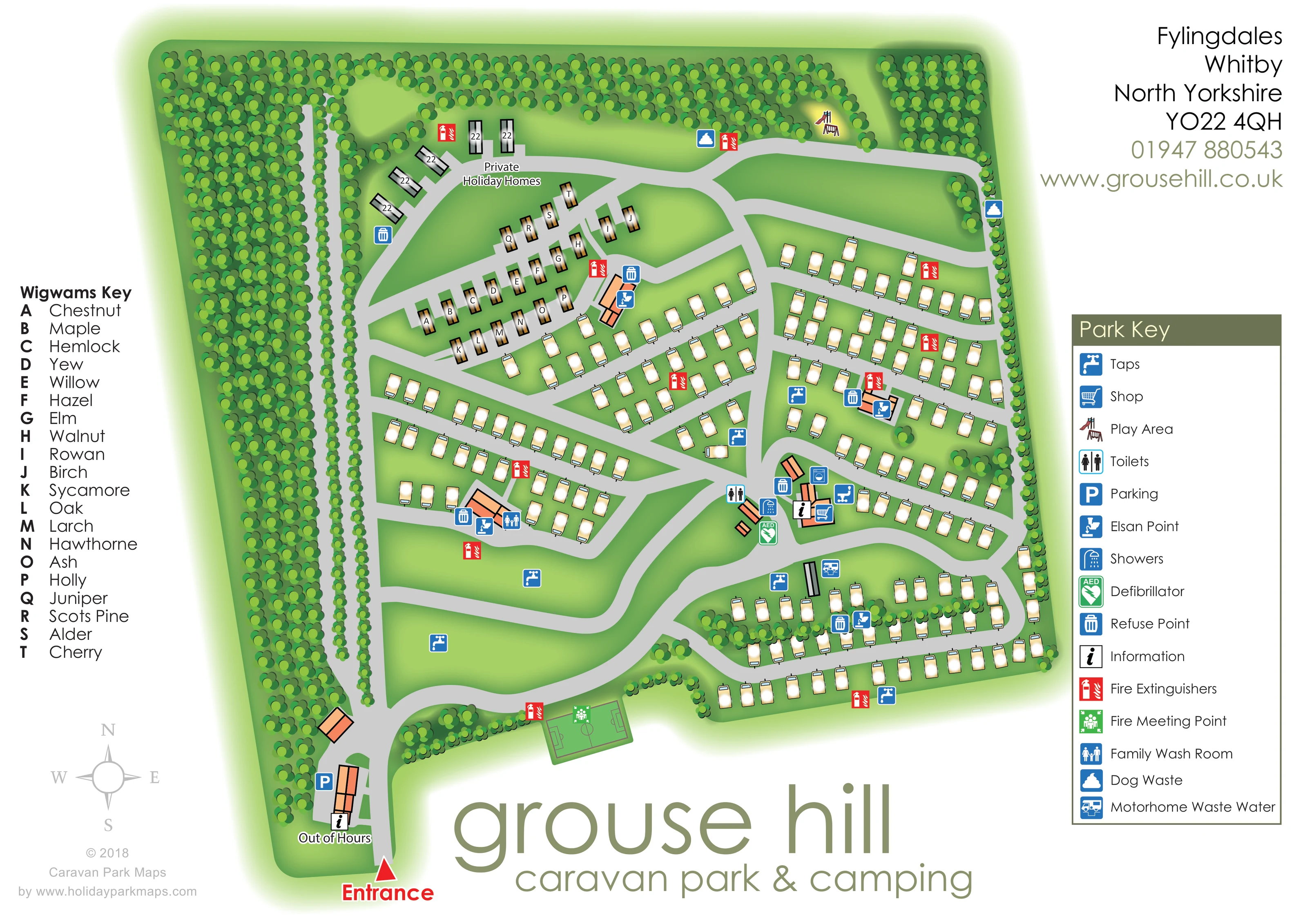
Dense stylised woodland occupies the western side and frames the northern boundary, with thinner tree belts along the east and between southern pitch rows.
ILLUSTRATED PARK MAP · P485
Fylingdales, Whitby, North Yorkshire · United Kingdom
 Enlarge the map ↗
A SENSE OF THE PLACE
Grouse Hill is a family-run park in a secluded valley in the North York Moors, near Robin Hood's Bay. It offers touring and seasonal pitches, holiday home ownership, glamping pods and self-catering accommodation.
Woodland, a forest lake and moorland views shape the setting. The park welcomes well-behaved pets under its lead rules, and its location provides access to coastal outings around Whitby and Scarborough.
LOOK CLOSER
Dense stylised woodland occupies the western side and frames the northern boundary, with thinner tree belts along the east and between southern pitch rows.
Broad unoccupied green spaces lie inside the western and entrance-side road loops; no camping capacity is assigned to them.
A red arrow and Entrance label mark arrival at the bottom-left corner, leading into the main internal road.
Parking and information symbols sit beside buildings immediately inside the entrance, with an Out of Hours label.
Shop and information icons identify a central cluster of orange-roofed service buildings beside a major road junction.
Toilet and shower symbols mark the central service area, while a family wash room symbol appears at a separate western service block.
A blue washing-machine pictogram appears on a building in the central service cluster, although it is not explained in the Park Key.
Repeated blue tap symbols serve the accommodation rows and the open grass towards the entrance.
A red arrow and Entrance label mark arrival at the bottom-left corner, leading into the main internal road.
Parking and information symbols sit beside buildings immediately inside the entrance, with an Out of Hours label.
Shop and information icons identify a central cluster of orange-roofed service buildings beside a major road junction.
Toilet and shower symbols mark the central service area, while a family wash room symbol appears at a separate western service block.
A blue washing-machine pictogram appears on a building in the central service cluster, although it is not explained in the Park Key.
Repeated blue tap symbols serve the accommodation rows and the open grass towards the entrance.
Refuse and Elsan symbols are distributed among service buildings and accommodation sections rather than confined to a single location.
A dedicated motorhome waste-water symbol marks a position beside the southern accommodation loop.
Dog-waste symbols appear along the northern and eastern perimeter roads.
A small illustrated slide and swings identify a play area beside the northern road and woodland edge.
A green rectangular pitch with goal and centre markings is drawn near the entrance-side road. It also carries the fire meeting-point symbol.
Red extinguisher symbols recur throughout the accommodation areas; a green meeting-point symbol is placed on the southern sports pitch.
A green AED symbol marks the central wash-facility area.
Dense stylised woodland occupies the western side and frames the northern boundary, with thinner tree belts along the east and between southern pitch rows.
Broad unoccupied green spaces lie inside the western and entrance-side road loops; no camping capacity is assigned to them.
Pale-grey roads form a connected network of loops and angled branches serving the wigwams, holiday homes and caravan rows.
READING THE MAP
This illustrated map of Grouse Hill Caravan Park & Camping presents a woodland-framed holiday park at Fylingdales, near Whitby in North Yorkshire. Its green setting is central to the composition: a substantial belt of trees fills the western side, while smaller tree groups frame the accommodation and internal roads. Cream caravan symbols occupy most of the plan, with a separate cluster of named wigwams and a small area labelled Private Holiday Homes.
Visitors arrive through a clearly marked entrance at the lower left, beside parking and out-of-hours information. From there, pale-grey roads lead towards the central service buildings and branch through the accommodation areas. A tall Park Key explains the facility symbols, including the shop, washing facilities, water taps, waste points and play area. The wigwams have their own letter-to-name key, giving this part of the park a distinct identity.
The sample demonstrates how a single illustrated sheet can combine a sizeable touring layout, smaller accommodation groups and practical visitor information without losing the character of a wooded setting.
The plan is organised around an entrance at the lower-left edge, marked with a red arrow and bold label. Nearby buildings carry parking and information symbols, together with an Out of Hours label. The arrival road curves into a branching network that connects the central facilities, accommodation rows and northern perimeter. Open grass remains visible inside the western loops, contrasting with the denser pitch arrangements to the east.
The accommodation is differentiated through both position and drawing style. A small northern group of long grey units is labelled Private Holiday Homes. Immediately below, brown wigwam symbols occupy an angled enclave, each carrying a letter linked to the separate Wigwams Key. Its tree-based names range from Chestnut and Maple to Scots Pine and Cherry. Cream touring-caravan symbols fill the central and eastern roadside rows, with further rows arranged around a southern loop and divided by a narrow tree belt.
Orange-roofed buildings identify service clusters within the layout. Symbols locate the shop, information, toilets, showers and family wash room, while a washing-machine pictogram appears at the central buildings. Taps, refuse points, Elsan points and fire extinguishers are distributed around the park. A motorhome waste-water point is marked near the southern loop, and dog-waste points appear along the upper perimeter. The northern play area is drawn as miniature play equipment; near the entrance, a marked sports pitch also carries the fire meeting-point symbol.
The page balances the main plan with a left-hand wigwam list, a right-hand facility legend and large branding below. The accompanying enlarged detail shows the same artwork's service symbols and Park Key more clearly, rather than a separate section or additional accommodation.
KEEP EXPLORING
Chosen for shared landscapes, accommodation or facilities.
 Explore the map ↗
United Kingdom
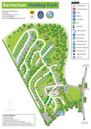
A wooded, mixed-accommodation park plan with winding lanes, a pool, camping areas and a clear facility key.
 Explore the map ↗
United Kingdom
Woodland-framed Barnsoul map with mixed accommodation, shared facilities and paw-marked walking routes.
 Explore the map ↗
United Kingdom
A colour-zoned coastal park map with touring areas, woodland trails, ponds and a leisure club.
Features may come from the sample artwork, its key or published park information. Approximate numbers describe the drawing and may cover only part of a park. They are intended to help you compare map examples. Current facilities and booking information should be checked with the park.
TAKE A CLOSER LOOK
View the illustrated map in detail or choose a file to download. These are sample maps; contact the park for current visitor information.


LET’S MAP YOUR PARK
For a map quotation, find your park and draw a rough boundary around it. The area you select helps us work out the design time and price.
Draw your park for a quote ↗Or talk to our map designers
01751 473136