
Specimen Lake
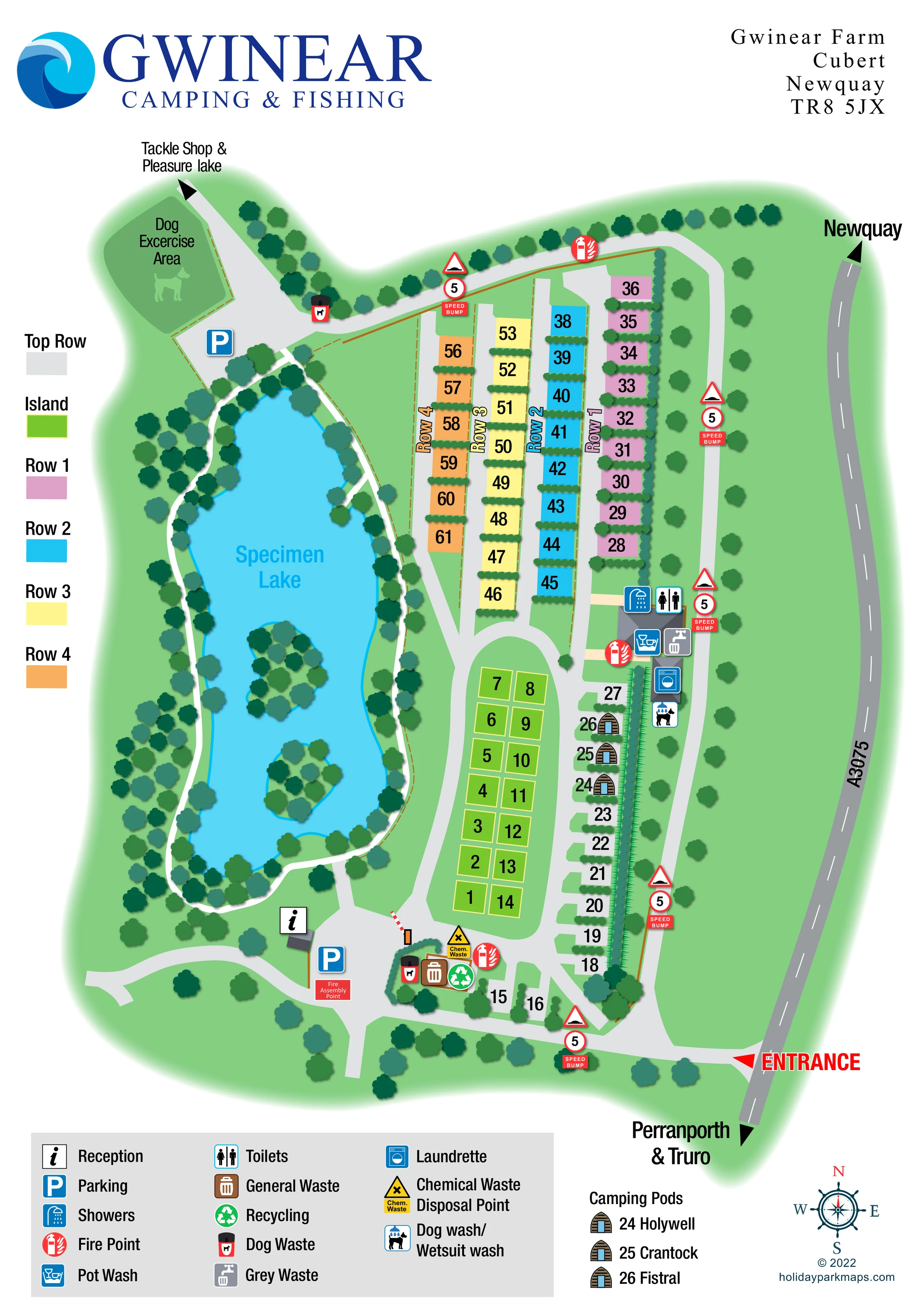
Large elongated lake occupying the western half of the plan, with two tree-covered islands and a strongly defined cyan shoreline.
ILLUSTRATED PARK MAP · P149
Gwinear Farm, Cubert, Newquay · United Kingdom
 Enlarge the map ↗
A SENSE OF THE PLACE
Gwinear Camping and Fishing lies in the Cornish countryside near Newquay. Its campsite shares the grounds with a specimen lake and a pleasure-fishing lake.
Anglers can visit for the day or combine fishing with a camping stay. The lakes hold carp and other coarse fish, and the site's angling business supplies tackle. Nearby coastal locations provide further options for exploring or fishing away from the park.
LOOK CLOSER
Large elongated lake occupying the western half of the plan, with two tree-covered islands and a strongly defined cyan shoreline.
Dense tree symbols frame the lake and northern boundary; clipped hedge strips divide many pitches and screen the eastern accommodation edge.
A narrow white path follows the lake perimeter, with connections towards reception and the campsite roads.
A separate green enclosure at the north-western end, marked with a dog silhouette beside parking and the onward access route.
An information symbol identifies a small building near the southern end of the lake, beside the arrival parking area.
Blue parking symbols appear near reception and at the north-western end beside the dog exercise area.
Toilet and shower symbols mark the eastern amenity block at the meeting point of the northern pitch rows and southern accommodation groups.
A washing-up pictogram is positioned at the eastern amenity block.
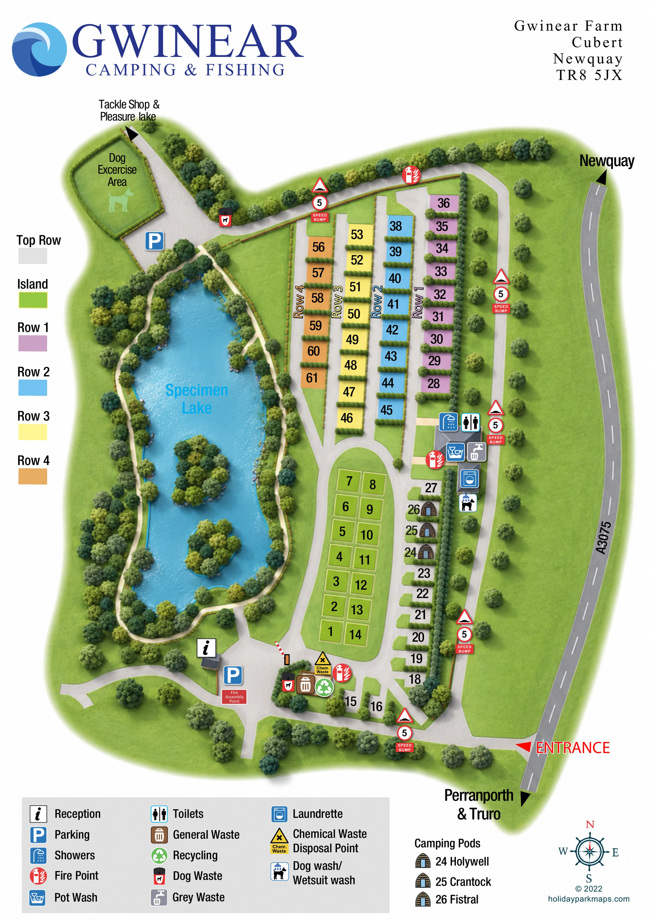
Large elongated lake occupying the western half of the plan, with two tree-covered islands and a strongly defined cyan shoreline.
A narrow white path follows the lake perimeter, with connections towards reception and the campsite roads.
Dense tree symbols frame the lake and northern boundary; clipped hedge strips divide many pitches and screen the eastern accommodation edge.
A separate green enclosure at the north-western end, marked with a dog silhouette beside parking and the onward access route.
An information symbol identifies a small building near the southern end of the lake, beside the arrival parking area.
Blue parking symbols appear near reception and at the north-western end beside the dog exercise area.
Toilet and shower symbols mark the eastern amenity block at the meeting point of the northern pitch rows and southern accommodation groups.
A washing-up pictogram is positioned at the eastern amenity block.
A washing-machine symbol marks a smaller eastern service building immediately south of the main amenity block.
A shared wash facility is identified beside the eastern service buildings, close to the camping pods.
General waste and recycling symbols are grouped near the southern arrival junction. Dog-waste bins are shown there and beside the northern dog exercise route.
Chemical waste disposal is marked near the southern waste compound; grey waste is marked beside the eastern amenity block.
Red extinguisher symbols identify fire points at the northern road, eastern amenity area and southern service compound.
A red labelled box marks the assembly point beside the reception-side parking area.
A prominent red entrance arrow marks access from the road along the eastern edge, with directional labels for Newquay and Perranporth & Truro.
Pale-grey roads connect the entrance, southern arrival junction, central pitch island and northern rows. A red-and-white barrier is illustrated near reception.
Repeated red-edged bump signs, circular 5 markers and red SPEED BUMP panels punctuate the entrance road and eastern and northern internal routes.
An arrow at the north-western continuation points towards the tackle shop and pleasure lake; neither is drawn within the main plan.
READING THE MAP
This map of Gwinear Camping & Fishing brings a lakeside campsite near Newquay into a clear, colour-coded visitor plan. The specimen lake fills the western side of the artwork, with two wooded islands, a shoreline path and a dense fringe of trees. Beside it, numbered pitches are organised into distinct rows and a central group, giving visitors a straightforward way to recognise their part of the site.
The design combines an overhead layout with small illustrated landmarks, including three timber-fronted camping pods named Holywell, Crantock and Fistral. Reception, parking, washing facilities and waste points are identified by a compact set of pictograms, while a separate dog exercise area sits at the north-western end. An arrow continues towards the tackle shop and pleasure lake beyond the main drawing.
Large navy branding anchors the portrait page, and bright pitch colours stand out against green grounds and pale-grey roads. The result is a useful sample for campsite operators who need accommodation allocation, arrival information and a prominent landscape feature to work together on one map.
The plan places the A3075 along its eastern edge, with Newquay indicated to the north and Perranporth and Truro to the south. A bold red entrance arrow leads into the southern road junction. Reception and parking sit near the bottom of the lake, beside an illustrated barrier and a labelled fire assembly point. Nearby, a grouped service area contains general waste, recycling, dog waste and chemical waste disposal symbols.
Accommodation occupies the centre and east. Four parallel northern rows are coloured pink, cyan, pale yellow and orange, with large black numbers and hedge strips dividing individual pitches. Below them, a lime-green two-column group labelled Island is enclosed by a curving road. Pale-grey pitches follow the eastern and southern edges. Three arched pod illustrations identify Holywell, Crantock and Fistral beside the eastern boundary planting.
The amenity buildings sit between the northern rows and the pods. Their symbols identify toilets, showers, pot washing, grey waste, a laundrette and a dog/wetsuit wash. Red fire-point symbols and repeated speed-bump panels provide additional reference points along the internal roads. At the north-western end, a dog exercise enclosure and parking area adjoin the route towards the tackle shop and pleasure lake.
The specimen lake is the largest landscape element, drawn in bright cyan with two tree-covered islands and a white path around its irregular shore. A left-hand colour key explains the accommodation groups, while the footer contains the facility legend, named pod key and compass. The artwork is a single portrait plan; the enlarged views show overlapping details of this same composition rather than separate sections or additional accommodation.
 Enlarge this map ↗
KEEP EXPLORING
Chosen for shared landscapes, accommodation or facilities.
 Explore the map ↗
United Kingdom
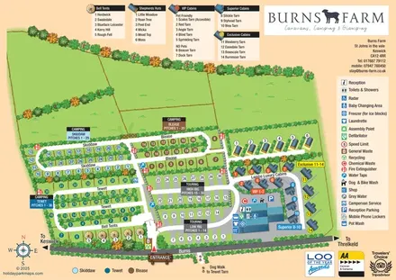
Colour-coded camping and touring sections, illustrated glamping units and a detailed amenities hub at Burns Farm.
 Explore the map ↗
United Kingdom
Illustrated farm campsite map with touring pitches, pods, camping fields and a riverside dog-walk route.
 Explore the map ↗
United Kingdom
Ashby Park map with seven fishing lakes, colour-coded accommodation and illustrated wooded shorelines.
Features may come from the sample artwork, its key or published park information. Approximate numbers describe the drawing and may cover only part of a park. They are intended to help you compare map examples. Current facilities and booking information should be checked with the park.
LET’S MAP YOUR PARK
For a map quotation, find your park and draw a rough boundary around it. The area you select helps us work out the design time and price.
Draw your park for a quote ↗Or talk to our map designers
01751 473136