
Hedgerows and tree belts
Continuous illustrated hedges define the roadside and pitch-field divisions, with denser mixed tree symbols around the farmyard and eastern boundary.
ILLUSTRATED PARK MAP · P486
Gwlgri Caravan Site, Rhydwyn, Anglesey · United Kingdom
 Enlarge the map ↗
A SENSE OF THE PLACE
Gwlgri Caravan Site is based at Rhydwyn, Anglesey. This is a rural setting near Church Bay on Anglesey. A former farmhouse provides self-catering accommodation for up to eight people. Touring caravans, motorhomes and seasonal caravan pitches are catered for.
Caravan amenities include electric hook-ups, water, waste disposal and a shower/WC block.
LOOK CLOSER
Continuous illustrated hedges define the roadside and pitch-field divisions, with denser mixed tree symbols around the farmyard and eastern boundary.
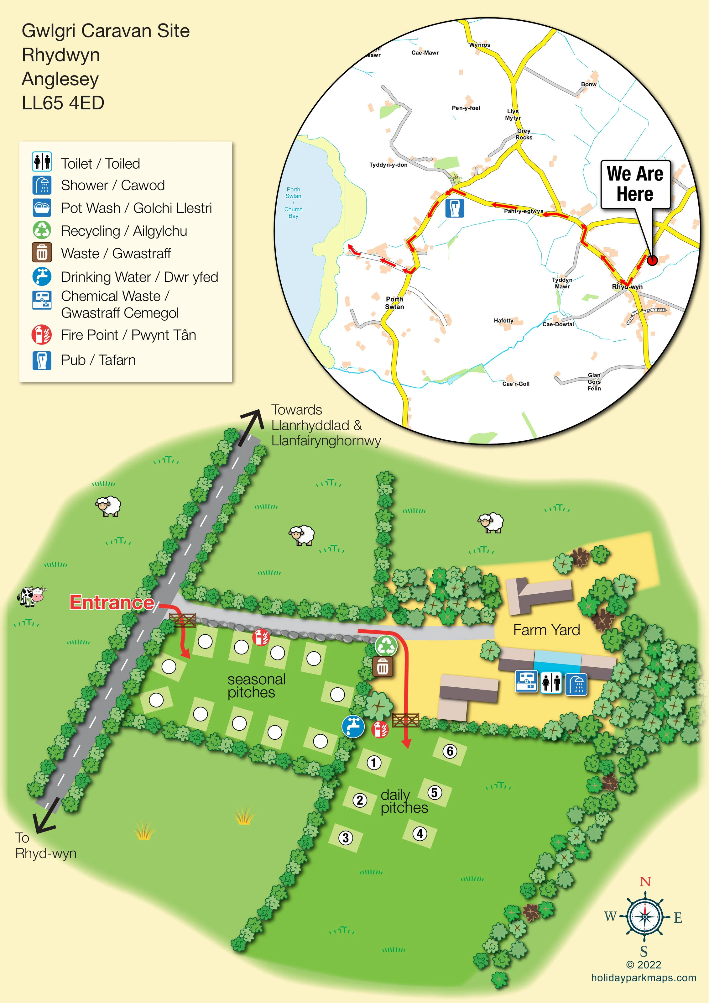
Green fields with grass marks, cartoon sheep and a cow establish the rural farm setting. The animals are illustrative scenery rather than a visitor attraction.
A line of grey stones separates the seasonal pitches from the access lane.
The inset names Church Bay and depicts its coastline and pale-blue sea. This is surrounding-area context, not an on-site waterfront.
A prominent red Entrance label and curved arrow mark the turn from the roadside through a wooden gate into the seasonal area. A separate gated approach leads towards the daily pitches.
A grey lane runs from the roadside towards the farmyard, along the upper edge of the seasonal pitches. Red arrows distinguish the approaches to the two pitch groups.
Large black arrows indicate Rhyd-wyn in one direction and Llanrhyddlad and Llanfairynghornwy in the other.
A yellow-surfaced yard contains several roof-plan buildings and the mapped sanitary facilities, immediately above the daily pitch field.
A prominent red Entrance label and curved arrow mark the turn from the roadside through a wooden gate into the seasonal area. A separate gated approach leads towards the daily pitches.
A grey lane runs from the roadside towards the farmyard, along the upper edge of the seasonal pitches. Red arrows distinguish the approaches to the two pitch groups.
Large black arrows indicate Rhyd-wyn in one direction and Llanrhyddlad and Llanfairynghornwy in the other.
A yellow-surfaced yard contains several roof-plan buildings and the mapped sanitary facilities, immediately above the daily pitch field.
Toilet and shower symbols are placed together at the long farmyard building, whose central section is highlighted in blue.
A chemical-waste symbol is positioned beside the toilet and shower symbols at the farmyard building.
A blue tap symbol marks drinking water near the boundary between the seasonal area, farmyard and daily-pitch entrance.
Recycling and waste-bin symbols are grouped at the farmyard edge beside the seasonal pitches.
Red fire-point symbols appear beside the seasonal pitches and near the gate into the daily pitch field.
Pot Wash / Golchi Llestri is included in the bilingual key, but a corresponding location is not clearly marked on the site plan.
Electric hook-ups are identified in the park information, but are not separately symbolised on this artwork.
Continuous illustrated hedges define the roadside and pitch-field divisions, with denser mixed tree symbols around the farmyard and eastern boundary.
Green fields with grass marks, cartoon sheep and a cow establish the rural farm setting. The animals are illustrative scenery rather than a visitor attraction.
A line of grey stones separates the seasonal pitches from the access lane.
A large inset locates the site near Rhyd-wyn with a We Are Here pointer and traces a red-arrow route through local roads towards Church Bay.
The inset names Church Bay and depicts its coastline and pale-blue sea. This is surrounding-area context, not an on-site waterfront.
A blue pub symbol appears beside the highlighted local-road route towards Church Bay, outside the caravan site.
A decorative compass rose at the lower right supplies cardinal orientation, with north highlighted in red.
READING THE MAP
This map of Gwlgri Caravan Site brings together a small rural pitch layout and a useful guide to the surrounding roads near Rhydwyn, Anglesey. The lower half of the portrait sheet shows two distinct accommodation areas: a compact seasonal field beside the entrance and a daily-pitch field next to the farmyard. Illustrated hedges, trees, stone edging and grazing animals give the plan its recognisable countryside character without competing with the practical information.
A large circular inset adds a second level of orientation. It marks the site with a prominent ‘We Are Here’ pointer and follows local roads towards Porth Swtan / Church Bay, including an off-site pub symbol. On the main plan, red arrows draw attention to the entrances, while coloured symbols identify water, waste disposal, fire points, toilets and showers. An English/Welsh key supports the bilingual setting. The result is a sample for a small caravan-site operator needing both clear on-site guidance and an approachable introduction to the surrounding area.
The artwork is a single portrait composition with two complementary map views. At lower left, a diagonal grey public road has a dashed white centre line and directional arrows towards Rhyd-wyn, Llanrhyddlad and Llanfairynghornwy. A large red Entrance label marks the turn into the site. Wooden gates and red curved arrows distinguish access to the seasonal pitches from the approach to the daily field.
The seasonal area sits between the road, the internal lane and enclosing hedges. Pale rectangular pitch pads with white circles are arranged around an open grassy centre. The daily pitches use the same graphic language, but their circles are numbered and arranged in two short rows below the farmyard. This difference makes the two booking-use areas easy to recognise without drawing individual caravans.
The yellow farmyard contains several simplified roof-plan buildings. Toilet, shower and chemical-waste symbols cluster at a long building with a blue central section. Recycling and general waste are grouped along the yard’s western edge, while drinking water and fire-point symbols sit close to the pitch areas. The English/Welsh legend also includes pot wash, although its position is not clearly plotted.
Across the upper right, a large circular inset shows yellow main roads, grey side roads, blue watercourses and the Church Bay coastline. Red arrows trace a local route from the site towards the bay, passing a pub symbol. A bold speech-bubble pointer identifies the site near Rhyd-wyn. The title and address balance this inset at upper left, with the legend below. Hedge illustrations, scattered trees and cartoon livestock connect the main plan to its farm setting; a compass rose completes the lower-right corner.
KEEP EXPLORING
Chosen for shared landscapes, accommodation or facilities.
 Explore the map ↗
United Kingdom
Illustrated Sanday aire map with a seasonal maze, café barn and motorhome service area.
 Explore the map ↗
United Kingdom
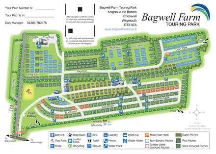
A colour-coded touring park plan with named pitch areas, service symbols and Coast Path links.
 Explore the map ↗
United Kingdom
Tree-framed mixed-accommodation park map with two entrances, touring loops and a clearly illustrated social hub.
Features may come from the sample artwork, its key or published park information. Approximate numbers describe the drawing and may cover only part of a park. They are intended to help you compare map examples. Current facilities and booking information should be checked with the park.
LET’S MAP YOUR PARK
For a map quotation, find your park and draw a rough boundary around it. The area you select helps us work out the design time and price.
Draw your park for a quote ↗Or talk to our map designers
01751 473136