
Pond
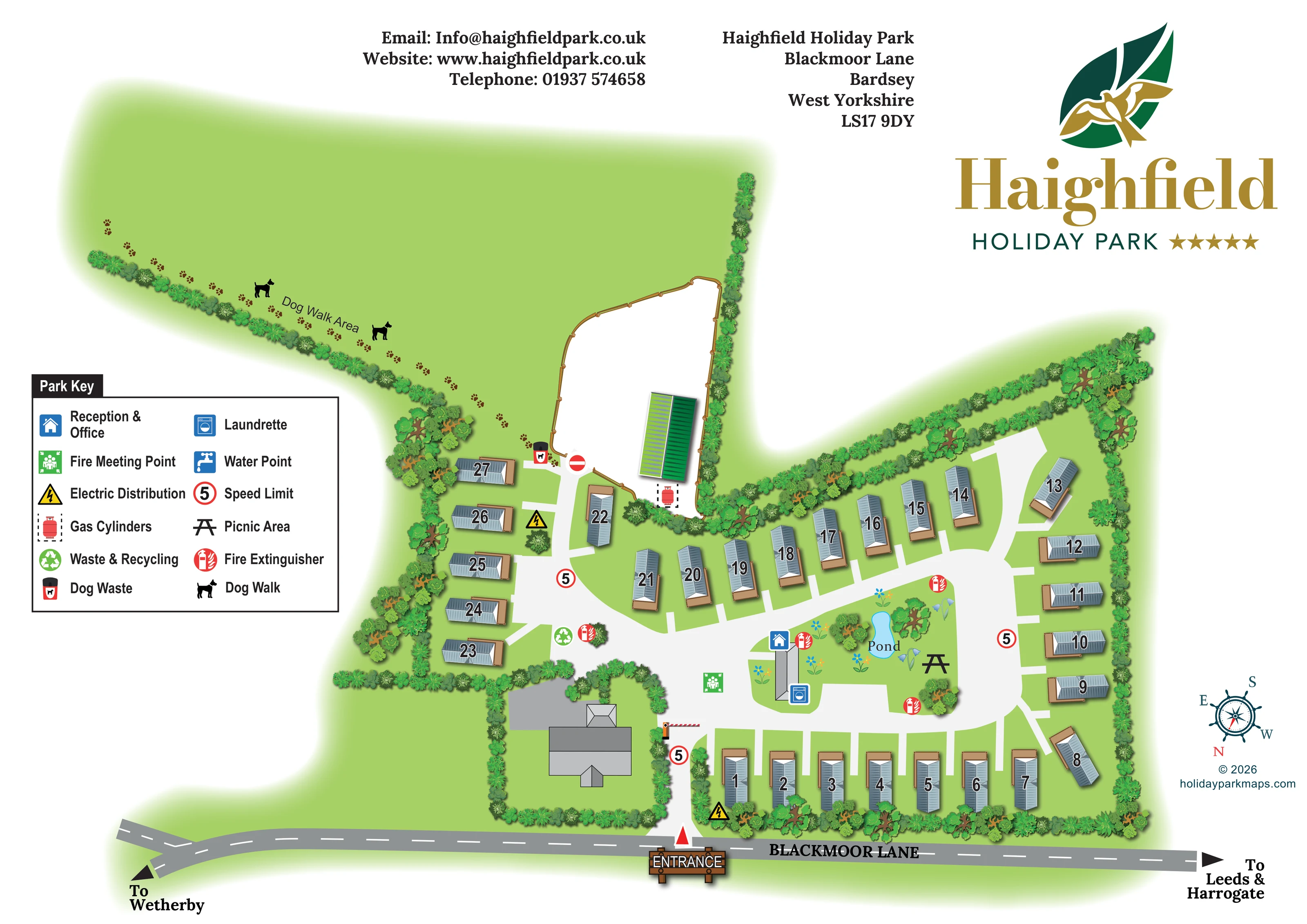
A labelled blue pond sits within the central landscaped green, surrounded by flowers and shrubs.
ILLUSTRATED PARK MAP · P151
Haighfield Holiday Park, Blackmoor Lane, Bardsey, West Yorkshire · United Kingdom
 Enlarge the map ↗
A SENSE OF THE PLACE
Haighfield is a family-run, owners-only holiday park in the countryside between Leeds, Wetherby and Harrogate. Static holiday homes provide a setting for private leisure stays.
The park welcomes pets and advertises gated access and on-site security. Touring caravans, rental stays and public subletting are not part of its published offering, with the map helping owners and their guests navigate the grounds.
LOOK CLOSER
A labelled blue pond sits within the central landscaped green, surrounded by flowers and shrubs.
A large grassy area extends above and to the left of the accommodation, with a labelled paw-print route following its tree-lined edge.
Dense illustrated planting encloses the home plots, divides the western building enclosure and follows the edge of the dog walk.
A blue reception symbol identifies the narrow building on the central green, just inside the entrance.
A washing-machine symbol marks the other end of the central reception and service building.
A picnic-table symbol is placed beside the pond on the central green.
A dog-waste bin symbol marks the transition from the western accommodation branch towards the dog walk.
A recycling symbol marks a collection point near the western junction of the internal roads.
A blue reception symbol identifies the narrow building on the central green, just inside the entrance.
A washing-machine symbol marks the other end of the central reception and service building.
A labelled blue pond sits within the central landscaped green, surrounded by flowers and shrubs.
A picnic-table symbol is placed beside the pond on the central green.
A large grassy area extends above and to the left of the accommodation, with a labelled paw-print route following its tree-lined edge.
A dog-waste bin symbol marks the transition from the western accommodation branch towards the dog walk.
A recycling symbol marks a collection point near the western junction of the internal roads.
A green assembly-point symbol appears on the entrance approach near the central service building.
Repeated red extinguisher symbols identify points around the central green and western road junction.
Yellow electrical symbols appear near the entrance-side accommodation and the western branch.
A red cylinder symbol in a dashed outline identifies a point beside the fenced upper compound.
A blue tap symbol is included in the Park Key; a corresponding location is not clearly visible in the plan.
A prominent entrance sign and red direction marker identify access from Blackmoor Lane, with a striped barrier shown just inside.
The public road runs across the bottom of the artwork, with directions towards Wetherby on the left and Leeds and Harrogate on the right.
Broad pale roads loop around the central green and connect to a short western branch, with short spurs towards individual homes.
Red-ringed signs marked 5 appear along the internal roads; a no-entry symbol is shown at the upper compound approach.
Dense illustrated planting encloses the home plots, divides the western building enclosure and follows the edge of the dog walk.
READING THE MAP
This illustrated map of Haighfield Holiday Park brings together a compact holiday-home layout and a generous dog-walking green in Bardsey, West Yorkshire. The plan shows roughly 30 static holiday homes arranged around a central road loop, with a smaller group extending along a western branch. A pond, picnic area and reception building give the centre of the park a clear visual focus.
Arrival is easy to recognise in the artwork: Blackmoor Lane runs across the bottom of the page, a wooden entrance sign marks the turn into the park, and outward arrows point towards Wetherby, Leeds and Harrogate. Numbered homes and colour-coded facility symbols provide the finer navigation detail.
The design combines an overhead plan with shaded roof illustrations, dense tree borders and softly fading green lawns. Its large gold-and-green park identity occupies the open upper-right space, while a boxed key on the left explains the practical symbols. The result is a distinctive sample for a small owners’ holiday park where individual home locations, shared facilities and outdoor space all need to be understood together.
The main plan is organised around a pale internal road loop enclosing a landscaped communal green. Reception and the laundrette are marked on a narrow building near the entrance side of this green. Further across, a labelled blue pond, flower details, shrubs and a picnic-table symbol distinguish the outdoor sitting area. Fire extinguisher markers appear around the loop, and a green fire meeting point is placed close to the entrance approach.
The holiday homes face the roads from individual grass plots. A long lower row follows Blackmoor Lane, the eastern row turns around the end of the loop, and an upper row follows the diagonal planted boundary. A shorter western branch serves another group of homes and connects towards the dog walk. Large outlined numbers are positioned directly on the grey roofs, allowing the accommodation to remain identifiable without adding a separate label grid.
Above this branch, the dog walk is depicted as an expansive green area. Paw prints, dog silhouettes and a sloping label follow its tree-lined edge. A dog-waste marker identifies the approach. Nearby, a fenced compound contains an unlabelled green-roofed structure and a gas-cylinder marker. A separate, larger unlabelled building sits in a planted enclosure beside the entrance.
The two-column Park Key explains reception, laundry, safety, utility, waste and dog-related symbols; its water-point entry does not have a clearly visible mapped location. Blackmoor Lane, directional arrows and a rotated compass establish the wider orientation. The accompanying detail image enlarges the key and western edge of this same plan rather than showing an additional site or map variant.
KEEP EXPLORING
Chosen for shared landscapes, accommodation or facilities.
 Explore the map ↗
United Kingdom
Woodland-framed Barnsoul map with mixed accommodation, shared facilities and paw-marked walking routes.
 Explore the map ↗
United Kingdom
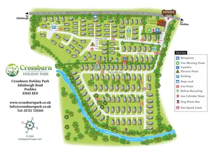
Numbered holiday homes, three named areas and a riverside dog walk at Crossburn Holiday Park, Peebles.
 Explore the map ↗
United Kingdom
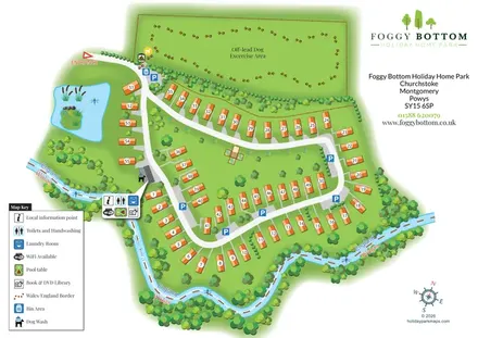
Numbered holiday homes, a riverside border setting and a dedicated dog exercise field at Foggy Bottom.
Features may come from the sample artwork, its key or published park information. Approximate numbers describe the drawing and may cover only part of a park. They are intended to help you compare map examples. Current facilities and booking information should be checked with the park.
LET’S MAP YOUR PARK
For a map quotation, find your park and draw a rough boundary around it. The area you select helps us work out the design time and price.
Draw your park for a quote ↗Or talk to our map designers
01751 473136