
River Caebitra
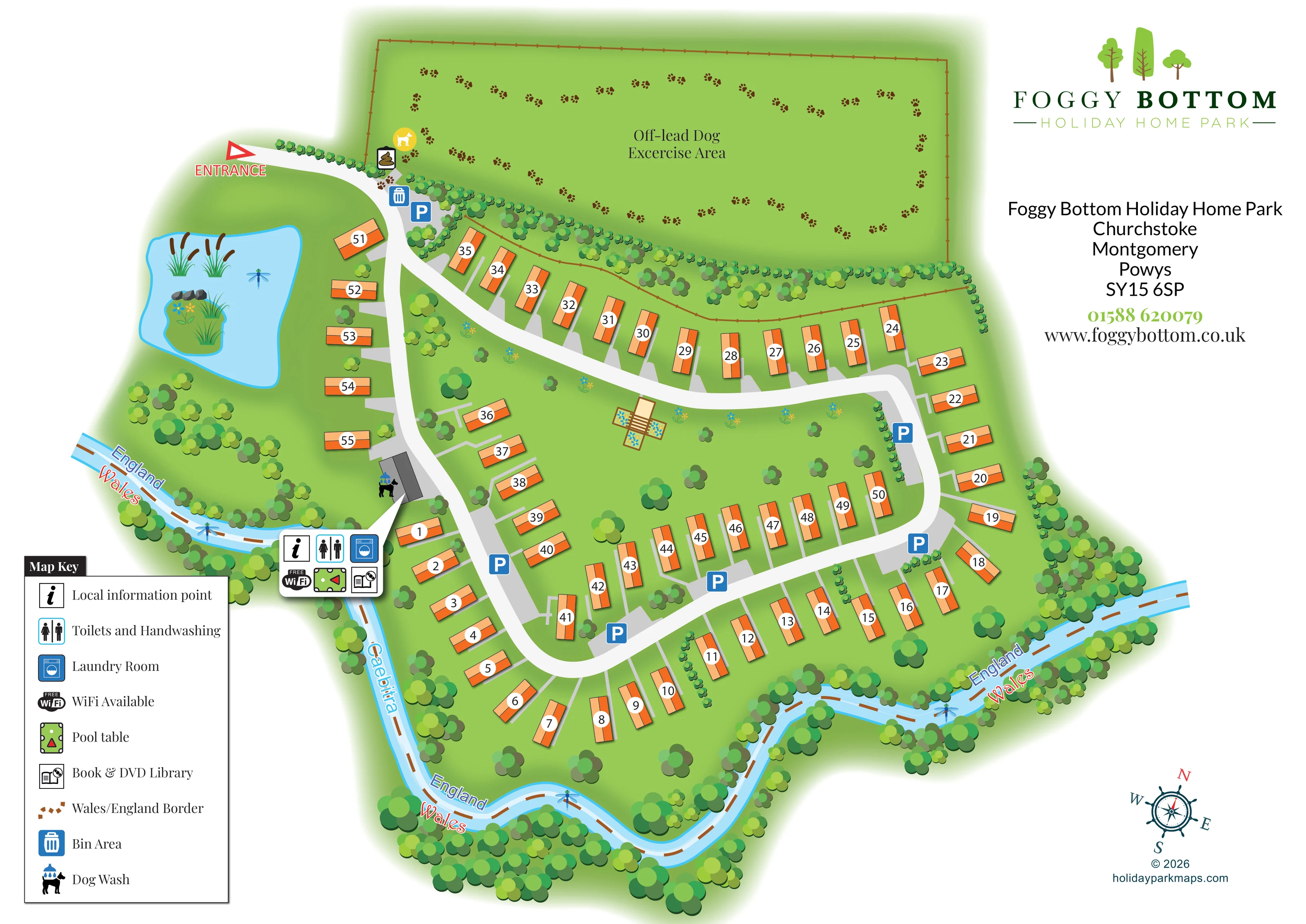
The named river curves around the western and southern edges of the accommodation, framed by dense illustrated trees.
ILLUSTRATED PARK MAP · P124
Foggy Bottom Holiday Home Park, Churchstoke, Montgomery, Powys · United Kingdom
 Enlarge the map ↗
A SENSE OF THE PLACE
Foggy Bottom Holiday Home Park lies beside the River Caebitra near Churchstoke, on the England–Wales border. The family-run park offers well-spaced, serviced static caravan plots in a rural setting.
Wi-Fi, laundry, a pool table and a library provide facilities for owners. Its quieter character and views of the surrounding countryside make it a base for repeated holidays in the Shropshire and Mid Wales border area.
LOOK CLOSER
The named river curves around the western and southern edges of the accommodation, framed by dense illustrated trees.
A brown dashed line follows the illustrated river corridor, with repeated England and Wales labels and an explanation in the key.
A blue pond near the entrance contains an illustrated planted island, reeds, stones and a dragonfly.
Dense tree belts follow the river and dog-field boundary, while scattered trees and flower motifs occupy the open spaces between accommodation rows.
An unlabelled timber-toned structure with adjoining flower beds provides a visual focal point in the central lawn; its exact function is not stated.
An information symbol appears in the grouped facility callout linked to the grey building beside the western access road.
Shown in the shared facility callout and identified in the map key.
A blue washing-machine symbol places the laundry within the grouped facilities associated with the western building.
An information symbol appears in the grouped facility callout linked to the grey building beside the western access road.
Shown in the shared facility callout and identified in the map key.
A blue washing-machine symbol places the laundry within the grouped facilities associated with the western building.
Wi-Fi is included in the facility callout and map key; the symbol does not establish coverage boundaries.
A green billiards-table pictogram appears in the grouped facility callout.
A book-and-disc symbol identifies the library in the shared facility callout.
A dog beneath blue shower droplets is placed beside the grey facility building.
A large fenced green field above the accommodation is explicitly labelled as an off-lead dog exercise area and illustrated with paw prints.
A blue bin symbol is positioned near the entrance, beside the approach to the dog exercise field.
Blue P symbols mark parking at the entrance and at several points around the internal road network.
A red outlined arrow and ENTRANCE label identify the upper-left arrival point.
Broad pale roads connect the entrance to a curved circulation loop, with short grey spurs serving individual plots.
The named river curves around the western and southern edges of the accommodation, framed by dense illustrated trees.
A brown dashed line follows the illustrated river corridor, with repeated England and Wales labels and an explanation in the key.
A blue pond near the entrance contains an illustrated planted island, reeds, stones and a dragonfly.
Dense tree belts follow the river and dog-field boundary, while scattered trees and flower motifs occupy the open spaces between accommodation rows.
An unlabelled timber-toned structure with adjoining flower beds provides a visual focal point in the central lawn; its exact function is not stated.
READING THE MAP
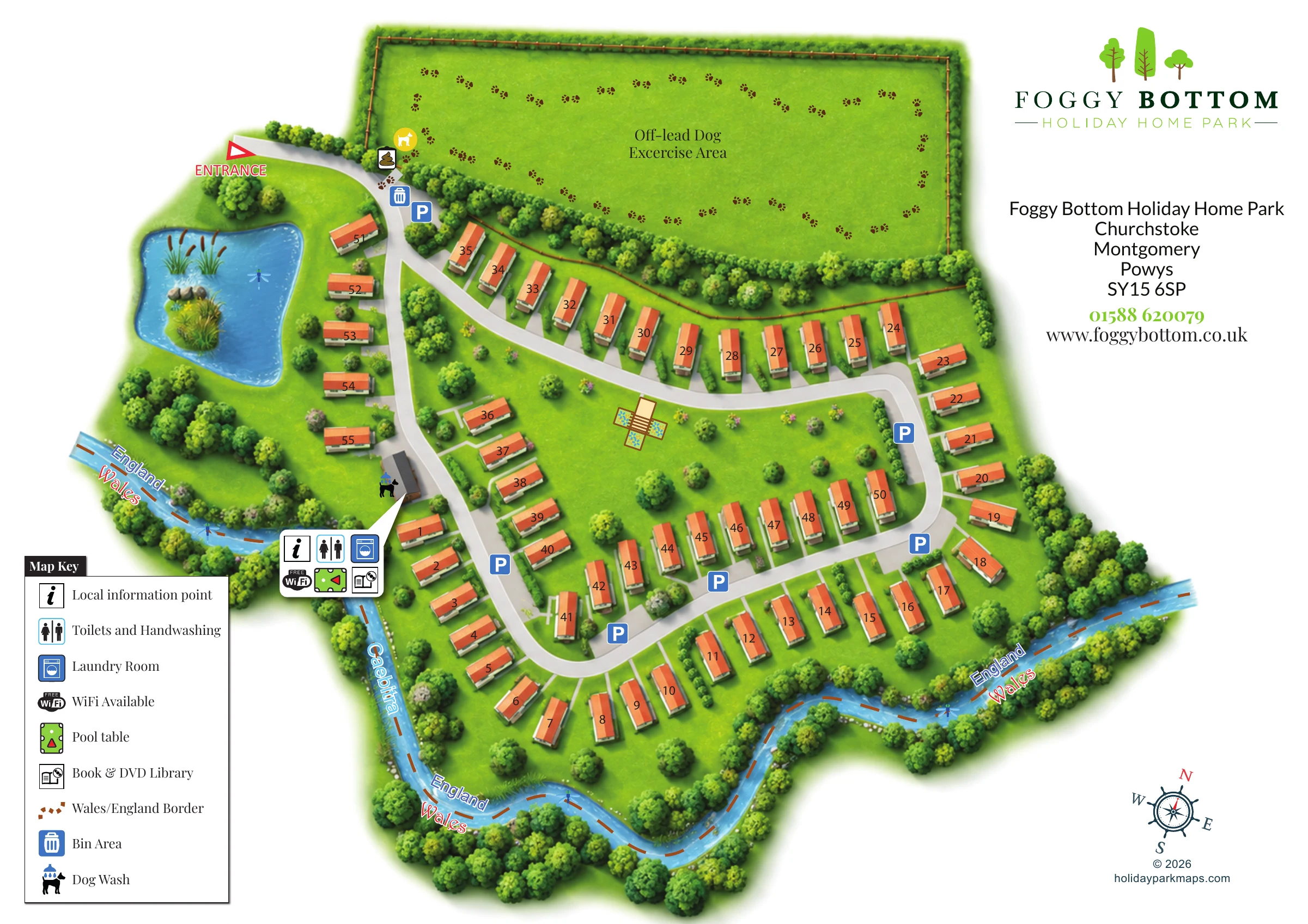
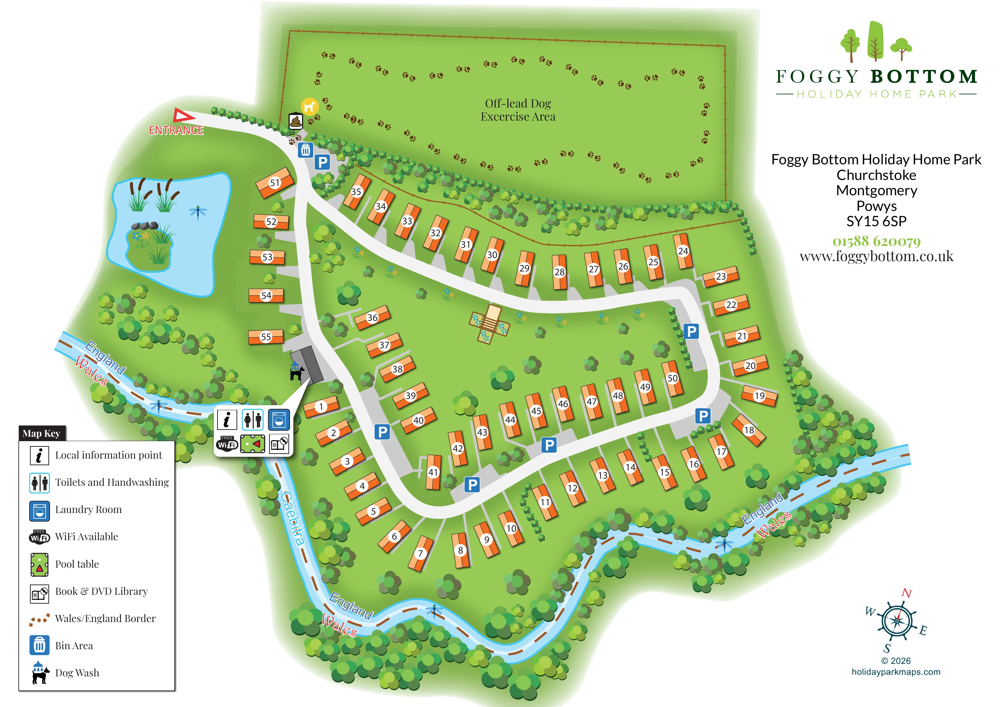
This illustrated map of Foggy Bottom Holiday Home Park brings together a compact holiday-home layout and an unusually distinctive setting: the River Caebitra and the England–Wales border. The park is near Churchstoke, in the Montgomery area of Powys, and the artwork makes its riverside character central to the visitor’s understanding of the site.
Around 55 numbered holiday homes are shown along pale, curving roads, with orange roofs standing clearly against green lawns and tree belts. The entrance is marked at the upper left, beside a landscaped pond, while a large off-lead dog exercise field occupies the top of the plan. Parking symbols are distributed around the accommodation rather than confined to a single arrival area.
A grouped callout identifies the information point, toilets and handwashing, laundry, Wi-Fi, pool table and book and DVD library. The dog wash is marked beside the associated building. With its generous white space for branding and its pictorial lower-left key, this sample combines practical plot-finding with a strong sense of the park’s landscape.
The complete artwork is a landscape-format overhead plan, supported by an enlarged view of the same legend and western facility area. The enlargement adds reading detail rather than a separate accommodation section.
Visitors enter from the upper left, where a red arrow leads onto a broad pale road. Bins and parking are marked close to the arrival point. Beyond this, the road network curves through the holiday homes and reconnects around a planted central space. Short grey spurs distinguish individual plot access from the main circulation routes. White circular numbers are placed over consistent orange-and-peach holiday-home symbols, allowing the accommodation to remain visually prominent without long labels.
The western side contains a pond with reeds, a planted island and small illustrated wildlife details. Nearby, a grey-roofed building is linked to a compact panel of six facility symbols: local information, toilets and handwashing, laundry, Wi-Fi, a pool table and a book and DVD library. A separate dog-wash pictogram sits beside the building. The map key explains these symbols, together with the bin area and national border.
Across the top, a fenced field labelled for off-lead dog exercise is decorated with a trail of paw prints. Dense tree planting separates it from the accommodation below. The River Caebitra then provides the main landscape frame, bending around the western and southern edges. A brown dashed border line and repeated England and Wales labels follow this watercourse.
Scattered trees, flower motifs and an unlabelled ornamental garden structure soften the central lawns. The park logo and contact block occupy the open upper-right margin, while a compass rose balances the lower-right corner.
 Enlarge this map ↗
KEEP EXPLORING
Chosen for shared landscapes, accommodation or facilities.
 Explore the map ↗
United Kingdom
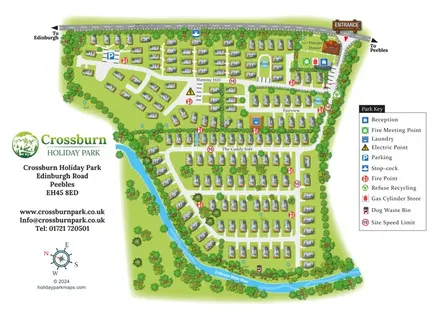
Numbered holiday homes, three named areas and a riverside dog walk at Crossburn Holiday Park, Peebles.
 Explore the map ↗
United Kingdom
A woodland estate park map combining caravan loops, touring pitches, riverside paths and Bruce’s Cave landmarks.
 Explore the map ↗
United Kingdom
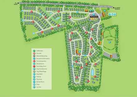
Tree-lined holiday-home park map with a showground, owners’ lounge and paw-print dog field.
Features may come from the sample artwork, its key or published park information. Approximate numbers describe the drawing and may cover only part of a park. They are intended to help you compare map examples. Current facilities and booking information should be checked with the park.
TAKE A CLOSER LOOK
View the illustrated map in detail or choose a file to download. These are sample maps; contact the park for current visitor information.


LET’S MAP YOUR PARK
For a map quotation, find your park and draw a rough boundary around it. The area you select helps us work out the design time and price.
Draw your park for a quote ↗Or talk to our map designers
01751 473136
 foggybottom_large.png