
Small landscaped pond
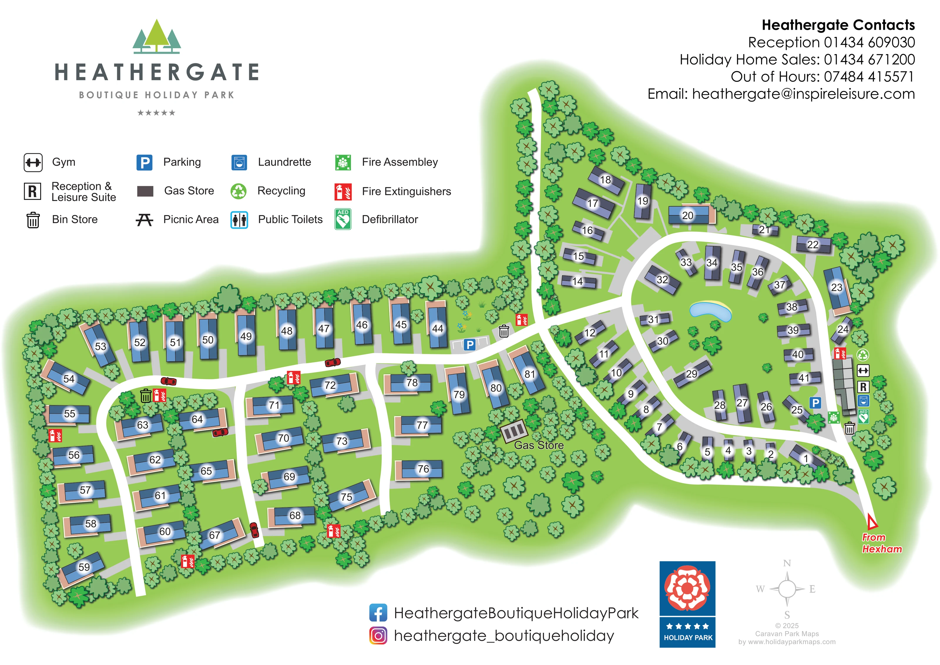
An unlabelled curved blue pond sits in the open green centre of the eastern road loop.
ILLUSTRATED PARK MAP · P159
Lowgate, Hexham, Northumberland · United Kingdom
 Enlarge the map ↗
A SENSE OF THE PLACE
Heathergate Boutique Holiday Park is based at Lowgate, Hexham, Northumberland. Holiday-home ownership includes static caravans and lodges.
Owners and invited guests have access to a private gym and the Bellamy Lounge. The operator maintains landscaped grounds and carries out grass cutting for owners. The park offers concierge help to holiday-home owners.
LOOK CLOSER
An unlabelled curved blue pond sits in the open green centre of the eastern road loop.
Dense perimeter trees, planted dividers between homes, scattered trees and small flower details give the plan a strongly landscaped character.
An R symbol identifies the elongated amenity building beside the eastern entrance road, with the legend defining it as Reception & Leisure Suite.
A dumbbell symbol locates the gym at the eastern amenity building.
A blue washing-machine symbol marks the laundrette alongside the reception and leisure facilities.
Blue P symbols identify parking near the eastern amenity building and at the connection between the two accommodation areas; the latter includes drawn bay markings.
Repeated bin symbols mark collection points near the entrance facilities, the connecting road and the western accommodation lanes.
A green recycling symbol is positioned beside the eastern amenity building.
An R symbol identifies the elongated amenity building beside the eastern entrance road, with the legend defining it as Reception & Leisure Suite.
A dumbbell symbol locates the gym at the eastern amenity building.
A blue washing-machine symbol marks the laundrette alongside the reception and leisure facilities.
Blue P symbols identify parking near the eastern amenity building and at the connection between the two accommodation areas; the latter includes drawn bay markings.
Repeated bin symbols mark collection points near the entrance facilities, the connecting road and the western accommodation lanes.
A green recycling symbol is positioned beside the eastern amenity building.
A labelled gas store is drawn in the planted space south of the road linking the two accommodation areas.
Red extinguisher symbols are distributed around the accommodation lanes, the connecting junction and the amenity building.
A green assembly symbol marks a point beside the eastern amenity building and nearby parking.
A green AED symbol is shown at the eastern reception and leisure facility cluster.
Public toilets appear in the legend, but no corresponding location is clearly identifiable on the plan.
A picnic-table symbol is included in the legend; a matching plotted location is not clearly visible.
An unlabelled curved blue pond sits in the open green centre of the eastern road loop.
Dense perimeter trees, planted dividers between homes, scattered trees and small flower details give the plan a strongly landscaped character.
A red outlined arrow and 'From Hexham' label mark the approach at the lower-right entrance.
White roads connect an oval eastern loop, a northern spur and an elongated western area with several short branching lanes.
A pale grey compass rose below the plan provides north, east, south and west orientation.
Operator information names the Bellamy Lounge as a facility for owners and invited guests; it is not separately labelled in the artwork.
READING THE MAP
This illustrated map of Heathergate Boutique Holiday Park presents a landscaped holiday-home setting at Lowgate, near Hexham in Northumberland. Its distinctive shape brings together two different accommodation layouts: an oval road loop around a small pond on the right, and a longer arrangement of rows and branching lanes on the left. Broad white roads make these connections easy to follow, while belts of trees give each part of the park a clear visual identity.
The map shows approximately 80 numbered holiday homes, using simplified roof shapes, decking details and pale grey approaches to describe individual plots. Arrival from Hexham is marked at the lower-right edge, close to the reception and leisure suite, gym and laundrette. Parking, recycling, bin stores and emergency facilities are communicated through a compact set of symbols.
A large Heathergate logo, generous legend and separate contact panel frame the plan without interrupting the accommodation layout. For the sample gallery, this is a useful example of a branded holiday-home park map that combines individual-unit wayfinding with a strong emphasis on planting and the relationship between connected neighbourhoods.
The single landscape-format map is arranged around an irregular green footprint, with the approach from Hexham entering at the lower right. Immediately beside this arrival route, an elongated grey building is accompanied by symbols for the gym, reception and leisure suite, laundrette and defibrillator. Recycling, a bin store, parking and a fire assembly point are also marked in this entrance-side cluster.
The eastern accommodation area follows an oval white road. Numbered homes sit around its outer edge and within the loop, where a small blue pond and scattered planting form a recognisable central landmark. A further group extends towards the top of the sheet beside a tree-lined northward spur. The connecting road leads west past another marked parking area and a bin point.
The western section has a different rhythm: a long upper row of homes follows the main road, while a curved lane and several shorter branches serve the homes below. Peach-coloured decking, grey approach strips and planted dividers give this area more plot-level detail. A labelled gas store occupies a wooded pocket near the connection between the two sections. Red fire-extinguisher symbols recur around the lanes.
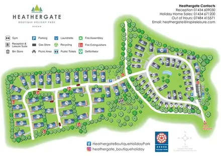
The artwork uses roof-plan building symbols, varied green tree canopies and soft shadows. Large numerals on white halo backgrounds remain prominent against both roof colours. Above the western section, a twelve-entry legend explains the facility icons; public toilets and picnic area are included there without clearly identifiable plotted positions. Branding and contacts occupy the upper corners, while social-media details, a holiday-park badge, compass and designer credit complete the lower margin. The enlarged views show details of this same sheet, rather than separate park sections or additional map variants.
KEEP EXPLORING
Chosen for shared landscapes, accommodation or facilities.
 Explore the map ↗
United Kingdom
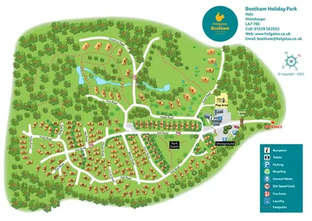
Woodland-framed Barnsoul map with mixed accommodation, shared facilities and paw-marked walking routes.
 Explore the map ↗
United Kingdom
A woodland holiday-park plan with numbered homes, tree-named roads, walking loops and a distinctive entrance totem pole.
 Explore the map ↗
United Kingdom
A colour-zoned coastal park map with touring areas, woodland trails, ponds and a leisure club.
Features may come from the sample artwork, its key or published park information. Approximate numbers describe the drawing and may cover only part of a park. They are intended to help you compare map examples. Current facilities and booking information should be checked with the park.
TAKE A CLOSER LOOK
View the illustrated map in detail or choose a file to download. These are sample maps; contact the park for current visitor information.


LET’S MAP YOUR PARK
For a map quotation, find your park and draw a rough boundary around it. The area you select helps us work out the design time and price.
Draw your park for a quote ↗Or talk to our map designers
01751 473136