
Hedged camping fields
Dense illustrated hedgerows divide the named camping fields and define their irregular outlines.
ILLUSTRATED PARK MAP · P164
Higher Pentreath, Praa Sands, Penzance, Cornwall · United Kingdom
 Enlarge the map ↗
A SENSE OF THE PLACE
Higher Pentreath is a family-run campsite overlooking Praa Sands in Cornwall. Established in the 1950s, it offers a camping base within walking distance of the beach.
Showers, Wi-Fi, laundry and phone-charging facilities support stays. The location suits beach days and excursions towards Helston, Porthleven, Marazion and the Lizard Peninsula, with the map providing an overview of the campsite layout.
LOOK CLOSER
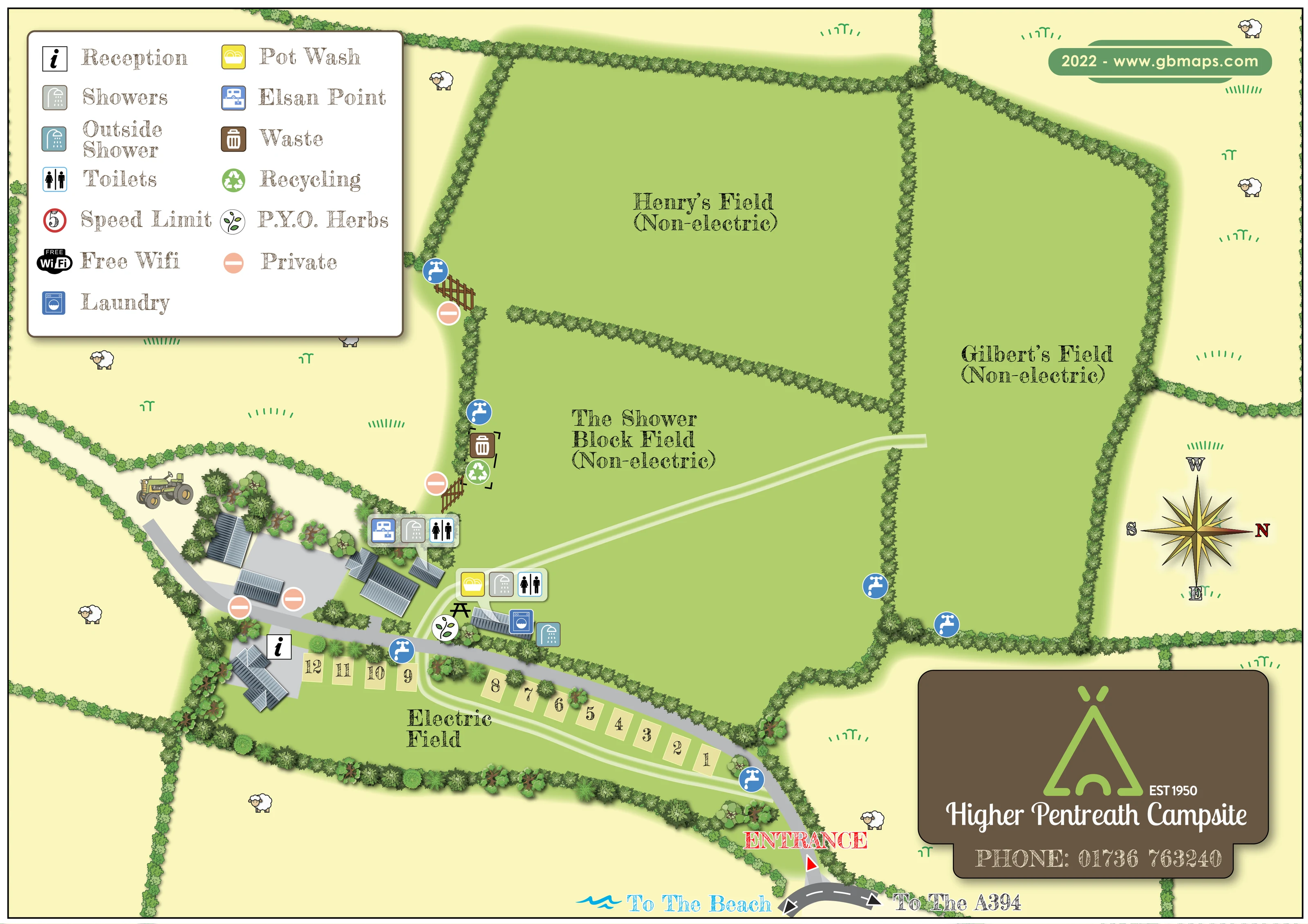
Dense illustrated hedgerows divide the named camping fields and define their irregular outlines.
Pale yellow-green surrounding fields contain decorative sheep, grass marks and a tractor, giving the plan a rural setting.
An information symbol identifies reception in the building cluster at the left-hand end of the electric pitch row.
Two groups of toilet and shower symbols sit around the buildings beside The Shower Block Field and the internal road.
A blue-green shower symbol marks an outside shower beside the laundry and washing facilities.
A yellow washing-up symbol appears with the central toilet and shower facilities.
A blue washing-machine symbol identifies laundry facilities in the central service cluster.
A chemical toilet disposal symbol is positioned with the western toilet and shower group.
An information symbol identifies reception in the building cluster at the left-hand end of the electric pitch row.
Two groups of toilet and shower symbols sit around the buildings beside The Shower Block Field and the internal road.
A blue-green shower symbol marks an outside shower beside the laundry and washing facilities.
A yellow washing-up symbol appears with the central toilet and shower facilities.
A blue washing-machine symbol identifies laundry facilities in the central service cluster.
A chemical toilet disposal symbol is positioned with the western toilet and shower group.
Repeated blue tap symbols mark water points beside field boundaries, the electric pitches and the entrance approach.
Waste-bin and recycling symbols are grouped along the western edge of The Shower Block Field, near a gated boundary.
The leaf symbol explained as P.Y.O. Herbs is placed beside the central service buildings.
A black picnic-table pictogram appears beside the pot wash and herb area.
Free Wi-Fi is listed in the key, without a corresponding location or coverage area marked on the plan.
The key includes a red-ringed speed-limit symbol displaying 5; no position or unit is specified on the plan.
Peach no-entry-style symbols, defined as Private in the key, identify parts of the western building yard and gated field boundaries.
A red ENTRANCE label and triangular marker identify the arrival point near the bottom edge of the artwork.
A grey road leads from the entrance past the electric pitches to reception and the building yard. Pale double-edged tracks branch through the electric and non-electric fields.
A blue wave motif and To The Beach label point along the external road at the bottom of the map. The beach itself is not depicted.
An opposing arrow on the external road is labelled To The A394.
Dense illustrated hedgerows divide the named camping fields and define their irregular outlines.
Pale yellow-green surrounding fields contain decorative sheep, grass marks and a tractor, giving the plan a rural setting.
READING THE MAP
This illustrated map of Higher Pentreath Campsite presents a field-based camping layout at Praa Sands in Cornwall. Rather than filling the site with accommodation icons, it gives prominence to the spaces visitors need to recognise: Henry’s Field, Gilbert’s Field, The Shower Block Field and the smaller Electric Field beside the arrival road. Leafy boundaries make the divisions clear, while numbered pitch rectangles distinguish the electric area from the open non-electric fields.
The entrance, reception and washing facilities form a readable route through the lower part of the plan. Coloured symbols identify toilets, showers, laundry, pot washing, water points and chemical toilet disposal, with a pick-your-own herb area adding a distinctive campsite detail. Directions towards the beach and the A394 connect the site layout to its wider setting without drawing a separate location map.
Pale greens, warm yellow surroundings and small farm illustrations give the artwork a rural character. A substantial legend, ornate compass and brown campsite identity panel complete a practical visitor map with a recognisable visual style.
The plan is organised around three broad, irregular non-electric camping fields. Henry’s Field lies across the upper middle, Gilbert’s Field occupies the right-hand side, and The Shower Block Field sits below Henry’s Field. Dense illustrated hedges separate these spaces, with openings and pale tracks showing connections between them. Along the lower edge, the Electric Field forms a narrower strip containing roughly a dozen numbered pitch rectangles.
Visitors enter near the bottom of the page, where a red label and triangular marker meet the external road. A grey internal road curves past the electric pitches towards reception and the building cluster on the left. The external road has opposing directions to the beach and the A394; the beach label is accompanied by a blue wave motif. The compass rose places north to the right, making orientation an explicit part of the composition.
Facility symbols gather around the buildings rather than being scattered indiscriminately across the fields. Two toilet-and-shower groups are shown, alongside pot washing, laundry, an outside shower and an Elsan point. A picnic-table pictogram and pick-your-own herb marker sit near the central service area. Blue tap symbols recur beside field boundaries and the electric strip, while waste and recycling are grouped near a western gate. Peach symbols distinguish private areas.
The upper-left key explains the principal pictograms and also lists free Wi-Fi and a speed-limit symbol. Grey, individually drawn roofs contrast with the green fields, and decorative sheep and a tractor establish the pastoral surroundings. A brown branded panel anchors the lower-right corner. The enlarged views show details of this same composition, rather than additional map variants.
KEEP EXPLORING
Chosen for shared landscapes, accommodation or facilities.
 Explore the map ↗
United Kingdom
A colour-zoned coastal park map with touring areas, woodland trails, ponds and a leisure club.
 Explore the map ↗
United Kingdom
Tree-framed mixed-accommodation park map with two entrances, touring loops and a clearly illustrated social hub.
 Explore the map ↗
United Kingdom
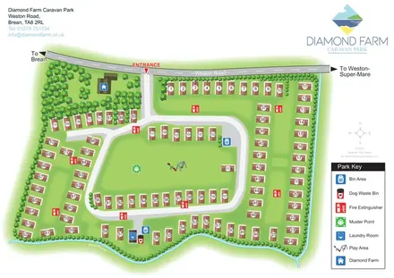
Numbered accommodation, a central green and tree-lined rhyne on the Diamond Farm park map.
Features may come from the sample artwork, its key or published park information. Approximate numbers describe the drawing and may cover only part of a park. They are intended to help you compare map examples. Current facilities and booking information should be checked with the park.
LET’S MAP YOUR PARK
For a map quotation, find your park and draw a rough boundary around it. The area you select helps us work out the design time and price.
Draw your park for a quote ↗Or talk to our map designers
01751 473136