
Fishing Lake
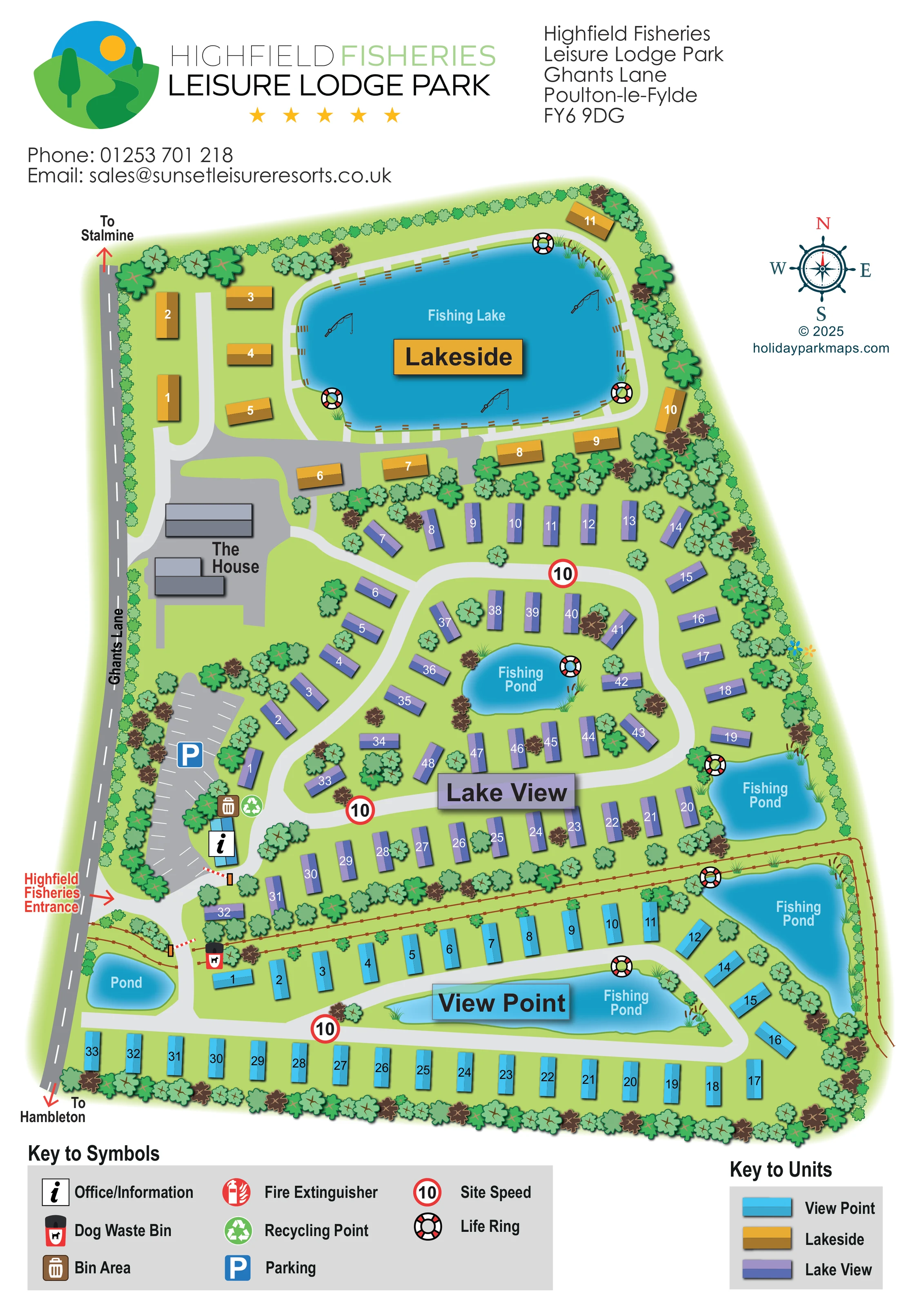
A large rounded lake dominates the northern Lakeside area, with fishing-rod illustrations, bankside markings and a surrounding pale route.
ILLUSTRATED PARK MAP · P165
Highfield Fisheries Leisure Lodge Park, Ghants Lane, Poulton-le-Fylde · United Kingdom
 Enlarge the map ↗
A SENSE OF THE PLACE
Highfield Leisure Lodge Park is an owners-only holiday park near Hambleton on Lancashire's Fylde Coast. Fishing lakes and a gated countryside setting form the backdrop to its lodges and holiday homes.
The park offers properties for sale and a base for repeated breaks near Poulton-le-Fylde and Blackpool. The map sets out the lodge areas, water features and internal access routes.
LOOK CLOSER
A large rounded lake dominates the northern Lakeside area, with fishing-rod illustrations, bankside markings and a surrounding pale route.
Four smaller waters are labelled Fishing Pond: two within or beside Lake View, an elongated pond within View Point and an irregular pond along the south-eastern edge.
A separate small waterbody labelled Pond sits just inside the western boundary, south of the principal entrance.
Dense stylised tree planting encloses the park and separates accommodation groups. A brown post-and-rail line divides the southern area from the central grounds and follows the eastern pond boundary.
An information symbol marks a small blue building beside the parking area near the entrance.
An elongated grey parking area with white bay markings and a blue P symbol runs beside Ghants Lane.
Two grey building footprints labelled The House occupy a paved area on the western side, north of the car park.
Bin and recycling symbols are grouped beside the information building at the southern end of the car park.
A large rounded lake dominates the northern Lakeside area, with fishing-rod illustrations, bankside markings and a surrounding pale route.
Four smaller waters are labelled Fishing Pond: two within or beside Lake View, an elongated pond within View Point and an irregular pond along the south-eastern edge.
A separate small waterbody labelled Pond sits just inside the western boundary, south of the principal entrance.
An information symbol marks a small blue building beside the parking area near the entrance.
An elongated grey parking area with white bay markings and a blue P symbol runs beside Ghants Lane.
Two grey building footprints labelled The House occupy a paved area on the western side, north of the car park.
Bin and recycling symbols are grouped beside the information building at the southern end of the car park.
A dog waste bin symbol appears beside the internal access into the southern View Point area.
Repeated red, white and black life-ring symbols identify waterside points around the large lake and smaller fishing ponds.
Fire Extinguisher appears in the symbol key; no position is clearly identifiable on the main plan.
Red-ringed signs displaying 10 appear along the internal routes and are explained as Site Speed in the key.
Ghants Lane follows the western boundary. A red arrow identifies the Highfield Fisheries Entrance near the lower end of the car park.
Red arrows at opposite ends of Ghants Lane point towards Stalmine to the north and Hambleton to the south.
Pale looping roads connect the accommodation areas, while a narrower route follows the perimeter of the northern Fishing Lake. Red-and-white barrier markings appear at the entrance and southern section access.
Dense stylised tree planting encloses the park and separates accommodation groups. A brown post-and-rail line divides the southern area from the central grounds and follows the eastern pond boundary.
READING THE MAP
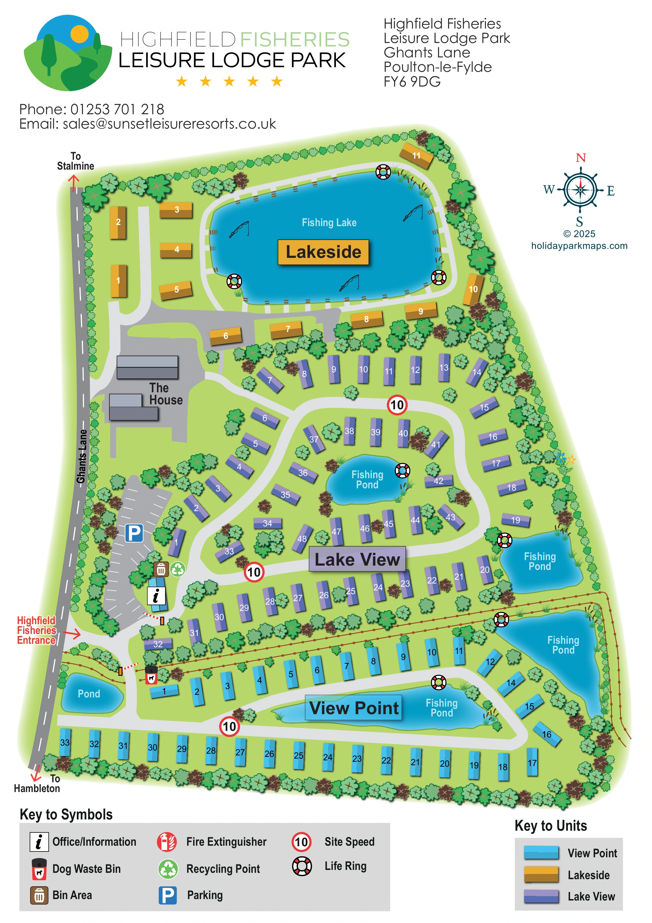
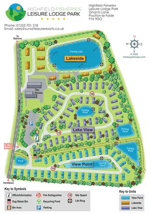
This illustrated map of Highfield Fisheries Leisure Lodge Park places its fishing waters at the centre of the visitor experience. Set beside Ghants Lane near Hambleton on Lancashire’s Fylde Coast, the park is shown as three clearly differentiated accommodation areas: gold Lakeside, purple Lake View and cyan View Point. A large lake anchors the northern section, while smaller fishing ponds shape the central and southern layouts.
The portrait design combines a practical numbered plan with a strong landscape character. Curving internal roads, dense tree planting and softly shaded blue water explain how the accommodation relates to its surroundings. The entrance, parking and information point are grouped along the western side, making the arrival sequence easy to recognise.
A branded header, compass rose and two separate keys complete the page. For a sample gallery, this is a useful example of a lodge-park map that uses colour to organise several neighbourhoods while keeping fishing features and everyday wayfinding visible.
The complete portrait artwork presents the park as a long, tapering site with Ghants Lane running down its western boundary. Red directional arrows point towards Stalmine at the top and Hambleton at the bottom. The labelled entrance opens beside a marked parking area and a small information building, with bin and recycling symbols nearby. Further north, two grey buildings labelled The House sit beside a wider paved space.
Accommodation is organised into three colour-coded sections. Lakeside occupies the northern end, where gold units face or flank the large Fishing Lake. A narrow pale route traces the lake edge, accompanied by reeds, fishing-rod illustrations and life-ring symbols. Lake View fills the middle of the plan with purple units arranged around looping roads and two smaller fishing ponds. The southern View Point section uses cyan units in straighter rows and curved groups around an elongated pond, with another irregular fishing pond along the eastern edge. A separate small pond lies close to the entrance.
Trees form a continuous visual enclosure and punctuate the spaces between units. A brown fence line separates the southern section and continues around the eastern waterbody. Red-and-white barrier markings and repeated 10 speed symbols add route detail without dominating the accommodation layout.
Above the plan, the park logo, title, address and contact block establish the page identity. A compass rose sits to the right; below, separate keys explain facility symbols and unit colours. The accompanying detail views enlarge these same footer keys rather than showing additional park sections.
KEEP EXPLORING
Chosen for shared landscapes, accommodation or facilities.
 Explore the map ↗
United Kingdom
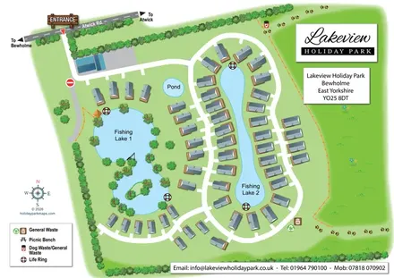
Illustrated lakeside park plan with numbered holiday units, leisure buildings and a looping Woodland Walk.
 Explore the map ↗
United Kingdom
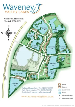
Illustrated lakeside holiday-home map with curving access roads, tree-lined grounds and prominent arrival signage.
 Explore the map ↗
United Kingdom
Illustrated lakeside caravan and lodge park map with numbered homes, wooded banks and a central reception cluster.
Features may come from the sample artwork, its key or published park information. Approximate numbers describe the drawing and may cover only part of a park. They are intended to help you compare map examples. Current facilities and booking information should be checked with the park.
TAKE A CLOSER LOOK
View the illustrated map in detail or choose a file to download. These are sample maps; contact the park for current visitor information.


LET’S MAP YOUR PARK
For a map quotation, find your park and draw a rough boundary around it. The area you select helps us work out the design time and price.
Draw your park for a quote ↗Or talk to our map designers
01751 473136
 highfieldsfisheries_large.png