
Wild Flower Field and Wild Flower Meadow
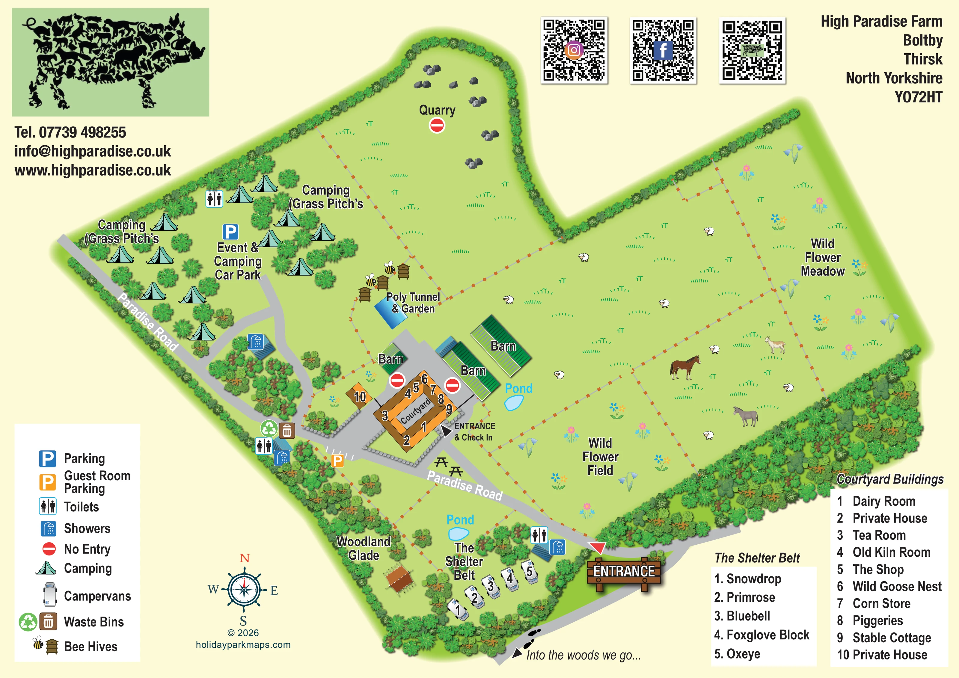
Two separately named flower areas occupy the eastern side of the plan, decorated with colourful flower illustrations.
ILLUSTRATED PARK MAP · P163
High Paradise Farm, Boltby, Thirsk, North Yorkshire · United Kingdom
 Enlarge the map ↗
A SENSE OF THE PLACE
High Paradise Farm is a traditional moorland farm on the Cleveland Way near Boltby in North Yorkshire. Camping and self-catering rooms provide accommodation for visitors exploring the North York Moors.
A tearoom and small essentials shop support stays, and the farm also hosts events and weddings. The map presents the accommodation and shared spaces within this working countryside setting.
LOOK CLOSER
Two separately named flower areas occupy the eastern side of the plan, decorated with colourful flower illustrations.
Dense illustrated woodland frames the southern and eastern edges. Woodland Glade is labelled beside the Shelter Belt, with a small canopy-like illustration in the clearing.
A tree-enclosed area near the main entrance contains the named campervan pitches, a pond and nearby toilet and shower facilities.
Two small blue ponds are labelled, one beside the barns and another above the Shelter Belt pitches.
Large central and eastern grass compartments contain illustrated sheep, a horse, a donkey and a goat. These convey farm character rather than a specified visitor animal attraction.
The northern quarry area is labelled, illustrated with rocks and marked with a no-entry symbol.
A prominent timber-style entrance sign and red triangular marker identify arrival from the road at the lower-right edge.
A separate entrance and check-in label points to the south-eastern side of the courtyard complex.
A prominent timber-style entrance sign and red triangular marker identify arrival from the road at the lower-right edge.
A separate entrance and check-in label points to the south-eastern side of the courtyard complex.
The named grey route connects the main entrance, courtyard and north-western camping area, with branches into the parking and farm building areas.
An orange-roofed building complex surrounds a central courtyard. A numbered key identifies rooms, former farm spaces, the tea room, shop, Stable Cottage and two private houses.
The Tea Room is identified within the courtyard building key.
The Shop is identified on the northern side of the courtyard complex through its numbered key.
The event and camping car park is labelled among the grass camping areas. Separate guest room parking beside the courtyard uses an orange parking symbol and illustrated bay markings.
Repeated toilet and shower symbols mark facilities serving the camping area, the route near the courtyard and the Shelter Belt.
Paired recycling and waste-bin symbols are placed beside the facilities south-west of the courtyard.
Two picnic-table silhouettes are shown beside Paradise Road near the courtyard check-in entrance.
Several green-roofed barns sit immediately north of the courtyard, reinforcing the working-farm setting.
A blue structure and its label identify the growing area north-west of the barns.
A cluster of illustrated hives and bees appears beside the polytunnel and garden.
Two separately named flower areas occupy the eastern side of the plan, decorated with colourful flower illustrations.
Dense illustrated woodland frames the southern and eastern edges. Woodland Glade is labelled beside the Shelter Belt, with a small canopy-like illustration in the clearing.
A tree-enclosed area near the main entrance contains the named campervan pitches, a pond and nearby toilet and shower facilities.
Two small blue ponds are labelled, one beside the barns and another above the Shelter Belt pitches.
Large central and eastern grass compartments contain illustrated sheep, a horse, a donkey and a goat. These convey farm character rather than a specified visitor animal attraction.
The northern quarry area is labelled, illustrated with rocks and marked with a no-entry symbol.
Red no-entry symbols appear at the quarry and beside the farmyard beyond the courtyard.
Footprints, an arrow and the phrase 'Into the woods we go...' indicate a continuation off the lower edge of the plan, without depicting a full walking circuit.
READING THE MAP
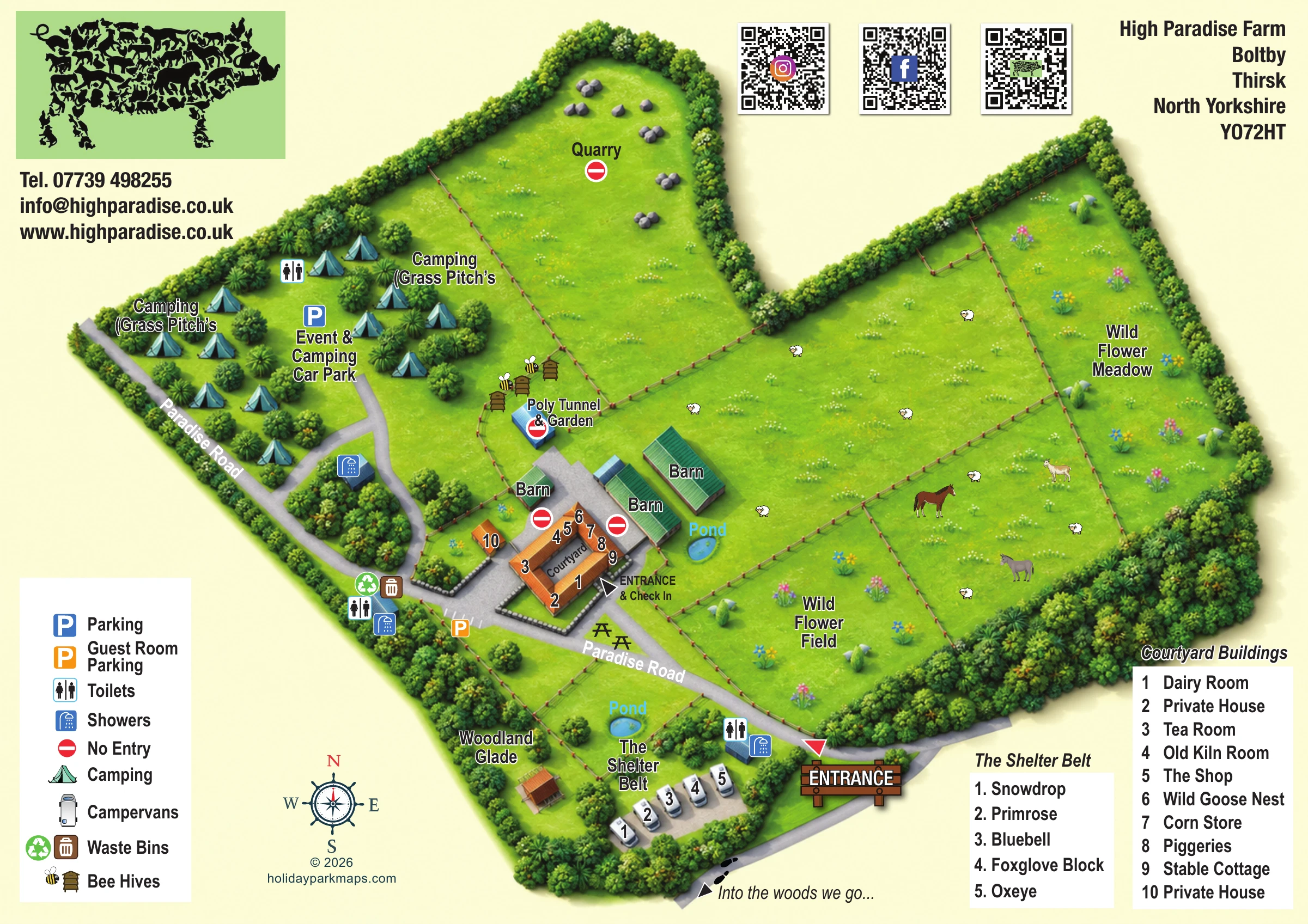
This illustrated map of High Paradise Farm brings together camping, campervan pitches and courtyard buildings in a working countryside setting near Boltby, Thirsk, in North Yorkshire. Rather than presenting a regular holiday-park grid, the design follows the farm’s irregular outline, with wooded boundaries, fenced pasture and two named wildflower areas giving the plan its distinctive shape.
The courtyard forms the main visitor hub. Its orange-roofed buildings are numbered against a clear naming panel, helping guests locate the tea room, shop, named rooms and Stable Cottage. Paradise Road connects this central area with grass camping to the north-west and the Shelter Belt campervan pitches near the main entrance. Parking, toilets, showers and waste facilities are picked out with straightforward symbols.
Farm details are an important part of the artwork: green-roofed barns, a polytunnel and garden, bee hives, ponds and illustrated livestock all contribute to the sense of place. A prominent entrance sign, compass rose and woodland direction complete a map that combines practical arrival information with the character of a rural farm stay.
The plan is organised around Paradise Road, a broad grey route entering at the lower-right edge and continuing past the Shelter Belt towards the courtyard and north-western camping areas. A timber-style entrance sign makes the arrival point conspicuous, while a separate arrow identifies entrance and check-in at the courtyard. Guest room parking is marked in orange beside the buildings; the event and camping car park uses a blue parking symbol farther north-west.
The courtyard is drawn as a compact orange-roofed complex around an open centre. Its numbered panel identifies Dairy Room, the Tea Room, Old Kiln Room, The Shop, Wild Goose Nest, Corn Store, Piggeries, Stable Cottage and private houses. Green-roofed barns stand just beyond it, with no-entry markers distinguishing parts of the farmyard. Nearby, the polytunnel and garden are accompanied by bee-hive illustrations.
Camping is shown in two labelled grass areas, where turquoise tents sit among pockets of foliage. At the southern end, five campervan illustrations identify the Shelter Belt pitches, named Snowdrop, Primrose, Bluebell, Foxglove Block and Oxeye. Toilet and shower symbols appear at several points, and waste and recycling symbols are grouped near the courtyard approach. Picnic tables are illustrated beside the road.
The eastern half gives substantial space to fenced pasture, the Wild Flower Field and Wild Flower Meadow. Animals, grass tufts and colourful flowers distinguish these areas, while layered trees form a dense boundary. Two ponds, Woodland Glade and a rock-strewn quarry add further landmarks. An arrow and footprints point beyond the plan towards the woods.
The artwork is a single landscape-format page, supported by a symbol legend, two naming panels, a compass, farm branding and three QR codes across the upper margin.
 Enlarge this map ↗
KEEP EXPLORING
Chosen for shared landscapes, accommodation or facilities.
 Explore the map ↗
United Kingdom
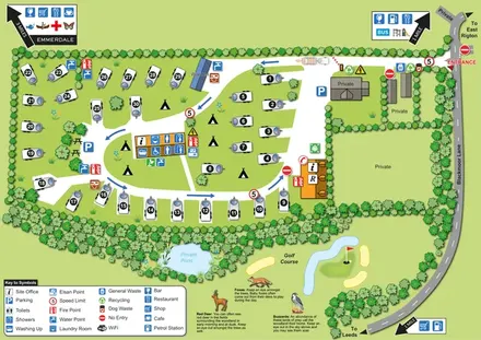
Woodland holiday-park map with named accommodation areas, touring loops and illustrated recreation facilities.
 Explore the map ↗
United Kingdom
Numbered touring pitches, central amenities and wildlife illustrations in a tree-lined countryside site map.
 Explore the map ↗
United Kingdom
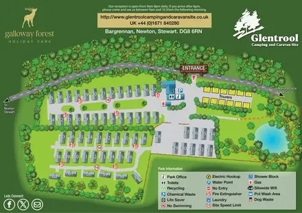
Woodland-framed Glentrool site map with numbered caravans, yellow touring pitches and a turquoise pond.
Features may come from the sample artwork, its key or published park information. Approximate numbers describe the drawing and may cover only part of a park. They are intended to help you compare map examples. Current facilities and booking information should be checked with the park.
LET’S MAP YOUR PARK
For a map quotation, find your park and draw a rough boundary around it. The area you select helps us work out the design time and price.
Draw your park for a quote ↗Or talk to our map designers
01751 473136