
Beach, dunes and sea
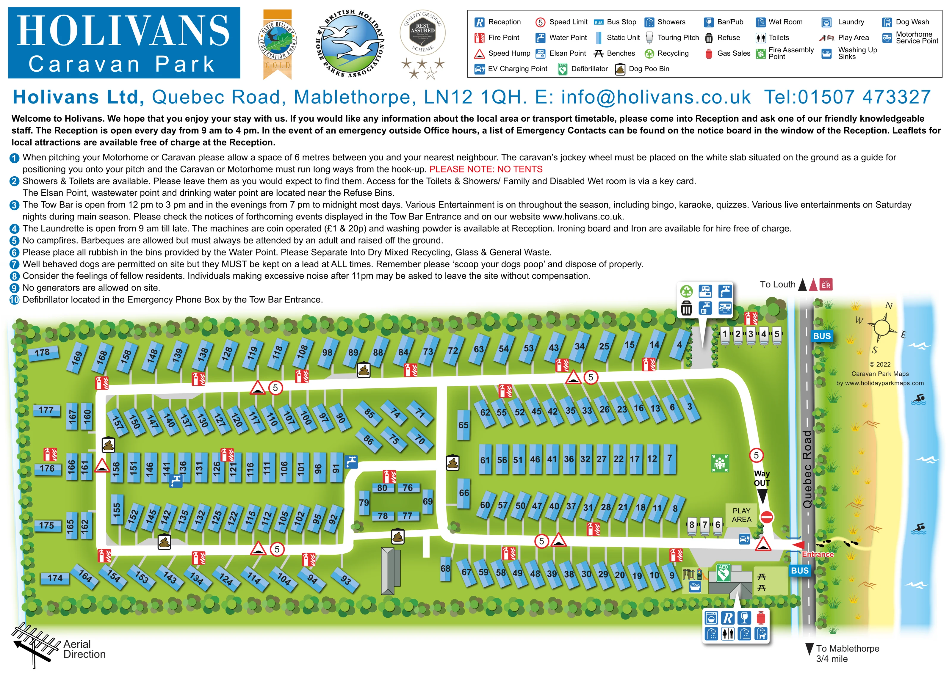
A stylised coastal strip beyond Quebec Road combines yellow sand, dune grasses, orange contour-like marks, footprints, blue water, white waves and swimmer pictograms.
ILLUSTRATED PARK MAP · P500
Holivans Ltd, Quebec Road, Mablethorpe · United Kingdom
 Enlarge the map ↗
A SENSE OF THE PLACE
Holivans is a family-run holiday park near Mablethorpe. It offers caravans, lodges and glamping pods for hire, together with a smaller touring area and holiday caravan ownership.
Selected accommodation welcomes dogs, and lodges are advertised with private outdoor hot tubs and garden space. The Tow Bar provides a social venue on the park, with the Lincolnshire coast offering further opportunities for days out.
LOOK CLOSER
A stylised coastal strip beyond Quebec Road combines yellow sand, dune grasses, orange contour-like marks, footprints, blue water, white waves and swimmer pictograms.
Overlapping circular tree canopies enclose the rectangular park and separate parts of the touring and entrance areas.
Identified in the facility callout attached to the south-eastern building complex beside the entrance.
The visitor information names the Tow Bar; a bar/pub symbol locates the social venue within the entrance-side building complex.
Grouped in the entrance-side facility callout. The text describes a family and disabled wet room, without establishing an accessibility guarantee.
A washing-machine symbol appears in the main building's facility callout.
A blue washing-up symbol is positioned beside the entrance-side buildings and illustrated play equipment.
The dog wash is included in the main facility callout; dog-waste bin symbols are distributed around the accommodation roads.
Identified in the facility callout attached to the south-eastern building complex beside the entrance.
The visitor information names the Tow Bar; a bar/pub symbol locates the social venue within the entrance-side building complex.
Grouped in the entrance-side facility callout. The text describes a family and disabled wet room, without establishing an accessibility guarantee.
A washing-machine symbol appears in the main building's facility callout.
A blue washing-up symbol is positioned beside the entrance-side buildings and illustrated play equipment.
The dog wash is included in the main facility callout; dog-waste bin symbols are distributed around the accommodation roads.
A red gas-cylinder symbol appears in the entrance-side building callout.
A northern callout beside the touring pitches groups an Elsan point, water point, wastewater-disposal symbol and motorhome service point. Additional water symbols appear within the static-unit area.
Refuse and recycling symbols share the northern touring-service callout.
A labelled play area lies beside the eastern touring group; colourful play equipment is also illustrated beside the main facility building.
Two picnic-bench symbols occupy the green space east of the main building.
A blue charging symbol is placed beside the eastern touring pitches near the entrance.
A prominent green AED symbol marks the main building area; accompanying text associates it with the emergency phone box by the Tow Bar entrance.
Repeated red fire-point symbols line the internal roads. A green assembly-point symbol occupies open ground inside the eastern loop.
Quebec Road runs vertically along the park's eastern edge. A red entrance arrow connects it to the lower internal road; a separate arrow marks the way out on the eastern loop.
Two blue BUS markers appear on Quebec Road, one near the entrance and one farther north.
Road-edge arrows point towards Louth and towards Mablethorpe; the latter carries a three-quarter-mile label.
Red-bordered hump warnings and circular 5 speed-limit symbols recur along the internal roads, with a no-entry sign beside the eastern exit route.
A stylised coastal strip beyond Quebec Road combines yellow sand, dune grasses, orange contour-like marks, footprints, blue water, white waves and swimmer pictograms.
Overlapping circular tree canopies enclose the rectangular park and separate parts of the touring and entrance areas.
A compass rose sits within the coastal strip, while a television-aerial illustration and direction arrow occupy the lower-left margin.
READING THE MAP
This illustrated map of Holivans Caravan Park places a busy, numbered caravan layout within an unmistakably coastal setting. The park occupies a long, tree-lined rectangle beside Quebec Road in Mablethorpe, with a strip of sand, dune grasses and blue sea drawn along the right-hand edge. Blue static-unit symbols and broad white roads make the accommodation pattern easy to follow, while two small touring groups sit close to the eastern entrance and service areas.
The design brings together more than a site plan. A prominent Holivans title, association and award graphics, a comprehensive symbol key and a substantial visitor-information section share the landscape page. Within the map, reception, the Tow Bar, washrooms and other shared facilities are gathered into clear pointer callouts. Play areas, bus stops, EV charging and touring-service symbols add practical detail without competing with the unit numbers. It is a useful sample for coastal caravan parks needing a single branded visitor sheet that combines accommodation finding, arrival information and everyday facilities.
The plan is drawn mainly from above, using two-tone blue rectangles for static units and white caravan illustrations for touring pitches. Large black numbers follow the orientation of each unit. Rows alternate between straight and angled arrangements, with a smaller central group enclosing an open lawn. Broad white roads form linked loops through the park, and short grey connections lead towards individual units. Rounded tree canopies create a continuous green boundary around most of the site.
At the lower-right edge, a red entrance arrow leads from Quebec Road towards the main building complex. A separate way-out arrow appears on the eastern return road. The entrance-side callout groups reception, bar/pub, laundry, gas sales, showers, toilets, wet room and dog wash symbols. Nearby details include washing-up sinks, picnic benches, illustrated play equipment and a green defibrillator marker. Another labelled play area and an EV charging symbol sit beside the southern touring group. Farther north, a second callout groups refuse, recycling, water, Elsan and motorhome-servicing facilities beside the other touring pitches.
Fire points, water points and dog-waste bins are distributed through the accommodation area. Speed-hump warnings and circular speed signs punctuate the internal roads. Outside the boundary, bus-stop markers and arrows towards Louth and Mablethorpe give the arrival route local context. The sand-and-sea illustration, compass rose and aerial-direction graphic add orientation and character.
Above the plan, the page combines bold branding, award graphics, a boxed legend, contact details and numbered visitor information. The enlarged views show details of this same single-page artwork, rather than separate park sections or additional maps.
KEEP EXPLORING
Chosen for shared landscapes, accommodation or facilities.
 Explore the map ↗
United Kingdom
A colour-zoned coastal park map with touring areas, woodland trails, ponds and a leisure club.
 Explore the map ↗
United Kingdom
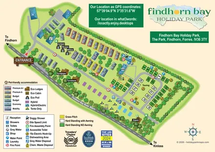
Illustrated mixed-accommodation park plan with colour-coded caravans, named eco units and a touring loop.
 Explore the map ↗
United Kingdom
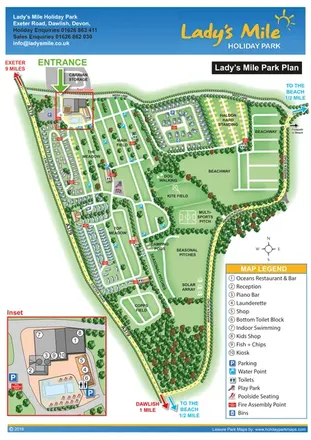
Portrait park plan with named fields, numbered accommodation, beach directions and an enlarged leisure-complex inset.
Features may come from the sample artwork, its key or published park information. Approximate numbers describe the drawing and may cover only part of a park. They are intended to help you compare map examples. Current facilities and booking information should be checked with the park.
TAKE A CLOSER LOOK
View the illustrated map in detail or choose a file to download. These are sample maps; contact the park for current visitor information.

LET’S MAP YOUR PARK
For a map quotation, find your park and draw a rough boundary around it. The area you select helps us work out the design time and price.
Draw your park for a quote ↗Or talk to our map designers
01751 473136