
Alpaca paddocks and shelters
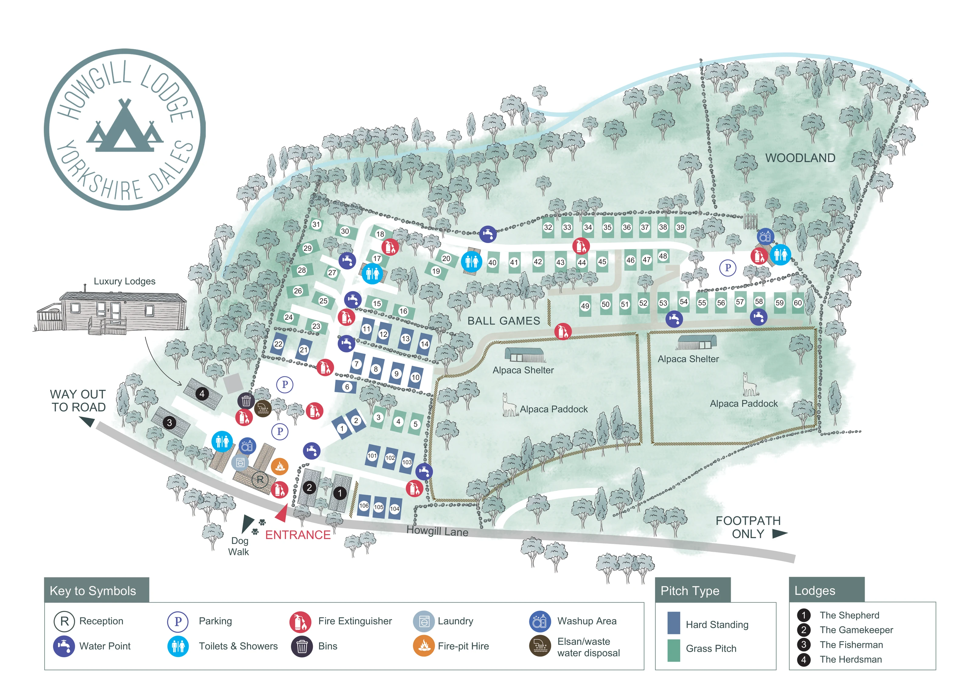
Two large adjoining paddocks occupy the lower-right side, each with a labelled shelter and an illustrated alpaca.
ILLUSTRATED PARK MAP · P170
Howgill Lodge, Barden, Skipton, North Yorkshire · United Kingdom
 Enlarge the map ↗
A SENSE OF THE PLACE
Howgill Lodge Campsite is based at Howgill Lodge, Barden, Skipton, North Yorkshire. Terraced hillside pitches overlook Wharfedale in the Yorkshire Dales. Timber glamping lodges have private hot tubs and are available year-round; camping is advertised April to October. Level grass tent pitches and hardstanding caravan pitches are offered; some tent pitches have 10-amp electricity, and each pitch has a picnic table.
Amenities include a coffee shop, small shop, laundry, communal fridge/freezer, Wi-Fi and washing-up area. Dogs are welcome, with an off-lead exercise field and a dog wash.
LOOK CLOSER
Two large adjoining paddocks occupy the lower-right side, each with a labelled shelter and an illustrated alpaca.
A broad wooded area extends above the upper pitches, with particularly extensive tree cover at the top right.
Individual tree drawings surround the accommodation, while dotted boundary lines and hatched paddock fences divide the grounds.
An R marker identifies reception within the building cluster beside the entrance.
Outlined P symbols mark parking near the lower accommodation and at the eastern end of the upper terraces.
Bright cyan symbols identify several toilet and shower locations distributed between the entrance area and upper pitch groups.
Purple tap symbols recur throughout the camping and hardstanding areas.
Red circular extinguisher symbols are distributed along the pitch terraces and around the entrance facilities.
An R marker identifies reception within the building cluster beside the entrance.
Outlined P symbols mark parking near the lower accommodation and at the eastern end of the upper terraces.
Bright cyan symbols identify several toilet and shower locations distributed between the entrance area and upper pitch groups.
Purple tap symbols recur throughout the camping and hardstanding areas.
Red circular extinguisher symbols are distributed along the pitch terraces and around the entrance facilities.
A dark bin symbol marks a disposal point beside the lower-left service cluster.
A pale blue washing-machine symbol appears among the facilities near reception.
Blue washing-up symbols mark facilities near the entrance and at the eastern end of the upper campsite.
An orange flame symbol identifies fire-pit hire beside the reception and service buildings.
A brown disposal symbol appears beside the bins in the lower-left part of the plan.
A labelled open area lies centrally between the pitch terraces and the alpaca paddocks.
Two large adjoining paddocks occupy the lower-right side, each with a labelled shelter and an illustrated alpaca.
A broad wooded area extends above the upper pitches, with particularly extensive tree cover at the top right.
Individual tree drawings surround the accommodation, while dotted boundary lines and hatched paddock fences divide the grounds.
Howgill Lane runs along the bottom of the plan. A red arrow marks the entrance, and a separate dark arrow points left towards the road.
A labelled arrow with paw-print graphics points off the plan near the entrance; the walk itself is not drawn in full.
A right-pointing arrow beside Howgill Lane identifies a footpath-only continuation at the lower-right edge.
Broad white routes rise from the entrance area, branch between the pitches and follow the long upper terraces.
READING THE MAP
This illustrated map of Howgill Lodge Campsite brings together terraced camping pitches, touring hardstandings and four named lodges in a leafy Yorkshire Dales setting. Based at Barden, near Skipton in North Yorkshire, the campsite is presented as a series of connected pitch rows rising from Howgill Lane, with woodland above and two alpaca paddocks alongside the accommodation.
The design combines a practical overhead plan with softer illustrative details. Green and blue pitch blocks distinguish grass from hardstanding, while numbered circles help visitors find their place without filling the grounds with drawings of tents and caravans. Colourful symbols identify everyday facilities, including toilets and showers, water points, laundry, washing-up areas and waste disposal.
The alpaca shelters, central ball games area and dog-walk direction give the map a distinctive sense of place. A separate timber-lodge illustration adds character beside the large circular park logo, while three clear keys along the bottom explain the facilities, pitch types and lodge names. It is a useful example of a campsite map that balances arrival information and pitch-finding with the landscape and attractions that make the site recognisable.
The plan is organised around Howgill Lane, drawn as a grey strip across the lower edge. A red entrance arrow directs attention to reception and a compact cluster of service buildings. Nearby symbols identify laundry, washing-up facilities, toilets and showers, fire-pit hire, bins and Elsan or waste-water disposal. Separate arrows indicate the way out to the road, a dog walk and the footpath-only continuation to the right.
From this arrival area, broad white internal routes branch into the accommodation. Blue hardstanding blocks occupy much of the lower campsite, while green grass pitches extend into shorter left-hand groups and long upper terrace rows. White numbered discs sit within the pitch blocks. Four lodge footprints beside the lane use black number circles, with their names listed separately: The Shepherd, The Gamekeeper, The Fisherman and The Herdsman. A timber-lodge side view in the left margin is linked to this area by a curved arrow.
The landscape is a substantial part of the composition. A labelled woodland spreads across the upper edge, individual trees soften the terrace divisions, and a central open space is marked for ball games. Two fenced alpaca paddocks fill the lower-right area, each illustrated with an animal and a small shelter. Rounded boundary marks and hatched fences help distinguish these spaces without competing with the route network.
Repeated water, toilet and shower, washing-up and fire-extinguisher symbols bring essential facilities into the pitch areas. Along the bottom, three coordinated legend panels explain the symbols, pitch colours and lodge numbering. The sample consists of one complete map; the accompanying enlarged views show overlapping portions of these keys rather than additional campsite sections.
KEEP EXPLORING
Chosen for shared landscapes, accommodation or facilities.
 Explore the map ↗
United Kingdom
Woodland-framed Barnsoul map with mixed accommodation, shared facilities and paw-marked walking routes.
 Explore the map ↗
United Kingdom
Illustrated farm campsite map with touring pitches, pods, camping fields and a riverside dog-walk route.
 Explore the map ↗
United Kingdom
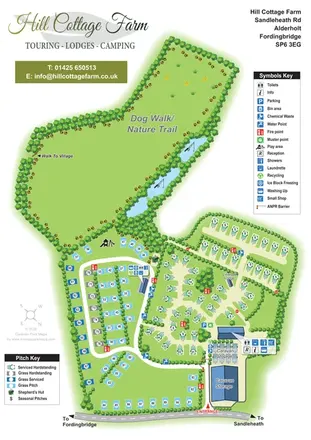
Portrait park map with mixed touring pitches, seasonal rows, ponds and an extensive dog walk.
Features may come from the sample artwork, its key or published park information. Approximate numbers describe the drawing and may cover only part of a park. They are intended to help you compare map examples. Current facilities and booking information should be checked with the park.
TAKE A CLOSER LOOK
View the illustrated map in detail or choose a file to download. These are sample maps; contact the park for current visitor information.


LET’S MAP YOUR PARK
For a map quotation, find your park and draw a rough boundary around it. The area you select helps us work out the design time and price.
Draw your park for a quote ↗Or talk to our map designers
01751 473136