
Dog-walking area
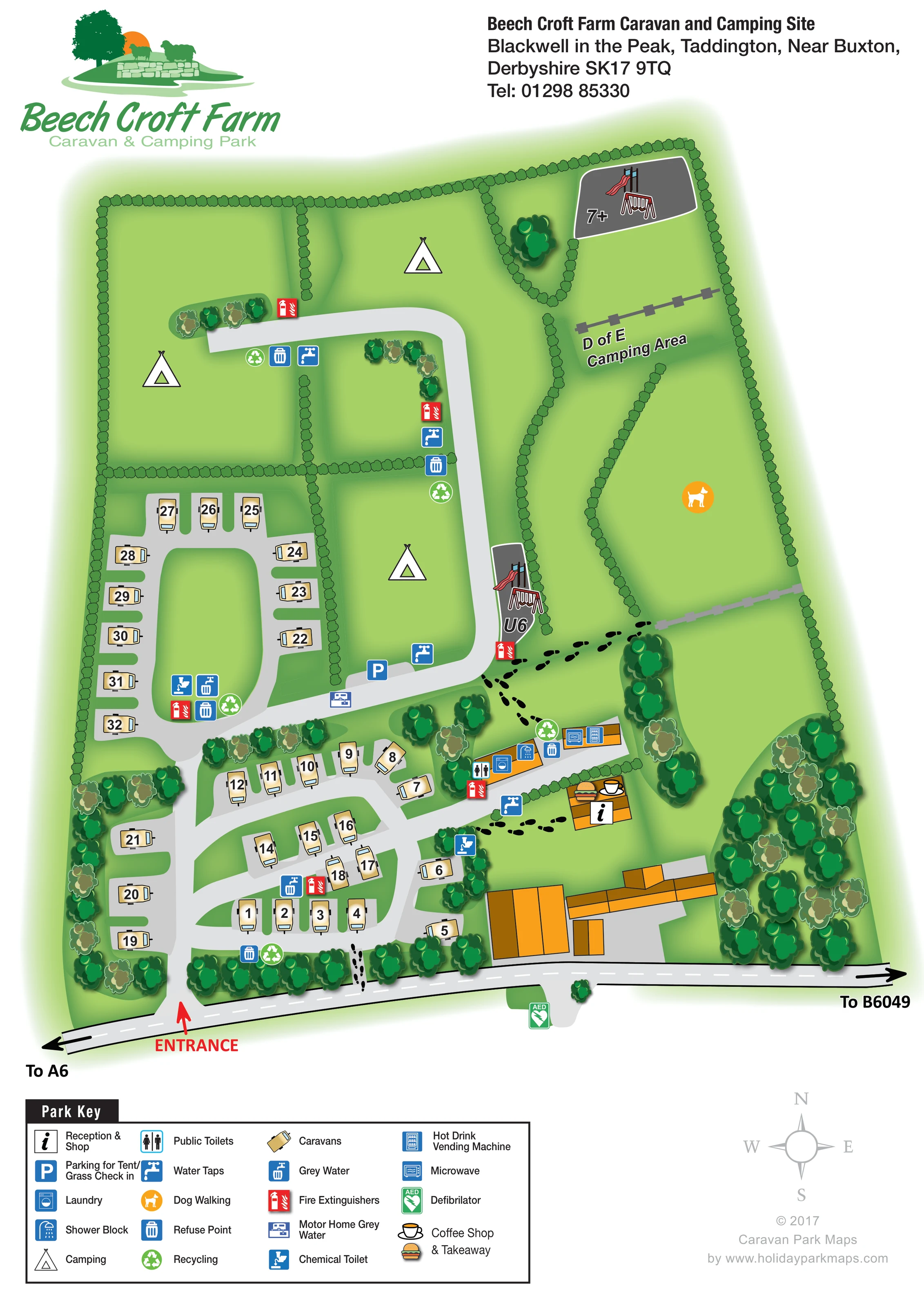
An orange dog symbol identifies a substantial eastern grass area bounded by hedges and fence lines.
ILLUSTRATED PARK MAP · P405
Beech Croft Farm Caravan and Camping Site, Blackwell in the Peak, Taddington, Near Buxton, Derbyshire · United Kingdom
 Enlarge the map ↗
A SENSE OF THE PLACE
Beech Croft Farm is a family-run campsite at Blackwell in the Peak, between Buxton and Bakewell. Touring caravans, motorhomes and tents are welcomed in a small hamlet within the Peak District.
Hardstanding pitches have electric connections, while separate camping areas provide options for tents. Heated washrooms, a provisions shop and washing-up facilities support stays. Children's play spaces cater for different ages, including a ball-game area and zip wire.
LOOK CLOSER
An orange dog symbol identifies a substantial eastern grass area bounded by hedges and fence lines.
Continuous illustrated hedges divide the northern fields and eastern spaces. Rounded tree clusters line the frontage, buildings and parts of the touring area.
An information symbol identifies the small orange-roofed building beside the main facilities cluster.
Cup and food symbols share the reception building, with their meaning explained in the key.
A blue P marks a parking bay on the central road near the camping fields and facilities.
Symbols locate these facilities along the elongated orange-roofed service building near the centre-right of the touring section.
Both appliance symbols are placed at the eastern end of the service building.
Blue tap symbols are distributed beside the camping access road, touring roads and central facilities.
An information symbol identifies the small orange-roofed building beside the main facilities cluster.
Cup and food symbols share the reception building, with their meaning explained in the key.
A blue P marks a parking bay on the central road near the camping fields and facilities.
Symbols locate these facilities along the elongated orange-roofed service building near the centre-right of the touring section.
Both appliance symbols are placed at the eastern end of the service building.
Blue tap symbols are distributed beside the camping access road, touring roads and central facilities.
Repeated blue refuse and green recycling symbols mark service locations around both touring and camping areas.
Separate symbols identify grey-water and chemical-toilet disposal points within the touring section.
A distinct purple motorhome service symbol sits on the cross-site road below the check-in parking bay.
Red extinguisher symbols are distributed around the camping road, touring areas and facilities.
A green AED symbol is shown beside the roadside frontage, south of the main building group.
Two grey play spaces contain slide-and-swing illustrations: one labelled U6 beside the central camping road, and one labelled 7+ in the north-eastern corner.
An orange dog symbol identifies a substantial eastern grass area bounded by hedges and fence lines.
A named camping area occupies the upper eastern part of the plan below the older children's playground.
Continuous illustrated hedges divide the northern fields and eastern spaces. Rounded tree clusters line the frontage, buildings and parts of the touring area.
A red entrance arrow marks access from the southern frontage road, with directional arrows towards the A6 on the left and B6049 on the right.
Pale-grey roads serve the touring pitches and extend north into the camping fields. Black footprint trails connect the frontage, facilities and eastern recreation spaces.
READING THE MAP
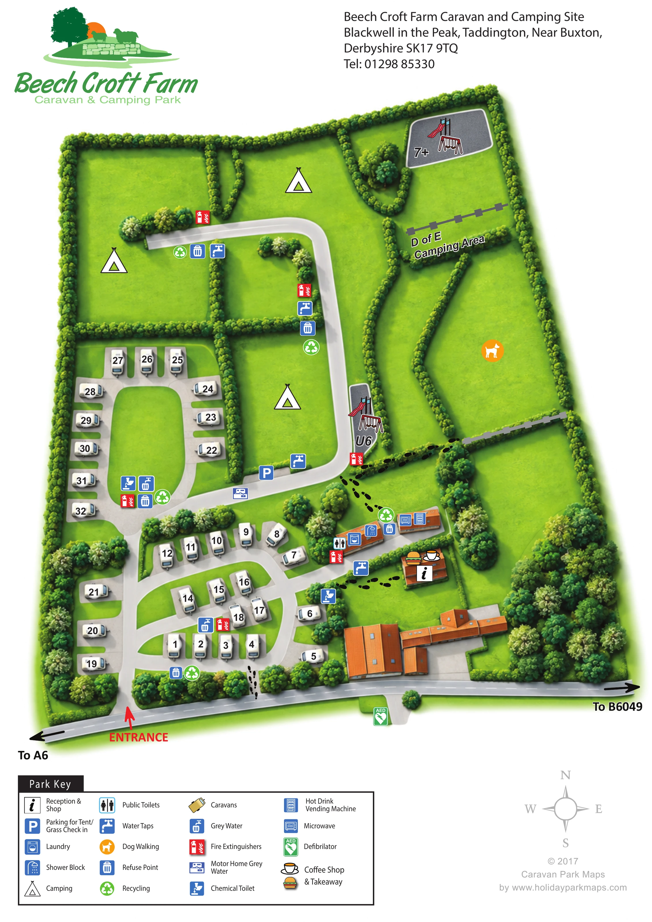
This illustrated map of Beech Croft Farm presents a compact touring and camping site at Blackwell in the Peak, near Buxton in Derbyshire. Its portrait composition makes the site's different spaces easy to distinguish: numbered caravan pitches occupy the lower half, hedge-divided camping fields extend northwards, and recreation areas sit along the eastern edge.
The artwork combines practical arrival information with a distinctly rural visual character. A red entrance arrow leads visitors from the frontage road into a network of pale-grey internal routes, while trees, hedges and soft green shading give structure to the open grass areas. Reception, the shop, coffee shop and takeaway are identified close to the main washroom and laundry building.
Particularly useful details include separate U6 and 7+ play areas, a named D of E camping area, dog walking, tent check-in parking and a motorhome grey-water point. A large pictorial key explains the service symbols, allowing the plan to carry detailed visitor information without filling every field with labels.
The single-page plan is organised around a southern roadside entrance, marked by a bold red arrow. The frontage road runs across the bottom of the illustration, with directions towards the A6 and B6049. Inside the site, pale-grey roads branch through the numbered touring pitches, forming curved rows and a western loop around an open green centre. Individual caravan illustrations and large pitch numbers provide the main accommodation reference points.
Further north, the road extends between hedge-divided camping fields. Large tent symbols identify these open grass areas without suggesting a fixed number of pitches. The eastern side contains a separately labelled D of E camping area, a dog-walking space and two illustrated playgrounds. The older children's area, labelled 7+, occupies the north-eastern corner; the U6 area sits beside the central camping road.
The principal facilities cluster lies where the touring and camping sections meet. An elongated orange-roofed building carries symbols for public toilets, laundry, showers, a microwave and hot-drink vending. Nearby, a smaller building is marked for reception, the shop, coffee shop and takeaway. Footprint trails show pedestrian connections between these facilities, the eastern spaces and the frontage.
Water taps, refuse and recycling points, grey-water disposal, chemical-toilet disposal and fire extinguishers appear at several locations. Tent and grass check-in parking and a distinct motorhome grey-water point are also marked. A green AED symbol appears beside the southern roadside. The composition is completed by a large four-column key, a compass, the park logo and contact heading. The accompanying detail views enlarge the key and footer of this same artwork rather than showing additional park sections.
 Enlarge this map ↗
KEEP EXPLORING
Chosen for shared landscapes, accommodation or facilities.
 Explore the map ↗
United Kingdom
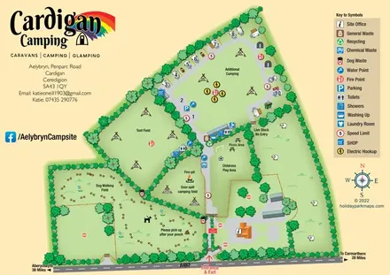
Illustrated farm-campsite map with mixed accommodation, named camping fields and a dedicated dog-walking area.
 Explore the map ↗
United Kingdom
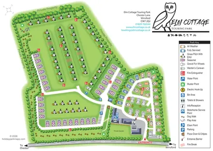
Tree-lined touring park plan with colour-coded pitches, a pawprint dog walk and distinctive owl branding.
 Explore the map ↗
United Kingdom
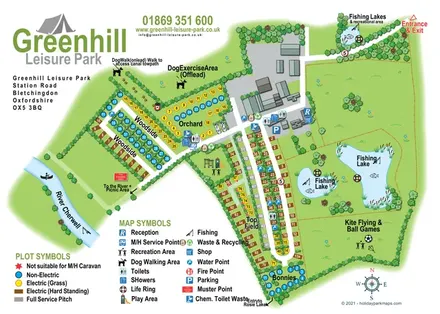
Illustrated camping and touring map with fishing lakes, dog areas and colour-coded pitches.
Features may come from the sample artwork, its key or published park information. Approximate numbers describe the drawing and may cover only part of a park. They are intended to help you compare map examples. Current facilities and booking information should be checked with the park.
TAKE A CLOSER LOOK
View the illustrated map in detail or choose a file to download. These are sample maps; contact the park for current visitor information.


LET’S MAP YOUR PARK
For a map quotation, find your park and draw a rough boundary around it. The area you select helps us work out the design time and price.
Draw your park for a quote ↗Or talk to our map designers
01751 473136