
River Thames
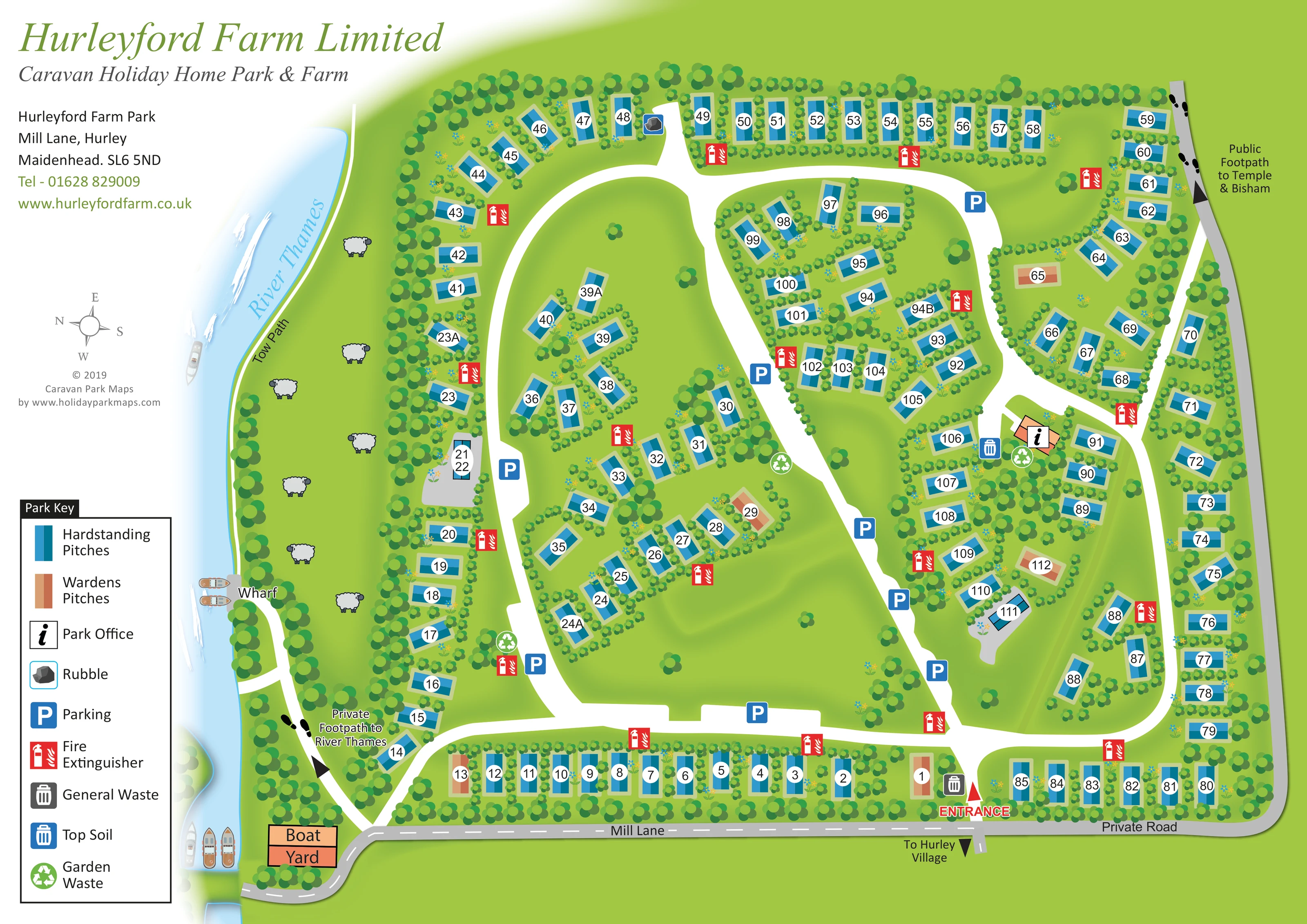
The River Thames forms a prominent pale-blue strip down the left side of the composition, with illustrated boats and white water highlights.
ILLUSTRATED PARK MAP · P502
Hurleyford Farm Park, Mill Lane, Hurley, Maidenhead · United Kingdom
 Enlarge the map ↗
A SENSE OF THE PLACE
Hurleyford Farm is a family-run, child-free holiday home park beside the Thames between Henley and Marlow. Mature, level parkland and surrounding farmland create its riverside setting.
The park is intended for owners of holiday caravans, with Hurley village and the Thames Path nearby. The map shows the arrangement of homes and access routes across the grounds.
LOOK CLOSER
The River Thames forms a prominent pale-blue strip down the left side of the composition, with illustrated boats and white water highlights.
Dense tree belts enclose the park and riverside strip. Small shrubs and flowers separate many pitches, while larger open green areas remain within the internal road network.
Sheep illustrations occupy the grassy strip between the river and the accommodation boundary, conveying the farm setting rather than an animal attraction.
A small illustrated building with an information symbol sits beside an internal junction in the right-hand half of the park.
Blue P symbols mark several parking locations beside the internal roads rather than a single central car park.
Repeated red extinguisher symbols are distributed around the pitch groups and road network.
Mapped symbols distinguish general waste, garden waste, top soil and rubble. General waste appears near the entrance, garden-waste symbols occur at several internal locations, and top soil is marked beside the office area.
A small number of orange pitch symbols distinguish wardens' locations from the blue hardstanding pitches.
A small illustrated building with an information symbol sits beside an internal junction in the right-hand half of the park.
Blue P symbols mark several parking locations beside the internal roads rather than a single central car park.
Repeated red extinguisher symbols are distributed around the pitch groups and road network.
Mapped symbols distinguish general waste, garden waste, top soil and rubble. General waste appears near the entrance, garden-waste symbols occur at several internal locations, and top soil is marked beside the office area.
A small number of orange pitch symbols distinguish wardens' locations from the blue hardstanding pitches.
A labelled orange building beside the river lies at the lower-left end of Mill Lane. Boats nearby reinforce its riverside context without establishing a visitor boating service.
A labelled riverside landing with illustrated boats is shown along the left-hand edge.
The River Thames forms a prominent pale-blue strip down the left side of the composition, with illustrated boats and white water highlights.
Dense tree belts enclose the park and riverside strip. Small shrubs and flowers separate many pitches, while larger open green areas remain within the internal road network.
Sheep illustrations occupy the grassy strip between the river and the accommodation boundary, conveying the farm setting rather than an animal attraction.
A red ENTRANCE label and arrow identify the access point from Mill Lane along the lower edge of the map.
The grey external road follows the lower boundary and curves up the right-hand side, where it is labelled Private Road.
Broad white routes loop through the grounds, connecting perimeter pitches, interior clusters, parking and the office.
A labelled white path branches towards the river and wharf near the lower-left corner, accompanied by footprint symbols.
A narrow labelled route follows the river along the left side of the artwork.
A directional label, footprints and an arrow identify the onward public footpath along the upper-right boundary.
An arrow beside Mill Lane points towards Hurley village beyond the depicted grounds.
READING THE MAP
This illustrated map of Hurleyford Farm Park places a caravan holiday-home layout within its distinctive Thames-side farm setting. The river runs down the left of the artwork, accompanied by a towpath, a labelled wharf, boats and a grassy strip illustrated with sheep. Across the main grounds, blue numbered hardstanding pitches follow tree-lined boundaries and gather in smaller groups around broad white internal roads.
The plan combines individual pitch finding with practical orientation. A clearly marked entrance leads from Mill Lane, while parking, fire-extinguisher points and waste facilities provide useful reference points around the park. Orange symbols distinguish wardens' pitches, and a small illustrated office gives the central-right area a recognisable landmark. Labels also identify the private footpath to the river and the public route towards Temple and Bisham.
A large title and contact panel sit above the boxed key on the left, leaving most of the landscape page for the grounds. The combination of simple pitch symbols, planted borders and riverside illustration makes this a useful sample for established holiday-home parks with a strong landscape identity.
The single landscape-format plan shows the park as a tree-enclosed layout between the River Thames and a curving boundary road. Mill Lane runs across the bottom, passing the boat yard at the riverside end and the red-labelled main entrance further along. The road continues around the right-hand boundary as a private road. Inside, broad white routes form connected loops and branches, separating long perimeter rows from angled groups of pitches and open lawns.
Accommodation is shown through numbered hardstanding symbols rather than detailed caravan illustrations. Blue rectangles sit within pale green pitch borders, with small shrubs and flowers between neighbouring plots. A few orange rectangles identify wardens' pitches. White number discs remain prominent against both colours. Parking markers are spread along the internal routes, and red fire-extinguisher symbols appear throughout the accommodation areas.
The office is drawn as a small roofed building beside a junction in the right-hand half of the plan. Nearby and elsewhere, distinct symbols identify general waste, garden waste, top soil and rubble. The large Park Key explains these categories as well as pitch colours, parking and the office marker.
Landscape detail is especially important along the left edge. Pale-blue water, boats and white highlights establish the Thames; a labelled wharf and boat yard provide specific landmarks. A private footpath connects towards the river, while the towpath and the public footpath towards Temple and Bisham place the grounds within a wider walking setting. Trees, sheep and planted pitch edges convey the park's farm and parkland character. A rotated compass, company heading and contact panel complete the composition. The accompanying enlarged view reveals the same artwork's key and riverside corner in greater detail, rather than a separate park section.
KEEP EXPLORING
Chosen for shared landscapes, accommodation or facilities.
 Explore the map ↗
United Kingdom
Riverside park map with named pitch fields, illustrated huts and a paw-print dog walk.
 Explore the map ↗
United Kingdom
Illustrated lakeside park plan with numbered holiday units, leisure buildings and a looping Woodland Walk.
 Explore the map ↗
United Kingdom
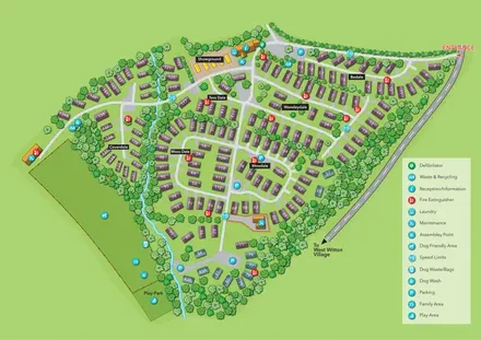
Numbered holiday homes, named sections and a tree-lined stream at Chantry Holiday Park.
Features may come from the sample artwork, its key or published park information. Approximate numbers describe the drawing and may cover only part of a park. They are intended to help you compare map examples. Current facilities and booking information should be checked with the park.
LET’S MAP YOUR PARK
For a map quotation, find your park and draw a rough boundary around it. The area you select helps us work out the design time and price.
Draw your park for a quote ↗Or talk to our map designers
01751 473136