
Ponds and wooded island
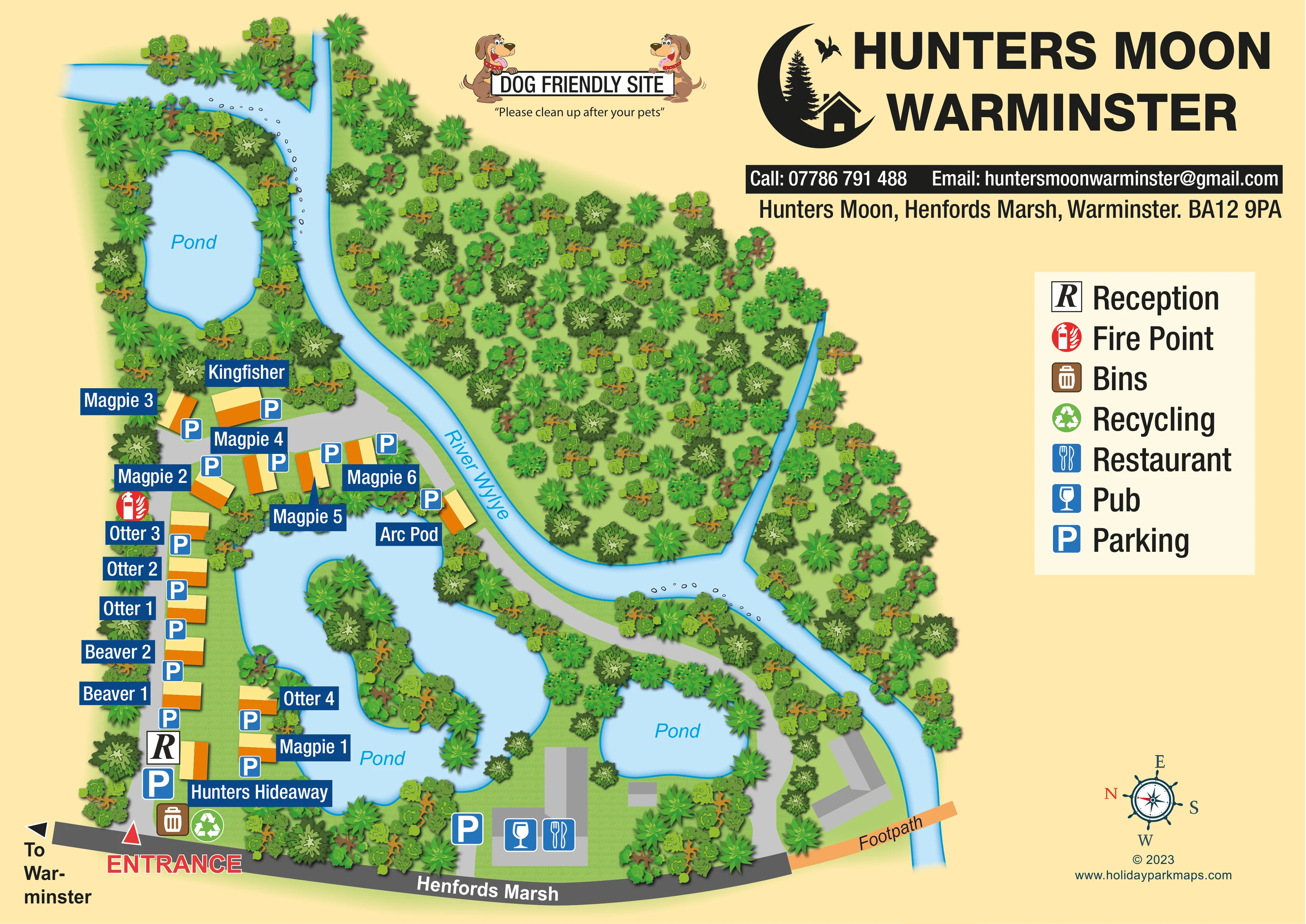
Three separate water shapes are labelled Pond: an upper-left pond, a large central pond surrounding an elongated wooded island, and a smaller pond near the pub/restaurant.
ILLUSTRATED PARK MAP · P172
Hunters Moon, Henfords Marsh, Warminster · United Kingdom
 Enlarge the map ↗
A SENSE OF THE PLACE
Hunters Moon Lodges is based at Henfords Marsh, Warminster. The Arc Pod is beside the River Were, with two wildlife lakes on site. Self-catering lodges and a pod cater for couples, families and small groups.
All advertised lodges have private hot tubs; Kingfisher and Hunters Hideaway additionally have private infrared saunas. Several lodges welcome dogs, but Magpie 3 is explicitly pet-free.
LOOK CLOSER
Three separate water shapes are labelled Pond: an upper-left pond, a large central pond surrounding an elongated wooded island, and a smaller pond near the pub/restaurant.
A broad, branching blue watercourse curves from the upper edge through the wooded setting and continues towards the lower-right edge.
Dense illustrated tree canopies frame the accommodation, river banks and ponds, with a large wooded area across the river.
An R marker locates reception beside the lower section of the accommodation lane, close to the entrance and Hunters Hideaway.
Blue P symbols accompany the named accommodation, with further parking marked near reception and the pub/restaurant building.
A glass symbol marks the roadside building below the smaller lower-right pond.
A cutlery symbol shares the roadside building marked as a pub, beside Henfords Marsh.
Bin and recycling markers are grouped just inside the entrance.
An R marker locates reception beside the lower section of the accommodation lane, close to the entrance and Hunters Hideaway.
Blue P symbols accompany the named accommodation, with further parking marked near reception and the pub/restaurant building.
A glass symbol marks the roadside building below the smaller lower-right pond.
A cutlery symbol shares the roadside building marked as a pub, beside Henfords Marsh.
Bin and recycling markers are grouped just inside the entrance.
A red fire-point symbol is placed beside the western lane near Magpie 2 and Otter 3.
Three separate water shapes are labelled Pond: an upper-left pond, a large central pond surrounding an elongated wooded island, and a smaller pond near the pub/restaurant.
A broad, branching blue watercourse curves from the upper edge through the wooded setting and continues towards the lower-right edge.
Dense illustrated tree canopies frame the accommodation, river banks and ponds, with a large wooded area across the river.
A red triangle and large ENTRANCE label identify the lower-left arrival point from the dark-grey roadside strip.
A grey lane runs up the western accommodation row, bends around the upper side of the central pond and follows the river towards the lower-right grounds.
An orange strip labelled Footpath extends from the lower-right roadside edge across the illustrated watercourse.
A left-pointing arrow at the end of Henfords Marsh directs visitors towards Warminster.
A prominent banner held by two cartoon dogs reads DOG FRIENDLY SITE, with a request to clean up after pets. This is site-level artwork messaging, not a statement that every lodge accepts dogs.
READING THE MAP
This illustrated map of Hunters Moon Lodges at Henfords Marsh, Warminster, brings a small waterside lodge park into a single, easy-to-read view. Named accommodation sits among ponds, river channels and thickly illustrated trees, with a large island-filled pond providing the main visual landmark. The map shows roughly 15 accommodation units, including the separately named Arc Pod, rather than a large grid of numbered pitches.
The arrival point is clearly marked from Henfords Marsh, with reception, parking, bins and recycling grouped nearby. Blue parking symbols accompany the accommodation, while a roadside building is identified with pub and restaurant symbols. A footpath crossing the river and an arrow towards Warminster add useful connections beyond the lodge layout.
Cream-and-orange roof shapes, navy nameplates and pale blue water give the plan a distinctive graphic hierarchy. The generous right-hand area holds the Hunters Moon branding, contact details and facility key, while a cartoon dog banner adds a friendly note above the landscape. It is a useful example of a compact lodge-park map that makes the setting as recognisable as the accommodation.
The plan is organised around the relationship between the accommodation, the water and the access lanes. Henfords Marsh runs along the bottom edge, with the entrance highlighted by a red triangle and a large outlined label at the lower left. Just inside this arrival point, the map places reception, parking and the bin and recycling symbols. A light-grey lane continues up the western side of the park, serving a row of named lodges before bending towards Kingfisher and the upper accommodation group.
Magpie, Otter and Beaver names appear in white lettering on navy panels, alongside Hunters Hideaway and Kingfisher. The lodge blocks have simple cream-and-orange roofs, and parking symbols sit close to them. Arc Pod is labelled beside the river-side route, at the upper-right edge of the large central pond. Two further lodges sit beside the pond’s lower-left shore.
Three water shapes carry Pond labels. The largest surrounds a long, densely wooded island; another lies above Kingfisher, and a smaller pond sits near the roadside pub/restaurant building. The river, labelled River Wylye in the artwork, curves through a broad wooded area before continuing down the right-hand edge. The grey internal route follows part of this waterside corridor. An orange footpath crosses the river near the bottom right, beside an unlabelled grey building.
The right-hand legend explains seven facility symbols, all supported by markers within the plan. Above it, the oversized park name and crescent-moon logo establish the identity. A separate dog-friendly banner, a Warminster direction arrow and a decorative compass complete the visitor information. The enlarged views reveal details of this same single-page design rather than additional park sections.
KEEP EXPLORING
Chosen for shared landscapes, accommodation or facilities.
 Explore the map ↗
United Kingdom
A woodland estate park map combining caravan loops, touring pitches, riverside paths and Bruce’s Cave landmarks.
 Explore the map ↗
United Kingdom
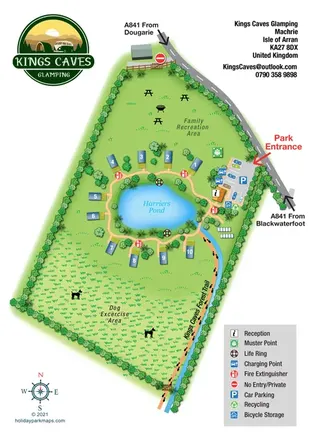
Pond-centred glamping map with numbered lodges, recreation lawns and a footprint-marked forest trail.
 Explore the map ↗
United Kingdom
Woodland camping, lodges, lakes and colour-coded bike trails at Avon Tyrrell Outdoor Centre.
Features may come from the sample artwork, its key or published park information. Approximate numbers describe the drawing and may cover only part of a park. They are intended to help you compare map examples. Current facilities and booking information should be checked with the park.
LET’S MAP YOUR PARK
For a map quotation, find your park and draw a rough boundary around it. The area you select helps us work out the design time and price.
Draw your park for a quote ↗Or talk to our map designers
01751 473136