
Haverah Beck
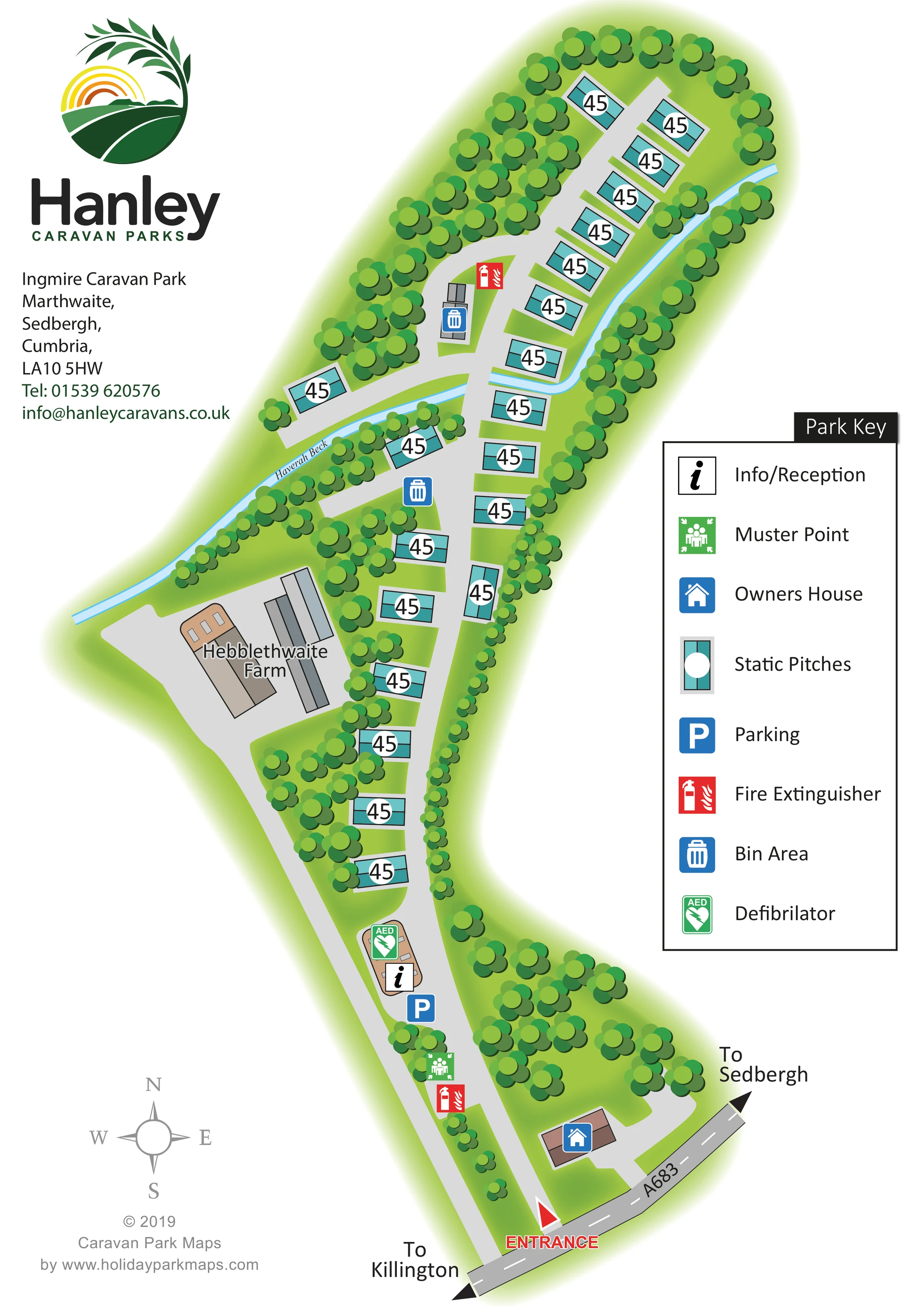
A named light-blue watercourse runs diagonally across the plan before following the eastern side of the upper pitch group.
ILLUSTRATED PARK MAP · P504
Marthwaite, Sedbergh, Cumbria · United Kingdom
 Enlarge the map ↗
A SENSE OF THE PLACE
Ingmire Caravan Park is located west of Sedbergh between the rivers Rawthey and Lune. Its position provides countryside views and access to outings around Cumbria.
Published park information describes toilet and washing facilities on site. The map helps guests understand the accommodation areas and internal routes within this setting near the A684 and A683.
LOOK CLOSER
A named light-blue watercourse runs diagonally across the plan before following the eastern side of the upper pitch group.
Dense stylised trees enclose the upper end, line much of the eastern boundary and separate several pitches and adjoining areas.
A labelled group of farm buildings and a broad grey yard provide a neighbouring landmark on the western side of the plan.
An information symbol marks a small building beside the lower part of the internal drive, near parking and the defibrillator.
A blue parking symbol is positioned beside the reception area.
A brown-roofed building near the A683 frontage is marked with the owner's-house symbol and has a short access branch.
A green AED symbol is placed at the reception building.
A green assembly symbol appears beside the entrance stretch of the internal drive.
An information symbol marks a small building beside the lower part of the internal drive, near parking and the defibrillator.
A blue parking symbol is positioned beside the reception area.
A brown-roofed building near the A683 frontage is marked with the owner's-house symbol and has a short access branch.
A green AED symbol is placed at the reception building.
A green assembly symbol appears beside the entrance stretch of the internal drive.
Red fire-extinguisher symbols mark locations near the entrance route and in the upper accommodation area.
Blue bin symbols identify waste points in the middle and upper parts of the park.
A named light-blue watercourse runs diagonally across the plan before following the eastern side of the upper pitch group.
Dense stylised trees enclose the upper end, line much of the eastern boundary and separate several pitches and adjoining areas.
A labelled group of farm buildings and a broad grey yard provide a neighbouring landmark on the western side of the plan.
A red arrow and prominent entrance label mark access from the A683 at the bottom of the artwork.
Black arrowheads at opposite ends of the illustrated A683 indicate Sedbergh and Killington.
A pale grey drive runs through the elongated site, crossing the beck and branching towards the farm, western pitches and upper accommodation group.
Published park information mentions toilet and washing facilities; these are not separately identified on this artwork.
READING THE MAP
This illustrated map of Ingmire Caravan Park presents a small, tree-lined static-caravan site at Marthwaite, near Sedbergh in Cumbria. Its long, narrow layout is organised around a drive leading from the A683, with accommodation extending towards a wooded upper end. A pale-blue beck threads through the plan, while Hebblethwaite Farm provides a clearly named landmark beside the central accommodation area.
The artwork combines a straightforward overhead plan with colourful landscape details. Turquoise caravan symbols stand out against bright green ground, and clusters of rounded trees show how the pitches sit within planted boundaries. Arrival information is concentrated towards the lower end: the entrance, owner's house, reception, parking, muster point and defibrillator are all marked with distinctive symbols.
A large Park Key sits alongside the drawing, balanced by Hanley Caravan Parks branding and the park's contact details on the left. The result is a useful sample for smaller countryside parks that need to explain a linear layout, identify practical facilities and retain a recognisable sense of their setting without using a highly detailed aerial illustration.
The portrait artwork follows the park from its A683 entrance at the bottom of the page to a tree-enclosed accommodation area at the top. Black arrows on the main road point towards Sedbergh and Killington, while a red entrance arrow establishes the starting point for the internal route. A short branch serves the owner's house near the frontage; the main drive continues past the muster point and a reception building marked with information and AED symbols. Parking is shown immediately beside this arrival area.
Further into the park, static pitches sit in a staggered sequence beside the drive. Their turquoise roof shapes and white circular label panels contrast with the brown and grey ancillary buildings. Planting groups interrupt the rows, and a closely spaced line of trees defines much of the eastern boundary. To the west, Hebblethwaite Farm is drawn as a group of roofed buildings within a broad grey yard, creating a useful landmark distinct from the caravans.
Haverah Beck cuts diagonally across the central plan and curves along the upper pitch area. The internal road crosses the watercourse and branches to serve pitches on either side. Bin and fire-extinguisher symbols identify practical points within this upper section, supplementing those closer to the entrance.
The large right-hand key explains all eight symbol types, including static pitches, reception, parking and emergency-related points. A compass appears in the lower-left margin beneath the branding and contact information. The accompanying enlargement shows the same key and roadside detail at a larger scale; it is not a separate park section or additional accommodation area.
KEEP EXPLORING
Chosen for shared landscapes, accommodation or facilities.
 Explore the map ↗
United Kingdom
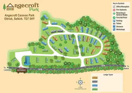
Tree-framed Angecroft Park map with colour-coded roofs, looping roads and a signed B709 entrance.
 Explore the map ↗
United Kingdom
Ashby Park map with seven fishing lakes, colour-coded accommodation and illustrated wooded shorelines.
 Explore the map ↗
United Kingdom
Woodland-framed Barnsoul map with mixed accommodation, shared facilities and paw-marked walking routes.
Features may come from the sample artwork, its key or published park information. Approximate numbers describe the drawing and may cover only part of a park. They are intended to help you compare map examples. Current facilities and booking information should be checked with the park.
LET’S MAP YOUR PARK
For a map quotation, find your park and draw a rough boundary around it. The area you select helps us work out the design time and price.
Draw your park for a quote ↗Or talk to our map designers
01751 473136