
Loch Lomond
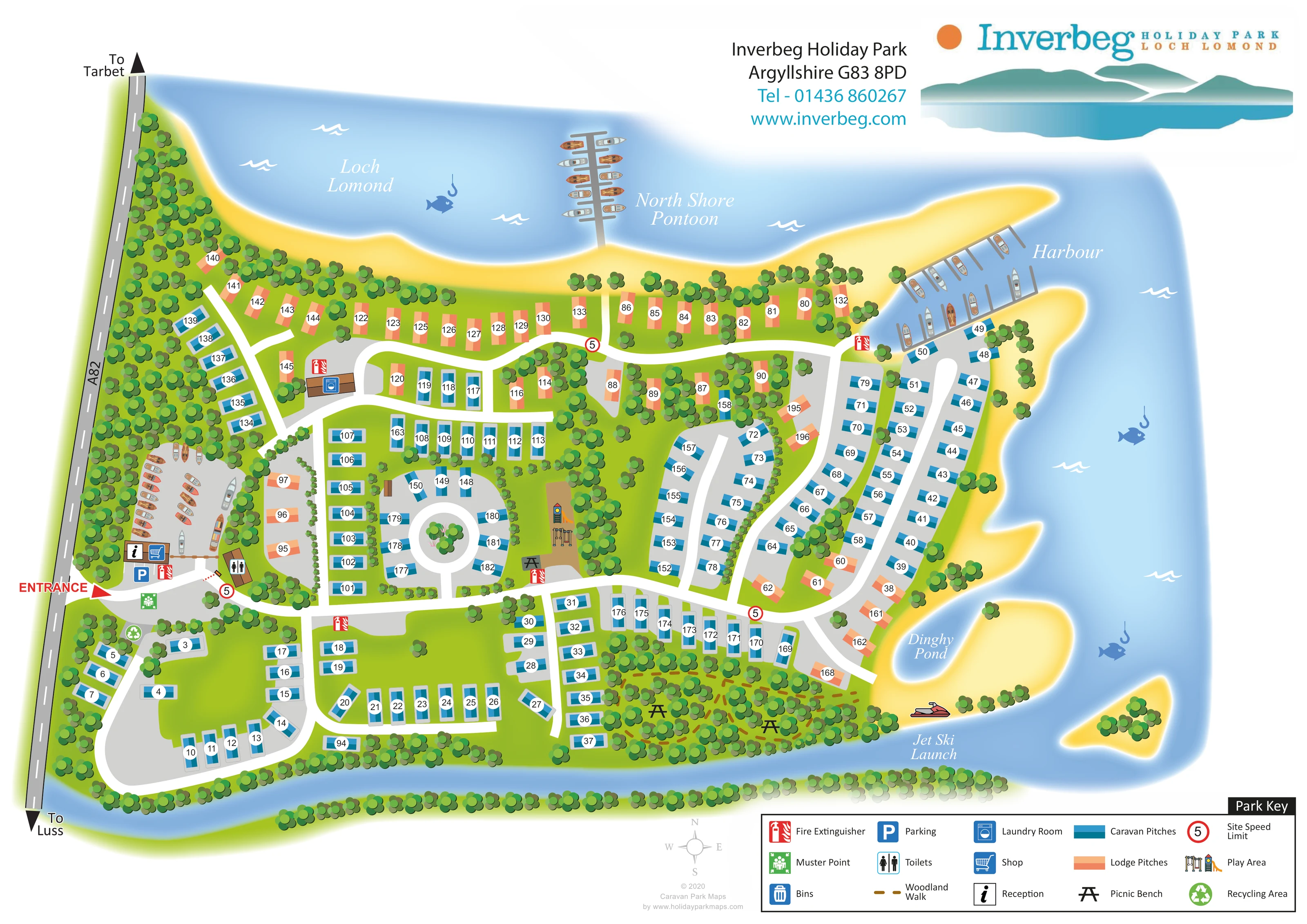
The named loch fills the upper and right-hand sides of the plan, giving the accommodation a strongly waterside setting.
ILLUSTRATED PARK MAP · P505
Inverbeg Holiday Park, Argyllshire · United Kingdom
 Enlarge the map ↗
A SENSE OF THE PLACE
Inverbeg Holiday Park occupies a lochside setting on Loch Lomond north of Luss. It focuses on caravan and lodge ownership, with new and pre-owned holiday homes available.
A private harbour, pontoon and dinghy pond provide facilities for owners interested in the water. A children's area and shop add conveniences on site, while the map shows the relationship between holiday homes and the loch shore.
LOOK CLOSER
The named loch fills the upper and right-hand sides of the plan, giving the accommodation a strongly waterside setting.
Yellow shoreline bands trace bays, narrow projections and a small offshore island; they are illustrative landscape treatment rather than a statement about beach access.
A narrow blue channel follows the southern boundary and joins the broader loch water at the right.
Dense trees screen the A82 edge, divide accommodation groups and form a substantial wooded area in the south-east.
A labelled pontoon projects into the loch from the northern shore, illustrated with boats along both sides.
The north-eastern harbour is shown as a sheltered inlet with branching mooring structures and boats.
A small labelled water pocket sits beside the south-eastern accommodation and shoreline.
A labelled launch location with a jet ski illustration appears on the lower-right shore.
The named loch fills the upper and right-hand sides of the plan, giving the accommodation a strongly waterside setting.
Yellow shoreline bands trace bays, narrow projections and a small offshore island; they are illustrative landscape treatment rather than a statement about beach access.
A narrow blue channel follows the southern boundary and joins the broader loch water at the right.
Dense trees screen the A82 edge, divide accommodation groups and form a substantial wooded area in the south-east.
A labelled pontoon projects into the loch from the northern shore, illustrated with boats along both sides.
The north-eastern harbour is shown as a sheltered inlet with branching mooring structures and boats.
A small labelled water pocket sits beside the south-eastern accommodation and shoreline.
A labelled launch location with a jet ski illustration appears on the lower-right shore.
Reception and shopping symbols mark the small arrival building just inside the western entrance.
A blue parking symbol identifies parking beside the entrance facilities.
A toilet symbol marks a separate small building immediately east of the reception area.
A laundry symbol identifies a building beside the upper-western internal road.
An illustrated slide and climbing equipment occupy a brown rectangular area near the centre of the park.
Black picnic-table symbols appear beside the play area and within the south-eastern woodland.
An ochre dashed route threads through the south-eastern trees, using the woodland-walk convention in the key.
A green recycling symbol appears just south of the entrance.
Repeated red fire-extinguisher symbols are distributed around the roads and facilities; a green muster-point symbol appears near the entrance.
A bin symbol is included in the Park Key, but its position is not clearly identifiable on the main plan.
A red entrance arrow marks access from the A82 on the left, with onward directions to Tarbet and Luss.
Broad pale-grey roads connect the arrival area to curving loops, shoreline branches and a small circular court.
Red-ringed signs displaying 5 appear at several internal junctions and are explained in the key as the site speed limit.
Several boats are drawn on a grey land area behind reception. The area is not named, so a specific storage or service function is not assigned.
READING THE MAP
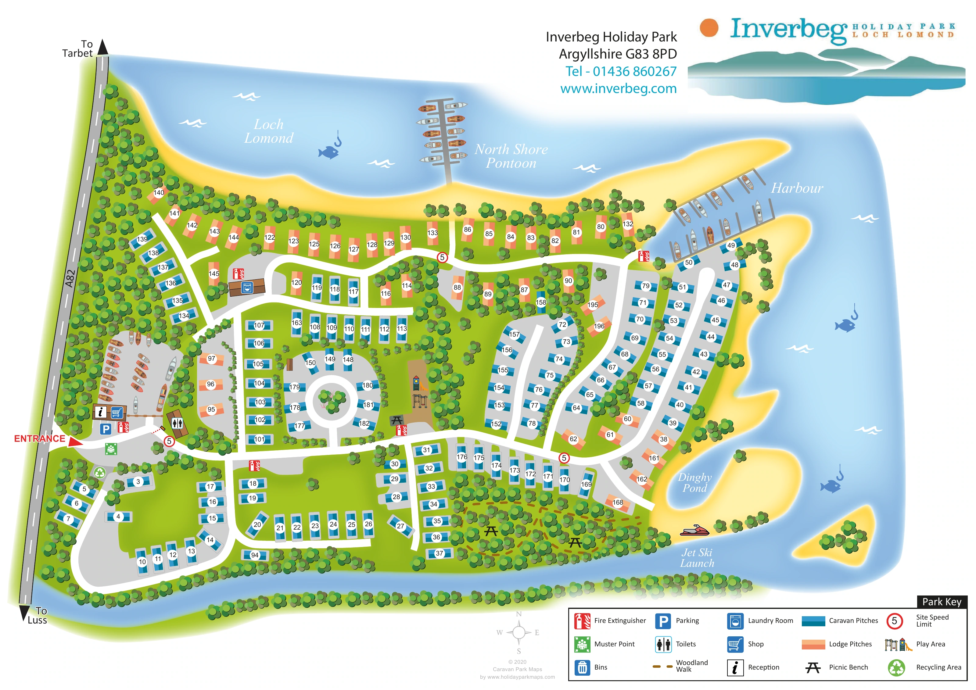
This illustrated map of Inverbeg Holiday Park places Loch Lomond at the centre of the visitor’s understanding of the site. Blue water wraps around the northern and eastern shores, while tree belts and a narrow southern water channel frame the accommodation. The A82 and a clearly marked entrance establish the arrival point on the western edge, with reception, the shop, parking and toilets grouped nearby.
The map distinguishes caravan pitches in blue from lodge pitches in peach and coral, making the accommodation pattern readable without detailed building drawings. Numbered units follow curving roads, shoreline rows and a small circular court, with woodland separating many of the groups. The waterside facilities receive particular attention: the North Shore Pontoon, harbour, Dinghy Pond and Jet Ski Launch are all named and illustrated.
A central play area, picnic benches and a dashed woodland walk add useful destinations away from the accommodation. Together with the boxed Park Key and prominent Inverbeg branding, these details make this a distinctive example of a holiday-park plan shaped around its lochside landscape.
The plan is drawn mainly from above, with the A82 running down the left edge and Loch Lomond occupying the top and right of the sheet. A red entrance arrow leads into a compact arrival area containing reception, shop, parking and toilet symbols. Boats are also illustrated on a grey area behind the arrival buildings, although that area has no specific label. A separate laundry building sits farther along the upper-western road.
Inside the park, broad pale-grey roads divide the accommodation into several recognisable groups. The southern section uses a large looping road, the centre includes a small circular court, and the eastern side has long curving rows following the water. Peach-and-coral lodge pitches are especially prominent along the northern shoreline, while blue caravan pitches occupy much of the southern and eastern accommodation. Each depicted pitch carries a white circular number label.
The landscape is integral to the drawing. Repeated rounded tree canopies create a dense western screen and smaller belts between pitches, with a larger woodland patch in the south-east. An ochre dashed walk passes through this area, where picnic-table symbols provide additional landmarks. The central play area is illustrated with a slide and climbing equipment.
Along the loch, boats give visual substance to the labelled North Shore Pontoon and harbour. The Dinghy Pond and Jet Ski Launch identify further waterside destinations. Red fire-extinguisher symbols, a green muster point, recycling and mapped speed-limit signs support practical orientation. A lower-right key explains the visual conventions, while the upper-right logo and mountain-and-loch graphic complete the page. The accompanying detail views enlarge the lower margin and key; they are crops of this same plan, not separate park sections.
KEEP EXPLORING
Chosen for shared landscapes, accommodation or facilities.
 Explore the map ↗
United Kingdom
Illustrated lakeside park plan with numbered holiday units, leisure buildings and a looping Woodland Walk.
 Explore the map ↗
United Kingdom
Colour-coded accommodation, lakeside facilities and woodland routes at Burton Constable Holiday Park & Arboretum.
 Explore the map ↗
United Kingdom
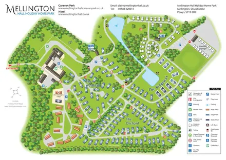
Wooded estate map with named lodge areas, lakeside touring, a hall-side arrival hub and Offa's Dyke Path.
Features may come from the sample artwork, its key or published park information. Approximate numbers describe the drawing and may cover only part of a park. They are intended to help you compare map examples. Current facilities and booking information should be checked with the park.
TAKE A CLOSER LOOK
View the illustrated map in detail or choose a file to download. These are sample maps; contact the park for current visitor information.


LET’S MAP YOUR PARK
For a map quotation, find your park and draw a rough boundary around it. The area you select helps us work out the design time and price.
Draw your park for a quote ↗Or talk to our map designers
01751 473136
 inverbeg_large.png