
Woodland and tree-lined clearings
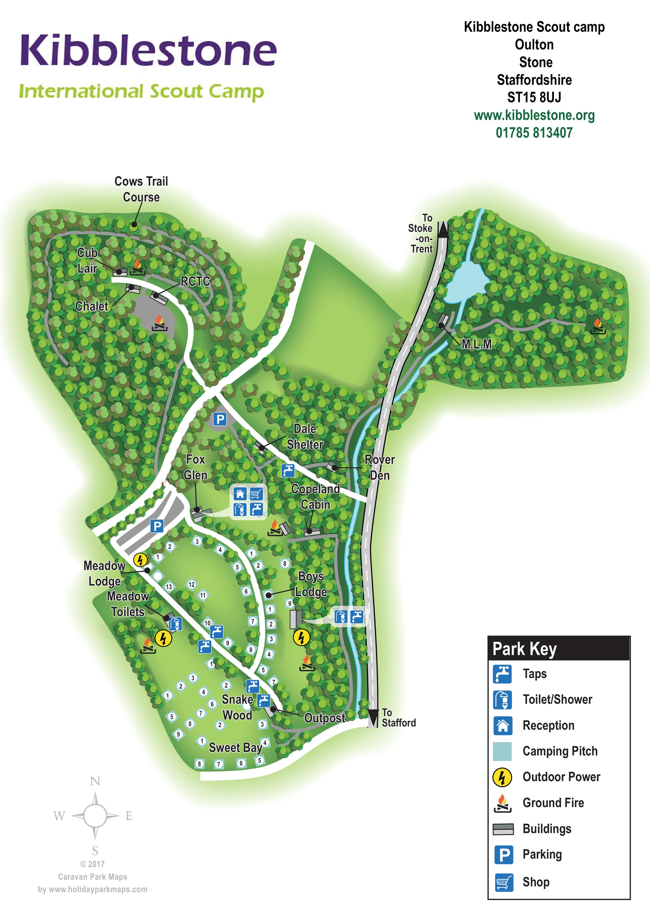
Dense illustrated tree cover defines two northern woodland lobes and encloses the more open southern camping spaces.
ILLUSTRATED PARK MAP · P509
Kibblestone Scout camp, Oulton, Stone, Staffordshire · United Kingdom
 Enlarge the map ↗
A SENSE OF THE PLACE
Kibblestone is a Scout campsite and activity centre near Stone in Staffordshire. Camping areas and several indoor accommodation blocks support organised groups of different sizes.
Adventure and team-building activities form a central part of the site, alongside events for younger groups and business sessions. The camp's history dates to 1927, and its map helps organisers plan their use of the extensive grounds.
LOOK CLOSER
Dense illustrated tree cover defines two northern woodland lobes and encloses the more open southern camping spaces.
A narrow cyan watercourse runs beside the eastern road and widens into a pale blue pool in the north-eastern woodland.
A blue reception symbol appears in the central service cluster near Fox Glen.
A shopping-trolley symbol marks the shop alongside reception in the central service cluster.
Combined toilet/shower symbols appear centrally, near Meadow Toilets and beside Boys Lodge.
Blue tap symbols are distributed around the service hub and southern camping areas.
Yellow circular lightning symbols identify outdoor power locations around the meadow and Boys Lodge areas.
Flame-and-log symbols mark ground-fire locations in both northern woodland lobes and near the southern camping clearings.
A blue reception symbol appears in the central service cluster near Fox Glen.
A shopping-trolley symbol marks the shop alongside reception in the central service cluster.
Combined toilet/shower symbols appear centrally, near Meadow Toilets and beside Boys Lodge.
Blue tap symbols are distributed around the service hub and southern camping areas.
Yellow circular lightning symbols identify outdoor power locations around the meadow and Boys Lodge areas.
Flame-and-log symbols mark ground-fire locations in both northern woodland lobes and near the southern camping clearings.
Two blue parking symbols mark grey areas on the western side of the central route network.
Leader lines identify Cub Lair, Chalet, RCTC, M.L.M, Dale Shelter, Rover Den, Copeland Cabin, Fox Glen, Meadow Lodge, Boys Lodge and Outpost. The abbreviations and individual building functions are not expanded.
A labelled course follows the wooded perimeter of the north-western lobe.
Dense illustrated tree cover defines two northern woodland lobes and encloses the more open southern camping spaces.
A narrow cyan watercourse runs beside the eastern road and widens into a pale blue pool in the north-eastern woodland.
Broad white routes branch between buildings and camping areas; narrower grey paths wind through woodland and alongside the watercourse.
The eastern road is labelled towards Stoke-on-Trent at the top and Stafford at the bottom, with black directional arrows.
A pale grey compass rose below the plan provides orientation with north towards the top of the page.
READING THE MAP
This illustrated map of Kibblestone International Scout Camp presents a wooded group campsite near Stone in Staffordshire. Rather than showing rows of holiday caravans, it brings together camping clearings, named camp buildings and practical facilities within an irregular landscape of trees, paths and water. Two broad woodland areas occupy the upper part of the plan, while numbered camping markers follow the more open grounds to the south.
The artwork gives organisers and visitors several ways to find their bearings. Buildings such as Copeland Cabin, Boys Lodge, Cub Lair and Outpost provide recognisable destinations, supported by symbols for reception, the shop, parking, taps and toilets/showers. Ground-fire locations and outdoor power points receive their own distinctive symbols. An eastern road carries directions towards Stafford and Stoke-on-Trent, and a compass rose helps relate the plan to the surrounding area.
The combination of a simple overhead layout and abundant illustrated trees makes this a useful sample for Scout camps, outdoor centres and group campsites where landscape, shared facilities and named activity spaces matter more than a conventional accommodation grid.
The portrait artwork places Kibblestone’s purple and lime title above a large illustrated site plan, with address and contact information in the opposite corner. The camp’s outline is irregular: a wooded north-western lobe contains Cub Lair, Chalet and RCTC, with the labelled Cows Trail Course following its outer woodland route. Across the page, a second woodland lobe contains M.L.M, a ground-fire symbol and a pool connected to the narrow watercourse running south beside the road.
Broad white internal routes branch through the central grounds and lead towards the camping clearings. Smaller grey paths provide a separate visual layer through the trees. Dale Shelter and Rover Den sit around the central connecting routes, while Fox Glen and Copeland Cabin help identify the service area. Reception, shop, toilets/showers and taps are grouped here using blue pictograms; parking is marked on the western side.
The lower section is more open, with pale turquoise numbered camping markers arranged around curved routes and tree-lined lawns. Meadow Lodge, Meadow Toilets and Boys Lodge are labelled among these spaces. Snake Wood and Sweet Bay name the southern camping areas, and Outpost marks a building close to the southern road connection. Water points, outdoor power and ground-fire symbols are distributed through this part of the plan.
A large lower-right key explains all nine symbol types. Black labels with white outlines, leader lines and dots distinguish named destinations from the dense tree illustration. The lower-left compass completes the page. The accompanying detail views enlarge portions of this same artwork, including the southern camping markers and key; they are not separate site plans.
KEEP EXPLORING
Chosen for shared landscapes, accommodation or facilities.
 Explore the map ↗
United Kingdom
Illustrated coastal campsite plan with named fields, electric pitch colours, beach routes and the Afon Hen.
 Explore the map ↗
United Kingdom
Woodland camping, lodges, lakes and colour-coded bike trails at Avon Tyrrell Outdoor Centre.
 Explore the map ↗
United Kingdom
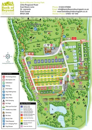
Colour-coded touring pitches, named glamping units and woodland routes at Back of Beyond Touring Park.
Features may come from the sample artwork, its key or published park information. Approximate numbers describe the drawing and may cover only part of a park. They are intended to help you compare map examples. Current facilities and booking information should be checked with the park.
TAKE A CLOSER LOOK
View the illustrated map in detail or choose a file to download. These are sample maps; contact the park for current visitor information.


LET’S MAP YOUR PARK
For a map quotation, find your park and draw a rough boundary around it. The area you select helps us work out the design time and price.
Draw your park for a quote ↗Or talk to our map designers
01751 473136