
Two ponds with fishing symbols
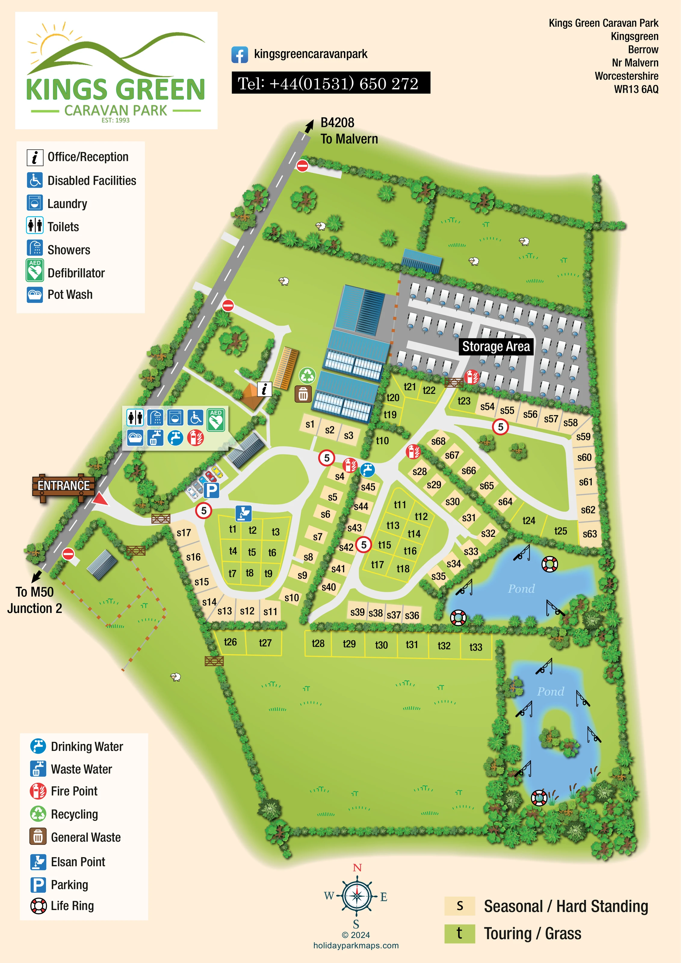
Two blue ponds occupy the eastern side. Fishing-rod symbols line their banks; the southern pond has a planted island.
ILLUSTRATED PARK MAP · P181
Kings Green Caravan Park, Kingsgreen, Berrow, Nr Malvern, Worcestershire · United Kingdom
 Enlarge the map ↗
A SENSE OF THE PLACE
Kings Green Caravan Park is located near Berrow and Malvern in Worcestershire. Its facilities support caravan stays with a purpose-built toilet and shower block.
Covered washing-up spaces and laundry equipment provide practical conveniences, and secure caravan storage is also offered. The map helps visitors understand the park's layout and locate shared facilities during their stay.
LOOK CLOSER
Two blue ponds occupy the eastern side. Fishing-rod symbols line their banks; the southern pond has a planted island.
Dense illustrated planting divides pitch areas and encloses the park. Open fields, sheep motifs, gates and fencing establish the rural surroundings.
Information symbol beside a small orange-roofed building near the western arrival and service area.
Toilet and shower symbols grouped in a service panel near the entrance-side buildings.
Wheelchair symbol within the main service cluster, identified in the legend as 'Disabled Facilities'; the artwork does not specify individual adaptations.
Laundry and washing-up symbols appear in the entrance-side service cluster.
Green AED symbol in the main facilities panel.
Both are marked at the main facilities cluster, with an additional drinking-water symbol among the pitches.
Information symbol beside a small orange-roofed building near the western arrival and service area.
Toilet and shower symbols grouped in a service panel near the entrance-side buildings.
Wheelchair symbol within the main service cluster, identified in the legend as 'Disabled Facilities'; the artwork does not specify individual adaptations.
Laundry and washing-up symbols appear in the entrance-side service cluster.
Green AED symbol in the main facilities panel.
Both are marked at the main facilities cluster, with an additional drinking-water symbol among the pitches.
Chemical toilet disposal symbol beside the western touring grass grid.
Repeated red fire-point symbols at the service area, internal pitch junctions and storage-area boundary.
Green recycling and brown general-waste symbols beside the central-western buildings.
Blue parking symbol and a small row of illustrated cars just inside the entrance.
A labelled northern compound contains rows of caravan illustrations on grey surfacing, separated from guest pitches by planting and a gate.
Two blue ponds occupy the eastern side. Fishing-rod symbols line their banks; the southern pond has a planted island.
Life-ring symbols are positioned around both ponds.
Dense illustrated planting divides pitch areas and encloses the park. Open fields, sheep motifs, gates and fencing establish the rural surroundings.
A prominent entrance sign marks access from the western roadside. Pale internal roads branch into loops serving the touring and seasonal pitches.
The western road is labelled B4208 towards Malvern, with the opposite direction indicated towards M50 Junction 2.
Red-ringed '5' markers appear along internal roads. No-entry symbols mark other roadside accesses, and timber-style gates identify several boundaries.
READING THE MAP
This illustrated map of Kings Green Caravan Park places a practical caravan-site layout within its rural Worcestershire setting near Berrow and Malvern. A prominent entrance on the western side leads visitors towards parking, reception and the shared facilities before the internal roads branch into the pitch areas. Cream seasonal hardstanding pitches and green touring grass pitches are easy to distinguish, with letter prefixes and numbers providing a second layer of identification.
The landscape is an important part of the composition. Hedgerows separate the pitch groups, trees frame the boundaries, and two blue ponds bring a distinctive feature to the eastern side of the park. Fishing-rod illustrations and life-ring symbols give the waterside areas useful visual meaning, while surrounding fields and small sheep motifs convey the countryside character.
A separate caravan storage compound is clearly labelled at the northern end. Two generous symbol legends, a pitch-colour key and a compass complete a portrait design that combines arrival information, everyday service locations and a readable overview of the whole site.
The single portrait map follows the park from the B4208 frontage on the west to the ponds and planted boundaries on the east. Directional arrows identify the road towards Malvern and the route towards M50 Junction 2. A timber-style entrance sign draws attention to the main access, while other roadside openings carry no-entry symbols. Inside the entrance, illustrated cars and a blue parking marker establish the arrival area.
Reception is marked beside an orange-roofed building, with larger blue-roofed structures nearby. A grouped facilities panel identifies toilets, showers, laundry, disabled facilities, a defibrillator, pot wash, drinking water, waste water and a fire point. Recycling and general-waste symbols sit beside the buildings, while an Elsan point is marked near the western touring block. Further fire and drinking-water symbols appear among the pitches.
Pale internal roads form linked loops around the accommodation. Seasonal hardstanding pitches are shown as cream rectangles, often following the outside of a bend or lining a hedge. Touring grass pitches use green areas with yellow boundaries, including two central grids and a row adjoining the southern field. Black s and t labels link each pitch to the bottom key. The northern storage compound is visually separate: grey surfacing, rows of white caravans, a gate and a prominent black-backed label distinguish it from guest accommodation.
Two ponds occupy the eastern edge, with fishing-rod and life-ring symbols around their banks. The longer southern pond includes a planted island and reeds. Dense hedges, varied tree canopies, fenced fields and sheep illustrations soften the plan without obscuring its structure. The header carries park branding and contact details; two left-hand legends and a lower compass provide supporting information without covering the main pitch layout.
KEEP EXPLORING
Chosen for shared landscapes, accommodation or facilities.
 Explore the map ↗
United Kingdom
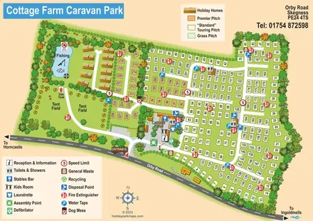
Illustrated touring and camping park map with numbered pitches, a fishing pond and a central farm courtyard.
 Explore the map ↗
United Kingdom
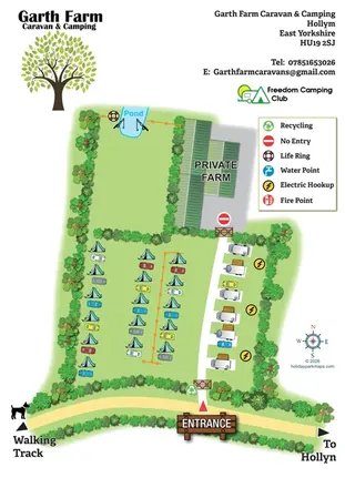
Illustrated farm campsite map with tent camping, electric touring bays, a pond and clearly marked private farm access.
 Explore the map ↗
United Kingdom
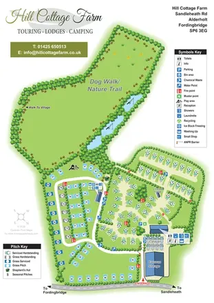
Portrait park map with mixed touring pitches, seasonal rows, ponds and an extensive dog walk.
Features may come from the sample artwork, its key or published park information. Approximate numbers describe the drawing and may cover only part of a park. They are intended to help you compare map examples. Current facilities and booking information should be checked with the park.
LET’S MAP YOUR PARK
For a map quotation, find your park and draw a rough boundary around it. The area you select helps us work out the design time and price.
Draw your park for a quote ↗Or talk to our map designers
01751 473136