
Pond
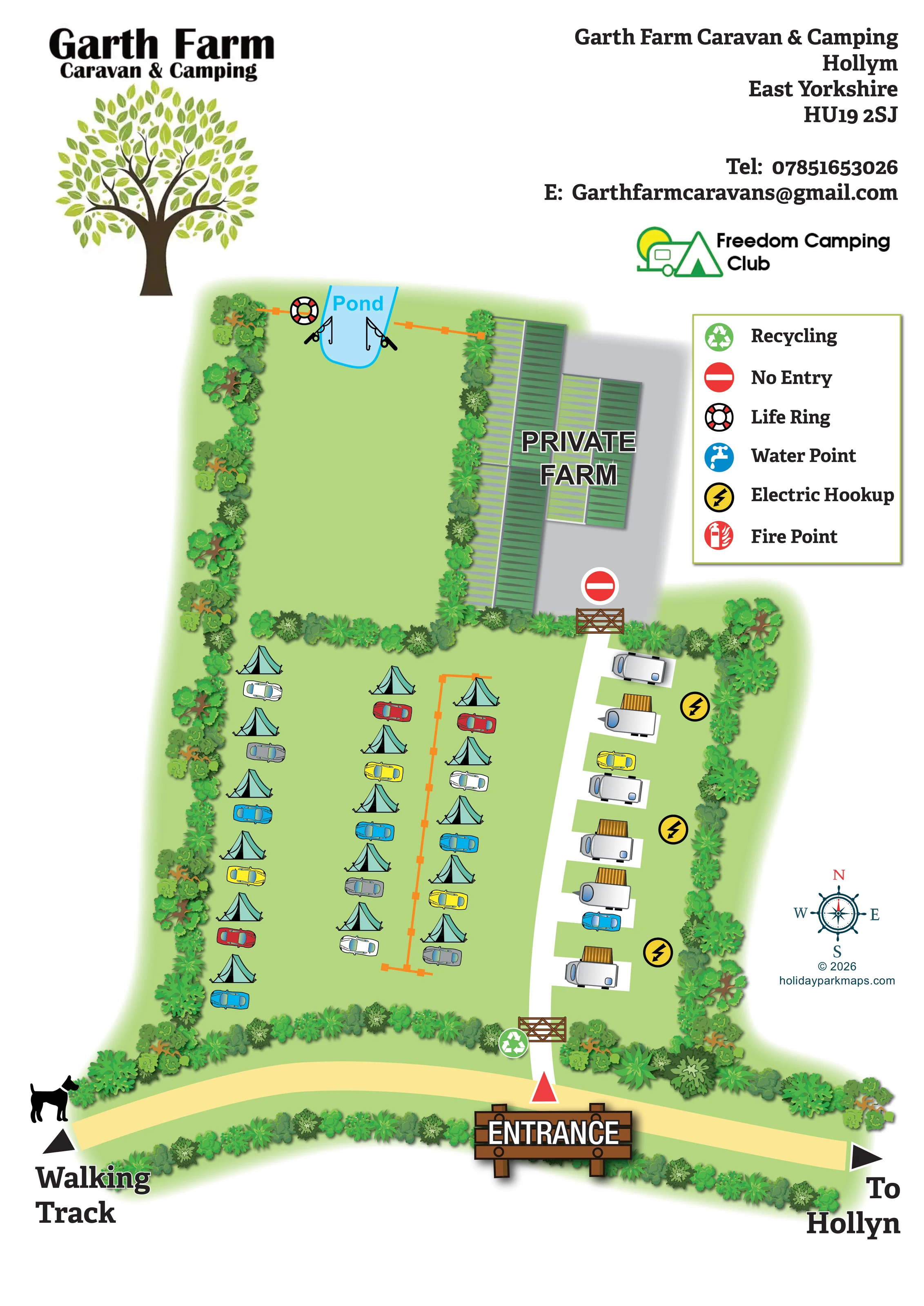
A labelled pale-blue pond sits at the northern edge of a large grassy enclosure, west of the private farm buildings.
ILLUSTRATED PARK MAP · P131
Garth Farm Caravan & Camping, Hollym, East Yorkshire · United Kingdom
 Enlarge the map ↗
A SENSE OF THE PLACE
Garth Farm Caravan and Camping is located at Hollym near Withernsea in East Yorkshire. Trees and open fields surround a site that offers grass and hardstanding spaces for tents and touring vehicles.
Electric pitches include individual drinking-water taps, with non-electric and winter options also described by the park. Nearby nature reserves, a village pub and a garden-centre café add options beyond the site.
LOOK CLOSER
A labelled pale-blue pond sits at the northern edge of a large grassy enclosure, west of the private farm buildings.
Large green-roofed agricultural buildings and a grey yard occupy the north-eastern part of the plan, prominently labelled 'PRIVATE FARM'.
Dense bands of illustrated trees and shrubs enclose the camping area, divide it from the pond enclosure and screen the farm buildings.
A broad, largely empty green enclosure extends south of the pond, separated from the tent field by planting.
Orange post-and-line marks appear across the pond enclosure's northern edge and within the camping field. They are not explained in the legend.
Two fishing-rod illustrations flank the pond, giving it a clear angling association without specifying access arrangements.
A life-ring symbol is positioned beside the pond and identified in the legend.
Yellow lightning-bolt symbols are placed alongside the touring-caravan strip on the eastern boundary.
A labelled pale-blue pond sits at the northern edge of a large grassy enclosure, west of the private farm buildings.
Two fishing-rod illustrations flank the pond, giving it a clear angling association without specifying access arrangements.
A life-ring symbol is positioned beside the pond and identified in the legend.
Yellow lightning-bolt symbols are placed alongside the touring-caravan strip on the eastern boundary.
A green recycling symbol marks a point beside the entrance gate.
A blue tap symbol appears in the legend; no corresponding location is clearly visible on the plan.
A red extinguisher symbol appears in the legend, but the plan does not clearly locate a matching fire point.
Large green-roofed agricultural buildings and a grey yard occupy the north-eastern part of the plan, prominently labelled 'PRIVATE FARM'.
A timber gate and red no-entry symbol distinguish the farm yard from the visitor lane.
A large illustrated timber entrance sign and red triangular marker identify the access from the pale-yellow route along the bottom of the plan.
A white lane runs north from the entrance, separating the tent field from the touring bays and ending at the private farm gate.
A left-pointing direction at the southern edge is labelled 'Walking Track' and accompanied by a dog silhouette. This is a route cue, not a statement of pet policy.
The right-hand end of the southern route carries the label 'To Hollyn', evidently referring to Hollym in the park address.
Dense bands of illustrated trees and shrubs enclose the camping area, divide it from the pond enclosure and screen the farm buildings.
A broad, largely empty green enclosure extends south of the pond, separated from the tent field by planting.
Orange post-and-line marks appear across the pond enclosure's northern edge and within the camping field. They are not explained in the legend.
READING THE MAP
This illustrated map of Garth Farm Caravan & Camping presents a small rural campsite at Hollym, near Withernsea in East Yorkshire. Its main organising feature is a white access lane leading from a prominently marked entrance towards the private farm. Open tent camping lies to the left, while a short row of touring caravans and electric-hookup symbols sits to the right.
The artwork gives equal attention to the site's landscape. Thick bands of trees and shrubs frame the camping field, screen the farm buildings and separate a quieter grassy enclosure containing a pond. Fishing-rod illustrations and a life-ring marker make the pond a recognisable destination. Along the bottom edge, a pale-yellow route points towards the walking track in one direction and the village in the other.
A large tree logo, contact block and Freedom Camping Club branding sit above the plan, with a six-symbol legend in the right-hand margin. The combination suits a compact farm campsite where visitors need to understand arrival, accommodation areas and private boundaries without navigating a complex numbered pitch plan.
The portrait artwork brings the site into one continuous overhead plan rather than separate accommodation insets. At the bottom, a large brown timber sign marks the entrance from the pale-yellow approach route. A red triangular marker reinforces the arrival point, and a timber gate spans the white lane just inside the planted boundary. Recycling is marked beside this gate.
Beyond the entrance, the lane runs north through the visitor area. On its western side, turquoise tents and brightly coloured cars are arranged in three loose rows across green grass. These pictorial groupings communicate open camping rather than a numbered allocation system. An orange post-and-line feature runs through part of the field. On the eastern side, silver-white touring caravans occupy individual white bays, several illustrated with striped ochre awning-like additions. Yellow electric-hookup symbols are positioned between the bays and the tree-lined edge.
A dense planted divider separates the camping field from a larger grassy enclosure above. Its northern end contains the labelled blue pond, with fishing rods on either side and a life ring nearby. To the east, long green agricultural roofs sit on a grey yard. The bold 'PRIVATE FARM' label, timber gate and red no-entry marker distinguish this area from the visitor route.
The southern route has a walking-track direction and dog silhouette at the left, and a village direction at the right. The right-hand legend explains recycling, no entry, life ring, water point, electric hookup and fire point symbols, although water and fire points are not visibly located on the plan. A compass and designer credit complete the margin. Large labels and contrasting surfaces carry the wayfinding, supported by detailed foliage and soft shadows.
KEEP EXPLORING
Chosen for shared landscapes, accommodation or facilities.
 Explore the map ↗
United Kingdom
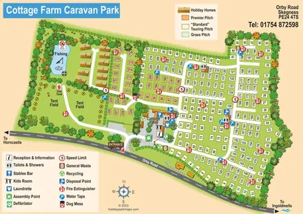
Illustrated touring and camping park map with numbered pitches, a fishing pond and a central farm courtyard.
 Explore the map ↗
United Kingdom
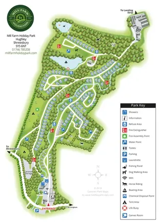
A wooded Shropshire park mapped with curved caravan rows, tent areas, ponds and a winding watercourse.
 Explore the map ↗
United Kingdom
Woodland holiday-park map with named accommodation areas, touring loops and illustrated recreation facilities.
Features may come from the sample artwork, its key or published park information. Approximate numbers describe the drawing and may cover only part of a park. They are intended to help you compare map examples. Current facilities and booking information should be checked with the park.
LET’S MAP YOUR PARK
For a map quotation, find your park and draw a rough boundary around it. The area you select helps us work out the design time and price.
Draw your park for a quote ↗Or talk to our map designers
01751 473136