
Linburn Beck
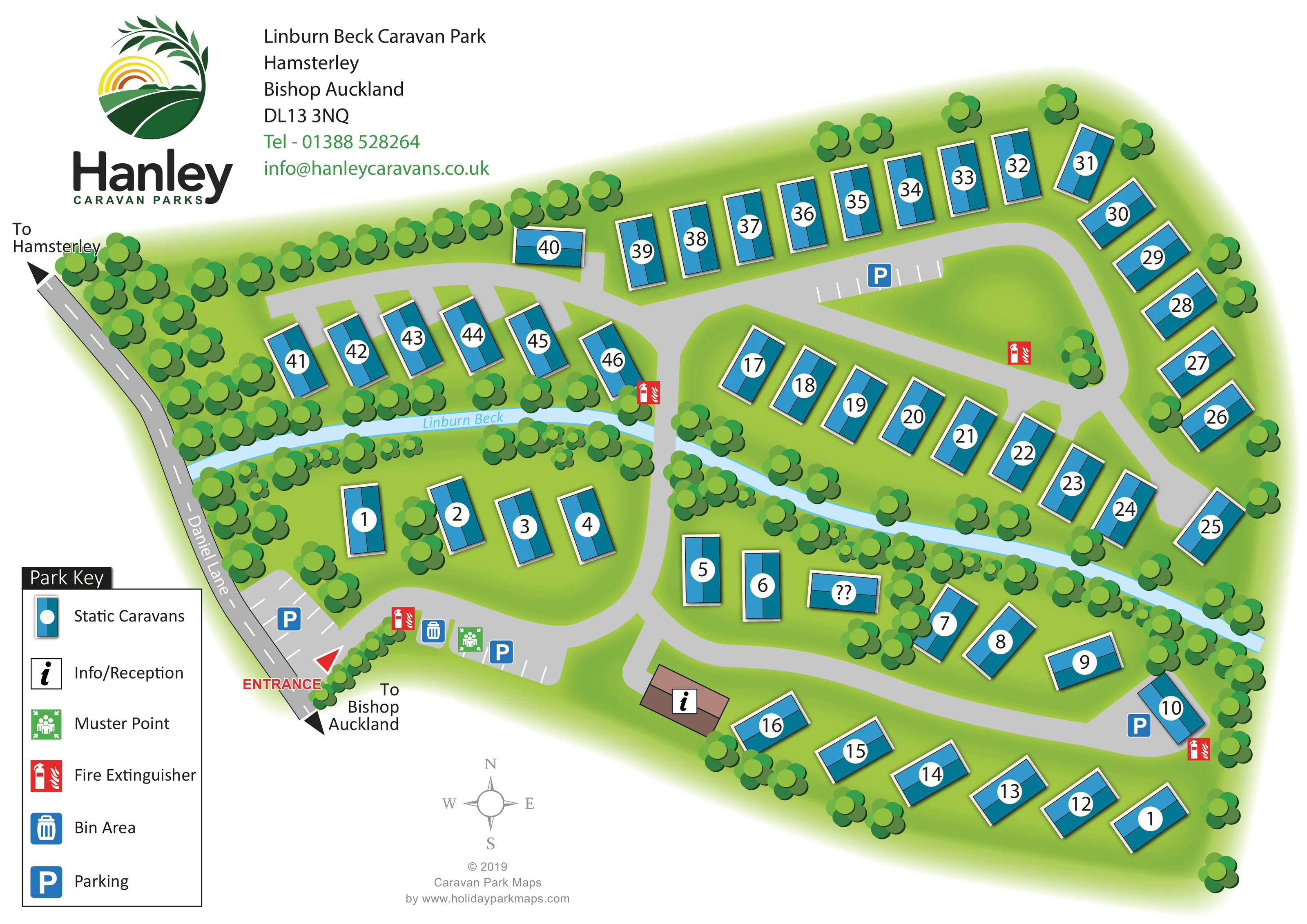
The named pale-blue watercourse runs across the centre of the park, separating upper and lower accommodation groups.
ILLUSTRATED PARK MAP · P522
Linburn Beck Caravan Park, Hamsterley, Bishop Auckland · United Kingdom
 Enlarge the map ↗
A SENSE OF THE PLACE
Linburn Beck Caravan Park is set in countryside at Hamsterley in County Durham. Its village location provides access to local amenities and a bus service towards Bishop Auckland.
The park is associated with holiday caravan stays and ownership, with Hamsterley Forest and the North Pennines among the area's attractions. The map gives an overview of plots and access routes within the rural site.
LOOK CLOSER
The named pale-blue watercourse runs across the centre of the park, separating upper and lower accommodation groups.
Dense illustrated tree belts follow the beck and much of the perimeter, with additional trees between caravans and broad green spaces inside the road layout.
A brown-roofed building beside the lower internal road carries the information symbol, identified in the key as Info/Reception.
Blue P symbols identify parking at the entrance, beside the arrival facilities, along the upper road and near the lower-right accommodation group. Several areas have white bay markings.
A blue bin symbol marks a waste collection area beside the entrance-side parking and muster point.
A green assembly symbol identifies a muster point in the arrival area.
Red fire extinguisher symbols are distributed around the arrival area and internal accommodation roads.
A red entrance arrow marks the connection from Daniel Lane at the lower-left edge of the plan.
A brown-roofed building beside the lower internal road carries the information symbol, identified in the key as Info/Reception.
Blue P symbols identify parking at the entrance, beside the arrival facilities, along the upper road and near the lower-right accommodation group. Several areas have white bay markings.
A blue bin symbol marks a waste collection area beside the entrance-side parking and muster point.
A green assembly symbol identifies a muster point in the arrival area.
Red fire extinguisher symbols are distributed around the arrival area and internal accommodation roads.
The named pale-blue watercourse runs across the centre of the park, separating upper and lower accommodation groups.
Dense illustrated tree belts follow the beck and much of the perimeter, with additional trees between caravans and broad green spaces inside the road layout.
A red entrance arrow marks the connection from Daniel Lane at the lower-left edge of the plan.
Grey roads form connected curved circuits and short access branches, with a central road crossing the beck to link the accommodation areas.
Black directional arrows at opposite ends of Daniel Lane indicate Hamsterley and Bishop Auckland.
READING THE MAP
This illustrated map of Linburn Beck Caravan Park in Hamsterley, County Durham, presents a compact static caravan site shaped by its namesake watercourse. Linburn Beck runs through the middle of the drawing, bordered by thick bands of trees, while curved access roads connect the caravan groups on either side. Around 45 caravans are represented by blue roof symbols with large white plot labels, making the accommodation easy to distinguish from the green grounds.
The arrival sequence is particularly clear: Daniel Lane forms the left-hand approach, a red arrow identifies the entrance, and nearby symbols mark parking, bins and the muster point. Reception is shown as a separate brown-roofed building beside the lower internal road. Further parking and fire extinguisher points appear around the site.
The artwork combines a practical numbered plan with a simplified rural landscape. Hanley Caravan Parks branding and the park address occupy the upper-left margin, while a boxed key and compass complete the visitor information. It is a useful example of mapping a smaller caravan park where the relationship between plots, roads and a natural feature matters more than a long list of leisure facilities.
The plan is arranged around a pale-blue ribbon labelled Linburn Beck, which crosses the site from the Daniel Lane boundary towards the right-hand edge. Layered green tree symbols line both banks and much of the perimeter, giving the watercourse a strong visual presence. A central internal road crosses the beck and joins the accommodation areas above and below it.
On the upper side, caravans follow a long curved outer road and continue down the right-hand boundary. Short branches serve an additional row nearer Daniel Lane, while another line of caravans sits between the road and the beck. Below the watercourse, smaller groups lead into a curved perimeter row around the lower-right grounds. Each caravan is drawn as a two-tone blue rectangle with a white outline, shadow and circular plot label; its orientation follows the local arrangement of roads and green spaces.
Daniel Lane is shown in darker grey with a dashed centre line and destination arrows towards Hamsterley and Bishop Auckland. The red entrance marker leads into an arrival area containing marked parking bays, a bin symbol, a green muster point and a fire extinguisher symbol. The information/reception building has a brown roof and sits beside the lower road. Additional blue parking and red fire symbols are distributed elsewhere on the plan.
The page uses a large upper-left branding and address block, a lower-left Park Key and a small grey compass beneath the site. The overlapping detail view enlarges the same artwork, clarifying the entrance, key and beck-side planting rather than introducing a separate section or additional accommodation. Broad grey roads and oversized labels keep the route structure readable against the densely illustrated greenery.
KEEP EXPLORING
Chosen for shared landscapes, accommodation or facilities.
 Explore the map ↗
United Kingdom
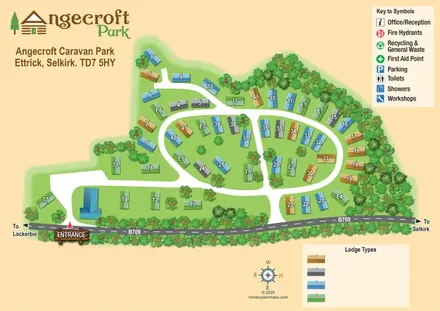
Tree-framed Angecroft Park map with colour-coded roofs, looping roads and a signed B709 entrance.
 Explore the map ↗
United Kingdom
Ashby Park map with seven fishing lakes, colour-coded accommodation and illustrated wooded shorelines.
 Explore the map ↗
United Kingdom
Woodland-framed Barnsoul map with mixed accommodation, shared facilities and paw-marked walking routes.
Features may come from the sample artwork, its key or published park information. Approximate numbers describe the drawing and may cover only part of a park. They are intended to help you compare map examples. Current facilities and booking information should be checked with the park.
LET’S MAP YOUR PARK
For a map quotation, find your park and draw a rough boundary around it. The area you select helps us work out the design time and price.
Draw your park for a quote ↗Or talk to our map designers
01751 473136