
Pond
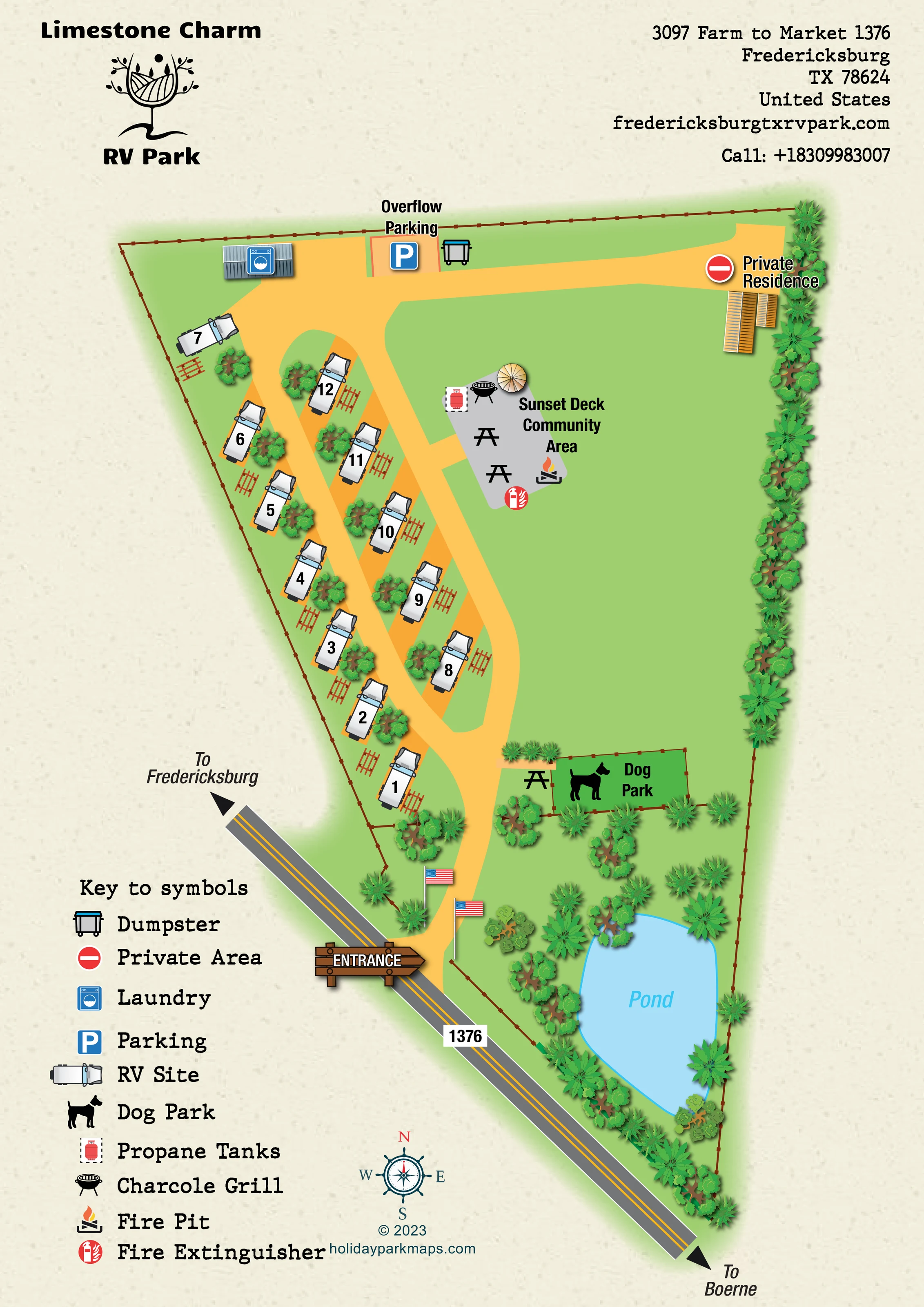
A large irregular blue pond occupies the tapered roadside end of the grounds, surrounded by illustrated planting.
ILLUSTRATED PARK MAP · P189
3097 Farm to Market 1376, Fredericksburg, Texas · United States
 Enlarge the map ↗
A SENSE OF THE PLACE
Limestone Charm RV Park is located near Fredericksburg in the Texas Hill Country. Its RV sites include full hookups and both back-in and pull-through arrangements.
An outdoor community kitchen with grills provides a shared gathering space, and laundry is available on site. The park welcomes groups, with the surrounding wine region and Hill Country attractions offering options for excursions.
LOOK CLOSER
A large irregular blue pond occupies the tapered roadside end of the grounds, surrounded by illustrated planting.
Dense stylised trees and shrubs follow the eastern boundary and pond edge, while scattered planting separates pitches from a broad open central lawn.
A thin brown fence line with regularly spaced posts outlines the irregular, tapering site.
A prominent wooden entrance sign marks the access from the diagonal roadside into the internal drive.
The external road is labelled 1376, with destination arrows towards Fredericksburg at the upper-left end and Boerne at the lower-right end.
Broad golden-yellow lanes serve the angled RV rows, loop around a narrow planted island and continue across the upper edge to service facilities and the private residence.
A labelled grey communal area beside the upper pitch rows, illustrated with picnic tables, a parasol, grill, propane tank, fire pit and fire extinguisher.
Repeated table symbols accompany the RV pitches, with further tables in the community area and beside the dog park.
A prominent wooden entrance sign marks the access from the diagonal roadside into the internal drive.
The external road is labelled 1376, with destination arrows towards Fredericksburg at the upper-left end and Boerne at the lower-right end.
Broad golden-yellow lanes serve the angled RV rows, loop around a narrow planted island and continue across the upper edge to service facilities and the private residence.
A labelled grey communal area beside the upper pitch rows, illustrated with picnic tables, a parasol, grill, propane tank, fire pit and fire extinguisher.
Repeated table symbols accompany the RV pitches, with further tables in the community area and beside the dog park.
A black barbecue symbol is placed within the Sunset Deck Community Area and explained in the key.
A red cylinder symbol appears at the community area. It indicates a mapped tank location, not a stated refill service.
A flame-and-logs symbol marks the fire pit at the community area.
A red fire-extinguisher symbol is positioned at the lower edge of the community area.
A rectangular fenced green enclosure is labelled Dog Park and marked with a large dog silhouette near the lower end of the RV rows.
A blue washing-machine symbol identifies a small grey-roofed building along the upper boundary.
A labelled parking bay with a blue P symbol sits beside the upper service drive.
The key's Dumpster symbol is placed beside the overflow parking area.
The building at the upper-right end of the drive is labelled Private Residence and marked with the key's red private-area symbol.
A large irregular blue pond occupies the tapered roadside end of the grounds, surrounded by illustrated planting.
Dense stylised trees and shrubs follow the eastern boundary and pond edge, while scattered planting separates pitches from a broad open central lawn.
A thin brown fence line with regularly spaced posts outlines the irregular, tapering site.
READING THE MAP
This illustrated map of Limestone Charm RV Park presents a small RV site near Fredericksburg in the Texas Hill Country. Its portrait format follows the shape of the grounds: a broad upper section narrows towards a planted pond beside Farm to Market 1376. Rather than filling the page with accommodation, the design gives equal attention to the open lawn, shared spaces and practical arrival information.
Roughly ten RV pitches form two short, angled rows along golden-yellow access lanes. Vehicle illustrations, clear pitch numbers and picnic-table symbols make the accommodation easy to recognise. The Sunset Deck Community Area sits alongside the rows, while a fenced dog park provides another prominent destination nearer the entrance. Laundry, overflow parking and a private residence are clearly distinguished across the upper edge.
A cream textured background, green planting and a pale blue pond give the artwork a warm, informal character. The wooden entrance sign, park logo and large symbol key add personality without obscuring the site's simple structure. It is a useful sample for a compact RV park needing both pitch-level orientation and a clear overview of shared amenities.
The plan is organised around a fenced, wedge-shaped parcel beside the diagonal line of Farm to Market 1376. Directional arrows identify the road towards Fredericksburg and Boerne, while a wooden entrance sign marks the turn into the park. Two illustrated American flags flank the arrival drive. From here, the golden-yellow route passes the landscaped pond and dog park before opening into the accommodation lanes.
The RV pitches occupy the left-hand portion of the grounds in two staggered rows. Each uses a consistent overhead vehicle illustration, a prominent number and an adjacent picnic-table symbol. Small groups of trees break up the rows, and a narrow green island separates sections of the looping drive. A larger open lawn fills much of the right-hand side, giving the plan a notably uncluttered centre.
The grey Sunset Deck Community Area projects into this lawn from the pitch-side route. Its picnic tables, parasol, charcoal grill, propane tank, fire pit and fire-extinguisher symbols make it a distinct social destination. Further down, the dog park is drawn as a fenced green rectangle with a large dog silhouette. The pond anchors the lower end of the composition, edged with dense stylised foliage.
Across the upper boundary, the map places laundry in a small grey-roofed building, overflow parking beside the drive and a waste container nearby. The private residence at the upper right is explicitly labelled and marked with a red private-area symbol.
The single portrait artwork combines park branding and contact details above the plan with a generous lower-left symbol key and decorative compass below. The enlarged detail views show portions of this same page, including the legend and pond, rather than additional park sections.
KEEP EXPLORING
Chosen for shared landscapes, accommodation or facilities.
 Explore the map ↗
United Kingdom
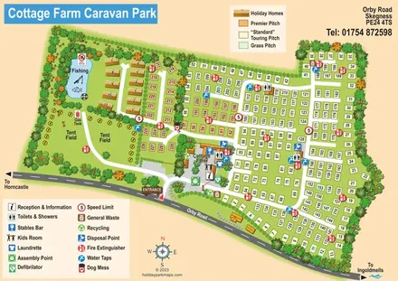
Illustrated touring and camping park map with numbered pitches, a fishing pond and a central farm courtyard.
 Explore the map ↗
United Kingdom
Woodland holiday-park map with named accommodation areas, touring loops and illustrated recreation facilities.
 Explore the map ↗
United Kingdom
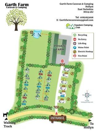
Illustrated farm campsite map with tent camping, electric touring bays, a pond and clearly marked private farm access.
Features may come from the sample artwork, its key or published park information. Approximate numbers describe the drawing and may cover only part of a park. They are intended to help you compare map examples. Current facilities and booking information should be checked with the park.
LET’S MAP YOUR PARK
For a map quotation, find your park and draw a rough boundary around it. The area you select helps us work out the design time and price.
Draw your park for a quote ↗Or talk to our map designers
01751 473136