
Private garden
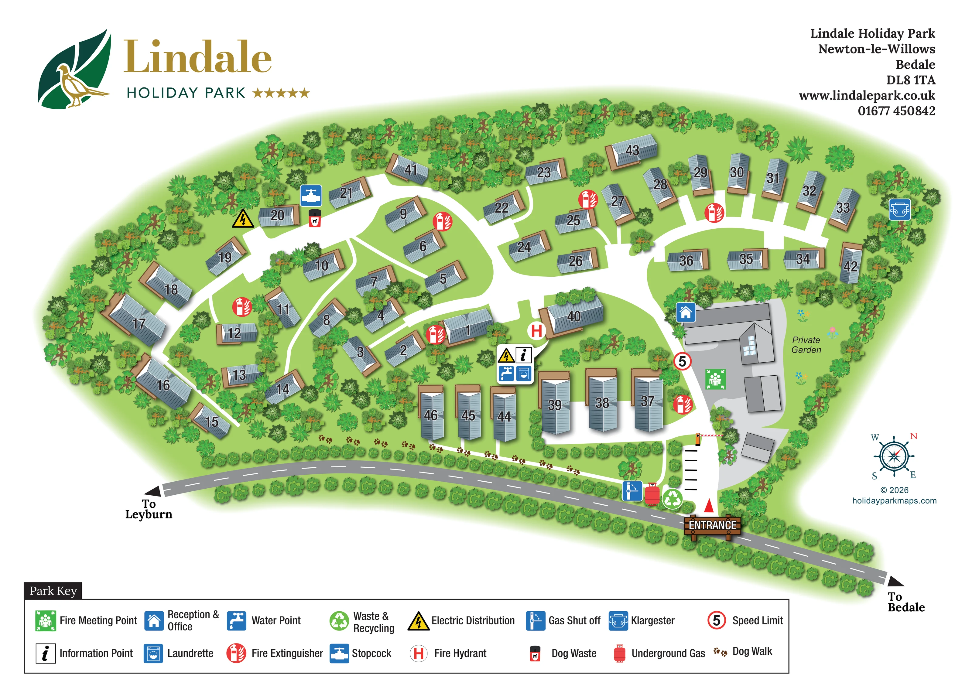
A lawn beside the reception-side buildings is explicitly labelled Private Garden and illustrated with small flowers.
ILLUSTRATED PARK MAP · P191
Lindale Holiday Park, Newton-le-Willows, Bedale · United Kingdom
 Enlarge the map ↗
A SENSE OF THE PLACE
Lindale Holiday Park is located at Newton-le-Willows near Bedale in North Yorkshire. Its rural Wensleydale setting is the backdrop to caravan and lodge holiday homes.
The park offers holiday home ownership and lodges for hire. The map provides an overview of its plots and internal routes, helping visitors understand the site before exploring the surrounding countryside.
LOOK CLOSER
A lawn beside the reception-side buildings is explicitly labelled Private Garden and illustrated with small flowers.
Dense mixed tree and shrub symbols enclose the park, with further planting between accommodation groups and hedges along the roadside boundary.
A blue house symbol identifies reception and office at the large building beside the eastern arrival route.
An information symbol marks the central service cluster south of the main internal junction.
A washing-machine symbol locates the laundrette within the central service cluster.
A tap symbol marks a water point at the central service cluster.
A green recycling symbol marks the waste and recycling point just inside the roadside entrance.
A dog-waste bin symbol appears beside the north-western internal road.
A blue house symbol identifies reception and office at the large building beside the eastern arrival route.
An information symbol marks the central service cluster south of the main internal junction.
A washing-machine symbol locates the laundrette within the central service cluster.
A tap symbol marks a water point at the central service cluster.
A green recycling symbol marks the waste and recycling point just inside the roadside entrance.
A dog-waste bin symbol appears beside the north-western internal road.
A green assembly symbol is positioned beside the reception building.
Repeated red extinguisher symbols are distributed among the accommodation groups and beside the arrival route.
An H symbol marks a hydrant near the central junction and service area.
Yellow electrical warning symbols mark points in the north-western and central parts of the park.
A blue stopcock symbol appears beside the north-western road.
The map's red underground-gas symbol is placed near the entrance.
A blue gas shut-off symbol is located next to the entrance-side utility symbols.
A blue Klargester symbol marks a utility installation at the north-eastern wooded edge.
A white path traced with brown paw prints follows the southern landscaped boundary from near the entrance towards the western side.
A timber-style ENTRANCE sign marks the roadside access at the lower right. A striped barrier and black transverse markings distinguish the arrival lane.
A red-ringed 5 symbol appears on the entrance road and is explained as Speed Limit in the key.
The grey road along the southern boundary has directional arrows labelled To Leyburn on the left and To Bedale on the right.
A lawn beside the reception-side buildings is explicitly labelled Private Garden and illustrated with small flowers.
Dense mixed tree and shrub symbols enclose the park, with further planting between accommodation groups and hedges along the roadside boundary.
READING THE MAP
This illustrated map of Lindale Holiday Park presents a compact holiday-home setting at Newton-le-Willows, near Bedale in North Yorkshire. Around 45 numbered homes sit within a richly planted layout, with curving roads, clusters of trees and a broad green perimeter giving the plan its distinctive character. The artwork combines a near-overhead view with shaded roofs and tan decking, making individual units recognisable without turning the page into a technical drawing.
Arrival is clearly anchored at the lower-right entrance, beside the road towards Bedale and Leyburn. Reception, a private garden and the principal service points are easy to relate to this approach. A paw-print dog-walk route follows the southern edge, while the extensive Park Key explains both everyday facilities and operational features such as fire points and utility locations.
The large green-and-gold Lindale branding, white page background and restrained grey buildings keep the accommodation layout central. It is a useful example of a holiday-park map that brings plot finding, visitor orientation and practical site information together in one illustrated sheet.
The plan is arranged around a single entrance from the road crossing the bottom of the page. Directional arrows identify the routes towards Leyburn and Bedale, while a timber-style entrance sign and striped barrier make the access point conspicuous. Inside the park, broad white roads branch past reception and curve through the accommodation areas. A compass rose at lower right provides a further orientation cue.
The homes are drawn as individual grey-roofed buildings with tan bases or decking and prominent roof numbers. Their placement follows several different patterns: an arc around the western edge, smaller groups among central planting, a fan-shaped arrangement in the north-east and a row of larger-looking units along the southern side. Dense trees and shrubs frame the site and divide many of the plots, softening what could otherwise be a repetitive arrangement of numbered buildings.
Reception and office are marked at the large eastern building, next to a labelled private garden and a fire meeting point. A central symbol cluster identifies information, the laundrette and water, with nearby electricity and fire-hydrant markers. Other symbols locate extinguishers, a stopcock, dog waste, waste and recycling, gas infrastructure and the Klargester installation. A red-ringed 5 sign appears on the arrival road.
The dog walk is particularly distinctive: brown paw prints trace a narrow white path along the southern landscaped boundary. Below the illustration, a two-row key explains the map's service and safety symbols. The single landscape-format artwork is accompanied by overlapping enlargements of this key; these show the same legend rather than additional park areas or alternative layouts.
KEEP EXPLORING
Chosen for shared landscapes, accommodation or facilities.
 Explore the map ↗
United Kingdom
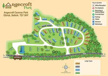
Tree-framed Angecroft Park map with colour-coded roofs, looping roads and a signed B709 entrance.
 Explore the map ↗
United Kingdom
Woodland-framed Barnsoul map with mixed accommodation, shared facilities and paw-marked walking routes.
 Explore the map ↗
United Kingdom
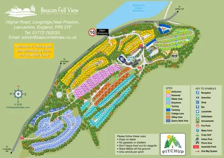
Colour-coded park map with numbered holiday-home areas, touring pitches, camping and an illustrated leisure hub.
Features may come from the sample artwork, its key or published park information. Approximate numbers describe the drawing and may cover only part of a park. They are intended to help you compare map examples. Current facilities and booking information should be checked with the park.
TAKE A CLOSER LOOK
View the illustrated map in detail or choose a file to download. These are sample maps; contact the park for current visitor information.


LET’S MAP YOUR PARK
For a map quotation, find your park and draw a rough boundary around it. The area you select helps us work out the design time and price.
Draw your park for a quote ↗Or talk to our map designers
01751 473136